Directions to Caca (Araucária) with public transportation
The following transit lines have routes that pass near Caca
How to get to Caca by bus?
Click on the bus route to see step by step directions with maps, line arrival times and updated time schedules.
From Mondelez Brasil, Cic
47 minFrom Terminal Angélica, Araucária
25 minFrom Rua João Chede, Cic
71 minFrom C.D. Condor Hipermercados, Umbará
77 minFrom Rua Joao Bettega, Cic
40 minFrom Deposito Do Condor, Umbará
76 minFrom Campo Redondo, Araucária
43 minFrom Cidade Industrial de Curitiba, Cic
45 minFrom CEASA - Centrais de Abastecimento do Paraná, Tatuquara
48 minFrom Vitoria Regia, Cic
53 min
Bus stops near Caca in Araucária
Bus lines to Caca in Araucária
- 01 LINHÃO 01 (ANGÉLICA / TUPY), Tupy → Terminal Vila Angélica,VIEW
- 27 HMA / UPA, Terminal Central Araucária → UPA Araucária (via Ortobom),VIEW
- 20 PLANALTO / GRALHA AZUL, Açougue Maranhão → Terminal Central Araucária,VIEW
- 25 COSTEIRA / D'AMPEZZO, Costeira / D'Ampezzo → Terminal Central Araucária,VIEW
- 20 PLANALTO / MINAS GERAIS, Davi Carneiro (via Minas Gerais) → Terminal Central Araucária,VIEW
- 03 HORTÊNCIA / ANGÉLICA, R. Costa e Silva → Terminal Vila Angélica,VIEW
- 05 MANOEL RIBAS / ANGÉLICA, Terminal Vila Angélica → Manoel Ribas,VIEW
- I11 ARAUCÁRIA / FAZENDA, Terminal Araucária → Terminal Fazenda,VIEW
What are the closest stations to Caca?
The closest stations to Caca are:
- Rua Paulo Cantador, 93 is 74 meters away, 2 min walk.
- Rua Paulo Cantador, 607 is 96 meters away, 2 min walk.
- Rua Bernardino Lemos, 504 is 210 meters away, 3 min walk.
- Rua Bernardino Lemos, 447 is 271 meters away, 4 min walk.
- R. Manoel Ribas, 3363 is 347 meters away, 5 min walk.
Which bus lines stop near Caca?
These bus lines stop near Caca: 03 HORTÊNCIA / ANGÉLICA, 25 COSTEIRA / D'AMPEZZO, I11 ARAUCÁRIA / FAZENDA.
What’s the nearest bus station to Caca in Araucária?
The nearest bus stations to Caca in Araucária are Rua Paulo Cantador, 93 and Rua Paulo Cantador, 607. The closest one is a 2 min walk away.
What time is the first bus to Caca in Araucária?
The 20 PLANALTO / MINAS GERAIS is the first bus that goes to Caca in Araucária. It stops nearby at 4:11 AM.
What time is the last bus to Caca in Araucária?
The 20 PLANALTO / GRALHA AZUL is the last bus that goes to Caca in Araucária. It stops nearby at 12:58 AM.
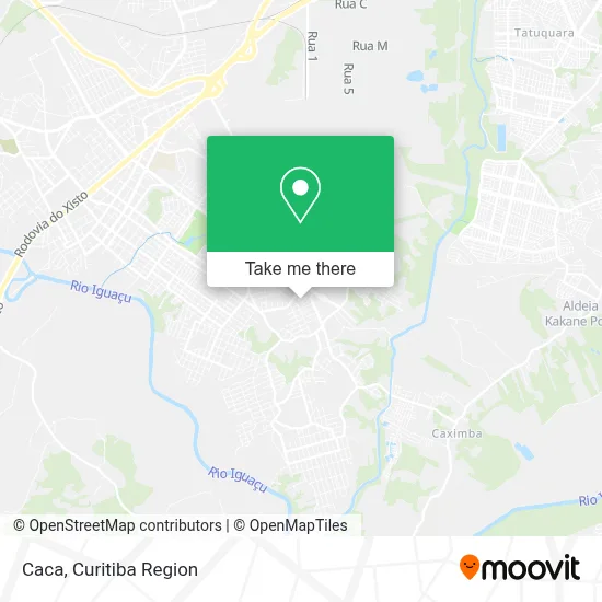
See Caca, Araucária, on the map
Public Transit to Caca in Araucária
Wondering how to get to Caca in Araucária? Moovit helps you find the best way to get to Caca with step-by-step directions from the nearest public transit station.
Moovit provides free maps and live directions to help you navigate through your city. View schedules, routes, timetables, and find out how long does it take to get to Caca in real time.
Looking for the nearest stop or station to Caca? Check out this list of stops closest to your destination: Rua Paulo Cantador; Rua Paulo Cantador; Rua Bernardino Lemos; Rua Bernardino Lemos; R. Manoel Ribas.
Bus: 03 HORTÊNCIA / ANGÉLICA, 25 COSTEIRA / D'AMPEZZO, I11 ARAUCÁRIA / FAZENDA, 01 LINHÃO 01 (ANGÉLICA / TUPY), 27 HMA / UPA, 20 PLANALTO / GRALHA AZUL, 20 PLANALTO / MINAS GERAIS, 05 MANOEL RIBAS / ANGÉLICA.
Want to see if there’s another route that gets you there at an earlier time? Moovit helps you find alternative routes or times. Get directions from and directions to Caca easily from the Moovit App or Website.
We make riding to Caca easy, which is why over 1.5 million users, including users in Araucária, trust Moovit as the best app for public transit. You don’t need to download an individual bus app or train app, Moovit is your all-in-one transit app that helps you find the best bus time or train time available.
For information on prices of bus, costs and ride fares to Caca, please check the Moovit app.
Use the app to navigate to popular places including to the airport, hospital, stadium, grocery store, mall, coffee shop, school, college, and university.
Caca Address: Rua Paulina Condessa Ferreira, 156 Costeira Araucária-PR 83709-130 street in Araucária
- Ale Doerr Salão Unissex,
- C. M. E. I. Planalto,
- N.P.N. Montagem e Manutenção Industrial,
- Panificadora Sensação,
- Instituto Essencia,
- Apmf - Cepmgssl - Ensino Medio,
- Escola Estadual Professora Maria da Graça Siqueira Silva e Lima,
- Armazem Amanda Gas,
- Barbearia Rei da Tribo,
- Rfa Comercio e Servicos,
- Sergio Borracharia e Comercio de Pneus,
- Escola Municipal David Carneiro,
- Sabordebuteco,
- Hr Cell,
- Dilac,
- R Araujo,
- Gold Pao,
- Rua Paulo Cantador 669,
- Amanda Gás,
- Distribuidora de Bebidas Zero Grau
Places Near Caca (Araucária)
- Shopping Palladium, Portão,
- Hospital Angelina Caron, Campina Grande Do Sul,
- Park Shopping Barigüi, Mossunguê,
- Hospital Da Cruz Vermelha, Batel,
- Hhhhh, Fazendinha,
- Rua General Mário Tourinho, Campina Do Siqueira,
- Rua Martim Afonso 558, Mercês,
- Hospital do Rocio, Campo,
- Campo Largo, Campo,
- Arena Da Baixada - Curitiba,
- Jardim Botânico de Curitiba PR, Centro,
- Hospital Erasto Gaertner, Jardim Das Américas,
- Hospital de Clínicas (HC - UFPR), Centro,
- Jockey Plaza Shopping Center, Tarumã,
- Parque Barigui, Mercês,
- Hospital Universitário Evangélico de Curitiba, Bigorrilho,
- Shopping Estação, Rebouças,
- Pontifícia Universidade Católica do Paraná (PUCPR), Prado Velho,
- Hospital Madalena Sofia, Bairro Alto,
- Hospital Nossa Senhora Das Graças, Mercês
How to get to popular places in Curitiba Region with public transit
Get around Araucária by public transit!
Traveling around Araucária has never been so easy. See step by step directions as you travel to any attraction, street or major public transit station. View bus and train schedules, arrival times, service alerts and detailed routes on a map, so you know exactly how to get to anywhere in Araucária.
When traveling to any destination around Araucária use Moovit's Live Directions with Get Off Notifications to know exactly where and how far to walk, how long to wait for your line, and how many stops are left. Moovit will alert you when it's time to get off — no need to constantly re-check whether yours is the next stop.
Wondering how to use public transit in Araucária or how to pay for public transit in Araucária? Moovit public transit app can help you navigate your way with public transit easily, and at minimum cost. It includes public transit fees, ticket prices, and costs. Looking for a map of Araucária public transit lines? Moovit public transit app shows all public transit maps in Araucária with all Bus and Cable Car routes and stops on an interactive map.
Curitiba Region has 2 transit type(s), including: Bus and Cable Car, operated by several transit agencies, including Sistema Integrado de Mobilidade (URBS), Sistema Integrado de Mobilidade (AMEP), URBS (Cartões bancários e Dinheiro), URBS (Cartões bancários / Cartão URBS), AMEP (Cartões bancários / Cartão MetroCard), AMEP (Cartões bancários / Cartão MetroCard / Dinheiro), Viação Colombo (Dinheiro), TRIAR (Cartão TRIAR / Dinheiro), Empresa Curitiba Cerro Azul (Dinheiro), Expresso Nossa Senhora da Penha (Dinheiro), Empresa Campo Alto Tijucas (Dinheiro), Auto Viação São José (Cartão VEM / Dinheiro), BRT S/A (Cartão VEM / Dinheiro), TransPiedade (Cartão Cidadão / Dinheiro) and Oceânica Sul (Cartão Transporte / Dinheiro)