How to get to Cache Cleaners by bus?
Click on the bus route to see step by step directions with maps, line arrival times and updated time schedules.
From Palm Beach County Courthouse, Court Room 4C, West Palm Beach
44 minFrom Singer Island Pump House, Riviera Beach
80 minFrom Tri-Rail-West Palm Beach Station, West Palm Beach
61 minFrom Brightline, West Palm Beach
70 minFrom Brightline West Palm Beach, West Palm Beach
46 minFrom Palm Beach County Courthouse Jurors Assembly Room, West Palm Beach
46 minFrom Donald Ross Rd / Military Trl, Jupiter
56 minFrom Congress/45th Street, West Palm Beach
28 minFrom JFK Medical Center, West Palm Beach
58 minFrom Tri-Rail-Mangonia Park Station, West Palm Beach
43 min
Bus stops near Cache Cleaners in Riviera Beach
What are the closest stations to Cache Cleaners?
The closest stations to Cache Cleaners are:
- NORTHLAKE BLVD at 10TH ST is 175 yards away, 3 min walk.
- OLD DIXIE HWY at NORTHLAKE BLVD is 570 yards away, 7 min walk.
Which bus lines stop near Cache Cleaners?
These bus lines stop near Cache Cleaners: 20, 33.
What’s the nearest bus station to Cache Cleaners in Riviera Beach?
The nearest bus station to Cache Cleaners in Riviera Beach is NORTHLAKE BLVD at 10TH ST. It’s a 3 min walk away.
What time is the first bus to Cache Cleaners in Riviera Beach?
The 20 is the first bus that goes to Cache Cleaners in Riviera Beach. It stops nearby at 5:04 AM.
What time is the last bus to Cache Cleaners in Riviera Beach?
The 20 is the last bus that goes to Cache Cleaners in Riviera Beach. It stops nearby at 10:21 PM.
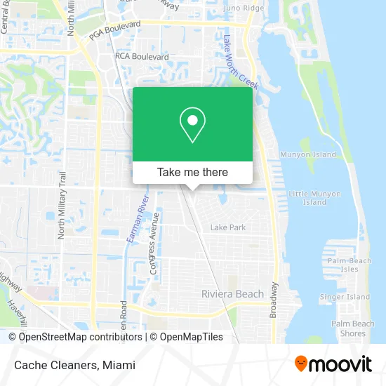
See Cache Cleaners, Riviera Beach, on the map
Public Transit to Cache Cleaners in Riviera Beach
Wondering how to get to Cache Cleaners in Riviera Beach? Moovit helps you find the best way to get to Cache Cleaners with step-by-step directions from the nearest public transit station.
Moovit provides free maps and live directions to help you navigate through your city. View schedules, routes, timetables, and find out how long does it take to get to Cache Cleaners in real time.
Looking for the nearest stop or station to Cache Cleaners? Check out this list of stops closest to your destination: NORTHLAKE BLVD at 10TH ST; OLD DIXIE HWY at NORTHLAKE BLVD.
Bus: 20, 33.
Want to see if there’s another route that gets you there at an earlier time? Moovit helps you find alternative routes or times. Get directions from and directions to Cache Cleaners easily from the Moovit App or Website.
We make riding to Cache Cleaners easy, which is why over 1.5 million users, including users in Riviera Beach, trust Moovit as the best app for public transit. You don’t need to download an individual bus app or train app, Moovit is your all-in-one transit app that helps you find the best bus time or train time available.
For information on prices of bus, costs and ride fares to Cache Cleaners, please check the Moovit app.
Use the app to navigate to popular places including to the airport, hospital, stadium, grocery store, mall, coffee shop, school, college, and university.
Cache Cleaners Address: 966 Northlake Blvd West Palm Beach, FL 33403 street in Riviera Beach
- Seadragon Studio - Kirt Decker,
- WING STOP,
- Floridas Best Management,
- Fully Promoted,
- Em Squared Restaurants,
- Botex Beauty,
- Spiritual Readings by Amanda,
- Tattoo Oasis,
- Turner Business Solutions Inc.,
- Nexgen Surveying,
- Uncle Chi Towing,
- Hibachi on the Go,
- HomeGoods,
- Badcock Home Furniture & More of South Florida,
- Riviera Beach City Parks & Recreation,
- The Book Exchange & Comic Book Shop,
- Pressure Washers USA,
- Bridging the Pieces Therapy,
- Wounded Veterans Relief Fund,
- F Skrandel Jerome Pa
Places Near Cache Cleaners (Riviera Beach)
- Sawgrass Mall, Miami,
- Hard Rock Stadium, Miami Gardens,
- Aventura Mall, Miami,
- Miami VA Hospital, Miami,
- Wynwood, Miami,
- Aventura Mall, Miami Beach,
- Sawgrass mall ( FL ), Miami Beach,
- Dolphin Mall Bus, Miami,
- Dolphin Mall, Miami,
- Little Havana, Miami,
- Marlins Park, Miami,
- Richard E. Gerstein Justice Building, Miami,
- Bayside Marketplace, Miami,
- Miami Freedom Park, Miami,
- Miami-Dade County Courthouse, Miami,
- Brickell City Centre, Miami,
- Keiser University Flagship Campus, West Palm Beach,
- Port of Miami Cruise Terminal, Miami,
- Zoo Miami, Miami,
- Miami Design District, Miami
How to get to popular places in Miami with public transit
Get around Riviera Beach by public transit!
Traveling around Riviera Beach has never been so easy. See step by step directions as you travel to any attraction, street or major public transit station. View bus and train schedules, arrival times, service alerts and detailed routes on a map, so you know exactly how to get to anywhere in Riviera Beach.
When traveling to any destination around Riviera Beach use Moovit's Live Directions with Get Off Notifications to know exactly where and how far to walk, how long to wait for your line, and how many stops are left. Moovit will alert you when it's time to get off — no need to constantly re-check whether yours is the next stop.
Wondering how to use public transit in Riviera Beach or how to pay for public transit in Riviera Beach? Moovit public transit app can help you navigate your way with public transit easily, and at minimum cost. It includes public transit fees, ticket prices, and costs. Looking for a map of Riviera Beach public transit lines? Moovit public transit app shows all public transit maps in Riviera Beach with all Bus, Train, Light Rail and Ferry routes and stops on an interactive map.
Miami has 4 transit type(s), including: Bus, Train, Light Rail and Ferry, operated by several transit agencies, including Broward County Transit, Miami-Dade Transit, Metrorail, Palm Tran, Tri-Rail, Brightline, MARTY, City of Homestead Trolley, Key West Transit, Treasure Coast Connector, GoLine IRT, Amtrak, Greyhound-us, FlixBus-us and Aventura Express Shuttle Bus