How to get to Cache Santa Fe by bus?
Click on the bus route to see step by step directions with maps, line arrival times and updated time schedules.
From Calle Emilia Pardo Bazán
47 minFrom Centro Comercial Alcampo
40 minFrom Puerta Elvira
29 minFrom Rotonda Hipercor
39 minFrom Churriana De La Vega
40 minFrom 18014
29 minFrom Calle Profesor Motos Guirao
34 minFrom Restaurante Camaura
39 minFrom Casa-Museo Federico García Lorca
43 minFrom Hospital Ruiz de Alda
31 min
Bus stops near Cache Santa Fe
Bus lines to Cache Santa Fe
- 140, Santa Fe De Bogotá 2,VIEW
- 240, Ayuntamiento Fuente Vaqueros V,VIEW
- 241, Plaza De La Constitución,VIEW
- 242, Rector Marín Ocete,VIEW
- 340, Castillo De Tajarja,VIEW
- 345, Cacín,VIEW
- CI1, Intercambiador Sur,VIEW
- CI2, Intercambiador Sur,VIEW
- 245, Palacios De Congresos,VIEW
- AERO-GRANA, Granada. Palacio De Congresos,VIEW
- MAL-GRA, Granada Estación De Autobuses,VIEW
- 335, Granada - Fte.Vaqueros - Valderrubio - Escóznar - Obéilar,VIEW
- 336, Granada - Chauchina - Fte.Vaqueros - Valderrubio - Obéilar,VIEW
- 245, Aeropuerto,VIEW
- GR-LI-AG R, Algeciras,VIEW
- GR-LOJA, Loja (Intercambiador),VIEW
- GRA-ALGAR., Algarinejo,VIEW
- GRA-CORDOB, Cabra,VIEW
- GRA-MAL, Aeropuerto Malaga,VIEW
- GRA-SEV P, Sevilla (Plaza De Armas),VIEW
What are the closest stations to Cache Santa Fe?
The closest stations to Cache Santa Fe are:
- Calderón is 142 meters away, 2 min walk.
- Ayuntamiento Santa Fe is 267 meters away, 4 min walk.
- Avenida Palos De La Frontera ,2 is 315 meters away, 5 min walk.
- Santa Fe is 324 meters away, 5 min walk.
- Avda. Palos De La Frontera 2 V is 339 meters away, 5 min walk.
- Avda. Palos De La Frontera 2 is 468 meters away, 7 min walk.
Which bus lines stop near Cache Santa Fe?
These bus lines stop near Cache Santa Fe: 140, CI1.
What’s the nearest bus station to Cache Santa Fe?
The nearest bus station to Cache Santa Fe is Calderón. It’s a 2 min walk away.
What time is the first bus to Cache Santa Fe?
The GRAN-AERO is the first bus that goes to Cache Santa Fe. It stops nearby at 4:54 AM.
What time is the last bus to Cache Santa Fe?
The 242 is the last bus that goes to Cache Santa Fe. It stops nearby at 3:31 AM.
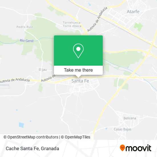
See Cache Santa Fe on the map
Public Transportation to Cache Santa Fe
Wondering how to get to Cache Santa Fe? Moovit helps you find the best way to get to Cache Santa Fe with step-by-step directions from the nearest public transit station.
Moovit provides free maps and live directions to help you navigate through your city. View schedules, routes, timetables, and find out how long does it take to get to Cache Santa Fe in real time.
Looking for the nearest stop or station to Cache Santa Fe? Check out this list of stops closest to your destination: Calderón; Ayuntamiento Santa Fe; Avenida Palos De La Frontera ,2; Santa Fe; Avda. Palos De La Frontera 2 V; Avda. Palos De La Frontera 2.
Bus: 140, CI1, 240, 241, 242, 340, CI2, 245, AERO-GRANA, MAL-GRA, 335, 336.
Want to see if there’s another route that gets you there at an earlier time? Moovit helps you find alternative routes or times. Get directions from and directions to Cache Santa Fe easily from the Moovit App or Website.
We make riding to Cache Santa Fe easy, which is why over 1.5 million users, including users in Santa Fe, trust Moovit as the best app for public transit. You don’t need to download an individual bus app or train app, Moovit is your all-in-one transit app that helps you find the best bus time or train time available.
For information on prices of bus, costs and ride fares to Cache Santa Fe, please check the Moovit app.
Use the app to navigate to popular places including to the airport, hospital, stadium, grocery store, mall, coffee shop, school, college, and university.
Cache Santa Fe Address: Calle Cristóbal Colón, 18320 Santa Fe street in Santa Fe
- Hontanilla Pérez Manuel,
- Recaudación Asesoria y Gestion,
- Domínguez & Rodríguez Abogados,
- Construcciones Segura Sánchez,
- La Pulga Comidas para Llevar S.L.,
- Siya Elevación,
- María Pilar Palmas Sierra,
- Margarita Empanadas Argentinas Santa Fe,
- Reiki Granada Centro SAE,
- Plaza José Martí,
- Antonio Garcia - Valdecasas Luque,
- 12 Modas,
- Gls,
- Hotel Santa Fe,
- Plaza Hermenegildo Lanz,
- Costura-Arreglos Primores Complementos,
- María Isabel Jiménez Villafranca,
- Perez de la Blanca M. C,
- Centro Médico de Conductores y Cazadores Calderón,
- Serviurbani 2004
Places Near Cache Santa Fe
- Serrallo Plaza, Granada,
- La Zubia, La Zubia,
- Estación De Autobuses De Granada, Granada,
- Renfe Estación de Tren, Granada,
- Palacio de Congresos de Granada, Granada,
- Centro Comercial Nevada Shopping, Armilla,
- Auditorio Manuel de Falla, Granada,
- PTS, Granada,
- Hospital de trauma, Granada,
- Nevada Shopping, Armilla,
- Jefatura Provincial De Tráfico, Granada,
- Estadio Nuevo Los Carmenes, Granada,
- Albaicín, Granada,
- Hospital Hla Inmaculada, Granada,
- Palacio De Congresos, Granada,
- Centro Comercial Kinépolis, Pulianas,
- Plaza de Toros, Granada,
- La Chana, Granada,
- Hospital Vithas, Granada,
- Carmen De Los Mártires, Granada
How to get to popular places in Granada with public transit
Get around Santa Fe by public transit!
Traveling around Santa Fe has never been so easy. See step by step directions as you travel to any attraction, street or major public transit station. View bus and train schedules, arrival times, service alerts and detailed routes on a map, so you know exactly how to get to anywhere in Santa Fe.
When traveling to any destination around Santa Fe use Moovit's Live Directions with Get Off Notifications to know exactly where and how far to walk, how long to wait for your line, and how many stops are left. Moovit will alert you when it's time to get off — no need to constantly re-check whether yours is the next stop.
Wondering how to use public transit in Santa Fe or how to pay for public transit in Santa Fe? Moovit public transit app can help you navigate your way with public transit easily, and at minimum cost. It includes public transit fees, ticket prices, and costs. Looking for a map of Santa Fe public transit lines? Moovit public transit app shows all public transit maps in Santa Fe with all Bus, Train and Metro routes and stops on an interactive map.
Granada has 3 transit type(s), including: Bus, Train and Metro, operated by several transit agencies, including Metro de Granada, Bus urbano Granada, TranspRober, Consorcio de Transporte Metropolitano de Granada, ALSA, Grupo Fajardo - Motril, Grupo Fajardo - Almuñécar, Grupo Fajardo - Salobreña, Paco Campos and Renfe