How to get to Cadida Software by bus?
Click on the bus route to see step by step directions with maps, line arrival times and updated time schedules.
How to get to Cadida Software by train?
Click on the train route to see step by step directions with maps, line arrival times and updated time schedules.
From Stadtwerke Villingen-Schwenningen GmbH, Villingen-Schwenningen
122 minFrom Hotel Palmenwald, Vereinbarte Verwaltungsgemeinschaft Freudenstadt
157 minFrom Lotto-Annahmestelle, Schopfheim
110 minFrom Klinik Hohenfreudenstadt, Vereinbarte Verwaltungsgemeinschaft Freudenstadt
197 minFrom Krankenhaus Freudenstadt, Vereinbarte Verwaltungsgemeinschaft Freudenstadt
190 minFrom Parkplatz Bauhaus, Verwaltungsgemeinschaft Offenburg
68 min
Bus stops near Cadida Software in Stuttgart
Light Rail stations near Cadida Software in Stuttgart
Train station near Cadida Software in Stuttgart
- Freiburg Hauptbahnhof, 8 min walk,VIEW
Bus lines to Cadida Software in Stuttgart
- 11, Freiburg Hauptbahnhof Bstg 14 - Freiburg, Munzinger Straße Bstg 12,VIEW
- 21, Freiburg, Dorfstraße Bstg 4 - Freiburg, Schauinslandbahn Talstation,VIEW
- 27, Freiburg, Europaplatz Bstg 4 - Freiburg, Richard-Strauss-Str.,VIEW
- 7208, Bad Krozingen Bahnhof Bstg 1 - Freiburg Hauptbahnhof Bstg 11,VIEW
- 7240, Staufen (Brsg) Bahnhof - Freiburg Hauptbahnhof Bstg 11,VIEW
- 7240, Freiburg Hauptbahnhof Bstg 9 - Bad Krozingen Bahnhof Bstg 4,VIEW
- 7240, Bad Krozingen Bahnhof Bstg 1 - Freiburg Hauptbahnhof Bstg 11,VIEW
- N40, Freiburg Hauptbahnhof Bstg 14 - Munzingen, Windhäuslegasse,VIEW
- 23, Freiburg, Gundelfinger Straße Bstg 7 - Freiburg Hauptbahnhof Bstg 4,VIEW
- 37, Munzingen, Windhäuslegasse - Freiburg Hauptbahnhof Bstg 4,VIEW
- 200, Elzach Bahnhof - Bleibach Bahnhof,VIEW
- 202, Freiburg, Gundelfinger Straße Bstg 7 - Denzlingen Bahnhof Bstg 2,VIEW
- 221, Himmelreich Bahnhof - Wagensteig Löwen,VIEW
- 510, Denzlingen Bahnhof Bstg 6 - Emmendingen Bahnhof Bussteig 4,VIEW
- 530, Umkirch, Adler - Freiburg, Gundelfinger Straße Bstg 7,VIEW
- 7212, Freiburg, Moosweiher Bstg 3 - March Holzhausen Pflugsweide,VIEW
- 7216, Freiburg Hauptbahnhof Bstg 11 - St. Peter Zähringer Eck,VIEW
- 7216, Freiburg Hauptbahnhof Bstg 11 - Kirchzarten Bahnhof Bstg 1,VIEW
- 7240, Freiburg Hauptbahnhof Bstg 10 - Staufen Süd / Gymnasium,VIEW
- RB 26, Offenburg - Freiburg Hauptbahnhof,VIEW
What are the closest stations to Cadida Software?
The closest stations to Cadida Software are:
- Freiburg, Rehlingstraße is 183 meters away, 3 min walk.
- Freiburg, Eschholzstraße is 202 meters away, 3 min walk.
- Freiburg Hauptbahnhof is 548 meters away, 8 min walk.
- Freiburg, Stadttheater is 921 meters away, 13 min walk.
Which bus lines stop near Cadida Software?
These bus lines stop near Cadida Software: 200, 221.
Which train lines stop near Cadida Software?
These train lines stop near Cadida Software: RE 7, RE7, S10.
Which light rail line stops near Cadida Software?
S10 (Freiburg Hauptbahnhof)
What’s the nearest light rail station to Cadida Software in Stuttgart?
The nearest light rail station to Cadida Software in Stuttgart is Freiburg, Eschholzstraße. It’s a 3 min walk away.
What’s the nearest train station to Cadida Software in Stuttgart?
The nearest train station to Cadida Software in Stuttgart is Freiburg Hauptbahnhof. It’s a 8 min walk away.
What’s the nearest bus station to Cadida Software in Stuttgart?
The nearest bus station to Cadida Software in Stuttgart is Freiburg, Rehlingstraße. It’s a 3 min walk away.
What time is the first light rail to Cadida Software in Stuttgart?
The 3 is the first light rail that goes to Cadida Software in Stuttgart. It stops nearby at 4:42 AM.
What time is the last light rail to Cadida Software in Stuttgart?
The 3 is the last light rail that goes to Cadida Software in Stuttgart. It stops nearby at 1:14 AM.
What time is the first train to Cadida Software in Stuttgart?
The RB27 is the first train that goes to Cadida Software in Stuttgart. It stops nearby at 4:29 AM.
What time is the last train to Cadida Software in Stuttgart?
The 20N is the last train that goes to Cadida Software in Stuttgart. It stops nearby at 7:23 AM.
What time is the first bus to Cadida Software in Stuttgart?
The 7212 is the first bus that goes to Cadida Software in Stuttgart. It stops nearby at 4:45 AM.
What time is the last bus to Cadida Software in Stuttgart?
The 27 is the last bus that goes to Cadida Software in Stuttgart. It stops nearby at 1:00 AM.
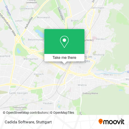
See Cadida Software, Stuttgart, on the map
Public Transit to Cadida Software in Stuttgart
Wondering how to get to Cadida Software in Stuttgart? Moovit helps you find the best way to get to Cadida Software with step-by-step directions from the nearest public transit station.
Moovit provides free maps and live directions to help you navigate through your city. View schedules, routes, timetables, and find out how long does it take to get to Cadida Software in real time.
Looking for the nearest stop or station to Cadida Software? Check out this list of stops closest to your destination: Freiburg; Freiburg; Freiburg Hauptbahnhof; Freiburg.
Bus: 200, 221, 11, 21, 27, 7208, 7240, 23, 37, 202.Train: RE 7, RE7, S10, TER, TGD, RE2, FLX10.Light Rail: S10.
Want to see if there’s another route that gets you there at an earlier time? Moovit helps you find alternative routes or times. Get directions from and directions to Cadida Software easily from the Moovit App or Website.
We make riding to Cadida Software easy, which is why over 1.5 million users, including users in Stuttgart, trust Moovit as the best app for public transit. You don’t need to download an individual bus app or train app, Moovit is your all-in-one transit app that helps you find the best bus time or train time available.
For information on prices of train, bus and light rail, costs and ride fares to Cadida Software, please check the Moovit app.
Use the app to navigate to popular places including to the airport, hospital, stadium, grocery store, mall, coffee shop, school, college, and university.
Cadida Software Address: Stühlingerstraße 24 Stühlinger, 79106 Freiburg im Breisgau street in Stuttgart
- Aesthemedica - Dr. Kalash & Prof. Dr. Simunovic Partnerschaft,
- Dr. med. Hansjoachim Krüger,
- Schwarzwaldaugenklinik Fr,
- Freiburg Gruendet de,
- Unternehmensberatung Becker,
- Lorettokrankenhaus,
- Whitecheap,
- Medikation Mediation,
- International Assistance Company Ug (Haftungsbeschränkt),
- Praxisklinik im Stühlinger,
- Gronewald Freiburg,
- Gebäudereinigung Drndelic,
- Kucci,
- Redaktionsbüro Frauke Bahle,
- Yeminli Tercüman Mütercim,
- Spezial Elektronik Produktion,
- Turk-Text,
- Dr. Thomas Uhlendahl,
- Axnovia,
- Angelika Jodl
Places Near Cadida Software (Stuttgart)
- Gleis 101/102 (tief), Stuttgart-Mitte,
- Mettingen Eros-Center Puff Laufhaus, Esslingen Am Neckar,
- Porsche-Arena, Bad Cannstatt,
- Hauptbahnhof Stuttgart, Stuttgart-Mitte,
- Geilhaus Haus 33a, Reutlingen-Betzingen,
- Im Wizemann (Halle), Bad Cannstatt,
- SI-Centrum, Möhringen,
- Hanns-Martin-Schleyer-Halle (Stuttgart Hans-Martin-Schleyerhalle), Bad Cannstatt,
- Gasometer Pforzheim, Pforzheim,
- Waldfriedhof, Degerloch,
- Schleyerhalle, Bad Cannstatt,
- FlixBus Haltestelle, Stuttgart,
- Wilhelma (U-Bahn Wilhelma), Bad Cannstatt,
- Porsche Museum, Zuffenhausen,
- Klinikum Stuttgart - Katharinenhospital, Stuttgart-Mitte,
- Hanns-Martin-Schleyer-Halle, Bad Cannstatt,
- Mercedes-Benz Museum, Bad Cannstatt,
- Mercedes-Benz Museum (Mercedes Museum Stuttgart), Bad Cannstatt,
- Pariser Platz Stuttgart, Stuttgart-Mitte,
- Marmorsaal Im Weissenburgpark, Stuttgart-Süd
How to get to popular places in Stuttgart with public transit
Get around Stuttgart by public transit!
Traveling around Stuttgart has never been so easy. See step by step directions as you travel to any attraction, street or major public transit station. View bus and train schedules, arrival times, service alerts and detailed routes on a map, so you know exactly how to get to anywhere in Stuttgart.
When traveling to any destination around Stuttgart use Moovit's Live Directions with Get Off Notifications to know exactly where and how far to walk, how long to wait for your line, and how many stops are left. Moovit will alert you when it's time to get off — no need to constantly re-check whether yours is the next stop.
Wondering how to use public transit in Stuttgart or how to pay for public transit in Stuttgart? Moovit public transit app can help you navigate your way with public transit easily, and at minimum cost. It includes public transit fees, ticket prices, and costs. Looking for a map of Stuttgart public transit lines? Moovit public transit app shows all public transit maps in Stuttgart with all Bus, Train, Subway, Light Rail, Ferry, S-Bahn and Funicular routes and stops on an interactive map.
Stuttgart has 7 transit type(s), including: Bus, Train, Subway, Light Rail, Ferry, S-Bahn and Funicular, operated by several transit agencies, including SSB - Stadtbahn, SSB, SSB - Seilbahn / Zacke, S-Bahn Stuttgart, Rhein-Neckar-Verkehr GmbH (rnv), Karlsruher Verkehrsverbund, DB AG, DB Regiobus BW, Arverio Baden-Württemberg GmbH, DB RegioNetz Verkehrs GmbH Westfrankenbahn, DB Regio AG Baden-Württemberg, Südwestdeutsche Verkehrs-AG, DB Regio AG Mitte Region Hessen, DB and Bodensee-Oberschwaben-Bahn
Public transit lines with stations closest to Cadida Software in Stuttgart
Train lines with stations closest to Cadida Software in Stuttgart
Bus lines with stations closest to Cadida Software in Stuttgart
Freiburg, Rehlingstraße
 11Freiburg Hauptbahnhof Bstg 14 - Freiburg, Munzinger Straße Bstg 12
- 21Freiburg, Dorfstraße Bstg 4 - Freiburg, Schauinslandbahn Talstation
- 27Freiburg, Europaplatz Bstg 4 - Freiburg, Richard-Strauss-Str.
- 7208Bad Krozingen Bahnhof Bstg 1 - Freiburg Hauptbahnhof Bstg 11
- 7240Staufen (Brsg) Bahnhof - Freiburg Hauptbahnhof Bstg 11