How to get to Café Raio de Lua by bus?
Click on the bus route to see step by step directions with maps, line arrival times and updated time schedules.
Bus stops near Café Raio de Lua in Vila Real
Bus lines to Café Raio de Lua in Vila Real
What are the closest stations to Café Raio de Lua?
The closest stations to Café Raio de Lua are:
- R. Frei Miguel Contreiras is 111 meters away, 2 min walk.
- Cemiterio is 112 meters away, 2 min walk.
Which bus lines stop near Café Raio de Lua?
These bus lines stop near Café Raio de Lua: 1, C-4019, IR004.
What’s the nearest bus station to Café Raio de Lua in Vila Real?
The nearest bus stations to Café Raio de Lua in Vila Real are R. Frei Miguel Contreiras and Cemiterio. The closest one is a 2 min walk away.
What time is the first bus to Café Raio de Lua in Vila Real?
The 1 is the first bus that goes to Café Raio de Lua in Vila Real. It stops nearby at 9:12 AM.
What time is the last bus to Café Raio de Lua in Vila Real?
The N is the last bus that goes to Café Raio de Lua in Vila Real. It stops nearby at 11:37 PM.
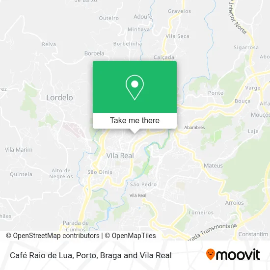
See Café Raio de Lua, Vila Real, on the map
Public Transit to Café Raio de Lua in Vila Real
Wondering how to get to Café Raio de Lua in Vila Real? Moovit helps you find the best way to get to Café Raio de Lua with step-by-step directions from the nearest public transit station.
Moovit provides free maps and live directions to help you navigate through your city. View schedules, routes, timetables, and find out how long does it take to get to Café Raio de Lua in real time.
Looking for the nearest stop or station to Café Raio de Lua? Check out this list of stops closest to your destination: R. Frei Miguel Contreiras; Cemiterio.
Bus: 1, C-4019, IR004, N, 3.
Want to see if there’s another route that gets you there at an earlier time? Moovit helps you find alternative routes or times. Get directions from and directions to Café Raio de Lua easily from the Moovit App or Website.
We make riding to Café Raio de Lua easy, which is why over 1.5 million users, including users in Vila Real, trust Moovit as the best app for public transit. You don’t need to download an individual bus app or train app, Moovit is your all-in-one transit app that helps you find the best bus time or train time available.
For information on prices of bus and train, costs and ride fares to Café Raio de Lua, please check the Moovit app.
Use the app to navigate to popular places including to the airport, hospital, stadium, grocery store, mall, coffee shop, school, college, and university.
Café Raio de Lua Address: Rua de Frei Miguel Contreiras Vila Real, 5000-406 Vila Real street in Vila Real
- Quorum Saúde,
- Symphony Coffee,
- Madeirenses na Bila,
- Onevet Hospital Veterinário Trás-os-Montes,
- Casa de Pasto Barros,
- Rua de Santa Iria,
- Instituto de Meteorologia,
- Rua Major António Fernandes Varão 15,
- Bairro S. Vicente de Paulo,
- Sociedade Interbancaria de Serviços S a Sibs,
- Café Bilhares,
- Clínica Médica da Cidade - Medical Cb,
- G.i.m. - Gestimac, Gestão e Investimentos Imobiliários, Macieirinha Sucrs.,
- Clínica Persona Vila Real,
- Cemitério de Santa Iria,
- Serv. Municipalizados de Água e Saneamento,
- Resp Nao Estava,
- Casa Li,
- Marechal Optical,
- Linha Magenta
Places Near Café Raio de Lua (Vila Real)
- Rua Calouste Gulbenkian, Lordelo do Ouro e Massarelos,
- Estádio do Dragão, Campanhã,
- Hospital Santos Silva, Vila Nova De Gaia,
- El Corte Inglés de Gaia, Mafamude e Vilar do Paraíso,
- Avintes, Vila Nova De Gaia,
- VILA do CONDE PORTO FASHION OUTLET, Modivas,
- Senhor de Matosinhos, Matosinhos e Leça da Palmeira,
- Palácio de Cristal, Lordelo do Ouro e Massarelos,
- Acesso ao Shopping Parque Nascente, Campanhã,
- Zoo Santo Inácio, Vila Nova De Gaia,
- Maia, Maia,
- Valongo, Valongo,
- Espinho, Espinho,
- Parque Aquatico Amarante - Aqua Aventura, Amarante,
- Hospital de Santo António, Cedofeita, Santo Ildefonso, Sé, Miragaia, São Nicolau e Vitória,
- Arrábida Shopping, Santa Marinha e São Pedro da Afurada,
- Hospital da Prelada, Ramalde,
- MAR Shopping, Matosinhos e Leça da Palmeira,
- Canidelo, Vila Nova De Gaia,
- Leça da Palmeira, Matosinhos e Leça da Palmeira
How to get to popular places in Porto, Braga and Vila Real with public transit
Get around Vila Real by public transit!
Traveling around Vila Real has never been so easy. See step by step directions as you travel to any attraction, street or major public transit station. View bus and train schedules, arrival times, service alerts and detailed routes on a map, so you know exactly how to get to anywhere in Vila Real.
When traveling to any destination around Vila Real use Moovit's Live Directions with Get Off Notifications to know exactly where and how far to walk, how long to wait for your line, and how many stops are left. Moovit will alert you when it's time to get off — no need to constantly re-check whether yours is the next stop.
Wondering how to use public transit in Vila Real or how to pay for public transit in Vila Real? Moovit public transit app can help you navigate your way with public transit easily, and at minimum cost. It includes public transit fees, ticket prices, and costs. Looking for a map of Vila Real public transit lines? Moovit public transit app shows all public transit maps in Vila Real with all Bus, Train, Metro, Ferry, Funicular and Gondola routes and stops on an interactive map.
Porto, Braga and Vila Real has 6 transit type(s), including: Bus, Train, Metro, Ferry, Funicular and Gondola, operated by several transit agencies, including Metro do Porto, Metro do Porto - Metrobus, CP - Comboios de Portugal, STCP, UNIR Mobilidade da Area Metropolitana do Porto, Getbus - Aerobus, Mobiave, Valpibus, TUB - Transportes Urbanos de Braga, TuViana, Guimabus, Ave Mobilidade, Cávado Mobilidade, Transdev and Câmara Municipal de Santo Tirso