How to get to Cafe City Chow by bus?
Click on the bus route to see step by step directions with maps, line arrival times and updated time schedules.
From Franklin Ave, Bronx
72 minFrom 52 Broadway, Manhattan
56 minFrom Staten Island Ferry - Whitehall Terminal, Manhattan
44 minFrom Red Rooster Harlem, Manhattan
54 minFrom 1231 Lafayette Avenue, Bronx
83 minFrom Broadway and 168th St, Manhattan
71 minFrom Brooklyn Bridge Park - Pier 1, Manhattan
113 minFrom Jackson Heights, NY, Queens
77 minFrom American Dream, East Rutherford
56 min
How to get to Cafe City Chow by train?
Click on the train route to see step by step directions with maps, line arrival times and updated time schedules.
How to get to Cafe City Chow by subway?
Click on the subway route to see step by step directions with maps, line arrival times and updated time schedules.
From Franklin Ave, Bronx
54 minFrom 52 Broadway, Manhattan
20 minFrom Staten Island Ferry - Whitehall Terminal, Manhattan
28 minFrom Red Rooster Harlem, Manhattan
24 minFrom 1231 Lafayette Avenue, Bronx
44 minFrom Broadway and 168th St, Manhattan
35 minFrom Brooklyn Bridge Park - Pier 1, Manhattan
32 minFrom Jackson Heights, NY, Queens
36 min
Bus stops near Cafe City Chow in Manhattan
Subway station near Cafe City Chow in Manhattan
- Grand Central-42 St, 4 min walk,VIEW
Bus lines to Cafe City Chow in Manhattan
- HAMPTON JITNEY NORTH FORK, Orient Point,VIEW
- BXM1, East Midtown 34 St Via Lex Av,VIEW
- QM31, Fresh Meadows - Midtown Express,VIEW
- QM35, Glen Oaks - Midtown Express,VIEW
- QM36, Lake Success - Midtown Express,VIEW
- QM44, Electchester - Midtown Express,VIEW
- M101, Ft George Via 3 Av Via Amsterdam Av,VIEW
- M102, Harlem 147 St Via 3 Av Via Lenox Av,VIEW
- M103, East Harlem 125 St Via 3 Av,VIEW
- M42, East Side U N-1 Av Crosstown,VIEW
- SUBURBAN TRANSIT, Twin Rivers,VIEW
- SUBURBAN TRANSIT, Hillsborough,VIEW
- SUBURBAN TRANSIT, New Brunswick,VIEW
- QM32, Bay Terrace - Midtown Express,VIEW
- QM34, Glendale - Midtown Express,VIEW
- QM40, Lefrak City - Midtown Express,VIEW
- QM42, Forest Hills - Midtown Express,VIEW
- 42ND ST, E 42nd St & 3rd Ave,VIEW
What are the closest stations to Cafe City Chow?
The closest stations to Cafe City Chow are:
- 44th Street is 127 yards away, 2 min walk.
- Lexington Av/E 42 St is 182 yards away, 3 min walk.
- 3 Av/E 44 St is 207 yards away, 3 min walk.
- 3 Av/E 45 St is 234 yards away, 4 min walk.
- E 42 St/Lexington Av is 242 yards away, 4 min walk.
- E 42nd St & 3rd Ave is 246 yards away, 3 min walk.
- 3 Av/E 43 St is 247 yards away, 4 min walk.
- Grand Central-42 St is 256 yards away, 4 min walk.
Which bus lines stop near Cafe City Chow?
These bus lines stop near Cafe City Chow: BM2, BXM4, M1, M15-SBS, M42, M5, M55, Q32, QM34.
Which train lines stop near Cafe City Chow?
These train lines stop near Cafe City Chow: 2, BABYLON BRANCH, YEL.
Which subway lines stop near Cafe City Chow?
These subway lines stop near Cafe City Chow: 4, 5, 6X, 7, S.
What’s the nearest subway station to Cafe City Chow in Manhattan?
The nearest subway station to Cafe City Chow in Manhattan is Grand Central-42 St. It’s a 4 min walk away.
What’s the nearest bus station to Cafe City Chow in Manhattan?
The nearest bus station to Cafe City Chow in Manhattan is 44th Street. It’s a 2 min walk away.
What time is the first subway to Cafe City Chow in Manhattan?
The 6X is the first subway that goes to Cafe City Chow in Manhattan. It stops nearby at 3:02 AM.
What time is the last subway to Cafe City Chow in Manhattan?
The 6 is the last subway that goes to Cafe City Chow in Manhattan. It stops nearby at 3:44 AM.
What time is the first bus to Cafe City Chow in Manhattan?
The M103 is the first bus that goes to Cafe City Chow in Manhattan. It stops nearby at 3:01 AM.
What time is the last bus to Cafe City Chow in Manhattan?
The M103 is the last bus that goes to Cafe City Chow in Manhattan. It stops nearby at 3:01 AM.
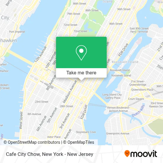
See Cafe City Chow, Manhattan, on the map
Public Transit to Cafe City Chow in Manhattan
Wondering how to get to Cafe City Chow in Manhattan? Moovit helps you find the best way to get to Cafe City Chow with step-by-step directions from the nearest public transit station.
Moovit provides free maps and live directions to help you navigate through your city. View schedules, routes, timetables, and find out how long does it take to get to Cafe City Chow in real time.
Looking for the nearest stop or station to Cafe City Chow? Check out this list of stops closest to your destination: 44th Street; Lexington Av/E 42 St; 3 Av/E 44 St; 3 Av/E 45 St; E 42 St/Lexington Av; E 42nd St & 3rd Ave; 3 Av/E 43 St; Grand Central-42 St.
Bus: BM2, BXM4, M1, M15-SBS, M42, M5, M55, Q32, QM34, HAMPTON JITNEY NORTH FORK, BXM1, QM31, QM35, QM36, QM44, SUBURBAN TRANSIT, SUBURBAN TRANSIT, SUBURBAN TRANSIT.Train: 2, BABYLON BRANCH, YEL.Subway: 4, 5, 6X, 7, S, 6.
Want to see if there’s another route that gets you there at an earlier time? Moovit helps you find alternative routes or times. Get directions from and directions to Cafe City Chow easily from the Moovit App or Website.
We make riding to Cafe City Chow easy, which is why over 1.5 million users, including users in Manhattan, trust Moovit as the best app for public transit. You don’t need to download an individual bus app or train app, Moovit is your all-in-one transit app that helps you find the best bus time or train time available.
For information on prices of subway, bus and train, costs and ride fares to Cafe City Chow, please check the Moovit app.
Use the app to navigate to popular places including to the airport, hospital, stadium, grocery store, mall, coffee shop, school, college, and university.
Cafe City Chow Address: 420 Lexington Ave street in Manhattan
- Mta Police Department,
- The Vault Nyc,
- Samyang Corporation,
- Lexington National Land Services,
- Corey M. Shapiro, Esq.,
- Funding Queen Usa,
- Inamerica,
- Omni Channel Career Services,
- New York Career Academy, Inc.,
- Student Hotel - Collge Inns,
- International Modern Arts Consortium - Imac,
- Smart Hotelz,
- Sl Green Realty Corp,
- Cloud Ventures,
- Bbb Business Financing,
- Gexfix - Distribution Partner Of Assut Europe,
- Hoppify,
- Hotel Managers Forum,
- Miranda Munro - Nylic,
- New York Life Greater New York General Office
Places Near Cafe City Chow (Manhattan)
- 66 John Street, Manhattan,
- Mountainside Hospital, Glen Ridge,
- 911 Memorial, Manhattan,
- Bellevue Hospital, Manhattan,
- Hudson Yards, Manhattan,
- qqqq, Manhattan,
- Chinatown, Manhattan,
- Rockefeller Center, Manhattan,
- Queens Center Mall, Queens,
- 1 Police Plaza, Manhattan,
- 26 Federal Plaza, Manhattan,
- 111 Centre New York City Supreme Court, Manhattan,
- 3 Stone St, Manhattan,
- San Gennaro Feast, Manhattan,
- SoHo, Manhattan,
- 376 Hudson Street, Manhattan,
- Wall Street, Manhattan,
- Katz's Deli, Manhattan,
- Times Square, Manhattan,
- Pier 83, Manhattan
How to get to popular places in New York - New Jersey with public transit
Get around Manhattan by public transit!
Traveling around Manhattan has never been so easy. See step by step directions as you travel to any attraction, street or major public transit station. View bus and train schedules, arrival times, service alerts and detailed routes on a map, so you know exactly how to get to anywhere in Manhattan.
When traveling to any destination around Manhattan use Moovit's Live Directions with Get Off Notifications to know exactly where and how far to walk, how long to wait for your line, and how many stops are left. Moovit will alert you when it's time to get off — no need to constantly re-check whether yours is the next stop.
Wondering how to use public transit in Manhattan or how to pay for public transit in Manhattan? Moovit public transit app can help you navigate your way with public transit easily, and at minimum cost. It includes public transit fees, ticket prices, and costs. Looking for a map of Manhattan public transit lines? Moovit public transit app shows all public transit maps in Manhattan with all Bus, Train, Subway, Light Rail, Ferry and Cable Car routes and stops on an interactive map.
New York - New Jersey has 6 transit type(s), including: Bus, Train, Subway, Light Rail, Ferry and Cable Car, operated by several transit agencies, including MTA Subway, Metro-North Railroad, LIRR, PATH, MTA New York City Transit - Express routes, MTA Bus, NJ Transit, NYC Ferry, NICE bus, Bee-Line Bus, NJ Transit Rail, Norwalk Transit District, Hartford Line, River Valley Transit and HART