How to get to Cafe Lets Eat by bus?
Click on the bus route to see step by step directions with maps, line arrival times and updated time schedules.
From Wakdewadi, Pune & Velhe
29 minFrom Sukhsagar Nagar, Pune & Velhe
22 minFrom The Westin, Pune & Velhe
44 minFrom Tingre Nagar-Vidya Nagar, Pune & Velhe
49 minFrom Kharadi Bypass, Pune & Velhe
51 minFrom Pune international airport, Pune & Velhe
48 minFrom Aero Mall Pune, Pune & Velhe
48 minFrom Koregaon Park, Pune & Velhe
39 minFrom Ramkrushna Mangal Karyalaya Pimple Gurav, Pune & Velhe
48 minFrom Reliance Mart, Pune & Velhe
51 min
How to get to Cafe Lets Eat by metro?
Click on the metro route to see step by step directions with maps, line arrival times and updated time schedules.
Metro stations near Cafe Lets Eat in Pune & Velhe
Bus stops near Cafe Lets Eat in Pune & Velhe
Bus lines to Cafe Lets Eat in Pune & Velhe
- 15, Bhekrainagar Depot - DSK Vishwa,VIEW
- 17, Narhegaon - Shivajinagar,VIEW
- 47, Swargate - Sanaswadi Nandoshi,VIEW
- 50, Shanivarwada Bus Stand - Sinhgad Paytha,VIEW
- 52, Swargate - Khanapur Manerwadi Phata,VIEW
- 60, Swargate - Ghule Nagar Vadgaon Budruk,VIEW
- 96, Swargate - Jambhali Nilkantheshwar Mandir Paytha,VIEW
- 117, Swargate - Dhayareshwar Mandir,VIEW
- 118, Swargate - Vadgaon Budruk Stand,VIEW
- 15A, Shewalewadi Depot - Dhayari Yash Platinum Society,VIEW
- 17A, Swargate - Narhegaon,VIEW
- 52A, Swargate - Varasgaon (Goradwadi),VIEW
- 118A, Swargate - Suncity,VIEW
- 50B, Swargate - Sinhgad Paytha,VIEW
- 52B, Marketyard - Khanapur,VIEW
- 55B, Swargate - Suncity,VIEW
- 117B, Swargate - Raikar Mala Dhayari,VIEW
- 118B, Swargate - Venutai Chavan College,VIEW
- 52C, Swargate - Osade Phata,VIEW
- 118C, Swargate - Bageshree Kalashree Society Nanded City,VIEW
What are the closest stations to Cafe Lets Eat?
The closest stations to Cafe Lets Eat are:
- Swargate is 123 meters away, 2 min walk.
- Swargate Natraj Stand is 139 meters away, 2 min walk.
- Swargate Corner is 157 meters away, 3 min walk.
- Gokul Bhavan (Swargate Corner) is 240 meters away, 4 min walk.
- Police Line Swargate is 289 meters away, 4 min walk.
- Chhatrapati Sambhaji Garden is 601 meters away, 8 min walk.
- Mitra Mandal Sabhagruha Chowk is 714 meters away, 10 min walk.
Which bus lines stop near Cafe Lets Eat?
These bus lines stop near Cafe Lets Eat: 11, 235, 24A, 24B, 42, 71.
Which metro line stops near Cafe Lets Eat?
PURPLE (Towards Swargate)
What’s the nearest metro station to Cafe Lets Eat in Pune & Velhe?
The nearest metro station to Cafe Lets Eat in Pune & Velhe is Swargate. It’s a 2 min walk away.
What’s the nearest bus station to Cafe Lets Eat in Pune & Velhe?
The nearest bus station to Cafe Lets Eat in Pune & Velhe is Swargate Natraj Stand. It’s a 2 min walk away.
What time is the first metro to Cafe Lets Eat in Pune & Velhe?
The PURPLE is the first metro that goes to Cafe Lets Eat in Pune & Velhe. It stops nearby at 6:00 AM.
What time is the last metro to Cafe Lets Eat in Pune & Velhe?
The PURPLE is the last metro that goes to Cafe Lets Eat in Pune & Velhe. It stops nearby at 11:33 PM.
What time is the first bus to Cafe Lets Eat in Pune & Velhe?
The RATRANI 2 is the first bus that goes to Cafe Lets Eat in Pune & Velhe. It stops nearby at 3:41 AM.
What time is the last bus to Cafe Lets Eat in Pune & Velhe?
The RATRANI 2 is the last bus that goes to Cafe Lets Eat in Pune & Velhe. It stops nearby at 2:59 AM.
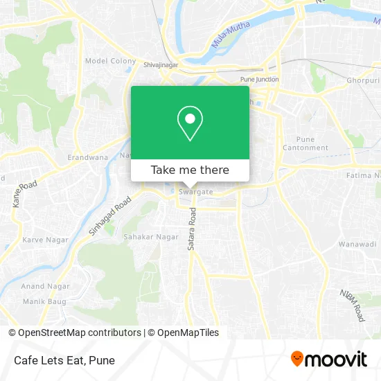
See Cafe Lets Eat, Pune & Velhe, on the map
Public Transit to Cafe Lets Eat in Pune & Velhe
Wondering how to get to Cafe Lets Eat in Pune & Velhe? Moovit helps you find the best way to get to Cafe Lets Eat with step-by-step directions from the nearest public transit station.
Moovit provides free maps and live directions to help you navigate through your city. View schedules, routes, timetables, and find out how long does it take to get to Cafe Lets Eat in real time.
Looking for the nearest stop or station to Cafe Lets Eat? Check out this list of stops closest to your destination: Swargate; Swargate Natraj Stand; Swargate Corner; Gokul Bhavan (Swargate Corner); Police Line Swargate; Chhatrapati Sambhaji Garden; Mitra Mandal Sabhagruha Chowk.
Bus: 11, 235, 24A, 24B, 42, 71, 15, 17, 47, 50, 52, 3, 4, 12, 26, 27, 2, 5, 6, 13, 37, 37A, 17B.Metro: PURPLE, AQUA.
Want to see if there’s another route that gets you there at an earlier time? Moovit helps you find alternative routes or times. Get directions from and directions to Cafe Lets Eat easily from the Moovit App or Website.
We make riding to Cafe Lets Eat easy, which is why over 1.5 million users, including users in Pune & Velhe, trust Moovit as the best app for public transit. You don’t need to download an individual bus app or train app, Moovit is your all-in-one transit app that helps you find the best bus time or train time available.
For information on prices of bus and metro, costs and ride fares to Cafe Lets Eat, please check the Moovit app.
Use the app to navigate to popular places including to the airport, hospital, stadium, grocery store, mall, coffee shop, school, college, and university.
Cafe Lets Eat Address: Golden Quadrilateral पुणे 411042 MH street in Pune & Velhe
- Janakalyan Raktapedhi,
- Bharat Vikas Parishad Pathology Laboratory,
- Oyo Hotel,
- Chanakya Tea Centre & Snacks Centre Pan Shop,
- Pune Municipal Corporation Regional Office,
- Sai Baba Math,
- Ganesh Kala Krida Manch,
- Heera Bagh,
- Shree Ganesh Krida Rang Manch,
- Maharana Pratap Gym,
- Swargate Pmpml Bus Stand,
- Swargate Police Station,
- MSRTC Swargate Bus Depot,
- Swargate Msrtc Bus Stand,
- Nucleonics Traffic Equipmentts,
- Jawaharlal Nehru Stadium,
- Swargate bus Station,
- Nehru Stadium,
- Pune labour court,
- Kalubai Mandir
Places Near Cafe Lets Eat (Pune & Velhe)
- Tulshibaug, Pune & Velhe,
- Pune Okayama Friendship Garden, Pune & Velhe,
- M G Road, Pune & Velhe,
- Laxmi Road, Pune & Velhe,
- Vishwakarma Institute Of Technology (Vit), Pune & Velhe,
- Fc Road, Pune & Velhe,
- Ion Digital Zone, Pune & Velhe,
- Dagdusheth Halwai Ganpati Mandir, Pune & Velhe,
- Chaturshringi Temple, Pune & Velhe,
- Pvr Icon - Pavilion Mall, Pune & Velhe,
- Swaminarayan Mandir, Pune & Velhe,
- Raviwar Peth, Pune & Velhe,
- Westend Mall, Pune & Velhe,
- Cognizant Deccan Campus (CDC), Paud,
- Sarasbaug, Pune & Velhe,
- Symbiosis Lavale Bus Stop, Pune & Velhe,
- ISKCON Pune, Pune & Velhe,
- ISKCON Nvcc Temple, Pune & Velhe,
- Dagadusheth Halwai Ganapati Temple, Pune & Velhe,
- Senapati Bapat Road, Pune & Velhe
How to get to popular places in Pune with public transit
Get around Pune & Velhe by public transit!
Traveling around Pune & Velhe has never been so easy. See step by step directions as you travel to any attraction, street or major public transit station. View bus and train schedules, arrival times, service alerts and detailed routes on a map, so you know exactly how to get to anywhere in Pune & Velhe.
When traveling to any destination around Pune & Velhe use Moovit's Live Directions with Get Off Notifications to know exactly where and how far to walk, how long to wait for your line, and how many stops are left. Moovit will alert you when it's time to get off — no need to constantly re-check whether yours is the next stop.
Wondering how to use public transit in Pune & Velhe or how to pay for public transit in Pune & Velhe? Moovit public transit app can help you navigate your way with public transit easily, and at minimum cost. It includes public transit fees, ticket prices, and costs. Looking for a map of Pune & Velhe public transit lines? Moovit public transit app shows all public transit maps in Pune & Velhe with all Bus, Train and Metro routes and stops on an interactive map.
Pune has 3 transit type(s), including: Bus, Train and Metro, operated by several transit agencies, including Pune Metro (Maha Metro), PMPML, PMPML Night Bus Service (Ratrani) and Central Railways (Indian Railways)