How to get to Cafetería Chupa Dedos by bus?
Click on the bus route to see step by step directions with maps, line arrival times and updated time schedules.
From Instituto Nacional de Seguridad Social, Granada
58 minFrom Direccion General de Trafico, Huétor Vega
59 minFrom Urgencias Hospital Clínico, Granada, Granada
30 minFrom Restaurante Balcón Del Genil, Huétor Vega
65 minFrom La Abuela Pepa, Armilla
63 minFrom Cruz Roja Granada, Granada
48 minFrom Yo10, Granada
55 minFrom Parque Tecnologico de la Salud, Granada
68 minFrom Plaza Larga, Granada
42 minFrom Lady Pepa 1 - Antigua Winston, Churriana De La Vega
70 min
How to get to Cafetería Chupa Dedos by metro?
Click on the metro route to see step by step directions with maps, line arrival times and updated time schedules.
From Instituto Nacional de Seguridad Social, Granada
67 minFrom Direccion General de Trafico, Huétor Vega
96 minFrom Urgencias Hospital Clínico, Granada, Granada
64 minFrom La Abuela Pepa, Armilla
89 minFrom Cruz Roja Granada, Granada
85 minFrom Yo10, Granada
66 minFrom Parque Tecnologico de la Salud, Granada
84 minFrom Plaza Larga, Granada
76 minFrom Lady Pepa 1 - Antigua Winston, Churriana De La Vega
107 min
Bus stops near Cafetería Chupa Dedos in Peligros
Metro station near Cafetería Chupa Dedos in Peligros
- Albolote, 27 min walk,VIEW
Bus lines to Cafetería Chupa Dedos in Peligros
What are the closest stations to Cafetería Chupa Dedos?
The closest stations to Cafetería Chupa Dedos are:
- Av Fco José Contreras Ruiz.N5 is 84 meters away, 2 min walk.
- Avda. Contreras Ruiz 1 V is 190 meters away, 3 min walk.
- Albolote is 2078 meters away, 27 min walk.
Which bus lines stop near Cafetería Chupa Dedos?
These bus lines stop near Cafetería Chupa Dedos: 110, L-0110 IDA.
Which metro line stops near Cafetería Chupa Dedos?
1 (Armilla→Albolote)
What’s the nearest metro station to Cafetería Chupa Dedos in Peligros?
The nearest metro station to Cafetería Chupa Dedos in Peligros is Albolote. It’s a 27 min walk away.
What’s the nearest bus station to Cafetería Chupa Dedos in Peligros?
The nearest bus station to Cafetería Chupa Dedos in Peligros is Av Fco José Contreras Ruiz.N5. It’s a 2 min walk away.
What time is the first metro to Cafetería Chupa Dedos in Peligros?
The 1 is the first metro that goes to Cafetería Chupa Dedos in Peligros. It stops nearby at 6:30 AM.
What time is the last metro to Cafetería Chupa Dedos in Peligros?
The 1 is the last metro that goes to Cafetería Chupa Dedos in Peligros. It stops nearby at 11:51 PM.
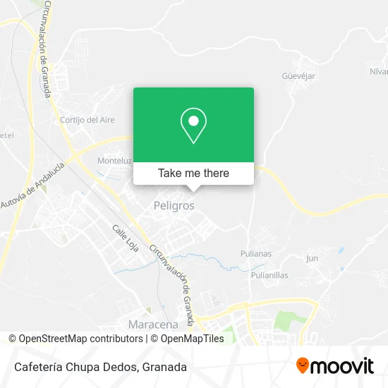
See Cafetería Chupa Dedos, Peligros, on the map
Public Transit to Cafetería Chupa Dedos in Peligros
Wondering how to get to Cafetería Chupa Dedos in Peligros? Moovit helps you find the best way to get to Cafetería Chupa Dedos with step-by-step directions from the nearest public transit station.
Moovit provides free maps and live directions to help you navigate through your city. View schedules, routes, timetables, and find out how long does it take to get to Cafetería Chupa Dedos in real time.
Looking for the nearest stop or station to Cafetería Chupa Dedos? Check out this list of stops closest to your destination: Av Fco José Contreras Ruiz.N5; Avda. Contreras Ruiz 1 V; Albolote.
Bus: 110, L-0110 IDA, L-111L, L-0111VTA, 111, 111L.Metro: 1.
Want to see if there’s another route that gets you there at an earlier time? Moovit helps you find alternative routes or times. Get directions from and directions to Cafetería Chupa Dedos easily from the Moovit App or Website.
We make riding to Cafetería Chupa Dedos easy, which is why over 1.5 million users, including users in Peligros, trust Moovit as the best app for public transit. You don’t need to download an individual bus app or train app, Moovit is your all-in-one transit app that helps you find the best bus time or train time available.
For information on prices of bus and metro, costs and ride fares to Cafetería Chupa Dedos, please check the Moovit app.
Use the app to navigate to popular places including to the airport, hospital, stadium, grocery store, mall, coffee shop, school, college, and university.
Cafetería Chupa Dedos Address: Calle Málaga, 5 18210 Peligros street in Peligros
- Artecar Decoración,
- Salon La Consentida,
- Cristóbal Lopez e Hijos,
- Strugal,
- Prima Europa Monitors,
- Macagran,
- Flamenkito,
- Pcolodro,
- Comesur,
- Puri Colodro,
- Esquelas de Ideal,
- Elisabetta Franchi For Celyn B Top,
- Talleres y Venta Gener,
- Fabrica de Muebles José Robles,
- Cafes Zaidin,
- Fer 4-J,
- Automaticos V,
- Supermercado San Andrés,
- Cafés Zaidín S a,
- Los Autenticos Artesan
Places Near Cafetería Chupa Dedos (Peligros)
- La Zubia, La Zubia,
- Hospital Vithas, Granada,
- Renfe Estación de Tren, Granada,
- Hospital Hla Inmaculada, Granada,
- Auditorio Manuel de Falla, Granada,
- Centro Comercial Nevada Shopping, Armilla,
- Carmen De Los Mártires, Granada,
- Hospital de trauma, Granada,
- Estación De Autobuses De Granada, Granada,
- La Chana, Granada,
- PTS, Granada,
- Palacio De Congresos, Granada,
- Plaza de Toros, Granada,
- Nevada Shopping, Armilla,
- Estadio Nuevo Los Carmenes, Granada,
- Centro Comercial Kinépolis, Pulianas,
- Albaicín, Granada,
- Serrallo Plaza, Granada,
- Palacio de Congresos de Granada, Granada,
- Jefatura Provincial De Tráfico, Granada
How to get to popular places in Granada with public transit
Get around Peligros by public transit!
Traveling around Peligros has never been so easy. See step by step directions as you travel to any attraction, street or major public transit station. View bus and train schedules, arrival times, service alerts and detailed routes on a map, so you know exactly how to get to anywhere in Peligros.
When traveling to any destination around Peligros use Moovit's Live Directions with Get Off Notifications to know exactly where and how far to walk, how long to wait for your line, and how many stops are left. Moovit will alert you when it's time to get off — no need to constantly re-check whether yours is the next stop.
Wondering how to use public transit in Peligros or how to pay for public transit in Peligros? Moovit public transit app can help you navigate your way with public transit easily, and at minimum cost. It includes public transit fees, ticket prices, and costs. Looking for a map of Peligros public transit lines? Moovit public transit app shows all public transit maps in Peligros with all Bus, Train and Metro routes and stops on an interactive map.
Granada has 3 transit type(s), including: Bus, Train and Metro, operated by several transit agencies, including Metro de Granada, Bus urbano Granada, TranspRober, Consorcio de Transporte Metropolitano de Granada, ALSA, Grupo Fajardo - Motril, Grupo Fajardo - Almuñécar, Grupo Fajardo - Salobreña, Paco Campos and Renfe