Directions to Caju with public transportation
The following transit lines have routes that pass near Caju
 Bus: 1931D, 210, 2533D (EXECUTIVO), 324, 350.
- Metro: L2.
- Train: RAMAL BELFORD ROXO, RAMAL DEODORO, RAMAL SARACURUNA.
- Light Rail: L4.
How to get to Caju by bus?
Click on the bus route to see step by step directions with maps, line arrival times and updated time schedules.
From Monte Escada de Jacó
68 minFrom INCA IV
43 minFrom Rua Aristides Caire
47 minFrom Rua General Severiano 91
37 minFrom Praça Da Cruz Vermelha
31 minFrom Avenida Monsenhor Félix
52 minFrom Hospital Municipal Rocha Maia
37 minFrom Av Meriti 2445
61 minFrom Avenida Dom Hélder Câmara 5200
41 minFrom UFRJ Praia Vermelha
35 min
How to get to Caju by train?
Click on the train route to see step by step directions with maps, line arrival times and updated time schedules.
How to get to Caju by metro?
Click on the metro route to see step by step directions with maps, line arrival times and updated time schedules.
How to get to Caju by light rail?
Click on the light rail route to see step by step directions with maps, line arrival times and updated time schedules.
Bus stops near Caju
Metro station near Caju
- Triagem, 44 min walk,VIEW
Bus lines to Caju
What are the closest stations to Caju?
The closest stations to Caju are:
- Manguinhos is 647 meters away, 9 min walk.
- Rua Carlos Seidl, 1227-1299 is 801 meters away, 11 min walk.
- Jacarezinho is 1004 meters away, 13 min walk.
- Rua Peter Lund, 254 is 1100 meters away, 15 min walk.
- Triagem is 3429 meters away, 44 min walk.
Which bus lines stop near Caju?
These bus lines stop near Caju: 1931D, 210, 2533D (EXECUTIVO), 324, 350, 362, SR 362.
Which metro line stops near Caju?
L2 (Botafogo)
Which train lines stop near Caju?
These train lines stop near Caju: RAMAL BELFORD ROXO, RAMAL DEODORO.
Which light rail line stops near Caju?
L4 (Terminal Gentileza)
What’s the nearest train station to Caju?
The nearest train station to Caju is Manguinhos. It’s a 9 min walk away.
What’s the nearest bus station to Caju?
The nearest bus station to Caju is Rua Carlos Seidl, 1227-1299. It’s a 11 min walk away.
What time is the first metro to Caju?
The L2 is the first metro that goes to Caju. It stops nearby at 5:26 AM.
What time is the last metro to Caju?
The L2 is the last metro that goes to Caju. It stops nearby at 12:24 AM.
What time is the first train to Caju?
The RAMAL BELFORD ROXO is the first train that goes to Caju. It stops nearby at 4:57 AM.
What time is the last train to Caju?
The RAMAL SARACURUNA is the last train that goes to Caju. It stops nearby at 10:49 PM.
What time is the first bus to Caju?
The 355 is the first bus that goes to Caju. It stops nearby at 3:01 AM.
What time is the last bus to Caju?
The SN 483 is the last bus that goes to Caju. It stops nearby at 3:28 AM.
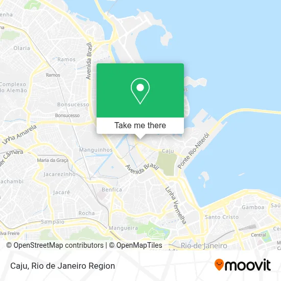
See Caju on the map
Public Transportation to Caju
Wondering how to get to Caju? Moovit helps you find the best way to get to Caju with step-by-step directions from the nearest public transit station.
Moovit provides free maps and live directions to help you navigate through your city. View schedules, routes, timetables, and find out how long does it take to get to Caju in real time.
Looking for the nearest stop or station to Caju? Check out this list of stops closest to your destination: Manguinhos; Rua Carlos Seidl; Jacarezinho; Rua Peter Lund; Triagem.
Bus: 1931D, 210, 2533D (EXECUTIVO), 324, 350, 362, SR 362, 209, SN 209, 906, SP 404.Metro: L2.Train: RAMAL BELFORD ROXO, RAMAL DEODORO, RAMAL SARACURUNA.Light Rail: L4.
Want to see if there’s another route that gets you there at an earlier time? Moovit helps you find alternative routes or times. Get directions from and directions to Caju easily from the Moovit App or Website.
We make riding to Caju easy, which is why over 1.5 million users, including users in Caju, trust Moovit as the best app for public transit. You don’t need to download an individual bus app or train app, Moovit is your all-in-one transit app that helps you find the best bus time or train time available.
For information on prices of bus, metro, train and light rail, costs and ride fares to Caju, please check the Moovit app.
Use the app to navigate to popular places including to the airport, hospital, stadium, grocery store, mall, coffee shop, school, college, and university.
Caju Address: Rio de Janeiro-RJ street in Caju
- Polimix - Usina de concreto,
- Rua Carlos Seidl 1388,
- Ciac Joaquim da Silva Xaver,
- Ponto de ônibus passarela linha vermelha (sentido caxias),
- Ilé Asé Omo Aladê Omi Yasessú,
- Pennant Serviços Marítimos Ltda.,
- Tracker Logística,
- Delícias da Rose,
- Teatro Vanucci - Shopping da Gávea,
- Rua Alegria, 62,
- Igreja Presbiteriana de Jacarezinho,
- Inovação Mix Bazar,
- Rua Harmonia, 26,
- Avenida Nossa Senhora de Copacabana 437,
- Comida Caseira,
- Centro Médico Pastore - Cardiologia Ecocardiografia,
- Linha 481 - Penha / Praia de Botafogo,
- Lrn Materiais de Construcao,
- Vila Olímpica do Caju,
- Beco do Aterro
Places Near Caju
- Feira Livre da Gloria, Glória,
- Hospital Federal Cardoso Fontes, Jacarepaguá,
- Rua Licínio Cardoso, São Francisco Xavier,
- Feirão De Malhas, Duque De Caxias,
- Shopping Nova América, Del Castilho,
- Hospital Pedro Ernesto, Vila Isabel,
- Rua Ulysses Guimarães 16, Cidade Nova,
- Rodoviária Novo Rio (Rodoviária do Rio de Janeiro), Santo Cristo,
- Shopping Rio Sul, Botafogo,
- Praia do Arpoador, Ipanema,
- Niterói, Niterói,
- Avenida Rio Branco, Centro,
- Norte Shopping, Cachambi,
- Museu Do Amanhã, Centro,
- Shopping RioSul, Botafogo,
- Rio De Janeiro,
- Hospital Federal Do Andaraí, Andaraí,
- Avenida Venezuela 134, Saúde,
- Hospital Municipal Ronaldo Gazolla, Acari,
- Shopping Downtown, Barra Da Tijuca
How to get to popular places in Rio de Janeiro Region with public transit
Get around Caju by public transit!
Traveling around Caju has never been so easy. See step by step directions as you travel to any attraction, street or major public transit station. View bus and train schedules, arrival times, service alerts and detailed routes on a map, so you know exactly how to get to anywhere in Caju.
When traveling to any destination around Caju use Moovit's Live Directions with Get Off Notifications to know exactly where and how far to walk, how long to wait for your line, and how many stops are left. Moovit will alert you when it's time to get off — no need to constantly re-check whether yours is the next stop.
Wondering how to use public transit in Caju or how to pay for public transit in Caju? Moovit public transit app can help you navigate your way with public transit easily, and at minimum cost. It includes public transit fees, ticket prices, and costs. Looking for a map of Caju public transit lines? Moovit public transit app shows all public transit maps in Caju with all Bus, Train, Metro, Light Rail, Ferry, Cable Car, Gondola and Funicular routes and stops on an interactive map.
Rio de Janeiro Region has 8 transit type(s), including: Bus, Train, Metro, Light Rail, Ferry, Cable Car, Gondola and Funicular, operated by several transit agencies, including TrensRJ, Metrô Rio, VLT Carioca, Barcas Rio, BRT MOBI-Rio, Auto Viação Alpha, Auto Viação Tijuca, Gire Transportes, Transurb, Viação Nossa Senhora das Graças, Consórcio INTERSUL, Braso Lisboa (Municipal), Caprichosa Auto Ônibus, Auto Viação Três Amigos and Rodoviária Âncora Matias