Directions to Calhas Angra (Angra Dos Reis) with public transportation
The following transit lines have routes that pass near Calhas Angra
 Bus: 106, 230, B206, T10, T11.
- Ferry: ANGRA DOS REIS - ILHA GRANDE, ANGRA DOS REIS - ILHA GRANDE.
How to get to Calhas Angra by bus?
Click on the bus route to see step by step directions with maps, line arrival times and updated time schedules.
From Condominio Praia do Engenho, Cunhambebe
62 minFrom BrasFELS, Jacuecanga
34 minFrom BR Marinas Bracuhy, Cunhambebe
75 minFrom Monsuaba, Jacuecanga
57 minFrom Condomínio Porto Marina Bracuhy, Cunhambebe
71 minFrom Praia do Sol- Monsuaba, Jacuecanga
56 minFrom Corca Transporte, Cunhambebe
37 minFrom Pousada das Bromélias, Jacuecanga
65 minFrom ponta leste, Jacuecanga
79 minFrom Escola Tecnica Brasfels, Jacuecanga
42 min
Bus stops near Calhas Angra in Angra Dos Reis
- Rua Oswaldo Neves Martins, 168, 2 min walk,VIEW
- Ponto De Embarque 04 - Praça Do Porto, 3 min walk,VIEW
- Centro / Praça Do Porto, 3 min walk,VIEW
- Ponto De Embarque 06 - Praça Do Porto, 3 min walk,VIEW
- Ponto De Embarque 07 - Praça Do Porto, 3 min walk,VIEW
- Centro / Largo Da Lapa, 4 min walk,VIEW
- Ponto 01 - Santa Luzia, 4 min walk,VIEW
- Ponto 02 - Santa Luzia, 4 min walk,VIEW
- Centro / Santa Luzia, 4 min walk,VIEW
- Centro / Largo Da Lapa II, 4 min walk,VIEW
- Ponto De Embarque 10 - Lapa, 5 min walk,VIEW
- Desembarque Centro / Largo Da Lapa, 5 min walk,VIEW
- Ponto De Embarque 11 - Lapa, 5 min walk,VIEW
Ferry station near Calhas Angra in Angra Dos Reis
- Estação Santa Luzia (Angra Dos Reis) ⛴, 3 min walk,VIEW
Bus lines to Calhas Angra in Angra Dos Reis
- C04, Vila Velha,VIEW
- C05, Centro (via Morro da Cruz),VIEW
- C05B, Centro (via Balneário),VIEW
- 205, Areal,VIEW
- B203, Serra D'Agua (Túnel),VIEW
- 208, Belém (Circular),VIEW
- A220, Japuíba (Via Gamboa - Circular),VIEW
- B220, Japuíba (Via Balneário / Ribeira - Circular),VIEW
- 207, Centro (Via Morro Da Cruz),VIEW
- B207, Japuíba (via Rio-Santos),VIEW
- 221, Nova Angra,VIEW
- B221, Nova Angra (via Gamboa / Ribeira),VIEW
- 203, Serra D'Água (Via Zungu),VIEW
- 204, Centro,VIEW
- B206, Centro (via Balneário),VIEW
- C206, Centro (Saída Vale da Banqueta),VIEW
- C01, Centro (Circular),VIEW
- C01B, Circular (via Pestalozzi),VIEW
- C03, Marinas,VIEW
- C03B, Marinas (via Balneário),VIEW
What are the closest stations to Calhas Angra?
The closest stations to Calhas Angra are:
- Rua Oswaldo Neves Martins, 168 is 116 meters away, 2 min walk.
- Estação Santa Luzia (Angra Dos Reis) ⛴ is 169 meters away, 3 min walk.
- Ponto De Embarque 04 - Praça Do Porto is 174 meters away, 3 min walk.
- Centro / Praça Do Porto is 186 meters away, 3 min walk.
- Ponto De Embarque 06 - Praça Do Porto is 201 meters away, 3 min walk.
- Ponto De Embarque 07 - Praça Do Porto is 209 meters away, 3 min walk.
- Centro / Largo Da Lapa is 267 meters away, 4 min walk.
- Ponto 01 - Santa Luzia is 273 meters away, 4 min walk.
- Ponto 02 - Santa Luzia is 283 meters away, 4 min walk.
- Centro / Santa Luzia is 291 meters away, 4 min walk.
- Centro / Largo Da Lapa II is 304 meters away, 4 min walk.
- Ponto De Embarque 10 - Lapa is 312 meters away, 5 min walk.
- Desembarque Centro / Largo Da Lapa is 316 meters away, 5 min walk.
- Ponto De Embarque 11 - Lapa is 324 meters away, 5 min walk.
Which bus lines stop near Calhas Angra?
These bus lines stop near Calhas Angra: 106, 230, B206, T10, T11, T21.
What’s the nearest bus station to Calhas Angra in Angra Dos Reis?
The nearest bus station to Calhas Angra in Angra Dos Reis is Rua Oswaldo Neves Martins, 168. It’s a 2 min walk away.
What’s the nearest ferry station to Calhas Angra in Angra Dos Reis?
The nearest ferry station to Calhas Angra in Angra Dos Reis is Estação Santa Luzia (Angra Dos Reis) ⛴. It’s a 3 min walk away.
What time is the first bus to Calhas Angra in Angra Dos Reis?
The T11 is the first bus that goes to Calhas Angra in Angra Dos Reis. It stops nearby at 4:50 AM.
What time is the last bus to Calhas Angra in Angra Dos Reis?
The T11 is the last bus that goes to Calhas Angra in Angra Dos Reis. It stops nearby at 2:01 AM.
What time is the first ferry to Calhas Angra in Angra Dos Reis?
The ANGRA DOS REIS - ILHA GRANDE is the first ferry that goes to Calhas Angra in Angra Dos Reis. It stops nearby at 8:35 AM.
What time is the last ferry to Calhas Angra in Angra Dos Reis?
The ANGRA DOS REIS - ILHA GRANDE is the last ferry that goes to Calhas Angra in Angra Dos Reis. It stops nearby at 6:30 PM.
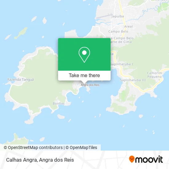
See Calhas Angra, Angra Dos Reis, on the map
Public Transit to Calhas Angra in Angra Dos Reis
Wondering how to get to Calhas Angra in Angra Dos Reis? Moovit helps you find the best way to get to Calhas Angra with step-by-step directions from the nearest public transit station.
Moovit provides free maps and live directions to help you navigate through your city. View schedules, routes, timetables, and find out how long does it take to get to Calhas Angra in real time.
Looking for the nearest stop or station to Calhas Angra? Check out this list of stops closest to your destination: Rua Oswaldo Neves Martins; Estação Santa Luzia (Angra Dos Reis) ⛴; Ponto De Embarque 04 - Praça Do Porto; Centro / Praça Do Porto; Ponto De Embarque 06 - Praça Do Porto; Ponto De Embarque 07 - Praça Do Porto; Centro / Largo Da Lapa; Ponto 01 - Santa Luzia; Ponto 02 - Santa Luzia; Centro / Santa Luzia; Centro / Largo Da Lapa II; Ponto De Embarque 10 - Lapa; Desembarque Centro / Largo Da Lapa; Ponto De Embarque 11 - Lapa.
Bus: 106, 230, B206, T10, T11, T21, C04, C05, C05B, 205, B203, 208, A220, B220, 207, B207, 221, B221, 203, 204, C206.Ferry: ANGRA DOS REIS - ILHA GRANDE, ANGRA DOS REIS - ILHA GRANDE.
Want to see if there’s another route that gets you there at an earlier time? Moovit helps you find alternative routes or times. Get directions from and directions to Calhas Angra easily from the Moovit App or Website.
We make riding to Calhas Angra easy, which is why over 1.5 million users, including users in Angra Dos Reis, trust Moovit as the best app for public transit. You don’t need to download an individual bus app or train app, Moovit is your all-in-one transit app that helps you find the best bus time or train time available.
For information on prices of bus, costs and ride fares to Calhas Angra, please check the Moovit app.
Use the app to navigate to popular places including to the airport, hospital, stadium, grocery store, mall, coffee shop, school, college, and university.
Calhas Angra Address: Avenida Reis Magos, Centro Angra dos Reis-RJ street in Angra Dos Reis
- Condomínio Porto Skorpius,
- Morro do Coco,
- Drogaria São Sebastião,
- Jorge Elias Miguel Júnior,
- Bar do Lico,
- Condomínio Pier 88,
- Rei dos Caldos,
- Camping Raio de Sol,
- Receita Federal,
- Agencia Da Receita Federal,
- Box Atacarejo,
- Rede Supermarket,
- Multi Angra 3 Mercado,
- Betao da Construcao,
- Hotel do Frade,
- Frade e Mar,
- Secretaria de Estado de Segurança Pública,
- Digital a,
- Angra dos Reis-CCR Barcas,
- Restaurante Recreativo
Places Near Calhas Angra (Angra Dos Reis)
- Praia do Laboratório, Angra Dos Reis,
- BR 101, Km 508 s/n, Cunhambebe,
- Centro Histórico de Paraty, Parati,
- Mambucaba, Mambucaba,
- Rodovia BR 101, Km 533 s/n, Mambucaba,
- Garatucaia, Angra Dos Reis,
- praia jabaquara - parati, Parati,
- Rua Prefeito João Gregório Galindo 2487, Angra Dos Reis,
- Vila Galé Eco Resort De Angra, Angra Dos Reis,
- Rua Prefeito João Gregório Galindo, Cunhambebe,
- Rua Cônegos Bittencourt, Angra Dos Reis,
- Praia de Paraty Mirim, Parati,
- Cachoeira do Tobogã, Parati,
- Verolme, Jacuecanga,
- Avenida Antônio Bertholdo da Silva Jordão 7346, Jacuecanga,
- Vila Residencial De Mambucaba, Mambucaba,
- Condominio Laranjeiras, Parati Mirim,
- Rodovia Procurador Haroldo Fernandes Duarte, Km 513,5 s / n, Cunhambebe,
- Alambique Engenho D'Ouro, Parati,
- Avenida Almirante Jair Carneiro Toscano de Brito 110, Angra Dos Reis
How to get to popular places in Angra dos Reis with public transit
Get around Angra Dos Reis by public transit!
Traveling around Angra Dos Reis has never been so easy. See step by step directions as you travel to any attraction, street or major public transit station. View bus and train schedules, arrival times, service alerts and detailed routes on a map, so you know exactly how to get to anywhere in Angra Dos Reis.
When traveling to any destination around Angra Dos Reis use Moovit's Live Directions with Get Off Notifications to know exactly where and how far to walk, how long to wait for your line, and how many stops are left. Moovit will alert you when it's time to get off — no need to constantly re-check whether yours is the next stop.
Wondering how to use public transit in Angra Dos Reis or how to pay for public transit in Angra Dos Reis? Moovit public transit app can help you navigate your way with public transit easily, and at minimum cost. It includes public transit fees, ticket prices, and costs. Looking for a map of Angra Dos Reis public transit lines? Moovit public transit app shows all public transit maps in Angra Dos Reis with all Bus and Ferry routes and stops on an interactive map.
Angra dos Reis has 2 transit type(s), including: Bus and Ferry, operated by several transit agencies, including Viação Senhor do Bonfim, Colitur Transportes Rodoviários, Cooparatyense (Vans), Costa Verde Transportes, Barcas Rio, Objetiva Tour, Vilanova Tour, Rodoviário Oceano, BusUFF and Colitur (Tarifa Zero - Paraty)