Directions to Caliber Auto Glass (Baltimore County) with public transportation
The following transit lines have routes that pass near Caliber Auto Glass
 Bus: 93.
How to get to Caliber Auto Glass by bus?
Click on the bus route to see step by step directions with maps, line arrival times and updated time schedules.
From Towson, MD, Baltimore County
31 minFrom I-695 @ Exit 27 (Dulaney Valley Road/MD 146), Baltimore County
41 minFrom Pimlico Race Course, Baltimore
101 minFrom Loyola University Maryland, Baltimore
64 minFrom I-695 @ Exit 26 (York Rd/MD 45), Baltimore County
31 minFrom I-695 Exit 29 (Loch Raven Blvd (MD 542)/Cromwell Bridge Rd), Baltimore County
69 minFrom Good Samaritan Hospital, Baltimore
59 minFrom Sinai Hospital, Baltimore
86 min
Bus stop near Caliber Auto Glass in Baltimore County
- Warren Rd & Wilmar Pl Wb, 1 min walk,VIEW
Light Rail stations near Caliber Auto Glass in Baltimore County
- Fairgrounds, 14 min walk,VIEW
Bus lines to Caliber Auto Glass in Baltimore County
- 93, Towson,VIEW
What are the closest stations to Caliber Auto Glass?
The closest stations to Caliber Auto Glass are:
- Warren Rd & Wilmar Pl Wb is 17 yards away, 1 min walk.
- Fairgrounds is 1148 yards away, 14 min walk.
Which bus line stops near Caliber Auto Glass?
93 (Hunt Valley)
What’s the nearest light rail station to Caliber Auto Glass in Baltimore County?
The nearest light rail station to Caliber Auto Glass in Baltimore County is Fairgrounds. It’s a 14 min walk away.
What’s the nearest bus station to Caliber Auto Glass in Baltimore County?
The nearest bus station to Caliber Auto Glass in Baltimore County is Warren Rd & Wilmar Pl Wb. It’s a 1 min walk away.
What time is the first light rail to Caliber Auto Glass in Baltimore County?
The LIGHT RAILLINK is the first light rail that goes to Caliber Auto Glass in Baltimore County. It stops nearby at 4:44 AM.
What time is the last light rail to Caliber Auto Glass in Baltimore County?
The LIGHT RAILLINK is the last light rail that goes to Caliber Auto Glass in Baltimore County. It stops nearby at 12:59 AM.
What time is the first bus to Caliber Auto Glass in Baltimore County?
The 93 is the first bus that goes to Caliber Auto Glass in Baltimore County. It stops nearby at 4:11 AM.
What time is the last bus to Caliber Auto Glass in Baltimore County?
The 93 is the last bus that goes to Caliber Auto Glass in Baltimore County. It stops nearby at 1:09 AM.
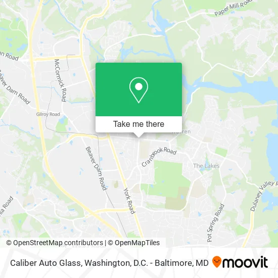
See Caliber Auto Glass, Baltimore County, on the map
Public Transit to Caliber Auto Glass in Baltimore County
Wondering how to get to Caliber Auto Glass in Baltimore County? Moovit helps you find the best way to get to Caliber Auto Glass with step-by-step directions from the nearest public transit station.
Moovit provides free maps and live directions to help you navigate through your city. View schedules, routes, timetables, and find out how long does it take to get to Caliber Auto Glass in real time.
Looking for the nearest stop or station to Caliber Auto Glass? Check out this list of stops closest to your destination: Warren Rd & Wilmar Pl Wb; Fairgrounds.
Bus: 93.
Want to see if there’s another route that gets you there at an earlier time? Moovit helps you find alternative routes or times. Get directions from and directions to Caliber Auto Glass easily from the Moovit App or Website.
We make riding to Caliber Auto Glass easy, which is why over 1.5 million users, including users in Baltimore County, trust Moovit as the best app for public transit. You don’t need to download an individual bus app or train app, Moovit is your all-in-one transit app that helps you find the best bus time or train time available.
For information on prices of bus, light rail and metro, costs and ride fares to Caliber Auto Glass, please check the Moovit app.
Use the app to navigate to popular places including to the airport, hospital, stadium, grocery store, mall, coffee shop, school, college, and university.
Caliber Auto Glass Address: Greenside Dr Cockeysville, MD 21030 street in Baltimore County
- Cockeysville Baptist Church,
- Peroma Essentials,
- BCPS,
- Baltimore County Resource Recovery Facility,
- Boulder Ct & Longmont Ct,
- All Paws by Jessica,
- JP Jensen Collections,
- Well Crafted Beauty,
- Rinn, Michael G,
- Chris Kenworthy - Vandyk Mortgage,
- William B. Hilliard Jr., DDS,
- Barboza and Sons,
- Fastkar Detailing,
- Athletes Serving at,
- Tender Care Adult Medical Day Program,
- El Paraiso Tropical L,
- T-Mobile,
- Glowmore,
- Jtcolours,
- Beauty Solution Studio
Places Near Caliber Auto Glass (Baltimore County)
- Westfield Montgomery Mall, Montgomery County,
- Museum Of The Bible, Washington,
- Basilica of the National Shrine, Washington,
- National Mall, Washington,
- Capital One Arena, Washington,
- Warner Theatre, Washington,
- The Anthem, Washington,
- PG Mall, Prince George's County,
- Marriott Marquis Washington, DC, Washington,
- National Zoo, Washington,
- Sibley Memorial Hospital, Washington,
- Washington DC VA Medical Center, Washington,
- Washington National Cathedral, Washington,
- Pennsylvania Ave NW (3rd st and pennsylvania), Washington,
- National Museum of African American History and Culture, Washington,
- Camden Yards, Baltimore,
- Amazon Hq2, Arlington County,
- Georgetown, Washington,
- Rock Creek Tennis Center, Washington,
- M&T Bank Stadium, Baltimore
How to get to popular places in Washington, D.C. - Baltimore, MD with public transit
Get around Baltimore County by public transit!
Traveling around Baltimore County has never been so easy. See step by step directions as you travel to any attraction, street or major public transit station. View bus and train schedules, arrival times, service alerts and detailed routes on a map, so you know exactly how to get to anywhere in Baltimore County.
When traveling to any destination around Baltimore County use Moovit's Live Directions with Get Off Notifications to know exactly where and how far to walk, how long to wait for your line, and how many stops are left. Moovit will alert you when it's time to get off — no need to constantly re-check whether yours is the next stop.
Wondering how to use public transit in Baltimore County or how to pay for public transit in Baltimore County? Moovit public transit app can help you navigate your way with public transit easily, and at minimum cost. It includes public transit fees, ticket prices, and costs. Looking for a map of Baltimore County public transit lines? Moovit public transit app shows all public transit maps in Baltimore County with all Bus, Train, Metro, Light Rail and Ferry routes and stops on an interactive map.
Washington, D.C. - Baltimore, MD has 5 transit type(s), including: Bus, Train, Metro, Light Rail and Ferry, operated by several transit agencies, including WMATA, Montgomery County Ride On, Fairfax Connector, TheBus, PRTC, DASH - Alexandria, Arlington Transit (ART), RTA of Central Maryland, MDOT MTA, MDOT MTA Light RailLink, MDOT MTA Commuter Bus, MDOT MTA Local Bus, FXBGO!, Virginia Railway Express (VRE) and MARC