How to get to Call2net by bus?
Click on the bus route to see step by step directions with maps, line arrival times and updated time schedules.
From Statuto Square, Torino
59 minFrom Mole Antonelliana, Torino
46 minFrom New Palace, Torino
46 minFrom Carignano Square, Torino
53 minFrom Consolata Sanctuary, Torino
60 minFrom Fermi Metro Station, Collegno
86 minFrom Meisino Park, Torino
76 minFrom Val Della Torre Street, Torino
77 minFrom Luigi Salvatore Cherubini Street, Torino
70 minFrom Venice Avenue, Torino
83 min
How to get to Call2net by train?
Click on the train route to see step by step directions with maps, line arrival times and updated time schedules.
How to get to Call2net by metro?
Click on the metro route to see step by step directions with maps, line arrival times and updated time schedules.
Bus stops near Call2net in Moncalieri
- Villafranca, 2 min walk,VIEW
- Moncalieri - Villafranca Street, 2 min walk,VIEW
- Elevated Road - A6 Highway Entrance, 2 min walk,VIEW
- Trieste West, 4 min walk,VIEW
- Knights Templar Bridge, 4 min walk,VIEW
- Carignano, 5 min walk,VIEW
- Po Bridge, 6 min walk,VIEW
- Market Borough, 8 min walk,VIEW
- Moncalieri - Market Borough, 8 min walk,VIEW
Train stations near Call2net in Moncalieri
Metro station near Call2net in Moncalieri
- Bengasi, 39 min walk,VIEW
Bus lines to Call2net in Moncalieri
- 39, Moncalieri Piazza Baden Baden,VIEW
- 81, Millefonti Corso Maroncelli,VIEW
- 82, Moncalieri Strada Carpice,VIEW
- 431, Piobesi Torinese - Terminal - Via Torino 41,VIEW
- 048, Priocca Madonnina - Castellinaldo Junction,VIEW
- 43, Moncalieri Via Goito,VIEW
- 45, Molinette Bramante Avenue,VIEW
- 99, Santena Carducci Square,VIEW
- 45 /, Molinette Bramante Avenue,VIEW
- 73, Moncalieri Foro Boario Square,VIEW
- 67, Moncalieri Testona - Piazza Marconi,VIEW
- 84, Millefonti Via Corradino,VIEW
- 091, Turin - Turin Exhibition Center,VIEW
- 108, Turin - Via Nizza Corner Corso Marconi,VIEW
- 259, Turin - Torino Esposizioni Bus Terminal,VIEW
What are the closest stations to Call2net?
The closest stations to Call2net are:
- Villafranca is 124 meters away, 2 min walk.
- Moncalieri - Villafranca Street is 126 meters away, 2 min walk.
- Elevated Road - A6 Highway Entrance is 134 meters away, 2 min walk.
- Trieste West is 247 meters away, 4 min walk.
- Knights Templar Bridge is 288 meters away, 4 min walk.
- Carignano is 347 meters away, 5 min walk.
- Po Bridge is 394 meters away, 6 min walk.
- Market Borough is 568 meters away, 8 min walk.
- Moncalieri - Market Borough is 573 meters away, 8 min walk.
- Moncalieri is 784 meters away, 11 min walk.
- Bengasi is 2991 meters away, 39 min walk.
- Turin Lingotto is 4336 meters away, 56 min walk.
Which bus lines stop near Call2net?
These bus lines stop near Call2net: 259, 39, 43, 45, 45 /, 67, 81.
Which train lines stop near Call2net?
These train lines stop near Call2net: SFM1, SFM2, SFM4.
Which metro line stops near Call2net?
M1 (Bengasi)
What’s the nearest train station to Call2net in Moncalieri?
The nearest train station to Call2net in Moncalieri is Moncalieri. It’s a 11 min walk away.
What’s the nearest bus station to Call2net in Moncalieri?
The nearest bus stations to Call2net in Moncalieri are Villafranca, Moncalieri - Villafranca Street and Elevated Road - A6 Highway Entrance. The closest one is a 2 min walk away.
What time is the first metro to Call2net in Moncalieri?
The M1 is the first metro that goes to Call2net in Moncalieri. It stops nearby at 5:22 AM.
What time is the last metro to Call2net in Moncalieri?
The M1 is the last metro that goes to Call2net in Moncalieri. It stops nearby at 10:02 PM.
What time is the first train to Call2net in Moncalieri?
The R is the first train that goes to Call2net in Moncalieri. It stops nearby at 4:53 AM.
What time is the last train to Call2net in Moncalieri?
The R is the last train that goes to Call2net in Moncalieri. It stops nearby at 11:34 PM.
What time is the first bus to Call2net in Moncalieri?
The 45 is the first bus that goes to Call2net in Moncalieri. It stops nearby at 4:19 AM.
What time is the last bus to Call2net in Moncalieri?
The 45 is the last bus that goes to Call2net in Moncalieri. It stops nearby at 1:22 AM.
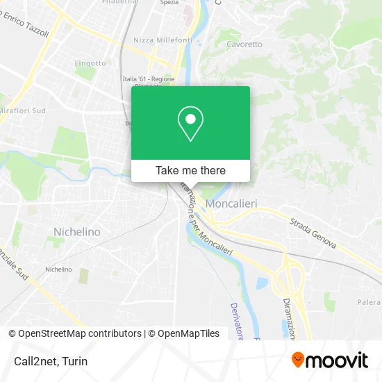
See Call2net, Moncalieri, on the map
Public Transit to Call2net in Moncalieri
Wondering how to get to Call2net in Moncalieri? Moovit helps you find the best way to get to Call2net with step-by-step directions from the nearest public transit station.
Moovit provides free maps and live directions to help you navigate through your city. View schedules, routes, timetables, and find out how long does it take to get to Call2net in real time.
Looking for the nearest stop or station to Call2net? Check out this list of stops closest to your destination: Villafranca; Moncalieri - Villafranca Street; Elevated Road - A6 Highway Entrance; Trieste West; Knights Templar Bridge; Carignano; Po Bridge; Market Borough; Moncalieri - Market Borough; Moncalieri; Bengasi; Turin Lingotto.
Bus: 259, 39, 43, 45, 45 /, 67, 81, 431, 82, 048.Train: SFM1, SFM2, SFM4, R, R, R, R, R, R, R.Metro: M1.
Want to see if there’s another route that gets you there at an earlier time? Moovit helps you find alternative routes or times. Get directions from and directions to Call2net easily from the Moovit App or Website.
We make riding to Call2net easy, which is why over 1.5 million users, including users in Moncalieri, trust Moovit as the best app for public transit. You don’t need to download an individual bus app or train app, Moovit is your all-in-one transit app that helps you find the best bus time or train time available.
For information on prices of bus, train, metro and light rail, costs and ride fares to Call2net, please check the Moovit app.
Use the app to navigate to popular places including to the airport, hospital, stadium, grocery store, mall, coffee shop, school, college, and university.
Call2net Address: Corso Roma, 3 10024 Moncalieri street in Moncalieri
- Atelier Clothides,
- Marras Facilities by Marras Fabrizio,
- M. Canuto Transportation Services,
- Kiloutou,
- Trieste Avenue / Roma Avenue,
- Sielt,
- Selfitalia,
- Santoro Maria Pasqualina,
- Studio M2,
- Burger King,
- Scotta,
- Construction Company De Nittis Rocco of Brothers De Nittis Elia Geom. Michele,
- Self,
- Grandma Mariuccia Farm,
- Raducan Tatiana,
- Florito Lake Restaurant Moncalieri,
- Medical Services Center Cascina Nonna Mariuccia,
- Roma Avenue, 13bis,
- Largo Pastrengo 3Bis,
- NEXI PAYMENTS
Places Near Call2net (Moncalieri)
- San Luigi Hospital, Orbassano,
- Sant'Anna Hospital, Torino,
- Molinette Hospital, Torino,
- New Gate, Torino,
- Regina Margherita Children's Hospital, Torino,
- Porta Susa, Torino,
- San Giovanni Bosco Hospital, Torino,
- Mauriziano Hospital, Torino,
- CDC Via Grazioli 11, Torino,
- Prarostino Street 10/A, Torino,
- Arturo Farinelli Street 25, Torino,
- Le Gru, Grugliasco,
- Cavour Street 31, Torino,
- Porta Palazzo, Torino,
- Pacchiotti Giacinto Street 4, Torino,
- Koelliker Hospital, Torino,
- CTO Hospital, Torino,
- Castle Square, Torino,
- Martini Hospital, Torino,
- Shopville Le Gru, Grugliasco
How to get to popular places in Turin with public transit
Get around Moncalieri by public transit!
Traveling around Moncalieri has never been so easy. See step by step directions as you travel to any attraction, street or major public transit station. View bus and train schedules, arrival times, service alerts and detailed routes on a map, so you know exactly how to get to anywhere in Moncalieri.
When traveling to any destination around Moncalieri use Moovit's Live Directions with Get Off Notifications to know exactly where and how far to walk, how long to wait for your line, and how many stops are left. Moovit will alert you when it's time to get off — no need to constantly re-check whether yours is the next stop.
Wondering how to use public transit in Moncalieri or how to pay for public transit in Moncalieri? Moovit public transit app can help you navigate your way with public transit easily, and at minimum cost. It includes public transit fees, ticket prices, and costs. Looking for a map of Moncalieri public transit lines? Moovit public transit app shows all public transit maps in Moncalieri with all Bus, Train, Metro, Light Rail, Funicular and Gondola routes and stops on an interactive map.
Turin has 6 transit type(s), including: Bus, Train, Metro, Light Rail, Funicular and Gondola, operated by several transit agencies, including GTT Urban Service, GTT Suburban Service, GTT Tourist Services, Trenitalia, Arenaways, Sadem, Cavourese, Grandabus Consortium, Bus Company - GrandaBus, Bus Company, Gelosobus, Nuova S.a.a.r., SAC, Giors Bus Lines and Allasia Bus Lines