Directions to Calvin Rodwell Elementary (Baltimore) with public transportation
The following transit lines have routes that pass near Calvin Rodwell Elementary
 Bus: 34, CITYLINK LIME.
- Metro: METRO.
How to get to Calvin Rodwell Elementary by bus?
Click on the bus route to see step by step directions with maps, line arrival times and updated time schedules.
From Walmart Supercenter, Baltimore County
71 minFrom Baltimore City Circuit Court, Baltimore
36 minFrom Fells Point, Baltimore
41 minFrom Lord Baltimore Hotel, Baltimore
34 minFrom Johns Hopkins Medicine at Green Spring Station, Baltimore County
48 minFrom Patterson Park, Baltimore
49 minFrom Nick's Fish House, Baltimore
59 minFrom Baltimore Convention Center, Baltimore
34 minFrom Patterson Park, Baltimore
50 minFrom I-83 Exit 5 (Maryland Ave/Charles St), Baltimore
30 min
How to get to Calvin Rodwell Elementary by metro?
Click on the metro route to see step by step directions with maps, line arrival times and updated time schedules.
Bus stop near Calvin Rodwell Elementary in Baltimore
- Liberty Heights Ave & Hillsdale Rd FS Sb, 1 min walk,VIEW
Metro station near Calvin Rodwell Elementary in Baltimore
- West Cold Spring Metro, 18 min walk,VIEW
Bus lines to Calvin Rodwell Elementary in Baltimore
What are the closest stations to Calvin Rodwell Elementary?
The closest stations to Calvin Rodwell Elementary are:
- Liberty Heights Ave & Hillsdale Rd FS Sb is 63 yards away, 1 min walk.
- West Cold Spring Metro is 1498 yards away, 18 min walk.
Which bus lines stop near Calvin Rodwell Elementary?
These bus lines stop near Calvin Rodwell Elementary: 34, CITYLINK LIME.
Which metro line stops near Calvin Rodwell Elementary?
METRO (Towards Owing Mills)
What’s the nearest metro station to Calvin Rodwell Elementary in Baltimore?
The nearest metro station to Calvin Rodwell Elementary in Baltimore is West Cold Spring Metro. It’s a 18 min walk away.
What’s the nearest bus station to Calvin Rodwell Elementary in Baltimore?
The nearest bus station to Calvin Rodwell Elementary in Baltimore is Liberty Heights Ave & Hillsdale Rd FS Sb. It’s a 1 min walk away.
What time is the first metro to Calvin Rodwell Elementary in Baltimore?
The METRO is the first metro that goes to Calvin Rodwell Elementary in Baltimore. It stops nearby at 3:45 AM.
What time is the last metro to Calvin Rodwell Elementary in Baltimore?
The METRO is the last metro that goes to Calvin Rodwell Elementary in Baltimore. It stops nearby at 12:21 AM.
What time is the first bus to Calvin Rodwell Elementary in Baltimore?
The CITYLINK LIME is the first bus that goes to Calvin Rodwell Elementary in Baltimore. It stops nearby at 4:10 AM.
What time is the last bus to Calvin Rodwell Elementary in Baltimore?
The CITYLINK LIME is the last bus that goes to Calvin Rodwell Elementary in Baltimore. It stops nearby at 2:57 AM.
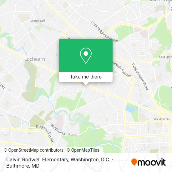
See Calvin Rodwell Elementary, Baltimore, on the map
Public Transit to Calvin Rodwell Elementary in Baltimore
Wondering how to get to Calvin Rodwell Elementary in Baltimore? Moovit helps you find the best way to get to Calvin Rodwell Elementary with step-by-step directions from the nearest public transit station.
Moovit provides free maps and live directions to help you navigate through your city. View schedules, routes, timetables, and find out how long does it take to get to Calvin Rodwell Elementary in real time.
Looking for the nearest stop or station to Calvin Rodwell Elementary? Check out this list of stops closest to your destination: Liberty Heights Ave & Hillsdale Rd FS Sb; West Cold Spring Metro.
Bus: 34, CITYLINK LIME.Metro: METRO.
Want to see if there’s another route that gets you there at an earlier time? Moovit helps you find alternative routes or times. Get directions from and directions to Calvin Rodwell Elementary easily from the Moovit App or Website.
We make riding to Calvin Rodwell Elementary easy, which is why over 1.5 million users, including users in Baltimore, trust Moovit as the best app for public transit. You don’t need to download an individual bus app or train app, Moovit is your all-in-one transit app that helps you find the best bus time or train time available.
For information on prices of bus and metro, costs and ride fares to Calvin Rodwell Elementary, please check the Moovit app.
Use the app to navigate to popular places including to the airport, hospital, stadium, grocery store, mall, coffee shop, school, college, and university.
Calvin Rodwell Elementary Address: 3501 Hillsdale Rd street in Baltimore
- Calvin M. Rodwell Elementary / Middle School,
- Calvin Rodwell Elementary School,
- BMO Harris Bank,
- Auntie's Caribbean Kitchen,
- ShopRite of Howard Park,
- 100 Black Men of Maryland,
- Howell's Funeral Home (Howell Funeral Services),
- Bibleway Christian fellowship church,
- Coinstar,
- Minute Key,
- The Ambassador Theater,
- New All Saints Music Ministries,
- Howard Park, Maryland,
- Liberty Heights Ave & Gwynn Oak Ave FS,
- Atm,
- Bitcoin Depot Bitcoin ATM,
- Liberty Heights Gwynn,
- American Monarch,
- Habibi Smoke Shop,
- Parklane Baptist Church
Places Near Calvin Rodwell Elementary (Baltimore)
- Washington DC VA Medical Center, Washington,
- National Museum of African American History and Culture, Washington,
- Rock Creek Tennis Center, Washington,
- Capital One Arena, Washington,
- PG Mall, Prince George's County,
- Museum Of The Bible, Washington,
- The Anthem, Washington,
- Washington National Cathedral, Washington,
- Sibley Memorial Hospital, Washington,
- Westfield Montgomery Mall, Montgomery County,
- National Mall, Washington,
- Georgetown, Washington,
- Amazon Hq2, Arlington County,
- Camden Yards, Baltimore,
- M&T Bank Stadium, Baltimore,
- Warner Theatre, Washington,
- Basilica of the National Shrine, Washington,
- Marriott Marquis Washington, DC, Washington,
- Pennsylvania Ave NW (3rd st and pennsylvania), Washington,
- National Zoo, Washington
How to get to popular places in Washington, D.C. - Baltimore, MD with public transit
Get around Baltimore by public transit!
Traveling around Baltimore has never been so easy. See step by step directions as you travel to any attraction, street or major public transit station. View bus and train schedules, arrival times, service alerts and detailed routes on a map, so you know exactly how to get to anywhere in Baltimore.
When traveling to any destination around Baltimore use Moovit's Live Directions with Get Off Notifications to know exactly where and how far to walk, how long to wait for your line, and how many stops are left. Moovit will alert you when it's time to get off — no need to constantly re-check whether yours is the next stop.
Wondering how to use public transit in Baltimore or how to pay for public transit in Baltimore? Moovit public transit app can help you navigate your way with public transit easily, and at minimum cost. It includes public transit fees, ticket prices, and costs. Looking for a map of Baltimore public transit lines? Moovit public transit app shows all public transit maps in Baltimore with all Bus, Train, Metro, Light Rail and Ferry routes and stops on an interactive map.
Washington, D.C. - Baltimore, MD has 5 transit type(s), including: Bus, Train, Metro, Light Rail and Ferry, operated by several transit agencies, including WMATA, Montgomery County Ride On, Fairfax Connector, TheBus, PRTC, DASH - Alexandria, Arlington Transit (ART), RTA of Central Maryland, MDOT MTA, MDOT MTA Light RailLink, MDOT MTA Commuter Bus, MDOT MTA Local Bus, FXBGO!, Virginia Railway Express (VRE) and MARC