Cambellotti stop - Tuesday schedule
| Line | Direction | Time |
|---|---|---|
| 20 | Cambellotti | 5:51 AM |
| 20 | Cambellotti | 5:58 AM |
| 20 | Cambellotti | 6:05 AM |
| 059 | Policlinico/Tor Vergata Hospital | 6:10 AM |
| 20 | Cambellotti | 6:12 AM |
| 20 | Cambellotti | 6:19 AM |
| 20 | Cambellotti | 6:27 AM |
| 20 | Cambellotti | 6:35 AM |
| 20 | Cambellotti | 6:43 AM |
| 20 | Cambellotti | 6:51 AM |
| 059 | Policlinico/Tor Vergata Hospital | 6:52 AM |
| 20 | Cambellotti | 6:59 AM |
| 20 | Cambellotti | 7:06 AM |
| 20 | Cambellotti | 7:16 AM |
| 20 | Cambellotti | 7:23 AM |
| 20 | Cambellotti | 7:30 AM |
| 059 | Policlinico/Tor Vergata Hospital | 7:34 AM |
| 20 | Cambellotti | 7:38 AM |
| 20 | Cambellotti | 7:46 AM |
| 20 | Cambellotti | 7:54 AM |
| 20 | Cambellotti | 8:01 AM |
| 20 | Cambellotti | 8:07 AM |
| 059 | Policlinico/Tor Vergata Hospital | 8:10 AM |
| 20 | Cambellotti | 8:13 AM |
| 20 | Cambellotti | 8:19 AM |
Directions to Cambellotti stop (Roma) with public transit
The following transit lines have routes that pass near Cambellotti
 Bus: 058, 106, 20, 500, A05.
- Metro: C.
How to get to Cambellotti stop by bus?
Click on the bus route to see step by step directions with maps, line arrival times and updated time schedules.
How to get to Cambellotti stop by metro?
Click on the metro route to see step by step directions with maps, line arrival times and updated time schedules.
Bus stops near Cambellotti stop in Roma
- Cambellotti, 2 min walk,
- Tor Bella Monaca/Conti, 3 min walk,
- Aspertini/Conti F., 4 min walk,
- Tor Bella Monaca, 5 min walk,
Metro stations near Cambellotti station in Roma
- Torre Angela, 18 min walk,
Bus lines to Cambellotti stop in Roma
- 20, Anagnina Metro,
- A05, Tor Sapienza Depot - Grotte Celoni (MC),
- N11, Grotte Celoni (Metro C) - Termini (Metro A-B-Rail) - Piazza Venezia,
- 057, Grotte Celoni (MC) - Tor Bella Monaca Circular,
- 059, Policlinico Tor Vergata - Tor Bella Monaca,
- 058, Ponte Mammolo (Metro B),
- A50, Prenestina/Candiani,
What are the closest stations to Cambellotti?
The closest stations to Cambellotti are:
- Cambellotti stop is 124 meters away, 2 min walk.
- Tor Bella Monaca/Conti stop is 184 meters away, 3 min walk.
- Aspertini/Conti F. stop is 260 meters away, 4 min walk.
- Tor Bella Monaca stop is 345 meters away, 5 min walk.
- Torre Angela station is 1358 meters away, 18 min walk.
Which bus lines stop near Cambellotti?
These bus lines stop near Cambellotti: 058, 106, 20, 500.
Which metro line stops near Cambellotti?
C (Monte Compatri-Pantano)
What’s the nearest metro station to Cambellotti in Roma?
The nearest metro station to Cambellotti in Roma is Torre Angela. It’s a 18 min walk away.
What’s the nearest bus station to Cambellotti in Roma?
The nearest bus station to Cambellotti in Roma is Cambellotti. It’s a 2 min walk away.
What time is the first metro to Cambellotti in Roma?
The C is the first metro that goes to Cambellotti in Roma. It stops nearby at 5:40 AM.
What time is the last metro to Cambellotti in Roma?
The C is the last metro that goes to Cambellotti in Roma. It stops nearby at 11:57 PM.
What time is the first bus to Cambellotti in Roma?
The N11 is the first bus that goes to Cambellotti in Roma. It stops nearby at 3:02 AM.
What time is the last bus to Cambellotti in Roma?
The N11 is the last bus that goes to Cambellotti in Roma. It stops nearby at 3:47 AM.
Cambellotti station
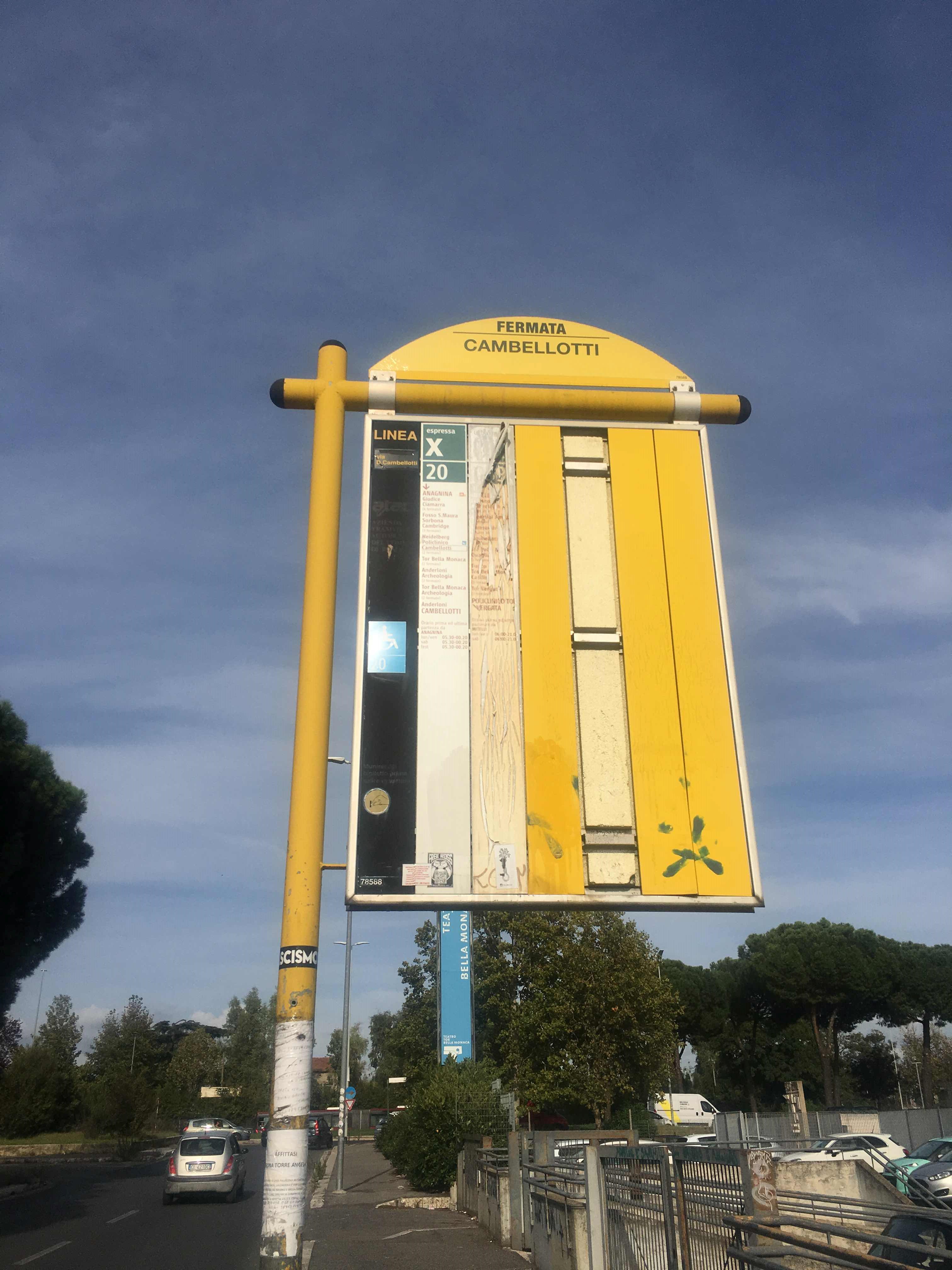 Taken by Danilo P.
See Cambellotti stop, Roma, on the map
Public transit to Cambellotti stop (ID: 78588) in Roma
Looking for directions to Cambellotti in Roma, Italy?
Download the Moovit App to find the current schedule and step-by-step directions for Bus, Metro or Light Rail routes that pass through Cambellotti.
Looking for the nearest stops closest to Cambellotti ? Check out this list of closest stops to your destination: Cambellotti; Tor Bella Monaca/Conti; Aspertini/Conti F.; Tor Bella Monaca; Torre Angela.
Bus: 058, 106, 20, 500, A05, N11, 057, 059, A50.Metro: C.
We make riding on public transit to Cambellotti easy, which is why over 1.7 billion users, including users in Roma trust Moovit as the best app for public transit.
Use the app to navigate to popular places including to the airport, hospital, stadium, grocery store, mall, coffee shop, school, college, and university.
Cambellotti stop’s code is 78588
The first line to this stop is 20, at 5:51 AM, and the last line is 20 at 12:38 AM.
This stop serves Troiani Transportation Services and ATAC’s lines
- Cambellotti,
- Tor Bella Monaca/Conti,
- Aspertini/Conti F.,
- Tor Bella Monaca
Bus stops near Cambellotti stop
- Torre Angela
Metro station near Cambellotti station
- Monte Capre/Orti Magliana,
- Flaminia/Vigna Clara (Railway Station),
- Alghero,
- Nepi | Via Cassia (Settevene),
- Settebagni/Motor Vehicle Department,
- Boccea/Galeotti,
- Torrenova,
- Torre Argentina Street,
- Corso Italia/Porta Pia,
- Martiri Di Belfiore Street,
- Colosseum,
- Monterotondo | Salaria Road (Industrial Zone),
- Good Shepherd Street,
- Tor Vergata,
- Portuense/La Loggia,
- Navicella/Villa Celimontana,
- Casal Boccone/Almaviva,
- Capannelle,
- Pomezia | Pontina Street Castelli Street,
- Grotte Celoni
Popular public transit stations in Roma
Get around Roma by public transit!
Traveling around Roma has never been so easy. See step by step directions as you travel to any attraction, street or major public transit station. View bus and train schedules, arrival times, service alerts and detailed routes on a map, so you know exactly how to get to anywhere in Roma.
When traveling to any destination around Roma use Moovit's Live Directions with Get Off Notifications to know exactly where and how far to walk, how long to wait for your line, and how many stops are left. Moovit will alert you when it's time to get off — no need to constantly re-check whether yours is the next stop.
Wondering how to use public transit in Roma or how to pay for public transit in Roma? Moovit public transit app can help you navigate your way with public transit easily, and at minimum cost. It includes public transit fees, ticket prices, and costs. Looking for a map of Roma public transit lines? Moovit public transit app shows all public transit maps in Roma with all Bus, Train, Metro, Light Rail, Ferry, Funicular and Gondola routes and stops on an interactive map.
Rome and Lazio has 7 transit type(s), including: Bus, Train, Metro, Light Rail, Ferry, Funicular and Gondola, operated by several transit agencies, including ATAC, Cotral, Trenitalia, Troiani Transportation Services, BIS, ATR Mobility, Tuscia, Shuttle, Seatour, Troiani Bus Lines, CSC Mobility, Terravision, ATRAL, Tambus and Sitbus