How to get to Cambridge Square by bus?
Click on the bus route to see step by step directions with maps, line arrival times and updated time schedules.
Bus stops near Cambridge Square in Washington, D.C. - Baltimore, MD
Bus lines to Cambridge Square in Washington, D.C. - Baltimore, MD
What are the closest stations to Cambridge Square?
The closest stations to Cambridge Square are:
- Whipple/Givens Sbnd is 45 yards away, 1 min walk.
- Patrick Henry/Main Wbnd is 1144 yards away, 14 min walk.
Which bus lines stop near Cambridge Square?
These bus lines stop near Cambridge Square: NMG, SWB.
What’s the nearest bus station to Cambridge Square in Washington, D.C. - Baltimore, MD?
The nearest bus station to Cambridge Square in Washington, D.C. - Baltimore, MD is Whipple/Givens Sbnd. It’s a 1 min walk away.
What time is the first bus to Cambridge Square in Washington, D.C. - Baltimore, MD?
The NMG is the first bus that goes to Cambridge Square in Washington, D.C. - Baltimore, MD. It stops nearby at 7:00 AM.
What time is the last bus to Cambridge Square in Washington, D.C. - Baltimore, MD?
The NMG is the last bus that goes to Cambridge Square in Washington, D.C. - Baltimore, MD. It stops nearby at 9:34 PM.
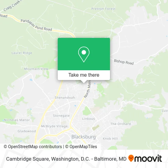
See Cambridge Square, Washington, D.C. - Baltimore, MD, on the map
Public Transit to Cambridge Square in Washington, D.C. - Baltimore, MD
Wondering how to get to Cambridge Square in Washington, D.C. - Baltimore, MD? Moovit helps you find the best way to get to Cambridge Square with step-by-step directions from the nearest public transit station.
Moovit provides free maps and live directions to help you navigate through your city. View schedules, routes, timetables, and find out how long does it take to get to Cambridge Square in real time.
Looking for the nearest stop or station to Cambridge Square? Check out this list of stops closest to your destination: Whipple/Givens Sbnd; Patrick Henry/Main Wbnd.
Bus: NMG, SWB, PHD.
Want to see if there’s another route that gets you there at an earlier time? Moovit helps you find alternative routes or times. Get directions from and directions to Cambridge Square easily from the Moovit App or Website.
We make riding to Cambridge Square easy, which is why over 1.5 million users, including users in Washington, D.C. - Baltimore, MD, trust Moovit as the best app for public transit. You don’t need to download an individual bus app or train app, Moovit is your all-in-one transit app that helps you find the best bus time or train time available.
For information on prices of bus and train, costs and ride fares to Cambridge Square, please check the Moovit app.
Use the app to navigate to popular places including to the airport, hospital, stadium, grocery store, mall, coffee shop, school, college, and university.
Cambridge Square Address: 1805 Whipple Dr Blacksburg, VA 24060 street in Washington, D.C. - Baltimore, MD
- Whipple Apartments,
- 1711 Apartments,
- Calen Fretts,
- Salon21 Blacksburg,
- New River Valley Christian Academy,
- Clark, Dm Painting Contractors,
- Alleghany Heights,
- Salon / Day Spa,
- Bell Electric,
- Baseline Solar,
- Music Milestones,
- Electrical Service and Construction,
- 1 A.M. Designs,
- Countryside Estates,
- Xueqin Jiang,
- A & J Quick Shop,
- Lewisgale Physicians-Occupational Medicine,
- Family Medicine of Blacksburg,
- Funeral Consumers Alliance of the Virginia Blue Ridge,
- Tasteful Treasures by Wende Boylan
Places Near Cambridge Square (Washington, D.C. - Baltimore, MD)
- Amazon Hq2, Arlington County,
- Sibley Memorial Hospital, Washington,
- National Mall, Washington,
- PG Mall, Prince George's County,
- Rock Creek Tennis Center, Washington,
- Georgetown, Washington,
- Camden Yards, Baltimore,
- Washington DC VA Medical Center, Washington,
- Pennsylvania Ave NW (3rd st and pennsylvania), Washington,
- Washington National Cathedral, Washington,
- National Zoo, Washington,
- Basilica of the National Shrine, Washington,
- National Museum of African American History and Culture, Washington,
- Capital One Arena, Washington,
- Museum Of The Bible, Washington,
- M&T Bank Stadium, Baltimore,
- Westfield Montgomery Mall, Montgomery County,
- The Anthem, Washington,
- Warner Theatre, Washington,
- Marriott Marquis Washington, DC, Washington
How to get to popular places in Washington, D.C. - Baltimore, MD with public transit
Get around Washington, D.C. - Baltimore, MD by public transit!
Traveling around Washington, D.C. - Baltimore, MD has never been so easy. See step by step directions as you travel to any attraction, street or major public transit station. View bus and train schedules, arrival times, service alerts and detailed routes on a map, so you know exactly how to get to anywhere in Washington, D.C. - Baltimore, MD.
When traveling to any destination around Washington, D.C. - Baltimore, MD use Moovit's Live Directions with Get Off Notifications to know exactly where and how far to walk, how long to wait for your line, and how many stops are left. Moovit will alert you when it's time to get off — no need to constantly re-check whether yours is the next stop.
Wondering how to use public transit in Washington, D.C. - Baltimore, MD or how to pay for public transit in Washington, D.C. - Baltimore, MD? Moovit public transit app can help you navigate your way with public transit easily, and at minimum cost. It includes public transit fees, ticket prices, and costs. Looking for a map of Washington, D.C. - Baltimore, MD public transit lines? Moovit public transit app shows all public transit maps in Washington, D.C. - Baltimore, MD with all Bus, Train, Metro, Light Rail and Ferry routes and stops on an interactive map.
Washington, D.C. - Baltimore, MD has 5 transit type(s), including: Bus, Train, Metro, Light Rail and Ferry, operated by several transit agencies, including WMATA, Montgomery County Ride On, Fairfax Connector, TheBus, PRTC, DASH - Alexandria, Arlington Transit (ART), RTA of Central Maryland, MDOT MTA, MDOT MTA Light RailLink, MDOT MTA Commuter Bus, MDOT MTA Local Bus, FXBGO!, Virginia Railway Express (VRE) and MARC