How to get to Canrobert by bus?
Click on the bus route to see step by step directions with maps, line arrival times and updated time schedules.
From Argenteuil, Argenteuil
59 minFrom Hôpital Simone Veil, Eaubonne
117 minFrom Montesson, Montesson
118 minFrom hôpital D' Argenteuil, Argenteuil
58 minFrom IKEA, Franconville
32 minFrom Fête des Loges, Saint-Germain-En-Laye
46 minFrom Hôpital de Poissy, Poissy
83 minFrom Franconville, Franconville
39 minFrom L'Isle-Adam, L'Isle-Adam
66 minFrom Herblay, Herblay
59 min
How to get to Canrobert by train?
Click on the train route to see step by step directions with maps, line arrival times and updated time schedules.
Bus stops near Canrobert in Pontoise
Train station near Canrobert in Pontoise
- Pontoise, 5 min walk,VIEW
RER station near Canrobert in Pontoise
- Cergy Préfecture, 24 min walk,VIEW
Bus lines to Canrobert in Pontoise
- 1229, Gare de Neuville - Université,VIEW
- 1236, Pontoise Gare,VIEW
- 1201, Gare de Cergy Saint-Christophe,VIEW
- 1230, Pontoise Gare,VIEW
- 1235, Zac de Puiseux,VIEW
- 7802, Thiers Gare de Saint-Germain En Laye,VIEW
- N150, Gare de Cergy-Le-Haut,VIEW
- 1206, Cergy Le Haut Rer - Gare De Pontoise,VIEW
- 1223, Gare De Pontoise - Les Pâtis,VIEW
- 1233, Gare De Pontoise - Gare De Neuville - Université,VIEW
- H, H Transilien,VIEW
- 1102, Gare de L'Isle-Adam - Parmain,VIEW
- 1112, Stade,VIEW
- 1101, Gare De Cergy Préfecture - Quai I - Zone D'activités,VIEW
- 1110, Gare De Cergy Préfecture - Quai I - Lavoir,VIEW
- 1103, Gare de Cergy Préfecture - Quai L,VIEW
What are the closest stations to Canrobert?
The closest stations to Canrobert are:
- Pontoise Gare is 313 meters away, 5 min walk.
- Place du Général de Gaulle - Gare is 313 meters away, 7 min walk.
- Gare de Pontoise is 313 meters away, 7 min walk.
- Pontoise is 313 meters away, 5 min walk.
- Cergy Préfecture is 1862 meters away, 24 min walk.
Which bus lines stop near Canrobert?
These bus lines stop near Canrobert: 1102, 1201, 1230, 7802, 95-19, 9513.
Which train lines stop near Canrobert?
These train lines stop near Canrobert: H, J.
Which RER line stops near Canrobert?
C (Pontoise/ Saint-Quentin-en-Yvelines/ Versailles-Chantiers/ Versailles-Château-Rive-Gauche)
What’s the nearest train station to Canrobert in Pontoise?
The nearest train station to Canrobert in Pontoise is Pontoise. It’s a 5 min walk away.
What’s the nearest bus station to Canrobert in Pontoise?
The nearest bus station to Canrobert in Pontoise is Pontoise Gare. It’s a 5 min walk away.
What’s the nearest RER station to Canrobert in Pontoise?
The nearest RER station to Canrobert in Pontoise is Cergy Préfecture. It’s a 24 min walk away.
What time is the first train to Canrobert in Pontoise?
The H is the first train that goes to Canrobert in Pontoise. It stops nearby at 4:36 AM.
What time is the last train to Canrobert in Pontoise?
The H is the last train that goes to Canrobert in Pontoise. It stops nearby at 1:22 AM.
What time is the first bus to Canrobert in Pontoise?
The N150 is the first bus that goes to Canrobert in Pontoise. It stops nearby at 3:04 AM.
What time is the last bus to Canrobert in Pontoise?
The N150 is the last bus that goes to Canrobert in Pontoise. It stops nearby at 3:34 AM.
What time is the first RER to Canrobert in Pontoise?
The A is the first RER that goes to Canrobert in Pontoise. It stops nearby at 4:48 AM.
What time is the last RER to Canrobert in Pontoise?
The C is the last RER that goes to Canrobert in Pontoise. It stops nearby at 10:32 PM.
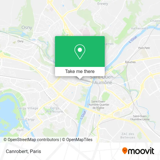
See Canrobert, Pontoise, on the map
Public Transit to Canrobert in Pontoise
Wondering how to get to Canrobert in Pontoise? Moovit helps you find the best way to get to Canrobert with step-by-step directions from the nearest public transit station.
Moovit provides free maps and live directions to help you navigate through your city. View schedules, routes, timetables, and find out how long does it take to get to Canrobert in real time.
Looking for the nearest stop or station to Canrobert? Check out this list of stops closest to your destination: Pontoise Gare; Place du Général de Gaulle - Gare; Gare de Pontoise; Pontoise; Cergy Préfecture.
Bus: 1102, 1201, 1230, 7802, 95-19, 9513, 1235, 1229, 1236.Train: H, J, C.RER: C, A, L.
Want to see if there’s another route that gets you there at an earlier time? Moovit helps you find alternative routes or times. Get directions from and directions to Canrobert easily from the Moovit App or Website.
We make riding to Canrobert easy, which is why over 1.5 million users, including users in Pontoise, trust Moovit as the best app for public transit. You don’t need to download an individual bus app or train app, Moovit is your all-in-one transit app that helps you find the best bus time or train time available.
For information on prices of bus, train and RER, costs and ride fares to Canrobert, please check the Moovit app.
Use the app to navigate to popular places including to the airport, hospital, stadium, grocery store, mall, coffee shop, school, college, and university.
Canrobert Address: Avenue du Marechal Canrobert street in Pontoise
- Obonbrunch,
- Gare routière Pontoise [30,45],
- Gare Routière Canrobert,
- Indigo,
- Pizza Luigi,
- Residence Services Seniors Cazam Pontoise,
- Ouanaim Toufik,
- Espace Marbre Pg,
- Bm Bat,
- C.H.U. HS Carrières,
- 10 Rue des Carrières,
- Photomaton,
- Charles de Gaulle,
- Relay Gare de Pontoise,
- Berthier Anne-Gaelle,
- Destination Multimedia,
- Santessentielles,
- Dassonville Vérane,
- Sarl Faya Chen,
- Ogia
Places Near Canrobert (Pontoise)
- Hôpital Saint-Joseph, Paris,
- Créteil Soleil, Creteil,
- Galeries Lafayette, Paris,
- Hopital Foch, Suresnes,
- Théâtre Mogador, Paris,
- Gare Routière Flixbus, Paris,
- Hôpital Necker, Paris,
- Galeries Lafayette Haussmann, Paris,
- Hôpital de la Pitié-Salpêtrière, Paris,
- Centre Hospitalier des 15/20, Paris,
- Hôpital Henri Mondor, Creteil,
- Hôpital Cochin, Paris,
- Fondation Louis Vuitton, Paris,
- Hôpital Pitié Salpêtrière, Paris,
- 29 Rue Manin, Paris,
- Marché Saint-Pierre, Paris,
- Atelier Des Lumieres, Paris,
- Institut Curie, Paris,
- Hopital Lariboisière, Paris,
- Hôpital Beaujon, Clichy
How to get to popular places in Paris with public transit
Get around Pontoise by public transit!
Traveling around Pontoise has never been so easy. See step by step directions as you travel to any attraction, street or major public transit station. View bus and train schedules, arrival times, service alerts and detailed routes on a map, so you know exactly how to get to anywhere in Pontoise.
When traveling to any destination around Pontoise use Moovit's Live Directions with Get Off Notifications to know exactly where and how far to walk, how long to wait for your line, and how many stops are left. Moovit will alert you when it's time to get off — no need to constantly re-check whether yours is the next stop.
Wondering how to use public transit in Pontoise or how to pay for public transit in Pontoise? Moovit public transit app can help you navigate your way with public transit easily, and at minimum cost. It includes public transit fees, ticket prices, and costs. Looking for a map of Pontoise public transit lines? Moovit public transit app shows all public transit maps in Pontoise with all Bus, Train, Metro, Light Rail, RER, Funicular and Gondola routes and stops on an interactive map.
Paris has 7 transit type(s), including: Bus, Train, Metro, Light Rail, RER, Funicular and Gondola, operated by several transit agencies, including RATP, RER, RER Bus de remplacement, Train, Train Bus de remplacement, Tramway Bus de remplacement, TER, ADP, Magical Shuttle, Argenteuil - Boucles de Seine, Autocars Dominique, Bièvre, Brie et 2 Morin, Le Bus - C.C. du Clermontois and Cœur d’Essonne