Cap Santa Rosa stop - Tuesday schedule
| Line | Direction | Time |
|---|---|---|
| M30 | Can Franquesa | 5:45 AM |
| M30 | Can Franquesa | 6:00 AM |
| M30 | Can Franquesa | 6:15 AM |
| M30 | Can Franquesa | 6:30 AM |
| M30 | Can Franquesa | 6:46 AM |
| B81 | Can Franquesa - Centre Cívic | 6:53 AM |
| M30 | Can Franquesa | 6:56 AM |
| B14 | Can Franquesa - Centre Cívic | 7:01 AM |
| M30 | Can Franquesa | 7:06 AM |
| B81 | Can Franquesa - Centre Cívic | 7:08 AM |
| M30 | Can Franquesa | 7:16 AM |
| B14 | Can Franquesa - Centre Cívic | 7:21 AM |
| B81 | Can Franquesa - Centre Cívic | 7:23 AM |
| M30 | Can Franquesa | 7:24 AM |
| M30 | Can Franquesa | 7:34 AM |
| B81 | Hospital Esperit Sant | 7:37 AM |
| B81 | Can Franquesa - Centre Cívic | 7:38 AM |
| B14 | Can Franquesa - Centre Cívic | 7:41 AM |
| M30 | Can Franquesa | 7:44 AM |
| B81 | Hospital Esperit Sant | 7:52 AM |
| B81 | Can Franquesa - Centre Cívic | 7:53 AM |
| M30 | Can Franquesa | 7:56 AM |
| B14 | Can Franquesa - Centre Cívic | 8:01 AM |
| M30 | Can Franquesa | 8:06 AM |
| B81 | Hospital Esperit Sant | 8:07 AM |
Directions to Cap Santa Rosa stop (Santa Coloma De Gramenet) with public transit
The following transit lines have routes that pass near Cap Santa Rosa
 Metro: L10N, L9N.
- Train: R2N.
- Bus: B14, B15, B24, B81, M30.
How to get to Cap Santa Rosa stop by bus?
Click on the bus route to see step by step directions with maps, line arrival times and updated time schedules.
How to get to Cap Santa Rosa stop by train?
Click on the train route to see step by step directions with maps, line arrival times and updated time schedules.
How to get to Cap Santa Rosa stop by metro?
Click on the metro route to see step by step directions with maps, line arrival times and updated time schedules.
Bus stops near Cap Santa Rosa stop in Santa Coloma De Gramenet
- Elcano - Roger De Llúria, 2 min walk,
- Escola Pere De Tera, 3 min walk,
- Av. Generalitat - St. Jordi, 4 min walk,
- Sant Bartomeu, 4 min walk,
- Raval - Pavelló, 5 min walk,
- Sant Antoni De Llefià - Lope De Vega, 5 min walk,
Metro stations near Cap Santa Rosa station in Santa Coloma De Gramenet
- Llefià, 4 min walk,
- Can Peixauet, 13 min walk,
Bus lines to Cap Santa Rosa stop in Santa Coloma De Gramenet
- B81, Can Franquesa - Centre Cívic,
- B5, Hospital Esperit Sant,
- B14, Can Franquesa - Centre Cívic,
- M30, Can Franquesa,
- 500, Ctra. Sta. Coloma - Av. St. Salvador,
- B3, Rotonda De Pomar,
- B15, Poliesportiu Nou Oliveres,
- N2, Pl. Josep Cortinas,
- B23, Metro Maresme / Fòrum,
- B24, Bruc - Rda. Sant Pere,
What are the closest stations to Cap Santa Rosa?
The closest stations to Cap Santa Rosa are:
- Elcano - Roger De Llúria stop is 96 meters away, 2 min walk.
- Escola Pere De Tera stop is 172 meters away, 3 min walk.
- Av. Generalitat - St. Jordi stop is 270 meters away, 4 min walk.
- Llefià station is 270 meters away, 4 min walk.
- Sant Bartomeu stop is 292 meters away, 4 min walk.
- Raval - Pavelló stop is 323 meters away, 5 min walk.
- Sant Antoni De Llefià - Lope De Vega stop is 381 meters away, 5 min walk.
- Can Peixauet station is 1001 meters away, 13 min walk.
Which metro lines stop near Cap Santa Rosa?
These metro lines stop near Cap Santa Rosa: L10N, L9N.
Which train line stops near Cap Santa Rosa?
R2N (Sant Celoni)
Which bus lines stop near Cap Santa Rosa?
These bus lines stop near Cap Santa Rosa: B14, B15, B24, B81, M30.
What’s the nearest metro station to Cap Santa Rosa in Santa Coloma De Gramenet?
The nearest metro station to Cap Santa Rosa in Santa Coloma De Gramenet is Llefià. It’s a 4 min walk away.
What’s the nearest bus station to Cap Santa Rosa in Santa Coloma De Gramenet?
The nearest bus station to Cap Santa Rosa in Santa Coloma De Gramenet is Elcano - Roger De Llúria. It’s a 2 min walk away.
What time is the first metro to Cap Santa Rosa in Santa Coloma De Gramenet?
The L9N is the first metro that goes to Cap Santa Rosa in Santa Coloma De Gramenet. It stops nearby at 3:00 AM.
What time is the last metro to Cap Santa Rosa in Santa Coloma De Gramenet?
The L9N is the last metro that goes to Cap Santa Rosa in Santa Coloma De Gramenet. It stops nearby at 12:13 AM.
What time is the first bus to Cap Santa Rosa in Santa Coloma De Gramenet?
The N2 is the first bus that goes to Cap Santa Rosa in Santa Coloma De Gramenet. It stops nearby at 3:02 AM.
What time is the last bus to Cap Santa Rosa in Santa Coloma De Gramenet?
The N2 is the last bus that goes to Cap Santa Rosa in Santa Coloma De Gramenet. It stops nearby at 4:02 AM.
Cap Santa Rosa station
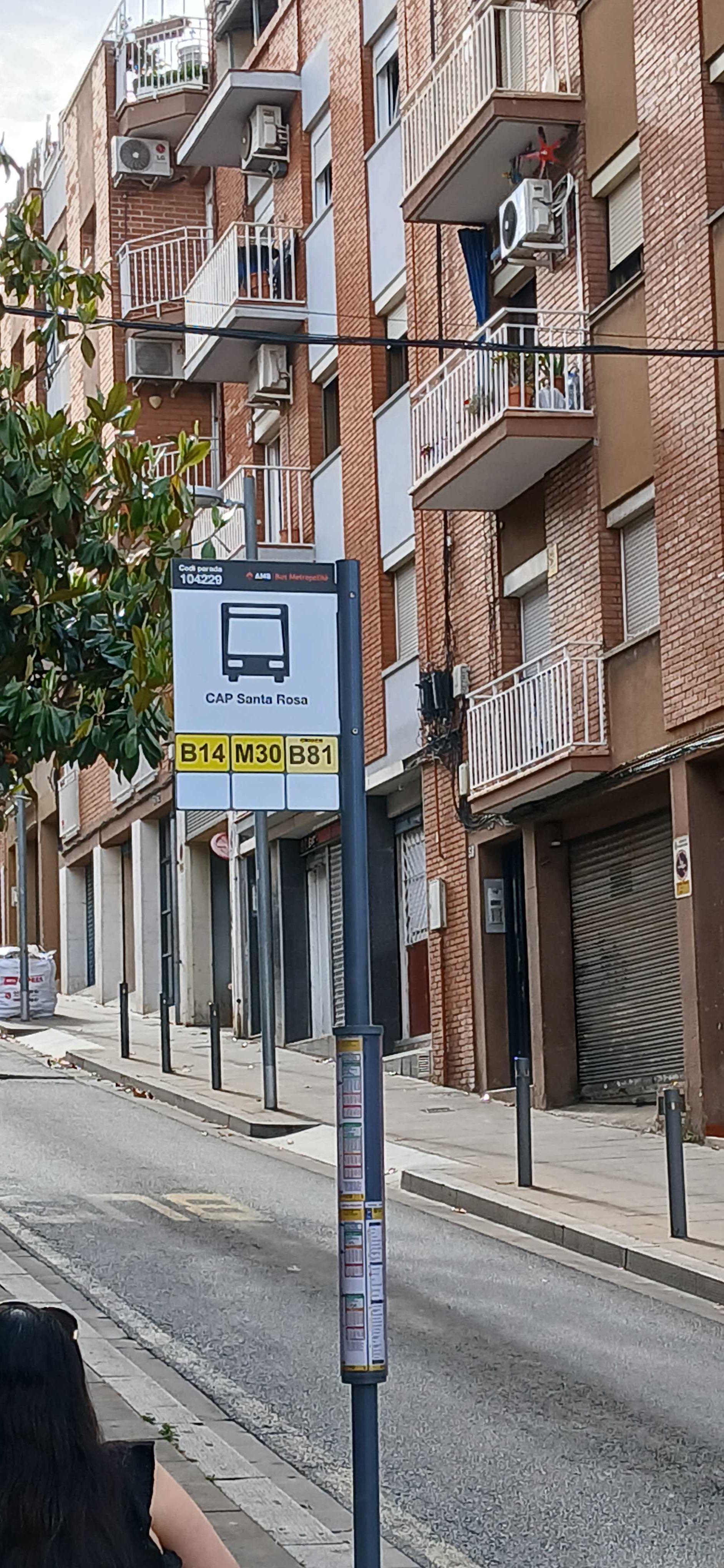 Taken by Anonymous
See Cap Santa Rosa stop, Santa Coloma De Gramenet, on the map
Public transit to Cap Santa Rosa stop (ID: 104229) in Santa Coloma De Gramenet
Looking for directions to Cap Santa Rosa in Santa Coloma De Gramenet, Spain?
Download the Moovit App to find the current schedule and step-by-step directions for Bus, Metro or Train routes that pass through Cap Santa Rosa.
Looking for the nearest stops closest to Cap Santa Rosa ? Check out this list of closest stops to your destination: Elcano - Roger De Llúria; Escola Pere De Tera; Av. Generalitat - St. Jordi; Llefià; Sant Bartomeu; Raval - Pavelló; Sant Antoni De Llefià - Lope De Vega; Can Peixauet.
Metro: L10N, L9N.Train: R2N.Bus: B14, B15, B24, B81, M30, B5, 500.
We make riding on public transit to Cap Santa Rosa easy, which is why over 1.7 billion users, including users in Santa Coloma De Gramenet trust Moovit as the best app for public transit.
Use the app to navigate to popular places including to the airport, hospital, stadium, grocery store, mall, coffee shop, school, college, and university.
Cap Santa Rosa stop’s code is 104229
The first line to this stop is M30, at 5:45 AM, and the last line is M30 at 11:04 PM.
67 Cl Sant Jordi, Badalona, Spain
This stop serves DIREXIS TUSGSAL’s lines
Popular routes from Cap Santa Rosa stop, Santa Coloma De Gramenet
- Elcano - Roger De Llúria,
- Escola Pere De Tera,
- Av. Generalitat - St. Jordi,
- Sant Bartomeu,
- Raval - Pavelló,
- Sant Antoni De Llefià - Lope De Vega
Bus stops near Cap Santa Rosa stop
- Llefià,
- Can Peixauet
Metro stations near Cap Santa Rosa station
- Sant Joan,
- Av. Mn. Jacint Verdaguer - Rambla,
- Metro Torras I Bages,
- Fornells De La Selva,
- Ripoll,
- Balmes - Trav. De Gràcia,
- Trinitat Nova,
- Fossar - Esplanada,
- Sant Joan Les Fonts,
- Llull-Llacuna,
- Av. Del Carrilet - Cooperativa,
- Ctra. Del Masnou A Granollers - Can Torras,
- Ferreries,
- Independència - Sant Antoni Maria Claret,
- Castellers,
- Creu Coberta-Pl. Espanya,
- Les Moreres,
- Can Palet De Vista Alegre,
- Pl Artós,
- Sant Martí De Centelles
Popular public transit stations in Santa Coloma De Gramenet
Get around Santa Coloma De Gramenet by public transit!
Traveling around Santa Coloma De Gramenet has never been so easy. See step by step directions as you travel to any attraction, street or major public transit station. View bus and train schedules, arrival times, service alerts and detailed routes on a map, so you know exactly how to get to anywhere in Santa Coloma De Gramenet.
When traveling to any destination around Santa Coloma De Gramenet use Moovit's Live Directions with Get Off Notifications to know exactly where and how far to walk, how long to wait for your line, and how many stops are left. Moovit will alert you when it's time to get off — no need to constantly re-check whether yours is the next stop.
Wondering how to use public transit in Santa Coloma De Gramenet or how to pay for public transit in Santa Coloma De Gramenet? Moovit public transit app can help you navigate your way with public transit easily, and at minimum cost. It includes public transit fees, ticket prices, and costs. Looking for a map of Santa Coloma De Gramenet public transit lines? Moovit public transit app shows all public transit maps in Santa Coloma De Gramenet with all Bus, Train, Metro, Tramvia, Ferry, Funicular and Gondola routes and stops on an interactive map.
Barcelona has 7 transit type(s), including: Bus, Train, Metro, Tramvia, Ferry, Funicular and Gondola, operated by several transit agencies, including TMB, FGC, Renfe Cercanias, Rodalies de Catalunya, Renfe Operadora, SNCF, Trambesòs, Monbus (Aerobús), Monbus (Papiol), Monbus (Horta), Aeri de Montserrat, Teleféricos de Barcelona, Tibidabo, Hispano Hilarienca, SA and Cots Alsina, SL