Capannelle/Gamiana stop - Thursday schedule
| Line | Direction | Time |
|---|---|---|
| 520 | Cinecitta (Ma) | 5:58 AM |
| 520 | Cinecitta (Ma) | 6:19 AM |
| 520 | Cinecitta (Ma) | 6:41 AM |
| 654 | Campo Farnia/Pellaro | 6:47 AM |
| 789 | Cinecitta (Ma) | 7:02 AM |
| 520 | Cinecitta (Ma) | 7:24 AM |
| 789 | Cinecitta (Ma) | 7:25 AM |
| 520 | Cinecitta (Ma) | 7:46 AM |
| 654 | Campo Farnia/Pellaro | 7:47 AM |
| 789 | Cinecitta (Ma) | 7:57 AM |
| 520 | Cinecitta (Ma) | 8:08 AM |
| 789 | Cinecitta (Ma) | 8:29 AM |
| 520 | Cinecitta (Ma) | 8:32 AM |
| 654 | Campo Farnia/Pellaro | 8:53 AM |
| 520 | Cinecitta (Ma) | 8:54 AM |
| 789 | Cinecitta (Ma) | 8:59 AM |
| 520 | Cinecitta (Ma) | 9:16 AM |
| 789 | Cinecitta (Ma) | 9:25 AM |
| 520 | Cinecitta (Ma) | 9:40 AM |
| 789 | Cinecitta (Ma) | 9:55 AM |
| 654 | Campo Farnia/Pellaro | 9:57 AM |
| 520 | Cinecitta (Ma) | 9:58 AM |
| 520 | Cinecitta (Ma) | 10:20 AM |
| 789 | Cinecitta (Ma) | 10:25 AM |
| 654 | Campo Farnia/Pellaro | 10:42 AM |
Directions to Capannelle/Gamiana stop (Roma) with public transit
The following transit lines have routes that pass near Capannelle/Gamiana
 Bus: 520, C11, 654, 789, COTRAL.
- Train: FL4.
- Metro: A.
How to get to Capannelle/Gamiana stop by bus?
Click on the bus route to see step by step directions with maps, line arrival times and updated time schedules.
How to get to Capannelle/Gamiana stop by train?
Click on the train route to see step by step directions with maps, line arrival times and updated time schedules.
How to get to Capannelle/Gamiana stop by metro?
Click on the metro route to see step by step directions with maps, line arrival times and updated time schedules.
Bus stops near Capannelle/Gamiana stop in Roma
- Capannelle/Gamiana, 1 min walk,
- Capannelle/Castroregio, 8 min walk,
- Capannelle Railway Station, 8 min walk,
- Lucrezia Romana/Pellaro, 8 min walk,
- Calice/Bova, 14 min walk,
Metro stations near Capannelle/Gamiana station in Roma
- Giulio Agricola, 10 min walk,
Train stations near Capannelle/Gamiana station in Roma
- Capannelle, 51 min walk,
Bus lines to Capannelle/Gamiana stop in Roma
- C11, Cinecittà (MA) - Cimitero Laurentino,
- 520, Circolare | Cinecittà (MA) - Aeroporto Ciampino - Circolare (MA),
- 654, Circolare | Capannelle - Statuario - Capannelle,
- 789, EUR Fermi (MB) - Casale Smeraldi - Cinecittà (MA),
- COTRAL, Rome | Anagnina (Metro A),
- ICCREA, Iccrea Lucrezia Romana to Anagnina,
- 533, Anagnina Metro A,
- 664, Colli Albani Square (Ma),
What are the closest stations to Capannelle/Gamiana?
The closest stations to Capannelle/Gamiana are:
- Capannelle/Gamiana stop is 56 meters away, 1 min walk.
- Capannelle/Castroregio stop is 581 meters away, 8 min walk.
- Capannelle Railway Station is 607 meters away, 8 min walk.
- Lucrezia Romana/Pellaro stop is 618 meters away, 8 min walk.
- Giulio Agricola station is 749 meters away, 10 min walk.
- Calice/Bova stop is 1065 meters away, 14 min walk.
- Capannelle station is 4049 meters away, 51 min walk.
Which bus line stops near Capannelle/Gamiana?
520 (Cinecitta (Ma))
Which train line stops near Capannelle/Gamiana?
FL4 (Frascati/Albano/Velletri)
Which metro line stops near Capannelle/Gamiana?
A (Anagnina)
What’s the nearest metro station to Capannelle/Gamiana in Roma?
The nearest metro station to Capannelle/Gamiana in Roma is Giulio Agricola. It’s a 10 min walk away.
What’s the nearest bus station to Capannelle/Gamiana in Roma?
The nearest bus station to Capannelle/Gamiana in Roma is Capannelle/Gamiana. It’s a 1 min walk away.
What time is the first metro to Capannelle/Gamiana in Roma?
The A is the first metro that goes to Capannelle/Gamiana in Roma. It stops nearby at 5:30 AM.
What time is the last metro to Capannelle/Gamiana in Roma?
The A is the last metro that goes to Capannelle/Gamiana in Roma. It stops nearby at 12:12 AM.
What time is the first train to Capannelle/Gamiana in Roma?
The FL4 is the first train that goes to Capannelle/Gamiana in Roma. It stops nearby at 6:09 AM.
What time is the last train to Capannelle/Gamiana in Roma?
The FL4 is the last train that goes to Capannelle/Gamiana in Roma. It stops nearby at 10:22 PM.
What time is the first bus to Capannelle/Gamiana in Roma?
The 664 is the first bus that goes to Capannelle/Gamiana in Roma. It stops nearby at 5:17 AM.
What time is the last bus to Capannelle/Gamiana in Roma?
The 664 is the last bus that goes to Capannelle/Gamiana in Roma. It stops nearby at 2:18 AM.
Capannelle/Gamiana station
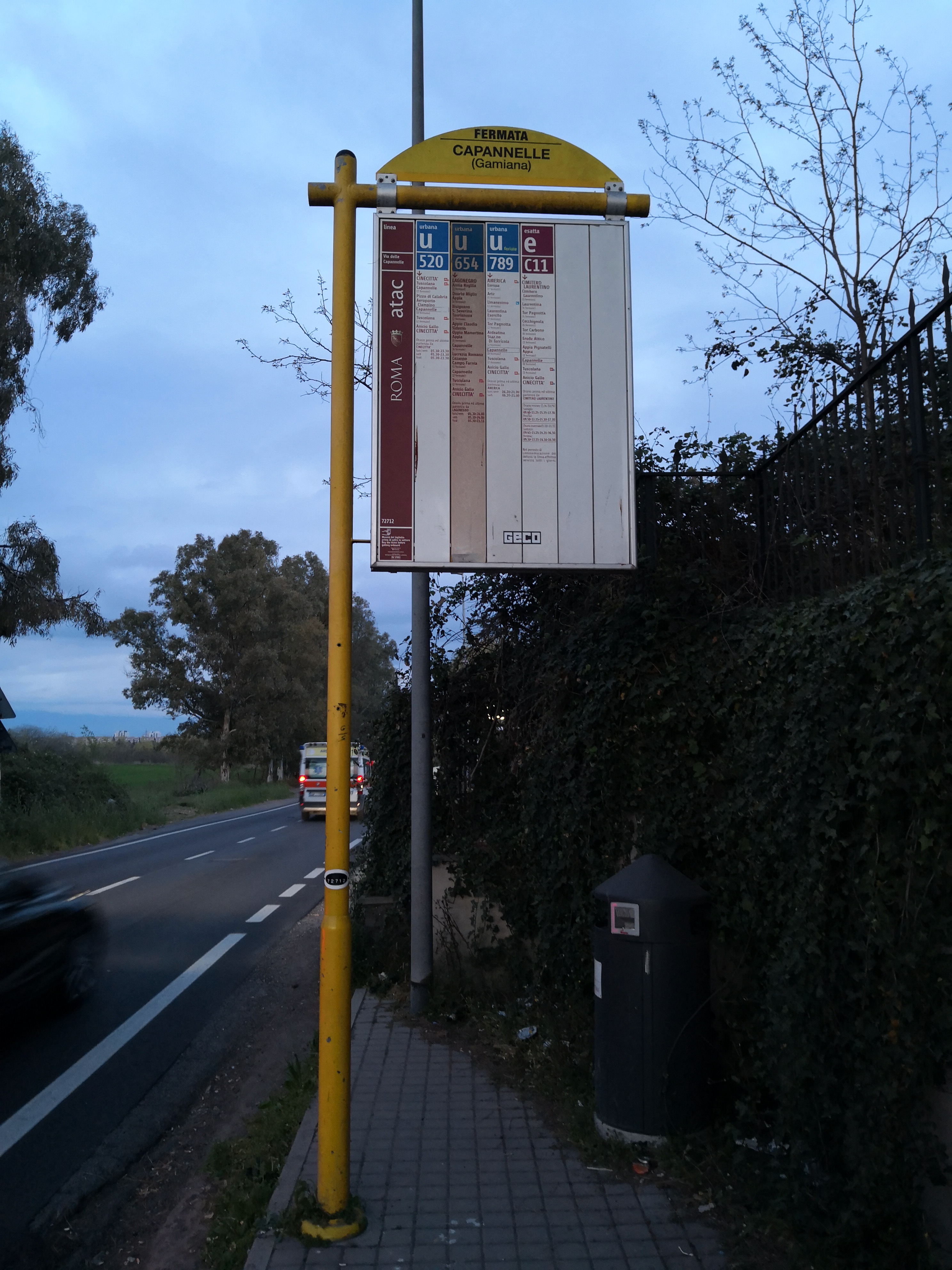 Taken by Lorenzo M.
See Capannelle/Gamiana stop, Roma, on the map
Public transit to Capannelle/Gamiana stop (ID: 72712) in Roma
Looking for directions to Capannelle/Gamiana in Roma, Italy?
Download the Moovit App to find the current schedule and step-by-step directions for Bus, Metro or Train routes that pass through Capannelle/Gamiana.
Looking for the nearest stops closest to Capannelle/Gamiana ? Check out this list of closest stops to your destination: Capannelle/Gamiana; Capannelle/Castroregio; Capannelle Railway Station; Lucrezia Romana/Pellaro; Giulio Agricola; Calice/Bova; Capannelle.
Bus: 520, C11, 654, 789, COTRAL, ICCREA, 533.Train: FL4.Metro: A.
We make riding on public transit to Capannelle/Gamiana easy, which is why over 1.7 billion users, including users in Roma trust Moovit as the best app for public transit.
Use the app to navigate to popular places including to the airport, hospital, stadium, grocery store, mall, coffee shop, school, college, and university.
Capannelle/Gamiana stop’s code is 72712
The first line to this stop is 520, at 5:58 AM, and the last line is 520 at 11:57 PM.
This stop serves ATAC and Troiani Transportation Services’s lines
- Capannelle/Gamiana,
- Capannelle/Castroregio,
- Capannelle Railway Station,
- Lucrezia Romana/Pellaro,
- Calice/Bova
Bus stops near Capannelle/Gamiana stop
- Giulio Agricola
Metro station near Capannelle/Gamiana station
- Capannelle
Train station near Capannelle/Gamiana station
- Gardenie,
- Monte Petrella/Monte Petroso,
- Flaminia/Pantaleoni,
- Viterbo,
- Cavour/Annibaldi,
- Rome | Via Aurelia (Massimina),
- Lungotevere Cadorna/Youth Hostel,
- Cicerone/Cavour,
- Trieste/Gorizia,
- Bufalotta/School,
- Morosini E./New Regina Margherita (Hospital),
- Vittorio Emanuele Course/Argentina,
- Cavour (Metro B),
- Risorgimento/S. Pietro,
- Nomentana/Villa Torlonia,
- Costamagna,
- Corso Italia/Porta Pia,
- Circus Maximus/Municipal Rose Garden,
- Saint Peter Station Square,
- Montalcini
Popular public transit stations in Roma
Get around Roma by public transit!
Traveling around Roma has never been so easy. See step by step directions as you travel to any attraction, street or major public transit station. View bus and train schedules, arrival times, service alerts and detailed routes on a map, so you know exactly how to get to anywhere in Roma.
When traveling to any destination around Roma use Moovit's Live Directions with Get Off Notifications to know exactly where and how far to walk, how long to wait for your line, and how many stops are left. Moovit will alert you when it's time to get off — no need to constantly re-check whether yours is the next stop.
Wondering how to use public transit in Roma or how to pay for public transit in Roma? Moovit public transit app can help you navigate your way with public transit easily, and at minimum cost. It includes public transit fees, ticket prices, and costs. Looking for a map of Roma public transit lines? Moovit public transit app shows all public transit maps in Roma with all Bus, Train, Metro, Light Rail, Ferry, Funicular and Gondola routes and stops on an interactive map.
Rome and Lazio has 7 transit type(s), including: Bus, Train, Metro, Light Rail, Ferry, Funicular and Gondola, operated by several transit agencies, including ATAC, Cotral, Trenitalia, Troiani Transportation Services, BIS, ATR Mobility, Tuscia, Shuttle, Seatour, Troiani Bus Lines, CSC Mobility, Terravision, ATRAL, Tambus and Sitbus