How to get to Capilla Santa Cruz by bus?
Click on the bus route to see step by step directions with maps, line arrival times and updated time schedules.
From Entrada A Huaycan, Ate
91 minFrom Santa Clara, Ate
79 minFrom Huachipa, Ate
86 minFrom Ñaña, Chaclacayo
98 minFrom Centro Comercial Real Plaza Santa Clara, Ate
84 minFrom Av.Javier Prado Este, Ate
91 minFrom Manchay, Pachacamac
51 minFrom Universidad Peruana Unión - UPeU, Lurigancho
114 minFrom Chaclacayo, Chaclacayo
117 minFrom Cevicheria El Rico Piura, Ate
93 min
Bus stop near Capilla Santa Cruz in Cieneguill
- Independencia, 19, 7 min walk,VIEW
Bus lines to Capilla Santa Cruz in Cieneguill
What are the closest stations to Capilla Santa Cruz?
The closest stations to Capilla Santa Cruz are:
- Independencia, 19 is 505 meters away, 7 min walk.
Which bus line stops near Capilla Santa Cruz?
1360 (Santa Clara (Ate) - Av. Huarochirí (Cieneguilla))
What’s the nearest bus station to Capilla Santa Cruz in Cieneguill?
The nearest bus station to Capilla Santa Cruz in Cieneguill is Independencia, 19. It’s a 7 min walk away.
What time is the first bus to Capilla Santa Cruz in Cieneguill?
The 1360 is the first bus that goes to Capilla Santa Cruz in Cieneguill. It stops nearby at 3:34 AM.
What time is the last bus to Capilla Santa Cruz in Cieneguill?
The 1358 is the last bus that goes to Capilla Santa Cruz in Cieneguill. It stops nearby at 10:49 PM.
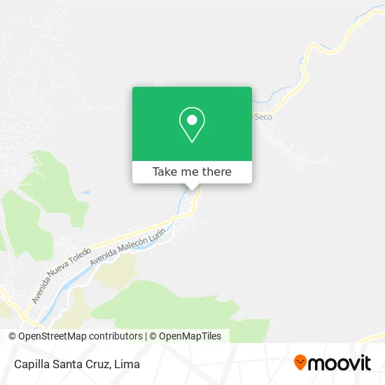
See Capilla Santa Cruz, Cieneguill, on the map
Public Transit to Capilla Santa Cruz in Cieneguill
Wondering how to get to Capilla Santa Cruz in Cieneguill? Moovit helps you find the best way to get to Capilla Santa Cruz with step-by-step directions from the nearest public transit station.
Moovit provides free maps and live directions to help you navigate through your city. View schedules, routes, timetables, and find out how long does it take to get to Capilla Santa Cruz in real time.
Looking for the nearest stop or station to Capilla Santa Cruz? Check out this list of stops closest to your destination: Independencia.
Bus: 1360, 1358.
Want to see if there’s another route that gets you there at an earlier time? Moovit helps you find alternative routes or times. Get directions from and directions to Capilla Santa Cruz easily from the Moovit App or Website.
We make riding to Capilla Santa Cruz easy, which is why over 1.5 million users, including users in Cieneguill, trust Moovit as the best app for public transit. You don’t need to download an individual bus app or train app, Moovit is your all-in-one transit app that helps you find the best bus time or train time available.
For information on prices of bus, costs and ride fares to Capilla Santa Cruz, please check the Moovit app.
Use the app to navigate to popular places including to the airport, hospital, stadium, grocery store, mall, coffee shop, school, college, and university.
Capilla Santa Cruz Address: Calle Manzanos Parcelacion Cieneguilla 3ra Etapa, 15593 Cieneguilla street in Cieneguill
- Sol de Cieneguilla,
- Restaurant Estacion 26,
- fundo molle s n,
- Loma Linda,
- Cieneguilla Tercera Etapa,
- Restaurant Turístico Ecológico Los Frutales,
- Capilla Santa Cruz,
- Cieneguilla,
- Restaurant Villa Alegre,
- Club Cieneguilla APC Sur,
- Helados Artesanales Frenesí,
- calle condorhuaca,
- av nueva toledo,
- Sauce Alto Resort,
- Parque Simón Bolívar,
- La Casita de Cieneguilla,
- Puente Panquilma,
- Cieneguilla Camping,
- Huaycán De Cieneguilla,
- Ruinas de Huaycán de Cieneguilla
Places Near Capilla Santa Cruz (Cieneguill)
- Av. La Marina, San Miguel,
- av arequipa, Lima,
- Barranco, Barranco,
- Miraflores, Miraflores,
- Gamarra,
- Real Plaza Puruchuco, Ate,
- Pontificia Universidad Católica del Perú - PUCP, San Miguel,
- Jockey Plaza, Santiago D,
- Larcomar, Miraflores,
- Paradero Av.Brasil,
- Aeropuerto Internacional Jorge Chávez, Ventanilla,
- Centro Comercial Plaza Norte, Independen,
- Plaza San Miguel, San Miguel,
- Parque Kennedy, Miraflores,
- Av. Abancay, Lima,
- Parque de las Leyendas, San Miguel,
- Circuito Mágico Del Agua, Lima,
- Hospital Edgardo Rebagliati Martins, Jesus Mari,
- Av. Salaverry, Jesus Mari,
- Mall Del Sur
How to get to popular places in Lima with public transit
Get around Cieneguill by public transit!
Traveling around Cieneguill has never been so easy. See step by step directions as you travel to any attraction, street or major public transit station. View bus and train schedules, arrival times, service alerts and detailed routes on a map, so you know exactly how to get to anywhere in Cieneguill.
When traveling to any destination around Cieneguill use Moovit's Live Directions with Get Off Notifications to know exactly where and how far to walk, how long to wait for your line, and how many stops are left. Moovit will alert you when it's time to get off — no need to constantly re-check whether yours is the next stop.
Wondering how to use public transit in Cieneguill or how to pay for public transit in Cieneguill? Moovit public transit app can help you navigate your way with public transit easily, and at minimum cost. It includes public transit fees, ticket prices, and costs. Looking for a map of Cieneguill public transit lines? Moovit public transit app shows all public transit maps in Cieneguill with all Bus, Metro and Ferry routes and stops on an interactive map.
Lima has 3 transit type(s), including: Bus, Metro and Ferry, operated by several transit agencies, including Metro de Lima Línea 2 , Metro de Lima, Corredor Rojo, Metropolitano, Metropolitano - Alimentadores, Corredor Morado, Corredor Azul, Rutas Tradicionales, Transportes y Servicios La Esperanza S.A., Las Flores S.A., Virgen de la Asunción S.A., Consorcio HAM, Transportes y Service Canadá S.A., ETUL4SA and ETUCHISA