How to get to Capybara by bus?
Click on the bus route to see step by step directions with maps, line arrival times and updated time schedules.
From Ben Calf Robe-St Clare Catholic Elementary/Junior Hi, Edmonton
86 minFrom Canada College, Edmonton
43 minFrom John E. Brownlee Building, Edmonton
51 minFrom Killarney Junior High School, Edmonton
81 minFrom 111 St NW, Edmonton
68 minFrom Plato's Closet, Edmonton
48 minFrom Lucky Supermarket, Edmonton
56 minFrom Graydon Hill, Edmonton
95 minFrom Sister Annata Brockman Elementary & Junior High, Edmonton
66 minFrom Mill Woods, Edmonton
88 min
Bus stops near Capybara in Edmonton
Light Rail stations near Capybara in Edmonton
Bus lines to Capybara in Edmonton
What are the closest stations to Capybara?
The closest stations to Capybara are:
- 142 Street & 80 Avenue is 1274 meters away, 17 min walk.
- Mckernan Belgravia Station is 1698 meters away, 23 min walk.
- Heath Sciences Tail Track is 1987 meters away, 27 min walk.
- Keillor Road & Fox Drive is 2552 meters away, 33 min walk.
Which bus lines stop near Capybara?
These bus lines stop near Capybara: 002, 904.
What’s the nearest light rail station to Capybara in Edmonton?
The nearest light rail station to Capybara in Edmonton is Mckernan Belgravia Station. It’s a 23 min walk away.
What time is the first light rail to Capybara in Edmonton?
The CAPITAL is the first light rail that goes to Capybara in Edmonton. It stops nearby at 5:19 AM.
What time is the last light rail to Capybara in Edmonton?
The CAPITAL is the last light rail that goes to Capybara in Edmonton. It stops nearby at 1:25 AM.
What time is the first bus to Capybara in Edmonton?
The 004 is the first bus that goes to Capybara in Edmonton. It stops nearby at 3:12 AM.
What time is the last bus to Capybara in Edmonton?
The 004 is the last bus that goes to Capybara in Edmonton. It stops nearby at 3:12 AM.
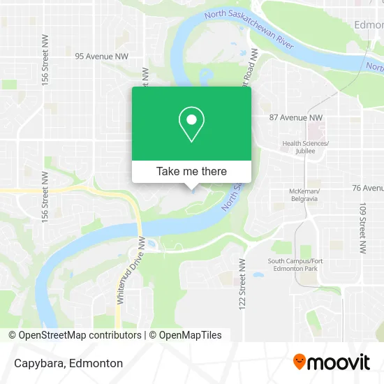
See Capybara, Edmonton, on the map
Public Transit to Capybara in Edmonton
Wondering how to get to Capybara in Edmonton? Moovit helps you find the best way to get to Capybara with step-by-step directions from the nearest public transit station.
Moovit provides free maps and live directions to help you navigate through your city. View schedules, routes, timetables, and find out how long does it take to get to Capybara in real time.
Looking for the nearest stop or station to Capybara? Check out this list of stops closest to your destination: 142 Street & 80 Avenue; Mckernan Belgravia Station; Heath Sciences Tail Track; Keillor Road & Fox Drive.
Bus: 002, 904, 004, 703, 724.
Want to see if there’s another route that gets you there at an earlier time? Moovit helps you find alternative routes or times. Get directions from and directions to Capybara easily from the Moovit App or Website.
We make riding to Capybara easy, which is why over 1.5 million users, including users in Edmonton, trust Moovit as the best app for public transit. You don’t need to download an individual bus app or train app, Moovit is your all-in-one transit app that helps you find the best bus time or train time available.
For information on prices of bus, costs and ride fares to Capybara, please check the Moovit app.
Use the app to navigate to popular places including to the airport, hospital, stadium, grocery store, mall, coffee shop, school, college, and university.
Capybara Address: Buena Vista Road NW street in Edmonton
- Edmonton Valley Zoo,
- Sir Wilfrid Laurier Park,
- Laurier Park Boat Launch,
- J N S Management Services,
- Gordon J B Company,
- Performance Electric LTD,
- The End Of The World,
- Belgravia Off Leash Dog Park,
- Nikathan Developments,
- Train Station Fort Edmonton Park,
- Campbell Bridge,
- Shafir, Joseph M Barrister & Solicitor,
- Crescendo Early Learning Academy,
- Grandview Stairs,
- Alfred H. Savage Centre,
- M D Lawn Care & Landscaping,
- D G E Consulting,
- Minute Key,
- Husky,
- Christine Gibson Photography
Places Near Capybara (Edmonton)
- Kaye Edmonton Clinic, Edmonton,
- Edmonton EXPO Centre, Edmonton,
- Edmonton Commonwealth Stadium, Edmonton,
- Cross Cancer Institute, Edmonton,
- Edmonton Valley Zoo, Edmonton,
- Kingsway Mall, Edmonton,
- Northgate Centre, Edmonton,
- University of Alberta, Edmonton,
- Edmonton VIA Rail Station, Edmonton,
- Borden Park, Edmonton,
- West Edmonton Mall, Edmonton,
- Whyte Avenue, Edmonton,
- MacEwan University, Edmonton,
- Rogers Place, Edmonton,
- Londonderry Mall, Edmonton,
- Canada Place Service Canada Centre, Edmonton,
- Fort Edmonton Park, Edmonton,
- Grey Nuns Community Hospital, Edmonton,
- Royal Alexandra Hospital, Edmonton,
- Alberta Legislature Building, Edmonton
How to get to popular places in Edmonton with public transit
Get around Edmonton by public transit!
Traveling around Edmonton has never been so easy. See step by step directions as you travel to any attraction, street or major public transit station. View bus and train schedules, arrival times, service alerts and detailed routes on a map, so you know exactly how to get to anywhere in Edmonton.
When traveling to any destination around Edmonton use Moovit's Live Directions with Get Off Notifications to know exactly where and how far to walk, how long to wait for your line, and how many stops are left. Moovit will alert you when it's time to get off — no need to constantly re-check whether yours is the next stop.
Wondering how to use public transit in Edmonton or how to pay for public transit in Edmonton? Moovit public transit app can help you navigate your way with public transit easily, and at minimum cost. It includes public transit fees, ticket prices, and costs. Looking for a map of Edmonton public transit lines? Moovit public transit app shows all public transit maps in Edmonton with all Bus and Light Rail routes and stops on an interactive map.
Edmonton has 2 transit type(s), including: Bus and Light Rail, operated by several transit agencies, including ETS LRT, ETS, Strathcona County Transit, St. Albert Transit, Spruce Grove Transit, Fort Saskatchewan Transit, Beaumont Transit and Leduc Transit