Directions to Carday Associates (Richmond) with public transportation
The following transit lines have routes that pass near Carday Associates
 Bus: 1A, 1B, FLIXBUS N2601, 1C, 87.
- Train: NORTHEAST REGIONAL.
How to get to Carday Associates by bus?
Click on the bus route to see step by step directions with maps, line arrival times and updated time schedules.
From Lorton, VA, Fairfax County
213 minFrom Hampton University, Hampton
304 minFrom Potomac Mills Mall, Prince William County
204 minFrom Busch Gardens Williamsburg (Employee Parking Lot), James City County
145 minFrom Lorton, VA - Amtrak Auto Train Station (LOR), Fairfax County
219 minFrom Rose Gaming Resort, Prince William County
229 minFrom Woodbridge, VA, Prince William County
148 minFrom UVA Hospital Medical Center, Charlottesville
293 minFrom Amazon Fulfillment Center-Ric3, Richmond
58 min
How to get to Carday Associates by train?
Click on the train route to see step by step directions with maps, line arrival times and updated time schedules.
Train station near Carday Associates in Richmond
- Pathrichmond Main Street Amtrak Station, 17 min walk,VIEW
Bus lines to Carday Associates in Richmond
What are the closest stations to Carday Associates?
The closest stations to Carday Associates are:
- Hull + 3rd is 165 yards away, 3 min walk.
- Maury + 9th is 410 yards away, 6 min walk.
- Pathrichmond Main Street Amtrak Station is 1368 yards away, 17 min walk.
Which bus lines stop near Carday Associates?
These bus lines stop near Carday Associates: 1A, 1B, FLIXBUS N2601.
Which train line stops near Carday Associates?
NORTHEAST REGIONAL (Newport News)
What’s the nearest train station to Carday Associates in Richmond?
The nearest train station to Carday Associates in Richmond is Pathrichmond Main Street Amtrak Station. It’s a 17 min walk away.
What’s the nearest bus station to Carday Associates in Richmond?
The nearest bus station to Carday Associates in Richmond is Hull + 3rd. It’s a 3 min walk away.
What time is the first train to Carday Associates in Richmond?
The NORTHEAST REGIONAL is the first train that goes to Carday Associates in Richmond. It stops nearby at 5:19 AM.
What time is the last train to Carday Associates in Richmond?
The NORTHEAST REGIONAL is the last train that goes to Carday Associates in Richmond. It stops nearby at 6:52 PM.
What time is the first bus to Carday Associates in Richmond?
The 1A is the first bus that goes to Carday Associates in Richmond. It stops nearby at 5:19 AM.
What time is the last bus to Carday Associates in Richmond?
The 1A is the last bus that goes to Carday Associates in Richmond. It stops nearby at 12:21 AM.
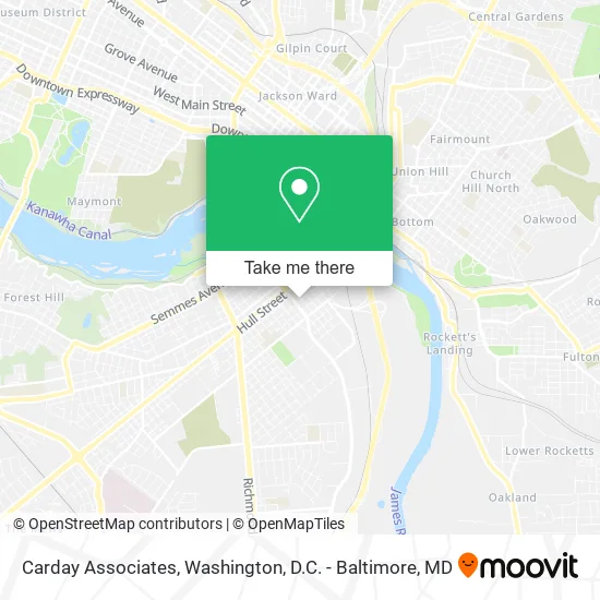
See Carday Associates, Richmond, on the map
Public Transit to Carday Associates in Richmond
Wondering how to get to Carday Associates in Richmond? Moovit helps you find the best way to get to Carday Associates with step-by-step directions from the nearest public transit station.
Moovit provides free maps and live directions to help you navigate through your city. View schedules, routes, timetables, and find out how long does it take to get to Carday Associates in real time.
Looking for the nearest stop or station to Carday Associates? Check out this list of stops closest to your destination: Hull + 3rd; Maury + 9th; Pathrichmond Main Street Amtrak Station.
Bus: 1A, 1B, FLIXBUS N2601, 1C, 87.Train: NORTHEAST REGIONAL.
Want to see if there’s another route that gets you there at an earlier time? Moovit helps you find alternative routes or times. Get directions from and directions to Carday Associates easily from the Moovit App or Website.
We make riding to Carday Associates easy, which is why over 1.5 million users, including users in Richmond, trust Moovit as the best app for public transit. You don’t need to download an individual bus app or train app, Moovit is your all-in-one transit app that helps you find the best bus time or train time available.
For information on prices of bus and train, costs and ride fares to Carday Associates, please check the Moovit app.
Use the app to navigate to popular places including to the airport, hospital, stadium, grocery store, mall, coffee shop, school, college, and university.
Carday Associates Address: 701 Stockton St Richmond, VA 23224 street in Richmond
- Plumber and Steam Fitters Local 10,
- Plumbers & Steamfitters,
- Southern Benefit Administrators,
- Localunionten,
- Jones Lillie M - Emergency Critical Illness,
- Tobacco Factory Lofts Receiver Ship,
- McFadden Group Accounting,
- Trimatrix Fitness,
- Lofts at Commerce,
- All Hours Tow Truck Service,
- Tobacco Row Apts,
- Lewis Supply Company,
- The Hudson Apartments,
- The Hudson,
- Rental Assistance Website,
- Equal Housing Opportunity,
- Motorworks at City View,
- Hopper Lofts,
- Virginia Scrtry of Health & HMN RSRCS,
- McDonald's
Places Near Carday Associates (Richmond)
- Pennsylvania Ave NW (3rd st and pennsylvania), Washington,
- Museum Of The Bible, Washington,
- Basilica of the National Shrine, Washington,
- Sibley Memorial Hospital, Washington,
- Washington National Cathedral, Washington,
- PG Mall, Prince George's County,
- Westfield Montgomery Mall, Montgomery County,
- Warner Theatre, Washington,
- Capital One Arena, Washington,
- The Anthem, Washington,
- Amazon Hq2, Arlington County,
- National Museum of African American History and Culture, Washington,
- M&T Bank Stadium, Baltimore,
- Georgetown, Washington,
- Rock Creek Tennis Center, Washington,
- Camden Yards, Baltimore,
- National Theatre, Washington,
- Washington DC VA Medical Center, Washington,
- Marriott Marquis Washington, DC, Washington,
- National Zoo, Washington
How to get to popular places in Washington, D.C. - Baltimore, MD with public transit
Get around Richmond by public transit!
Traveling around Richmond has never been so easy. See step by step directions as you travel to any attraction, street or major public transit station. View bus and train schedules, arrival times, service alerts and detailed routes on a map, so you know exactly how to get to anywhere in Richmond.
When traveling to any destination around Richmond use Moovit's Live Directions with Get Off Notifications to know exactly where and how far to walk, how long to wait for your line, and how many stops are left. Moovit will alert you when it's time to get off — no need to constantly re-check whether yours is the next stop.
Wondering how to use public transit in Richmond or how to pay for public transit in Richmond? Moovit public transit app can help you navigate your way with public transit easily, and at minimum cost. It includes public transit fees, ticket prices, and costs. Looking for a map of Richmond public transit lines? Moovit public transit app shows all public transit maps in Richmond with all Bus, Train, Metro, Light Rail and Ferry routes and stops on an interactive map.
Washington, D.C. - Baltimore, MD has 5 transit type(s), including: Bus, Train, Metro, Light Rail and Ferry, operated by several transit agencies, including WMATA, Montgomery County Ride On, Fairfax Connector, TheBus, PRTC, DASH - Alexandria, Arlington Transit (ART), RTA of Central Maryland, MDOT MTA, MDOT MTA Light RailLink, MDOT MTA Commuter Bus, MDOT MTA Local Bus, FXBGO!, Virginia Railway Express (VRE) and MARC