Directions to Cardinal Financial (Roanoke) with public transportation
The following transit lines have routes that pass near Cardinal Financial
 Bus: GREYHOUND US0600, 35, 51, TROLLEY, 52.
- Train: NORTHEAST REGIONAL.
How to get to Cardinal Financial by bus?
Click on the bus route to see step by step directions with maps, line arrival times and updated time schedules.
How to get to Cardinal Financial by train?
Click on the train route to see step by step directions with maps, line arrival times and updated time schedules.
Bus stops near Cardinal Financial in Roanoke
Train station near Cardinal Financial in Roanoke
- Roanoke, 53 min walk,VIEW
Bus lines to Cardinal Financial in Roanoke
- 35, 35 - Third Street Station To Vinton,VIEW
- 51, Tanglewood Mall (Barnes And Noble),VIEW
- TROLLEY, Downtown Market,VIEW
- 52, 3rd St Station Slip Q,VIEW
- 36, 3rd St Station Slip L,VIEW
- SWB, To Roanoke,VIEW
- 22, 3rd St Station Slip H,VIEW
- 26, 3rd St Station Slip A,VIEW
- 32, Westbound,VIEW
- 31, 31 - Third Street Station To Blue Hills,VIEW
- 41, 11th Sb at Jamison,VIEW
- 55, Tanglewood Mall (Barnes And Noble),VIEW
- 61, Red Rock Nb at Brambleton (Shell Station),VIEW
- 42, 3rd St Station Slip K,VIEW
- 56, 3rd St Station Slip P,VIEW
- 62, 3rd St Station Slip O,VIEW
- FERRUM EXPRESS, Ferrum College,VIEW
What are the closest stations to Cardinal Financial?
The closest stations to Cardinal Financial are:
- Jefferson Sb at Luck is 167 yards away, 3 min walk.
- Jefferson & Luck is 177 yards away, 3 min walk.
- Franklin Wb at Jefferson is 268 yards away, 4 min walk.
- Roanoke Campbell Court is 390 yards away, 5 min walk.
- Campbell Ave at Market is 400 yards away, 5 min walk.
- 3rd St at Church Ave is 406 yards away, 5 min walk.
- Roanoke is 410 yards away, 5 min walk.
Which bus line stops near Cardinal Financial?
GREYHOUND US0600 (Nashville Bus Station)
Which train line stops near Cardinal Financial?
NORTHEAST REGIONAL (Roanoke)
What’s the nearest bus station to Cardinal Financial in Roanoke?
The nearest bus stations to Cardinal Financial in Roanoke are Jefferson Sb at Luck and Jefferson & Luck. The closest one is a 3 min walk away.
What time is the first train to Cardinal Financial in Roanoke?
The NORTHEAST REGIONAL is the first train that goes to Cardinal Financial in Roanoke. It stops nearby at 9:35 AM.
What time is the last train to Cardinal Financial in Roanoke?
The NORTHEAST REGIONAL is the last train that goes to Cardinal Financial in Roanoke. It stops nearby at 10:13 PM.
What time is the first bus to Cardinal Financial in Roanoke?
The 36 is the first bus that goes to Cardinal Financial in Roanoke. It stops nearby at 6:05 AM.
What time is the last bus to Cardinal Financial in Roanoke?
The SWB is the last bus that goes to Cardinal Financial in Roanoke. It stops nearby at 10:15 PM.
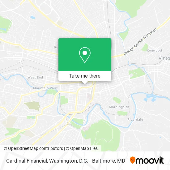
See Cardinal Financial, Roanoke, on the map
Public Transit to Cardinal Financial in Roanoke
Wondering how to get to Cardinal Financial in Roanoke? Moovit helps you find the best way to get to Cardinal Financial with step-by-step directions from the nearest public transit station.
Moovit provides free maps and live directions to help you navigate through your city. View schedules, routes, timetables, and find out how long does it take to get to Cardinal Financial in real time.
Looking for the nearest stop or station to Cardinal Financial? Check out this list of stops closest to your destination: Jefferson Sb at Luck; Jefferson & Luck; Franklin Wb at Jefferson; Roanoke Campbell Court; Campbell Ave at Market; 3rd St at Church Ave; Roanoke.
Bus: GREYHOUND US0600, 35, 51, TROLLEY, 52, 36, SWB, 22, 26, 32, 31.Train: NORTHEAST REGIONAL.
Want to see if there’s another route that gets you there at an earlier time? Moovit helps you find alternative routes or times. Get directions from and directions to Cardinal Financial easily from the Moovit App or Website.
We make riding to Cardinal Financial easy, which is why over 1.5 million users, including users in Roanoke, trust Moovit as the best app for public transit. You don’t need to download an individual bus app or train app, Moovit is your all-in-one transit app that helps you find the best bus time or train time available.
For information on prices of bus and train, costs and ride fares to Cardinal Financial, please check the Moovit app.
Use the app to navigate to popular places including to the airport, hospital, stadium, grocery store, mall, coffee shop, school, college, and university.
Cardinal Financial Address: 26 Church Ave SW Roanoke, VA 24011 street in Roanoke
- Anniemac Home Mortgage - Roanoke,
- Annie Mac,
- RRMM Architects,
- Bread Craft,
- 23 Hearts Media,
- Idevicemd Iphone, Ipad, Ipod Repair,
- 22 Church,
- Sir Speedy,
- Tudor's Biscuit World,
- Blue Ridge Land Conservancy,
- Downtown Soul,
- Silver Seas Pr,
- The Fluffnstuff Zoo,
- Daryl DC Rich CSCS,
- Sixteen West Marketplace,
- Salty's Lobster & Co.,
- Bridging Communities,
- Fleda A. Ring Artworks,
- 16 West Marketplace,
- Delicias Boricuas VA
Places Near Cardinal Financial (Roanoke)
- Museum Of The Bible, Washington,
- Camden Yards, Baltimore,
- Georgetown, Washington,
- Washington DC VA Medical Center, Washington,
- The Anthem, Washington,
- Westfield Montgomery Mall, Montgomery County,
- Amazon Hq2, Arlington County,
- National Zoo, Washington,
- Marriott Marquis Washington, DC, Washington,
- Washington National Cathedral, Washington,
- Rock Creek Tennis Center, Washington,
- Pennsylvania Ave NW (3rd st and pennsylvania), Washington,
- Warner Theatre, Washington,
- National Museum of African American History and Culture, Washington,
- M&T Bank Stadium, Baltimore,
- PG Mall, Prince George's County,
- Basilica of the National Shrine, Washington,
- Capital One Arena, Washington,
- National Mall, Washington,
- Sibley Memorial Hospital, Washington
How to get to popular places in Washington, D.C. - Baltimore, MD with public transit
Get around Roanoke by public transit!
Traveling around Roanoke has never been so easy. See step by step directions as you travel to any attraction, street or major public transit station. View bus and train schedules, arrival times, service alerts and detailed routes on a map, so you know exactly how to get to anywhere in Roanoke.
When traveling to any destination around Roanoke use Moovit's Live Directions with Get Off Notifications to know exactly where and how far to walk, how long to wait for your line, and how many stops are left. Moovit will alert you when it's time to get off — no need to constantly re-check whether yours is the next stop.
Wondering how to use public transit in Roanoke or how to pay for public transit in Roanoke? Moovit public transit app can help you navigate your way with public transit easily, and at minimum cost. It includes public transit fees, ticket prices, and costs. Looking for a map of Roanoke public transit lines? Moovit public transit app shows all public transit maps in Roanoke with all Bus, Train, Metro, Light Rail and Ferry routes and stops on an interactive map.
Washington, D.C. - Baltimore, MD has 5 transit type(s), including: Bus, Train, Metro, Light Rail and Ferry, operated by several transit agencies, including WMATA, Montgomery County Ride On, Fairfax Connector, TheBus, PRTC, DASH - Alexandria, Arlington Transit (ART), RTA of Central Maryland, MDOT MTA, MDOT MTA Light RailLink, MDOT MTA Commuter Bus, MDOT MTA Local Bus, FXBGO!, Virginia Railway Express (VRE) and MARC