Directions to Carniceria Hermanos Chavez (Puebla) with public transportation
The following transit lines have routes that pass near Carniceria Hermanos Chavez
How to get to Carniceria Hermanos Chavez by bus?
Click on the bus route to see step by step directions with maps, line arrival times and updated time schedules.
From Ceuni Puebla, San Andrés Cholula
26 minFrom Centro Expositor Puebla, Puebla
48 minFrom Funerales Humboldt, Puebla
39 minFrom El Oasis Valsequillo, Puebla
53 minFrom Infonavit San Pedro, Puebla
50 minFrom Benemerito Instituto Normal del Estado Bine, Puebla
51 minFrom Blvd. Forjadores de Puebla #7326 Col. San José del Puente, San Pedro Cholula
47 minFrom Concepción La Cruz, San Andrés Cholula
44 minFrom SNTE Sección 23, San Pedro Cholula
53 minFrom Av. Emiliano Zapata, San Andrés Cholula
40 min
Bus stops near Carniceria Hermanos Chavez in Puebla
Bus lines to Carniceria Hermanos Chavez in Puebla
- LÍNEA PERIFÉRICO, Ramal Finsa - Buap (Circuito),VIEW
- RUTA CUAUTINCHÁN, Ramal 2, Huehuetlán - Veinte De Noviembre,VIEW
- RUTA REMANENTE 1, Ramal 1, San Rafael Oriente - Cabañas Del Lago (Regreso),VIEW
- RUTA S3, Ramal 1, La Cruz - Centro,VIEW
- RUTA 10A, Ramal 1, San Fco Totimehuacán - San Felipe Hueyotlipan,VIEW
- RUTA 10B, Ramal 1, Cabañas Del Lago - San Jerónimo Caleras,VIEW
- RUTA 72 - 14 SUR, Ramal 2 Xilotzingo - Los Héroes De Puebla (Regreso),VIEW
- RUTA TEPEACA - PUEBLA, Ramal 1, Valsequillo - B. De San Sebastián (Ida),VIEW
- RUTA VILLA FRONTERA, Ramal 1, Jorge Murad - San José Xilotzingo (Ida),VIEW
- RUTA LÍNEA M1, Ramal 1 , Oasis - Valsequillo,VIEW
- RUTA M2, Ramal 1, San Pedro Zacachimalpa - Centro,VIEW
- RUTA 55, Ramal 2, La Margarita - Concepción La Cruz (Regreso),VIEW
What are the closest stations to Carniceria Hermanos Chavez?
The closest stations to Carniceria Hermanos Chavez are:
- De Los Olivos, 2220_1 is 134 meters away, 2 min walk.
- De La Huerta, 67 is 185 meters away, 3 min walk.
- Avenida Del Jardín is 252 meters away, 4 min walk.
Which bus lines stop near Carniceria Hermanos Chavez?
These bus lines stop near Carniceria Hermanos Chavez: RUTA S3, RUTA 72 - 14 SUR, RUTA M2, RUTA REMANENTE 1, RUTA VILLA FRONTERA.
What’s the nearest bus station to Carniceria Hermanos Chavez in Puebla?
The nearest bus station to Carniceria Hermanos Chavez in Puebla is De Los Olivos, 2220_1. It’s a 2 min walk away.
What time is the first bus to Carniceria Hermanos Chavez in Puebla?
The RUTA VILLA FRONTERA is the first bus that goes to Carniceria Hermanos Chavez in Puebla. It stops nearby at 6:00 AM.
What time is the last bus to Carniceria Hermanos Chavez in Puebla?
The RUTA CUAUTINCHÁN is the last bus that goes to Carniceria Hermanos Chavez in Puebla. It stops nearby at 12:29 AM.
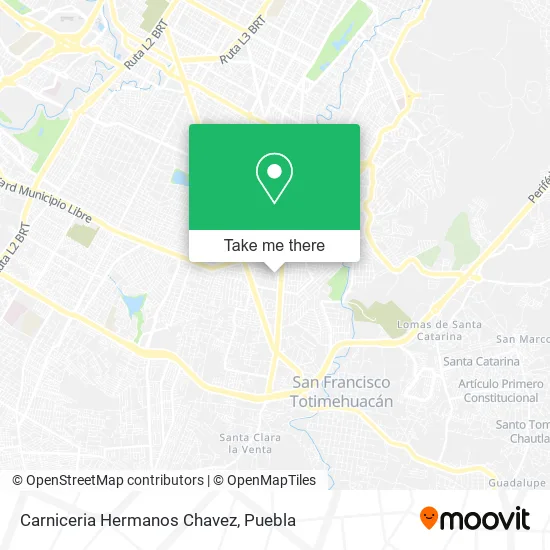
See Carniceria Hermanos Chavez, Puebla, on the map
Public Transit to Carniceria Hermanos Chavez in Puebla
Wondering how to get to Carniceria Hermanos Chavez in Puebla? Moovit helps you find the best way to get to Carniceria Hermanos Chavez with step-by-step directions from the nearest public transit station.
Moovit provides free maps and live directions to help you navigate through your city. View schedules, routes, timetables, and find out how long does it take to get to Carniceria Hermanos Chavez in real time.
Looking for the nearest stop or station to Carniceria Hermanos Chavez? Check out this list of stops closest to your destination: De Los Olivos; De La Huerta; Avenida Del Jardín.
Bus: RUTA S3, RUTA 72 - 14 SUR, RUTA M2, RUTA REMANENTE 1, RUTA VILLA FRONTERA, LÍNEA PERIFÉRICO, RUTA CUAUTINCHÁN, RUTA 10A, RUTA TEPEACA - PUEBLA, RUTA LÍNEA M1, RUTA 55.
Want to see if there’s another route that gets you there at an earlier time? Moovit helps you find alternative routes or times. Get directions from and directions to Carniceria Hermanos Chavez easily from the Moovit App or Website.
We make riding to Carniceria Hermanos Chavez easy, which is why over 1.5 million users, including users in Puebla, trust Moovit as the best app for public transit. You don’t need to download an individual bus app or train app, Moovit is your all-in-one transit app that helps you find the best bus time or train time available.
For information on prices of bus, costs and ride fares to Carniceria Hermanos Chavez, please check the Moovit app.
Use the app to navigate to popular places including to the airport, hospital, stadium, grocery store, mall, coffee shop, school, college, and university.
Carniceria Hermanos Chavez Address: Carniceria Hermanos Chavez, Cerrada Florentino Maya, San José Xilotzingo, 72590 Puebla, Puebla street in Puebla
- Xilotzingo,
- Miscelanea Xime,
- Club de Nutricion Tonic Life,
- Polleria y Verduleria Ana Karen,
- Cocina Rosy,
- Clases Particulares de Ingles,
- Recauderia,
- Regalos Shane,
- Papeleria Richars,
- Miscelanea Sarita II,
- Carniceria El Corazon de Jesus,
- Escuela Cadete Juan Escutia,
- Frutas y Verdura Lupita,
- Peleteria,
- Escuela Agustín Melgar,
- Residencial Las Flores,
- Pañaleria Luna,
- INFONAVIT San José Xilotzingo,
- Taqueria Los Tarascos Xilotzingo,
- Gorditas
Places Near Carniceria Hermanos Chavez (Puebla)
- Hospital General Regional 36 IMSS San Alejandro, San Andrés Cholula,
- Plaza Las Animas, Puebla,
- Secretaria de Finanzas, Puebla,
- Centro Comercial Angelópolis, San Andrés Cholula,
- Centro Integral de Servicios CIS, San Andrés Cholula,
- Zona de los Fuertes, Puebla,
- Tres Cruces, Puebla,
- Parque Ecologico, Pue., San Andrés Cholula,
- Hospital Imss La Margarita, Puebla,
- Ciudad Universitaria, Puebla,
- Galerías Serdán, San Pedro Cholula,
- Hospital Traumatología y Ortopedia de Puebla, San Pedro Cholula,
- SAT, San Andrés Cholula,
- Parque Puebla, Puebla,
- Complejo Cultural Universitario, Ocoyucan,
- Plaza Dorada Centro Comercial, Puebla,
- Ciudad Judicial del Estado de Puebla, San Andrés Cholula,
- Centro de Desarrollo Comunitario Tres Cruces, Puebla,
- 25 Zona Militar, Puebla,
- Estadio Cuauhtémoc, Puebla
How to get to popular places in Puebla with public transit
Get around Puebla by public transit!
Traveling around Puebla has never been so easy. See step by step directions as you travel to any attraction, street or major public transit station. View bus and train schedules, arrival times, service alerts and detailed routes on a map, so you know exactly how to get to anywhere in Puebla.
When traveling to any destination around Puebla use Moovit's Live Directions with Get Off Notifications to know exactly where and how far to walk, how long to wait for your line, and how many stops are left. Moovit will alert you when it's time to get off — no need to constantly re-check whether yours is the next stop.
Wondering how to use public transit in Puebla or how to pay for public transit in Puebla? Moovit public transit app can help you navigate your way with public transit easily, and at minimum cost. It includes public transit fees, ticket prices, and costs. Looking for a map of Puebla public transit lines? Moovit public transit app shows all public transit maps in Puebla with all bus routes and stops on an interactive map.
Puebla has 1 transit type(s), including: bus, operated by several transit agencies, including RUTA, RUTA Alimentadoras, Rutas Convencionales and Líneas temporales