How to get to Carnitas by bus?
Click on the bus route to see step by step directions with maps, line arrival times and updated time schedules.
From Dra. Claudia Sofia Muñoz De La Torre, Aguascalientes
49 minFrom Panteon Municipal San Francisco, Aguascalientes
58 minFrom Centro de Convenciones Isla San Marcos - Oficial, Aguascalientes
50 minFrom H-E-B, Aguascalientes
37 minFrom Si Unicen, Aguascalientes
53 minFrom Villas de San Antonio, Aguascalientes
60 minFrom Templo De Guadalupe, Aguascalientes
45 minFrom Centro Comercial Villasunción, Aguascalientes
72 minFrom Fracc. José López Portillo, Aguascalientes
68 minFrom Hacienda Nueva, Aguascalientes
74 min
Bus stops near Carnitas in Aguascalientes
Bus lines to Carnitas in Aguascalientes
What are the closest stations to Carnitas?
The closest stations to Carnitas are:
- Del Laurel Poniente, 106 is 64 meters away, 2 min walk.
- Arcos Los Miradores is 219 meters away, 3 min walk.
Which bus lines stop near Carnitas?
These bus lines stop near Carnitas: RUTA 09, RUTA 16, RUTA 45, RUTA 48.
What’s the nearest bus station to Carnitas in Aguascalientes?
The nearest bus station to Carnitas in Aguascalientes is Del Laurel Poniente, 106. It’s a 2 min walk away.
What time is the first bus to Carnitas in Aguascalientes?
The RUTA 09 is the first bus that goes to Carnitas in Aguascalientes. It stops nearby at 5:50 AM.
What time is the last bus to Carnitas in Aguascalientes?
The RUTA 45 is the last bus that goes to Carnitas in Aguascalientes. It stops nearby at 10:26 PM.
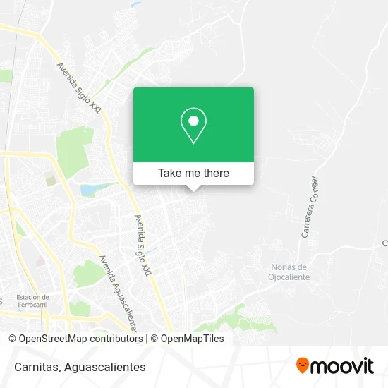
See Carnitas, Aguascalientes, on the map
Public Transit to Carnitas in Aguascalientes
Wondering how to get to Carnitas in Aguascalientes? Moovit helps you find the best way to get to Carnitas with step-by-step directions from the nearest public transit station.
Moovit provides free maps and live directions to help you navigate through your city. View schedules, routes, timetables, and find out how long does it take to get to Carnitas in real time.
Looking for the nearest stop or station to Carnitas? Check out this list of stops closest to your destination: Del Laurel Poniente; Arcos Los Miradores.
Bus: RUTA 09, RUTA 16, RUTA 45, RUTA 48.
Want to see if there’s another route that gets you there at an earlier time? Moovit helps you find alternative routes or times. Get directions from and directions to Carnitas easily from the Moovit App or Website.
We make riding to Carnitas easy, which is why over 1.5 million users, including users in Aguascalientes, trust Moovit as the best app for public transit. You don’t need to download an individual bus app or train app, Moovit is your all-in-one transit app that helps you find the best bus time or train time available.
For information on prices of bus, costs and ride fares to Carnitas, please check the Moovit app.
Use the app to navigate to popular places including to the airport, hospital, stadium, grocery store, mall, coffee shop, school, college, and university.
Carnitas Address: Carnitas, Circuito Agapanto, Fraccionamiento Los Laureles, 20174 Aguascalientes, Aguascalientes street in Aguascalientes
- La Cocina de Mamá,
- Paletería Martita,
- Fruteria La Morena,
- Venta de Pañal y Productos de Limpieza,
- WESTERN UNION,
- Venta de Pozole,
- Venta de Jugos,
- Alora +Dent Dentista,
- Calle Cultura Olmeca 109,
- Capellanía Juan Pablo Ll,
- Consultorios Privados de Medicina Especializada,
- Villacanto,
- Escuela José Refugio Esparza Reyes,
- Fracc. Los Pericos,
- Cooperativa Escolar Mano Amiga T.M,
- Cultura Maya Agu,
- Gorditas y Quesadillas Doña Rouss,
- Deposito de Arena Ricardo López Muñoz,
- Los Laureles II,
- Cooperativa de Escuela José Refugio Esparza Reyes
Places Near Carnitas (Aguascalientes)
- Isla San Marcos, Aguascalientes,
- Terminal De Combis, Aguascalientes,
- Nuevo Hospital Hidalgo, Aguascalientes,
- ESPACIOS, Aguascalientes,
- Jesús María, Aguascalientes,
- Imss Clinica 1, Aguascalientes,
- La Isla San Marcos, Aguascalientes,
- Parque Las Tres Centurias, Aguascalientes,
- Aeropuerto de Aguascalientes S.A. de C.V., Aguascalientes,
- Central De Autobuses, Aguascalientes,
- Agropecuario, Aguascalientes,
- Ciudad industrial, Aguascalientes,
- Centro Comercial Altaria, Aguascalientes,
- Hospital Imss No. 3, Aguascalientes,
- Blvd. Luis Donaldo Colosio, Aguascalientes,
- Villasuncion, Aguascalientes,
- clinica 3 uaa, Aguascalientes,
- Villas de Nuestra Señora de la Asunción, Aguascalientes,
- Centro, Aguascalientes,
- Universidad Autónoma de Aguascalientes, Aguascalientes
How to get to popular places in Aguascalientes with public transit
Get around Aguascalientes by public transit!
Traveling around Aguascalientes has never been so easy. See step by step directions as you travel to any attraction, street or major public transit station. View bus and train schedules, arrival times, service alerts and detailed routes on a map, so you know exactly how to get to anywhere in Aguascalientes.
When traveling to any destination around Aguascalientes use Moovit's Live Directions with Get Off Notifications to know exactly where and how far to walk, how long to wait for your line, and how many stops are left. Moovit will alert you when it's time to get off — no need to constantly re-check whether yours is the next stop.
Wondering how to use public transit in Aguascalientes or how to pay for public transit in Aguascalientes? Moovit public transit app can help you navigate your way with public transit easily, and at minimum cost. It includes public transit fees, ticket prices, and costs. Looking for a map of Aguascalientes public transit lines? Moovit public transit app shows all public transit maps in Aguascalientes with all bus routes and stops on an interactive map.
Aguascalientes has 1 transit type(s), including: bus, operated by several transit agencies, including Coordinación General de Movilidad