Directions to Carnitas El Chaperon (Matamoros) with public transportation
The following transit lines have routes that pass near Carnitas El Chaperon
How to get to Carnitas El Chaperon by bus?
Click on the bus route to see step by step directions with maps, line arrival times and updated time schedules.
From Cecilio Rodriguez Salón Peluquería, Torreón
47 minFrom Soriana Independencia, Torreón
48 minFrom Banco Santander Sucursal Galerias, Torreón
39 minFrom Distribuidora Sabesa del Norte, Torreón
57 minFrom Recaudacion de Rentas. Coahuila, Torreón
46 minFrom Estadio Revolucion, Torreón
32 minFrom Parques Las Americas de Torreon, S.A. de C.V., Torreón
48 minFrom Colegio de Bachillerato Tecnológico Agropecuario No. 1, Torreón
81 minFrom Dr. Luis Rey González Parrilla, Torreón
57 minFrom Hipermart Independencia, Torreón
50 min
Bus stops near Carnitas El Chaperon in Matamoros
Bus lines to Carnitas El Chaperon in Matamoros
What are the closest stations to Carnitas El Chaperon?
The closest stations to Carnitas El Chaperon are:
- Carretera Torreón - Matamoros, 137 is 2 meters away, 2 min walk.
- Cerrada Asturias, 220 is 395 meters away, 6 min walk.
- Prol. Juarez is 403 meters away, 6 min walk.
Which bus lines stop near Carnitas El Chaperon?
These bus lines stop near Carnitas El Chaperon: CENTENARIO, INDEPENDENCIA- ANTONIO NARRO, LA JOYA - ALIANZA.
What’s the nearest bus station to Carnitas El Chaperon in Matamoros?
The nearest bus station to Carnitas El Chaperon in Matamoros is Carretera Torreón - Matamoros, 137. It’s a 2 min walk away.
What time is the first bus to Carnitas El Chaperon in Matamoros?
The NORTE is the first bus that goes to Carnitas El Chaperon in Matamoros. It stops nearby at 6:00 AM.
What time is the last bus to Carnitas El Chaperon in Matamoros?
The NORTE is the last bus that goes to Carnitas El Chaperon in Matamoros. It stops nearby at 11:21 PM.
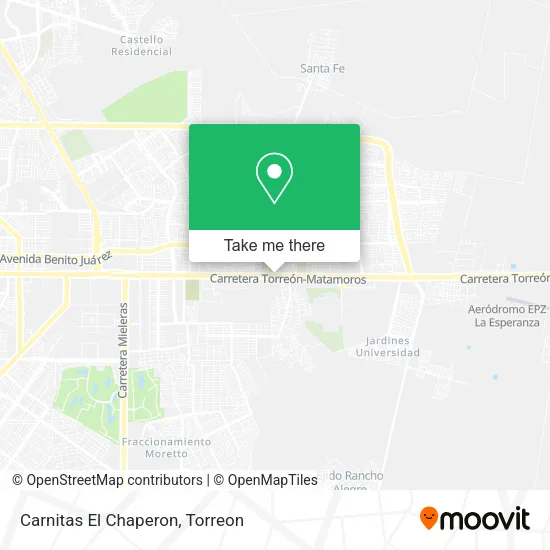
See Carnitas El Chaperon, Matamoros, on the map
Public Transit to Carnitas El Chaperon in Matamoros
Wondering how to get to Carnitas El Chaperon in Matamoros? Moovit helps you find the best way to get to Carnitas El Chaperon with step-by-step directions from the nearest public transit station.
Moovit provides free maps and live directions to help you navigate through your city. View schedules, routes, timetables, and find out how long does it take to get to Carnitas El Chaperon in real time.
Looking for the nearest stop or station to Carnitas El Chaperon? Check out this list of stops closest to your destination: Carretera Torreón - Matamoros; Cerrada Asturias; Prol. Juarez.
Bus: CENTENARIO, INDEPENDENCIA- ANTONIO NARRO, LA JOYA - ALIANZA, ALLENDE-ABASTOS- LA CORTINA, NORTE.
Want to see if there’s another route that gets you there at an earlier time? Moovit helps you find alternative routes or times. Get directions from and directions to Carnitas El Chaperon easily from the Moovit App or Website.
We make riding to Carnitas El Chaperon easy, which is why over 1.5 million users, including users in Matamoros, trust Moovit as the best app for public transit. You don’t need to download an individual bus app or train app, Moovit is your all-in-one transit app that helps you find the best bus time or train time available.
For information on prices of bus, costs and ride fares to Carnitas El Chaperon, please check the Moovit app.
Use the app to navigate to popular places including to the airport, hospital, stadium, grocery store, mall, coffee shop, school, college, and university.
Carnitas El Chaperon Address: Carnitas El Chaperon, Carretera Torreón-Matamoros, Oscar Flores Tapia, 27086 Torreón, Coahuila de Z street in Matamoros
- Oscar Flores Tapia,
- Umaa 90 Imss,
- IMSS UMAA #90,
- Templo Príncipe de Paz,
- Ejido El Águila,
- Iglesia Metodista de México,
- Cebtis 156,
- Cbtis 156 La Joya,
- Universidad Autónoma de Durango Campus Laguna,
- Villas De San Angel 3,
- Villas De San Ángel,
- Fraccionamiento Villas de San Ángel,
- Fraccionamiento El Castaño,
- Campo Militar 33 - 5to Bat Militar,
- 33% BATALLÓN DE INFANTERÍA, 6a. ZONA,
- Torreon La Latino,
- Escuela de Arquitectura UAdeC,
- Facultad de Economía y Mercadotecnia,
- Fraccionamiento Los Almendros,
- Veredas de la Joya
Places Near Carnitas El Chaperon (Matamoros)
- Afore XXI Banorte Centro de Atencion, Torreón,
- Subdelegacion Imss, Torreón,
- Bosque Venustiano Carranza, Torreón,
- Plaza Jumbo, Torreón,
- Hospital General Del ISSSTE En Torreon, Torreón,
- Residencial Senderos, Torreón,
- IMSS 71 Clinica De Especialidades Torreon Coah., Torreón,
- Calzada Saltillo 400, Torreón,
- IMSS Clinica 66, Torreón,
- Centro de Convenciones de Torreón, Torreón,
- Galerías Laguna, Torreón,
- Bosque Urbano, Torreón,
- Tsm (Territorio Santos Modelo), Torreón,
- Central De Autobuses Torreón, Torreón,
- Viñedos, Torreón,
- Química del Rey, S.A. de C.V., Torreón,
- La Playa, Matamoros,
- Fraccionamiento Las Arboledas, Torreón,
- Francisco I Madero, Torreón,
- Cuatro Caminos, Torreón
How to get to popular places in Torreon with public transit
Get around Matamoros by public transit!
Traveling around Matamoros has never been so easy. See step by step directions as you travel to any attraction, street or major public transit station. View bus and train schedules, arrival times, service alerts and detailed routes on a map, so you know exactly how to get to anywhere in Matamoros.
When traveling to any destination around Matamoros use Moovit's Live Directions with Get Off Notifications to know exactly where and how far to walk, how long to wait for your line, and how many stops are left. Moovit will alert you when it's time to get off — no need to constantly re-check whether yours is the next stop.
Wondering how to use public transit in Matamoros or how to pay for public transit in Matamoros? Moovit public transit app can help you navigate your way with public transit easily, and at minimum cost. It includes public transit fees, ticket prices, and costs. Looking for a map of Matamoros public transit lines? Moovit public transit app shows all public transit maps in Matamoros with all Bus and Gondola routes and stops on an interactive map.
Torreon has 2 transit type(s), including: Bus and Gondola, operated by several transit agencies, including IMPLAN, Sindicato de Rutas Urbanas de Gomez Palacio CTM, TRANSPORTES MOCTEZUMA, TRANSPORTES DEL NAZAS and Autobuses Torreón-Solima