How to get to Carproof Auto Center by bus?
Click on the bus route to see step by step directions with maps, line arrival times and updated time schedules.
From Travelodge by Wyndham, Edmonton
55 minFrom Costco Wholesale, Edmonton
44 minFrom Blue Quill Pharmacy, Edmonton
51 minFrom Lee Valley Tools, Edmonton
75 minFrom Ermineskin Park, Edmonton
50 minFrom Old Town Bookshop Stony Plain, Edmonton
42 minFrom St. Joseph's Auxiliary Hospital, Edmonton
51 minFrom Jubilations Dinner Theatre, Edmonton
40 minFrom Canadian Tire, Edmonton
45 minFrom Hillcrest Junior High School, Edmonton
54 min
Bus stops near Carproof Auto Center in Edmonton
Light Rail stations near Carproof Auto Center in Edmonton
Bus lines to Carproof Auto Center in Edmonton
- 111, Stadium Transit Centre,VIEW
- 701, Government Transit Centre,VIEW
- 120X, Eaux Claires - Government Centre,VIEW
- 130X, Baturyn - Eaux Claires - Government Centre,VIEW
- 150X, Dunluce - Castle Downs - Government Centre,VIEW
- 001A, Capilano Transit Centre,VIEW
- 001B, 102 Street & Macdonald Drive,VIEW
- 900X, 101 Street & 102 Avenue,VIEW
- 005, Coliseum Transit Centre,VIEW
- 009, Eaux Claires Transit Centre,VIEW
- 901, Jasper Place Transit Centre,VIEW
What are the closest stations to Carproof Auto Center?
The closest stations to Carproof Auto Center are:
- 97 Street & 105 Avenue is 96 meters away, 2 min walk.
- 97 Street & 107 Avenue is 271 meters away, 4 min walk.
- 97 Street & 103a Avenue is 392 meters away, 6 min walk.
- 95 Street & 106 Avenue is 507 meters away, 7 min walk.
- 101 Street & 105a Avenue is 511 meters away, 7 min walk.
- Churchill Stop is 1856 meters away, 24 min walk.
- Churchill Station Underground is 2276 meters away, 30 min walk.
Which bus lines stop near Carproof Auto Center?
These bus lines stop near Carproof Auto Center: 007, 009, 523, 701.
Which light rail line stops near Carproof Auto Center?
METRO (Nait Blatchford Market)
What’s the nearest light rail station to Carproof Auto Center in Edmonton?
The nearest light rail station to Carproof Auto Center in Edmonton is Churchill Stop. It’s a 24 min walk away.
What’s the nearest bus station to Carproof Auto Center in Edmonton?
The nearest bus station to Carproof Auto Center in Edmonton is 97 Street & 105 Avenue. It’s a 2 min walk away.
What time is the first light rail to Carproof Auto Center in Edmonton?
The VALLEY is the first light rail that goes to Carproof Auto Center in Edmonton. It stops nearby at 5:15 AM.
What time is the last light rail to Carproof Auto Center in Edmonton?
The VALLEY is the last light rail that goes to Carproof Auto Center in Edmonton. It stops nearby at 1:12 AM.
What time is the first bus to Carproof Auto Center in Edmonton?
The 009 is the first bus that goes to Carproof Auto Center in Edmonton. It stops nearby at 3:03 AM.
What time is the last bus to Carproof Auto Center in Edmonton?
The 009 is the last bus that goes to Carproof Auto Center in Edmonton. It stops nearby at 3:03 AM.
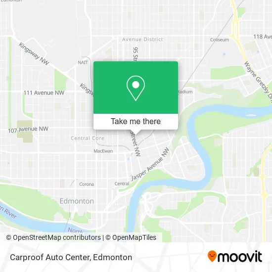
See Carproof Auto Center, Edmonton, on the map
Public Transit to Carproof Auto Center in Edmonton
Wondering how to get to Carproof Auto Center in Edmonton? Moovit helps you find the best way to get to Carproof Auto Center with step-by-step directions from the nearest public transit station.
Moovit provides free maps and live directions to help you navigate through your city. View schedules, routes, timetables, and find out how long does it take to get to Carproof Auto Center in real time.
Looking for the nearest stop or station to Carproof Auto Center? Check out this list of stops closest to your destination: 97 Street & 105 Avenue; 97 Street & 107 Avenue; 97 Street & 103a Avenue; 95 Street & 106 Avenue; 101 Street & 105a Avenue; Churchill Stop; Churchill Station Underground.
Bus: 007, 009, 523, 701, 111, 120X, 130X, 150X, 001A, 001B, 900X, 005, 901.Light Rail: METRO.
Want to see if there’s another route that gets you there at an earlier time? Moovit helps you find alternative routes or times. Get directions from and directions to Carproof Auto Center easily from the Moovit App or Website.
We make riding to Carproof Auto Center easy, which is why over 1.5 million users, including users in Edmonton, trust Moovit as the best app for public transit. You don’t need to download an individual bus app or train app, Moovit is your all-in-one transit app that helps you find the best bus time or train time available.
For information on prices of bus and light rail, costs and ride fares to Carproof Auto Center, please check the Moovit app.
Use the app to navigate to popular places including to the airport, hospital, stadium, grocery store, mall, coffee shop, school, college, and university.
Carproof Auto Center Address: 9650 105A Ave NW Edmonton, AB T5H street in Edmonton
- Downtown Vapes,
- Chinatown Business Association 華埠及地區商會,
- Ambrose Place,
- Ulasi Law Group,
- Little Bonbon Ice Cream,
- CJS Design Canada,
- The Owl of Minerva, Scarborough,
- LS 1778735 Alberta in,
- Balance Media LTD,
- Canadian Diamond Boyz,
- China Marble,
- RBC Royal Bank,
- Pacific Mall,
- H2 Healing Hands,
- Interact Realty,
- Eleanor Gift Shop,
- Pacific Rim Mall - Diamond Parking Lot #N309,
- Chinatown,
- Matella Spotless Spaces,
- Metro Pharmacy
Places Near Carproof Auto Center (Edmonton)
- Northgate Centre, Edmonton,
- Grey Nuns Community Hospital, Edmonton,
- Royal Alexandra Hospital, Edmonton,
- MacEwan University, Edmonton,
- Edmonton Commonwealth Stadium, Edmonton,
- Alberta Legislature Building, Edmonton,
- Edmonton Valley Zoo, Edmonton,
- Fort Edmonton Park, Edmonton,
- Borden Park, Edmonton,
- Kingsway Mall, Edmonton,
- Whyte Avenue, Edmonton,
- Cross Cancer Institute, Edmonton,
- Londonderry Mall, Edmonton,
- Edmonton VIA Rail Station, Edmonton,
- Kaye Edmonton Clinic, Edmonton,
- University of Alberta, Edmonton,
- Edmonton EXPO Centre, Edmonton,
- West Edmonton Mall, Edmonton,
- Canada Place Service Canada Centre, Edmonton,
- Rogers Place, Edmonton
How to get to popular places in Edmonton with public transit
Get around Edmonton by public transit!
Traveling around Edmonton has never been so easy. See step by step directions as you travel to any attraction, street or major public transit station. View bus and train schedules, arrival times, service alerts and detailed routes on a map, so you know exactly how to get to anywhere in Edmonton.
When traveling to any destination around Edmonton use Moovit's Live Directions with Get Off Notifications to know exactly where and how far to walk, how long to wait for your line, and how many stops are left. Moovit will alert you when it's time to get off — no need to constantly re-check whether yours is the next stop.
Wondering how to use public transit in Edmonton or how to pay for public transit in Edmonton? Moovit public transit app can help you navigate your way with public transit easily, and at minimum cost. It includes public transit fees, ticket prices, and costs. Looking for a map of Edmonton public transit lines? Moovit public transit app shows all public transit maps in Edmonton with all Bus and Light Rail routes and stops on an interactive map.
Edmonton has 2 transit type(s), including: Bus and Light Rail, operated by several transit agencies, including ETS LRT, ETS, Strathcona County Transit, St. Albert Transit, Spruce Grove Transit, Fort Saskatchewan Transit, Beaumont Transit and Leduc Transit