Directions to Carrier Library (Harrisonburg) with public transportation
The following transit lines have routes that pass near Carrier Library
 Bus: BRCC NORTH, 1, 1-B, EXT 1, 4.
Bus stops near Carrier Library in Harrisonburg
Bus lines to Carrier Library in Harrisonburg
- 1, Route 1,VIEW
- 1-B, Route 1-B,VIEW
- EXT 1, Extended Route 1,VIEW
- 4, Route 4,VIEW
- 4-B, Route 4-B,VIEW
- EXT 4, Extended Route 4,VIEW
- GREEN, JMU Green Line,VIEW
- ICS, JMU ICS,VIEW
- ICSSAT, JMU ICS Saturday,VIEW
- JMU ICS NIGHT, JMU ICS Night,VIEW
- JMU SUMMER GOLD, JMU Summer Gold,VIEW
- SHOP, JMU Sunday Shopper,VIEW
- YELLOW, JMU Yellow (Weekdays),VIEW
- YELLOW, JMU Yellow (Saturdays),VIEW
- YELLOW, JMU Yellow Night (Weekdays),VIEW
- 6, Route 6,VIEW
- 6-B, Route 6-B,VIEW
- EXT 6, Extended Route 6,VIEW
- 3, Route 3,VIEW
- 3-B, Route 3-B,VIEW
- Starbucks,
- Madison Memorial Library,
- Hillcrest House,
- Dukes Dining,
- Panda Express,
- Top Dog Cafe,
- Panera Bread,
- Keezell Hall,
- Grace Street Deck,
- Burruss Hall,
- James Madison,
- Wxjm-Fm (Harrisonburg),
- Grafton-Stovall Theatre,
- Wilson Hall,
- North Campus Steam Plant,
- Grace Street Parking Deck,
- The Commons,
- Jmu Commonwealth One,
- Warren Hall,
- Alumnae Hall
Places Near Carrier Library (Harrisonburg)
- Marriott Marquis Washington, DC, Washington,
- Museum Of The Bible, Washington,
- PG Mall, Prince George's County,
- Warner Theatre, Washington,
- Westfield Montgomery Mall, Montgomery County,
- Washington DC VA Medical Center, Washington,
- Rock Creek Tennis Center, Washington,
- National Museum of African American History and Culture, Washington,
- Washington National Cathedral, Washington,
- Georgetown, Washington,
- National Zoo, Washington,
- Basilica of the National Shrine, Washington,
- National Theatre, Washington,
- M&T Bank Stadium, Baltimore,
- The Anthem, Washington,
- Amazon Hq2, Arlington County,
- Capital One Arena, Washington,
- Pennsylvania Ave NW (3rd st and pennsylvania), Washington,
- Sibley Memorial Hospital, Washington,
- Camden Yards, Baltimore
How to get to popular places in Washington, D.C. - Baltimore, MD with public transit
What are the closest stations to Carrier Library?
The closest stations to Carrier Library are:
- South Main St. & M.L.King Way is 89 yards away, 2 min walk.
- Bluestone Dr. Across From the Union is 238 yards away, 4 min walk.
- Grace St. Across From Taylor Down under (Shelter) is 246 yards away, 4 min walk.
- Jmu Godwin Transit Center is 397 yards away, 5 min walk.
- Godwin Transit Center is 451 yards away, 6 min walk.
Which bus line stops near Carrier Library?
BRCC NORTH (Brcc)
What’s the nearest bus station to Carrier Library in Harrisonburg?
The nearest bus station to Carrier Library in Harrisonburg is South Main St. & M.L.King Way. It’s a 2 min walk away.
What time is the first bus to Carrier Library in Harrisonburg?
The 6 is the first bus that goes to Carrier Library in Harrisonburg. It stops nearby at 6:34 AM.
What time is the last bus to Carrier Library in Harrisonburg?
The 1-B is the last bus that goes to Carrier Library in Harrisonburg. It stops nearby at 10:40 PM.
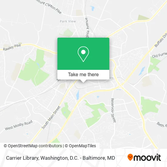
See Carrier Library, Harrisonburg, on the map
Public Transit to Carrier Library in Harrisonburg
Wondering how to get to Carrier Library in Harrisonburg? Moovit helps you find the best way to get to Carrier Library with step-by-step directions from the nearest public transit station.
Moovit provides free maps and live directions to help you navigate through your city. View schedules, routes, timetables, and find out how long does it take to get to Carrier Library in real time.
Looking for the nearest stop or station to Carrier Library? Check out this list of stops closest to your destination: South Main St. & M.L.King Way; Bluestone Dr. Across From the Union; Grace St. Across From Taylor Down under (Shelter); Jmu Godwin Transit Center; Godwin Transit Center.
Bus: BRCC NORTH, 1, 1-B, EXT 1, 4, 4-B, GREEN, ICS, ICSSAT, JMU ICS NIGHT, JMU SUMMER GOLD, 3, 3-B, EXT 3, BRCC SOUTH, GOLD, GOLD, JMU SUMMER SILVER, SHOP, SILVER.
Want to see if there’s another route that gets you there at an earlier time? Moovit helps you find alternative routes or times. Get directions from and directions to Carrier Library easily from the Moovit App or Website.
We make riding to Carrier Library easy, which is why over 1.5 million users, including users in Harrisonburg, trust Moovit as the best app for public transit. You don’t need to download an individual bus app or train app, Moovit is your all-in-one transit app that helps you find the best bus time or train time available.
For information on prices of train and bus, costs and ride fares to Carrier Library, please check the Moovit app.
Use the app to navigate to popular places including to the airport, hospital, stadium, grocery store, mall, coffee shop, school, college, and university.
Carrier Library Address: 880 Madison Dr Harrisonburg, VA 22807 street in Harrisonburg
Get around Harrisonburg by public transit!
Traveling around Harrisonburg has never been so easy. See step by step directions as you travel to any attraction, street or major public transit station. View bus and train schedules, arrival times, service alerts and detailed routes on a map, so you know exactly how to get to anywhere in Harrisonburg.
When traveling to any destination around Harrisonburg use Moovit's Live Directions with Get Off Notifications to know exactly where and how far to walk, how long to wait for your line, and how many stops are left. Moovit will alert you when it's time to get off — no need to constantly re-check whether yours is the next stop.
Wondering how to use public transit in Harrisonburg or how to pay for public transit in Harrisonburg? Moovit public transit app can help you navigate your way with public transit easily, and at minimum cost. It includes public transit fees, ticket prices, and costs. Looking for a map of Harrisonburg public transit lines? Moovit public transit app shows all public transit maps in Harrisonburg with all Bus, Train, Metro, Light Rail and Ferry routes and stops on an interactive map.
Washington, D.C. - Baltimore, MD has 5 transit type(s), including: Bus, Train, Metro, Light Rail and Ferry, operated by several transit agencies, including WMATA, Montgomery County Ride On, Fairfax Connector, TheBus, PRTC, DASH - Alexandria, Arlington Transit (ART), RTA of Central Maryland, MDOT MTA, MDOT MTA Light RailLink, MDOT MTA Commuter Bus, MDOT MTA Local Bus, FXBGO!, Virginia Railway Express (VRE) and MARC