How to get to Korea House by bus?
Click on the bus route to see step by step directions with maps, line arrival times and updated time schedules.
Bus stop near Korea House in Vagli Sotto
- Vagli Di Sopra, 3 min walk,VIEW
What are the closest stations to Korea House?
The closest stations to Korea House are:
- Vagli Di Sopra is 168 meters away, 3 min walk.
Which bus line stops near Korea House?
E67 (Piazza Al Serchio Station)
What’s the nearest bus station to Korea House in Vagli Sotto?
The nearest bus station to Korea House in Vagli Sotto is Vagli Di Sopra. It’s a 3 min walk away.
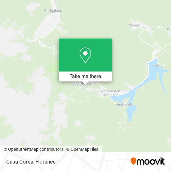
See Korea House, Vagli Sotto, on the map
Public Transit to Korea House in Vagli Sotto
Wondering how to get to Korea House in Vagli Sotto? Moovit helps you find the best way to get to Korea House with step-by-step directions from the nearest public transit station.
Moovit provides free maps and live directions to help you navigate through your city. View schedules, routes, timetables, and find out how long does it take to get to Korea House in real time.
Looking for the nearest stop or station to Korea House? Check out this list of stops closest to your destination: Vagli Di Sopra.
Bus: E67, E52, E52.
Want to see if there’s another route that gets you there at an earlier time? Moovit helps you find alternative routes or times. Get directions from and directions to Korea House easily from the Moovit App or Website.
We make riding to Korea House easy, which is why over 1.5 million users, including users in Vagli Sotto, trust Moovit as the best app for public transit. You don’t need to download an individual bus app or train app, Moovit is your all-in-one transit app that helps you find the best bus time or train time available.
For information on prices of bus, costs and ride fares to Korea House, please check the Moovit app.
Use the app to navigate to popular places including to the airport, hospital, stadium, grocery store, mall, coffee shop, school, college, and university.
Korea House Address: Via Potone, 18 55030 Vagli Sotto street in Vagli Sotto
- Home in Garfagnana,
- Balducci Mountain Hut,
- Campocatino Refuge Restaurant,
- Campocatino Refuge,
- Gaspari Giovanni,
- Futura Vagli a,
- The Meeting Social Cooperative,
- Alps,
- Vagli Sopra,
- Vagli Sotto Municipality,
- Vagli di Sotto Municipality,
- The Lake,
- Municipal Swimming Pool Le Monache,
- Vagli Park & Zip Line,
- Kindergarten,
- Convent Square,
- San Regolo,
- Fanti Bridge in Marina,
- Gretamassa,
- Serenaia Valley
Places Near Korea House (Vagli Sotto)
- Field of Mars, Florence,
- Santa Maria Nuova Hospital, Florence,
- Artemio Franchi Municipal Stadium, Florence,
- Asmana, Campi Bisenzio,
- Campi Bisenzio, Campi Bisenzio,
- Visarno Arena, Florence,
- Verdi Theater, Florence,
- Tobacco Manufacture, Florence,
- OOO, Florence,
- Torregalli Hospital Scandicci *, Scandicci,
- Nelson Mandela Forum, Florence,
- I Gigli, Campi Bisenzio,
- Cascine Park, Florence,
- IKEA Florence, Sesto Fiorentino,
- Michelangelo Square, Florence,
- Piero Palagi Hospital Facility-Florence, Florence,
- Visarno Hippodrome, Florence,
- Mandela Forum (Nelson Mandela Forum), Florence,
- Santa Maria Novella Station, Florence,
- Michelangelo Square, Florence
How to get to popular places in Florence with public transit
Get around Vagli Sotto by public transit!
Traveling around Vagli Sotto has never been so easy. See step by step directions as you travel to any attraction, street or major public transit station. View bus and train schedules, arrival times, service alerts and detailed routes on a map, so you know exactly how to get to anywhere in Vagli Sotto.
When traveling to any destination around Vagli Sotto use Moovit's Live Directions with Get Off Notifications to know exactly where and how far to walk, how long to wait for your line, and how many stops are left. Moovit will alert you when it's time to get off — no need to constantly re-check whether yours is the next stop.
Wondering how to use public transit in Vagli Sotto or how to pay for public transit in Vagli Sotto? Moovit public transit app can help you navigate your way with public transit easily, and at minimum cost. It includes public transit fees, ticket prices, and costs. Looking for a map of Vagli Sotto public transit lines? Moovit public transit app shows all public transit maps in Vagli Sotto with all Bus, Train, Light Rail, Ferry and Funicular routes and stops on an interactive map.
Florence has 5 transit type(s), including: Bus, Train, Light Rail, Ferry and Funicular, operated by several transit agencies, including Florence Urban - Tuscan Bus Lines, GEST, Livorno and Province - Tuscan Bus Lines, Arezzo, Florence and Provinces - Tuscan Bus Lines, Prato and Province - Tuscan Bus Lines, Lucca and Province - Tuscan Bus Lines, Massa, Carrara and Province - Tuscan Bus Lines, Pisa and Province - Tuscan Bus Lines, Grosseto, Siena and Provinces - Tuscan Bus Lines, Arezzo, Siena and Provinces - Tuscan Bus Lines, Florence and Province - Tuscan Bus Lines, Pistoia and Province - Tuscan Bus Lines, Siena and Province - Tuscan Bus Lines, Arezzo and Province - Tuscan Bus Lines and Trenitalia