How to get to Cassiopeia by bus?
Click on the bus route to see step by step directions with maps, line arrival times and updated time schedules.
Bus stops near Cassiopeia in Slagelse
Bus lines to Cassiopeia in Slagelse
What are the closest stations to Cassiopeia?
The closest stations to Cassiopeia are:
- Havnepladsen (Havnevej) is 195 meters away, 3 min walk.
- Bakkenborgvej (Carl Medingsvej) is 312 meters away, 5 min walk.
Which bus lines stop near Cassiopeia?
These bus lines stop near Cassiopeia: 470R, 670, 907.
What’s the nearest bus station to Cassiopeia in Slagelse?
The nearest bus station to Cassiopeia in Slagelse is Havnepladsen (Havnevej). It’s a 3 min walk away.
What time is the first bus to Cassiopeia in Slagelse?
The 470R is the first bus that goes to Cassiopeia in Slagelse. It stops nearby at 7:19 AM.
What time is the last bus to Cassiopeia in Slagelse?
The 470R is the last bus that goes to Cassiopeia in Slagelse. It stops nearby at 12:36 AM.
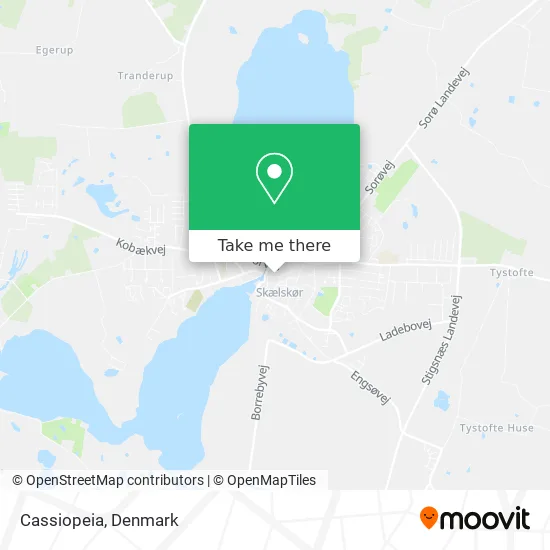
See Cassiopeia, Slagelse, on the map
Public Transit to Cassiopeia in Slagelse
Wondering how to get to Cassiopeia in Slagelse? Moovit helps you find the best way to get to Cassiopeia with step-by-step directions from the nearest public transit station.
Moovit provides free maps and live directions to help you navigate through your city. View schedules, routes, timetables, and find out how long does it take to get to Cassiopeia in real time.
Looking for the nearest stop or station to Cassiopeia? Check out this list of stops closest to your destination: Havnepladsen (Havnevej); Bakkenborgvej (Carl Medingsvej).
Bus: 470R, 670, 907, 495, 963, 462.
Want to see if there’s another route that gets you there at an earlier time? Moovit helps you find alternative routes or times. Get directions from and directions to Cassiopeia easily from the Moovit App or Website.
We make riding to Cassiopeia easy, which is why over 1.5 million users, including users in Slagelse, trust Moovit as the best app for public transit. You don’t need to download an individual bus app or train app, Moovit is your all-in-one transit app that helps you find the best bus time or train time available.
For information on prices of bus and train, costs and ride fares to Cassiopeia, please check the Moovit app.
Use the app to navigate to popular places including to the airport, hospital, stadium, grocery store, mall, coffee shop, school, college, and university.
Cassiopeia Address: Algade 15 4230 Skælskør street in Slagelse
- Kosmorama, Skælskør - Byens Bedste Bif,
- Butik Mille Modetøj til Piger & Kvinder,
- Radioselskabet Holm Radio Aps,
- Læge Birger Kreutzfeldt,
- Skælskør Vinhandel,
- Susanne B Kristensen Tandlæge,
- Brockhuus Data V / Mads Brockhuus,
- Steenfeldt Boghandel V / Hans Henrik Steenfeldt Pedersen,
- Unni Frisør Design,
- Gardinhuset Skæ,
- Clever,
- Borgerservice,
- Skælskør Salon,
- Fonden til Bevarelse af Gamle Bygninger i Skælskør Kommune,
- Skælskør Havn,
- Omy Sushi,
- Skælskør,
- Baronessens Walkin,
- Dansk Svejse- og Rørmontage Aps,
- John Jensen
Places Near Cassiopeia (Slagelse)
- Royal Arena, København,
- Dr Koncerthuset, København,
- Nyhavn, København,
- Rigshospitalet, København,
- Copenhagen Street Food - Reffen, København,
- Carlsberg Byen, København,
- Bispebjerg Hospital, København,
- Christiania, København,
- Ikea, Århus,
- Reffen, København,
- Havnebus 993 (Nyhavn - Operaen),
- Grundtvigs Kirke, København,
- Bella Center, København,
- Marmorkirken, København,
- Fisketorvet, København,
- Refshaleøen, København,
- Seduction Girls, Rødovre,
- Field's, København,
- Eventyrpigerne, Sorø,
- Operaen, København
How to get to popular places in Denmark with public transit
Get around Slagelse by public transit!
Traveling around Slagelse has never been so easy. See step by step directions as you travel to any attraction, street or major public transit station. View bus and train schedules, arrival times, service alerts and detailed routes on a map, so you know exactly how to get to anywhere in Slagelse.
When traveling to any destination around Slagelse use Moovit's Live Directions with Get Off Notifications to know exactly where and how far to walk, how long to wait for your line, and how many stops are left. Moovit will alert you when it's time to get off — no need to constantly re-check whether yours is the next stop.
Wondering how to use public transit in Slagelse or how to pay for public transit in Slagelse? Moovit public transit app can help you navigate your way with public transit easily, and at minimum cost. It includes public transit fees, ticket prices, and costs. Looking for a map of Slagelse public transit lines? Moovit public transit app shows all public transit maps in Slagelse with all Bus, Train, Metro, Light Rail and Ferry routes and stops on an interactive map.
Denmark has 5 transit type(s), including: Bus, Train, Metro, Light Rail and Ferry, operated by several transit agencies, including Metroselskabet, DSB S-tog, Lokaltog A/S, Midttrafik, Odense Letbane, DSB, NT, GoCollective, Skånetrafiken, Movia, FYNBUS, Sydtrafik, Bornholms Trafik, Citybus and Ærø Kommune