Castle Shannon station - Saturday schedule
| Line | Direction | Time |
|---|---|---|
| RED | Inbound-North Shore | 5:19 AM |
| RED | Inbound-North Shore | 5:39 AM |
| RED | Inbound-North Shore | 5:59 AM |
| RED | Inbound-North Shore | 6:19 AM |
| RED | Outbound-Outbound-South Hills Village | 6:34 AM |
| RED | Inbound-North Shore | 6:39 AM |
| RED | Outbound-Outbound-South Hills Village | 6:54 AM |
| RED | Inbound-North Shore | 6:59 AM |
| RED | Outbound-Outbound-South Hills Village | 7:14 AM |
| RED | Inbound-North Shore | 7:19 AM |
| RED | Outbound-Outbound-South Hills Village | 7:34 AM |
| RED | Inbound-North Shore | 7:39 AM |
| RED | Outbound-Outbound-South Hills Village | 7:54 AM |
| RED | Inbound-North Shore | 7:59 AM |
| RED | Outbound-Outbound-South Hills Village | 8:14 AM |
| RED | Inbound-North Shore | 8:19 AM |
| RED | Outbound-Outbound-South Hills Village | 8:34 AM |
| RED | Inbound-North Shore | 8:38 AM |
| RED | Outbound-Outbound-South Hills Village | 8:54 AM |
| RED | Inbound-North Shore | 8:58 AM |
| RED | Outbound-Outbound-South Hills Village | 9:14 AM |
| RED | Inbound-North Shore | 9:18 AM |
| RED | Outbound-Outbound-South Hills Village | 9:35 AM |
| RED | Inbound-North Shore | 9:38 AM |
| RED | Outbound-Outbound-South Hills Village | 9:57 AM |
Directions to Castle Shannon station with public transit
The following transit lines have routes that pass near Castle Shannon
 Bus: 36, 41, A.
- Train: RED, BLUE, SLVR.
How to get to Castle Shannon station by bus?
Click on the bus route to see step by step directions with maps, line arrival times and updated time schedules.
How to get to Castle Shannon station by train?
Click on the train route to see step by step directions with maps, line arrival times and updated time schedules.
Bus stops near Castle Shannon stop
- Route 88 + Castle Shannon Blvd, 11 min walk,
Train stations near Castle Shannon station
- Willow, 16 min walk,
- St. Anne's, 16 min walk,
Bus lines to Castle Shannon station
- A, Toward Donora Via Rt. 88 South,
What are the closest stations to Castle Shannon?
The closest stations to Castle Shannon are:
- Route 88 + Castle Shannon Blvd stop is 881 yards away, 11 min walk.
- Willow station is 1321 yards away, 16 min walk.
- St. Anne's station is 1340 yards away, 16 min walk.
Which bus lines stop near Castle Shannon?
These bus lines stop near Castle Shannon: 36, 41, A.
Which train line stops near Castle Shannon?
RED (Outbound-Outbound-South Hills Village)
What’s the nearest train station to Castle Shannon?
The nearest train stations to Castle Shannon are Willow and St. Anne's. The closest one is a 16 min walk away.
What’s the nearest bus station to Castle Shannon?
The nearest bus station to Castle Shannon is Route 88 + Castle Shannon Blvd. It’s a 11 min walk away.
What time is the first train to Castle Shannon?
The RED is the first train that goes to Castle Shannon. It stops nearby at 4:15 AM.
What time is the last train to Castle Shannon?
The RED is the last train that goes to Castle Shannon. It stops nearby at 2:08 AM.
What time is the first bus to Castle Shannon?
The A is the first bus that goes to Castle Shannon. It stops nearby at 5:45 AM.
What time is the last bus to Castle Shannon?
The A is the last bus that goes to Castle Shannon. It stops nearby at 9:06 PM.
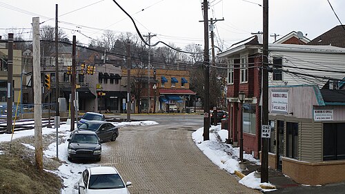
Castle Shannon station
 Taken by Andrew A.
See Castle Shannon station on the map
Public transit to Castle Shannon station
Looking for directions to Castle Shannon in Castle Shannon, United States?
Download the Moovit App to find the current schedule and step-by-step directions for Bus or Train routes that pass through Castle Shannon.
Looking for the nearest stops closest to Castle Shannon ? Check out this list of closest stops to your destination: Route 88 + Castle Shannon Blvd; Willow; St. Anne's.
Bus: 36, 41, A.Train: RED, BLUE, SLVR.
We make riding on public transit to Castle Shannon easy, which is why over 1.7 billion users, including users in Castle Shannon trust Moovit as the best app for public transit.
Use the app to navigate to popular places including to the airport, hospital, stadium, grocery store, mall, coffee shop, school, college, and university.
The station has the following entrances: Parking Lot
The first line to this station is RED, at 5:19 AM, and the last line is RED at 1:35 AM.
700 Castle Shannon Blvd, Castle Shannon, PA, USA
This station serves Pittsburgh Regional Transit’s lines
Castle Shannon is a borough in Allegheny County, Pennsylvania, United States. The population was 8,249 at the 2020 census. It is part of the Pittsburgh metropolitan area.Wiki
Popular routes from Castle Shannon station
- Route 88 + Castle Shannon Blvd
Bus stop near Castle Shannon stop
- Willow,
- St. Anne's
Train stations near Castle Shannon station
- Lincoln Ave + Fremont Ave,
- Charles St + Izora,
- Woodrow Wilson,
- S 18th St + Crossman St,
- Second Ave + Bates FS,
- Rhine St + Steine,
- Ohio River Blvd + Memorial,
- Middletown Rd + Hodgson FS,
- Itin St + Goehring,
- Liberty After 11th (Amtrak),
- Walnut St + 28th,
- Frankstown Rd + 1st Reformed Church,
- Pines Of East Pike,
- Iup Wallwork Hall on Grant St at Pratt D,
- Penfort St + #173,
- Conniston Ave + Bon Air,
- West Busway + Carnegie Station,
- Verona Rd + Riverside,
- Browns Ln + Mcknight Rd FS,
- Spring Garden Ave + #3851
Popular public transit stations in Castle Shannon
Get around Castle Shannon by public transit!
Traveling around Castle Shannon has never been so easy. See step by step directions as you travel to any attraction, street or major public transit station. View bus and train schedules, arrival times, service alerts and detailed routes on a map, so you know exactly how to get to anywhere in Castle Shannon.
When traveling to any destination around Castle Shannon use Moovit's Live Directions with Get Off Notifications to know exactly where and how far to walk, how long to wait for your line, and how many stops are left. Moovit will alert you when it's time to get off — no need to constantly re-check whether yours is the next stop.
Wondering how to use public transit in Castle Shannon or how to pay for public transit in Castle Shannon? Moovit public transit app can help you navigate your way with public transit easily, and at minimum cost. It includes public transit fees, ticket prices, and costs. Looking for a map of Castle Shannon public transit lines? Moovit public transit app shows all public transit maps in Castle Shannon with all Bus, Train and Funicular routes and stops on an interactive map.
Pittsburgh has 3 transit type(s), including: Bus, Train and Funicular, operated by several transit agencies, including Pittsburgh Regional Transit, CamTran, Amtran, Mid Mon Valley Transit, BCTA, Butler Transit Authority, IndiGo, Area Transportation Authority, Freedom Transit, Mountain Line Transit Authority, Megabus, Greyhound-us, Fullington Trailways, Amtrak and FlixBus-us