Directions to Cat Scale (Fort Pierce) with public transportation
The following transit lines have routes that pass near Cat Scale
 Bus: 3, FLIXBUS N2411, GREYHOUND US0630, GREYHOUND US0710S.
How to get to Cat Scale by bus?
Click on the bus route to see step by step directions with maps, line arrival times and updated time schedules.
From CVS Pharmacy - (Lyngate Dr), Port St. Lucie
145 minFrom US-1, Fort Pierce
112 minFrom Hca Florida Lawnwood Hospital, Fort Pierce
31 minFrom Stuart, Florida, Stuart
194 minFrom US-1 / SE Port St Lucie Blvd, Port St. Lucie
154 minFrom Clover Park, Port St. Lucie
142 minFrom Tradition Park, Port St. Lucie
59 minFrom William T. Dwyer High School, Jupiter
423 minFrom Donald Ross Rd / Military Trl, Jupiter
409 minFrom Suncoast High School, Riviera Beach
482 min
Bus stops near Cat Scale in Fort Pierce
Bus lines to Cat Scale in Fort Pierce
What are the closest stations to Cat Scale?
The closest stations to Cat Scale are:
- Fort Pierce (Love'S) is 2 yards away, 1 min walk.
- Wheeler Ter & Okeechobee Rd is 307 yards away, 4 min walk.
Which bus lines stop near Cat Scale?
These bus lines stop near Cat Scale: 3, FLIXBUS N2411, GREYHOUND US0630, GREYHOUND US0710S.
What’s the nearest bus station to Cat Scale in Fort Pierce?
The nearest bus station to Cat Scale in Fort Pierce is Fort Pierce (Love'S). It’s a 1 min walk away.
What time is the first bus to Cat Scale in Fort Pierce?
The 3 is the first bus that goes to Cat Scale in Fort Pierce. It stops nearby at 6:25 AM.
What time is the last bus to Cat Scale in Fort Pierce?
The GREYHOUND US0630 is the last bus that goes to Cat Scale in Fort Pierce. It stops nearby at 8:30 PM.
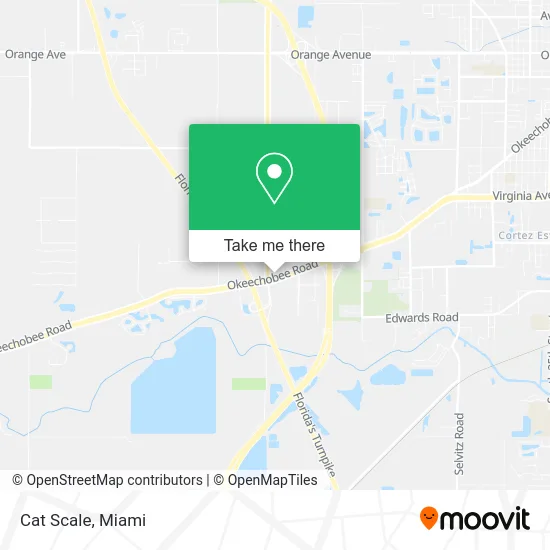
See Cat Scale, Fort Pierce, on the map
Public Transit to Cat Scale in Fort Pierce
Wondering how to get to Cat Scale in Fort Pierce? Moovit helps you find the best way to get to Cat Scale with step-by-step directions from the nearest public transit station.
Moovit provides free maps and live directions to help you navigate through your city. View schedules, routes, timetables, and find out how long does it take to get to Cat Scale in real time.
Looking for the nearest stop or station to Cat Scale? Check out this list of stops closest to your destination: Fort Pierce (Love'S); Wheeler Ter & Okeechobee Rd.
Bus: 3, FLIXBUS N2411, GREYHOUND US0630, GREYHOUND US0710S.
Want to see if there’s another route that gets you there at an earlier time? Moovit helps you find alternative routes or times. Get directions from and directions to Cat Scale easily from the Moovit App or Website.
We make riding to Cat Scale easy, which is why over 1.5 million users, including users in Fort Pierce, trust Moovit as the best app for public transit. You don’t need to download an individual bus app or train app, Moovit is your all-in-one transit app that helps you find the best bus time or train time available.
For information on prices of bus, costs and ride fares to Cat Scale, please check the Moovit app.
Use the app to navigate to popular places including to the airport, hospital, stadium, grocery store, mall, coffee shop, school, college, and university.
Cat Scale Address: 7150 Okeechobee Rd Fort Pierce, FL 34945 street in Fort Pierce
- Greyhound-Fort Pierce,
- Hogs N Hunnies BBQ,
- Fantasy Decor & Floral Designs,
- Sea Breeze Organic Farm,
- bp,
- Colossal Locksmith,
- The Cuban Corner,
- Krispy Krunchy Chicken,
- Coinsource,
- DUNKIN',
- Fleetpride Truck & Trailer Parts,
- La Granja,
- Fleetpride443,
- Ajs Petroleum,
- National Tire and Truck Repair,
- Love's,
- Pappy's Liquors,
- 3 Palms Hotel,
- Holiday Inn Express,
- BURGER KING
Places Near Cat Scale (Fort Pierce)
- Sawgrass Mall, Miami,
- Miami VA Hospital, Miami,
- Aventura Mall, Miami,
- Keiser University Flagship Campus, West Palm Beach,
- Port of Miami Cruise Terminal, Miami,
- Hard Rock Stadium, Miami Gardens,
- Wynwood, Miami,
- Aventura Mall, Miami Beach,
- Zoo Miami, Miami,
- Sawgrass mall ( FL ), Miami Beach,
- Bayside Marketplace, Miami,
- Miami Freedom Park, Miami,
- Little Havana, Miami,
- Miami-Dade County Courthouse, Miami,
- Dolphin Mall, Miami,
- Dolphin Mall Bus, Miami,
- Miami Design District, Miami,
- Richard E. Gerstein Justice Building, Miami,
- Brickell City Centre, Miami,
- Marlins Park, Miami
How to get to popular places in Miami with public transit
Get around Fort Pierce by public transit!
Traveling around Fort Pierce has never been so easy. See step by step directions as you travel to any attraction, street or major public transit station. View bus and train schedules, arrival times, service alerts and detailed routes on a map, so you know exactly how to get to anywhere in Fort Pierce.
When traveling to any destination around Fort Pierce use Moovit's Live Directions with Get Off Notifications to know exactly where and how far to walk, how long to wait for your line, and how many stops are left. Moovit will alert you when it's time to get off — no need to constantly re-check whether yours is the next stop.
Wondering how to use public transit in Fort Pierce or how to pay for public transit in Fort Pierce? Moovit public transit app can help you navigate your way with public transit easily, and at minimum cost. It includes public transit fees, ticket prices, and costs. Looking for a map of Fort Pierce public transit lines? Moovit public transit app shows all public transit maps in Fort Pierce with all Bus, Train, Light Rail and Ferry routes and stops on an interactive map.
Miami has 4 transit type(s), including: Bus, Train, Light Rail and Ferry, operated by several transit agencies, including Broward County Transit, Miami-Dade Transit, Metrorail, Palm Tran, Tri-Rail, Brightline, MARTY, City of Homestead Trolley, Key West Transit, Treasure Coast Connector, GoLine IRT, Amtrak, Greyhound-us, FlixBus-us and Aventura Express Shuttle Bus