Directions to Catumbi with public transportation
The following transit lines have routes that pass near Catumbi
 Bus: 109, 202, 410, 435, 498.
- Metro: L1, L4.
- Train: RAMAL SANTA CRUZ, RAMAL SARACURUNA.
- Ferry: PRAÇA ARARIBÓIA - PRAÇA XV.
- Cable Car: BONDE (LINHA TURÍSTICA).
How to get to Catumbi by bus?
Click on the bus route to see step by step directions with maps, line arrival times and updated time schedules.
From Estádio Nilton Santos (Engenhão)
56 minFrom Sesc Copacabana
23 minFrom Rua Arquias Cordeiro 1516
39 minFrom niterói x itaipuaçu Viação Nossa Senhora Do Amparo
38 minFrom Rua Dr Mario Viana
55 minFrom Hospital Federal da Lagoa
27 minFrom Santa Rosa
53 minFrom Rua 24 de Fevereiro
23 minFrom Praça Afonso Viseu
42 minFrom Niterói
118 min
How to get to Catumbi by train?
Click on the train route to see step by step directions with maps, line arrival times and updated time schedules.
How to get to Catumbi by metro?
Click on the metro route to see step by step directions with maps, line arrival times and updated time schedules.
How to get to Catumbi by ferry?
Click on the ferry route to see step by step directions with maps, line arrival times and updated time schedules.
Bus stops near Catumbi
- Cemitério São Francisco De Paula, 1 min walk,VIEW
- Rua Do Catumbi, 67-83, 2 min walk,VIEW
- Rua Dos Coqueiros (Somente Sentido Santa Bárbara), 3 min walk,VIEW
- BRS 1,2,3,4,I: Marquês De Sapucaí, 6 min walk,VIEW
- Sambódromo | Marquês De Sapucaí - Linhas Intermunicipais, 6 min walk,VIEW
- Rua Pintora Djanira, 7, 10 min walk,VIEW
- Rua Progresso, 67, 11 min walk,VIEW
Cable Car stations near Catumbi
Metro station near Catumbi
- Praça Onze, 15 min walk,VIEW
Bus lines to Catumbi
- 201, Santa Alexandrina ↔ Castelo (Domingo),VIEW
- 202, Rio Comprido,VIEW
- 109, São Conrado (Reversível),VIEW
- 410, Saens Peña,VIEW
- 435, Gávea,VIEW
- 456, Norte Shopping,VIEW
- 485, Ipanema,VIEW
- 486, Fundão,VIEW
- 426, Jardim De Alah,VIEW
- 498, Largo Do Machado (Via Catumbi),VIEW
- 108C, Caxias - Estácio (Brs I),VIEW
- 229, Usina - Castelo / Carioca (Brs 2 - Via Saens Peña),VIEW
- 238, Água Santa - Castelo (Brs 4 - Via Grajaú / Lapa),VIEW
- SN 238, Água Santa - Castelo (Brs 4 - Via Grajaú / Lapa),VIEW
- 239, Água Santa - Passeio (Brs 4 - Via 24 de Maio),VIEW
- 321, Bancários - Castelo (Brs 4 - Via Linha Vermelha),VIEW
- 323, Bananal - Castelo (Brs 4 - via Linha Vermelha),VIEW
- 409, Saens Peña - Horto (Brs 2 - Via Lapa),VIEW
- 520D, Jardim Alcântara - Estácio (BRS I - via Av. Maricá / Central),VIEW
- 2520D (EXECUTIVO), Jardim Alcântara - Estácio (BRS I - via Av. Maricá / Central),VIEW
What are the closest stations to Catumbi?
The closest stations to Catumbi are:
- Cemitério São Francisco De Paula is 23 meters away, 1 min walk.
- Rua Do Catumbi, 67-83 is 65 meters away, 2 min walk.
- Rua Dos Coqueiros (Somente Sentido Santa Bárbara) is 182 meters away, 3 min walk.
- BRS 1,2,3,4,I: Marquês De Sapucaí is 370 meters away, 6 min walk.
- Sambódromo | Marquês De Sapucaí - Linhas Intermunicipais is 428 meters away, 6 min walk.
- Largo Das Neves is 720 meters away, 10 min walk.
- Rua Pintora Djanira, 7 is 731 meters away, 10 min walk.
- Rua Progresso, 67 is 808 meters away, 11 min walk.
- Praça Onze is 1138 meters away, 15 min walk.
- Parada Praça Odilo Costa Neto is 1424 meters away, 19 min walk.
Which bus lines stop near Catumbi?
These bus lines stop near Catumbi: 109, 202, 410, 435, 498.
Which metro line stops near Catumbi?
L1, L4 (Uruguai)
Which train lines stop near Catumbi?
These train lines stop near Catumbi: RAMAL SANTA CRUZ, RAMAL SARACURUNA.
Which ferry line stops near Catumbi?
PRAÇA ARARIBÓIA - PRAÇA XV (Praça XV)
What’s the nearest metro station to Catumbi?
The nearest metro station to Catumbi is Praça Onze. It’s a 15 min walk away.
What’s the nearest bus station to Catumbi?
The nearest bus station to Catumbi is Cemitério São Francisco De Paula. It’s a 1 min walk away.
What’s the nearest cable car station to Catumbi?
The nearest cable car station to Catumbi is Largo Das Neves. It’s a 10 min walk away.
What time is the first metro to Catumbi?
The L1, L4 is the first metro that goes to Catumbi. It stops nearby at 5:08 AM.
What time is the last metro to Catumbi?
The L1, L4 is the last metro that goes to Catumbi. It stops nearby at 12:34 AM.
What time is the first bus to Catumbi?
The 520 is the first bus that goes to Catumbi. It stops nearby at 3:02 AM.
What time is the last bus to Catumbi?
The SN 238 is the last bus that goes to Catumbi. It stops nearby at 2:41 AM.
What time is the first cable car to Catumbi?
The BONDE (LINHA TURÍSTICA) is the first cable car that goes to Catumbi. It stops nearby at 8:08 AM.
What time is the last cable car to Catumbi?
The BONDE (LINHA TURÍSTICA) is the last cable car that goes to Catumbi. It stops nearby at 5:12 PM.
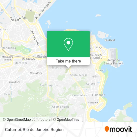
See Catumbi on the map
Public Transportation to Catumbi
Wondering how to get to Catumbi? Moovit helps you find the best way to get to Catumbi with step-by-step directions from the nearest public transit station.
Moovit provides free maps and live directions to help you navigate through your city. View schedules, routes, timetables, and find out how long does it take to get to Catumbi in real time.
Looking for the nearest stop or station to Catumbi? Check out this list of stops closest to your destination: Cemitério São Francisco De Paula; Rua Do Catumbi; Rua Dos Coqueiros (Somente Sentido Santa Bárbara); BRS 1,2,3,4,I: Marquês De Sapucaí; Sambódromo | Marquês De Sapucaí - Linhas Intermunicipais; Largo Das Neves; Rua Pintora Djanira; Rua Progresso; Praça Onze; Parada Praça Odilo Costa Neto.
Bus: 109, 202, 410, 435, 498, 201, 456, 485, 426, 108C, 229, 238, SN 238, 239.Metro: L1, L4.Train: RAMAL SANTA CRUZ, RAMAL SARACURUNA.Ferry: PRAÇA ARARIBÓIA - PRAÇA XV.Cable Car: BONDE (LINHA TURÍSTICA).
Want to see if there’s another route that gets you there at an earlier time? Moovit helps you find alternative routes or times. Get directions from and directions to Catumbi easily from the Moovit App or Website.
We make riding to Catumbi easy, which is why over 1.5 million users, including users in Catumbi, trust Moovit as the best app for public transit. You don’t need to download an individual bus app or train app, Moovit is your all-in-one transit app that helps you find the best bus time or train time available.
For information on prices of bus, train, metro and ferry, costs and ride fares to Catumbi, please check the Moovit app.
Use the app to navigate to popular places including to the airport, hospital, stadium, grocery store, mall, coffee shop, school, college, and university.
Catumbi Address: Catumbi, Rio de Janeiro - RJ, 20251-000, Brasil street in Catumbi
- Botafogo, Cidade Maravilhosa,
- Café e Bar Salete,
- Apoteose,
- Rua de Catumbi 120,
- Cemitério São Francisco de Paula (Catumbi),
- Largo do Catumbi,
- Linha 201 - Rio Comprido / Praça XV,
- Rua Itapiru / Rua do Catumbi,
- Rua do Catumbi, 89,
- Rua dos Coqueiros,
- Rua Chichorro,
- Rua do Chichorro 34,
- Boteco do Catumbi,
- Agência Bradesco,
- Rua Eleone de Almeida Próximo ao 30,
- Rua Padre Miguelinho / Rua Eleone de Almeida,
- Paróquia Nossa Senhora da Salete,
- Viaduto 31 de Março,
- Rua Eleone de Almeida,
- Túnel Santa Bárbara
Places Near Catumbi
- Shopping RioSul, Botafogo,
- Rua Licínio Cardoso, São Francisco Xavier,
- Hospital Federal Cardoso Fontes, Jacarepaguá,
- Shopping Rio Sul, Botafogo,
- Shopping Downtown, Barra Da Tijuca,
- Niterói, Niterói,
- Rua Ulysses Guimarães 16, Cidade Nova,
- Feirão De Malhas, Duque De Caxias,
- Avenida Rio Branco, Centro,
- Praia do Arpoador, Ipanema,
- Shopping Nova América, Del Castilho,
- Avenida Venezuela 134, Saúde,
- Hospital Federal Do Andaraí, Andaraí,
- Rio De Janeiro,
- Hospital Municipal Ronaldo Gazolla, Acari,
- Hospital Pedro Ernesto, Vila Isabel,
- Norte Shopping, Cachambi,
- Rodoviária Novo Rio (Rodoviária do Rio de Janeiro), Santo Cristo,
- Museu Do Amanhã, Centro,
- Feira Livre da Gloria, Glória
How to get to popular places in Rio de Janeiro Region with public transit
Get around Catumbi by public transit!
Traveling around Catumbi has never been so easy. See step by step directions as you travel to any attraction, street or major public transit station. View bus and train schedules, arrival times, service alerts and detailed routes on a map, so you know exactly how to get to anywhere in Catumbi.
When traveling to any destination around Catumbi use Moovit's Live Directions with Get Off Notifications to know exactly where and how far to walk, how long to wait for your line, and how many stops are left. Moovit will alert you when it's time to get off — no need to constantly re-check whether yours is the next stop.
Wondering how to use public transit in Catumbi or how to pay for public transit in Catumbi? Moovit public transit app can help you navigate your way with public transit easily, and at minimum cost. It includes public transit fees, ticket prices, and costs. Looking for a map of Catumbi public transit lines? Moovit public transit app shows all public transit maps in Catumbi with all Bus, Train, Metro, Light Rail, Ferry, Cable Car, Gondola and Funicular routes and stops on an interactive map.
Rio de Janeiro Region has 8 transit type(s), including: Bus, Train, Metro, Light Rail, Ferry, Cable Car, Gondola and Funicular, operated by several transit agencies, including TrensRJ, Metrô Rio, VLT Carioca, Barcas Rio, BRT MOBI-Rio, Auto Viação Alpha, Auto Viação Tijuca, Gire Transportes, Transurb, Viação Nossa Senhora das Graças, Consórcio INTERSUL, Braso Lisboa (Municipal), Caprichosa Auto Ônibus, Auto Viação Três Amigos and Rodoviária Âncora Matias
Public transit lines with stations closest to Catumbi
Metro lines with stations closest to Catumbi
Bus lines with stations closest to Catumbi
Rua Do Catumbi, 67-83
- 109LECD131 - Terminal Gentileza - São Conrado (Via Santa Bárbara / Jardim Botânico)
- 410Saens Peña - Gávea / Puc (Brs 2 - Via Rio Comprido / Lapa)
- 435Grajaú - Gávea (Brs 2 - Via Túnel Santa Bárbara / Túnel Velho)
- 456LECD132 - Norte Shopping - Copacabana (Brs 3 - via Vila Isabel / Estácio / Santa Bárbara)
- 485Fundão - Ipanema (Brs 3 - Via Linha Vermelha)