Directions to Caxias Shopping (Duque De Caxias) with public transportation
The following transit lines have routes that pass near Caxias Shopping
 Bus: 3559B (EXECUTIVO), 415M, 417T, 444L, 470C.
- Train: RAMAL SARACURUNA.
How to get to Caxias Shopping by bus?
Click on the bus route to see step by step directions with maps, line arrival times and updated time schedules.
From Shopping Nova América (Shopping Nova América Del Castilho), Del Castilho
44 minFrom Avenida Coronel Phidias Távora, Pavuna
33 minFrom Pilares, Pilares
61 minFrom Previdencia Social - Ramos, Ramos
45 minFrom Hospital Estadual Getúlio Vargas-PS, Penha
37 minFrom Terminal Brt Fundão, Cidade Universitária (Fundão)
33 minFrom Shopping Nova América, Del Castilho
44 minFrom Avenida Horácio Macedo 2151, Cidade Universitária (Fundão)
40 minFrom Avenida Itaóca 2532, Inhaúma
43 minFrom Avenida Ministro Edgard Romero, Madureira
53 min
How to get to Caxias Shopping by train?
Click on the train route to see step by step directions with maps, line arrival times and updated time schedules.
From Shopping Nova América (Shopping Nova América Del Castilho), Del Castilho
90 minFrom Pilares, Pilares
92 minFrom Previdencia Social - Ramos, Ramos
78 minFrom Hospital Estadual Getúlio Vargas-PS, Penha
62 minFrom Shopping Nova América, Del Castilho
90 minFrom Avenida Ministro Edgard Romero, Madureira
108 min
Bus stops near Caxias Shopping in Duque De Caxias
- Rod. Washington Luíz 2895 - Vila São Luís Duque De Caxias, 2 min walk,VIEW
- Rodovia Washington Luíz (Sentido Rio) | Caxias Shopping - Entrada Principal, 2 min walk,VIEW
- Rodovia Washington Luiz (Sentido Rio) | Rei Do Bacalhau Rp, 4 min walk,VIEW
- Rodovia Washington Luiz (Sentido Rio) | Hospital Moacir Do Carmo, 7 min walk,VIEW
- Estrada São Vicente, 897, 7 min walk,VIEW
- Rodovia Washington Luiz (Sentido Petrópolis) | Gráfica Jornal O Globo, 8 min walk,VIEW
- Rua Cruz Das Almas, 23b, 13 min walk,VIEW
Train station near Caxias Shopping in Duque De Caxias
- Duque De Caxias, 28 min walk,VIEW
Bus lines to Caxias Shopping in Duque De Caxias
- 417T, Xerém - Barra da Tijuca (via Linha Vermelha / Washington Luiz),VIEW
- 2417T, Xerém - Barra da Tijuca (Executivo),VIEW
- 603I, Magé - Nova Iguaçu,VIEW
- PETRÓPOLIS - CAXIAS (PARADOR), Petrópolis - Caxias (Parador),VIEW
- 01, Caxias - Xerém,VIEW
- 02, Caxias - Capivari (Via Figueira / São Lourenço),VIEW
- 11, Caxias - Bom Retiro (Via W. Luiz),VIEW
- MB16, Caxias - Guapimirim (Via Parada Modelo),VIEW
- TZ16, Parque das Missões - Hospital Moacyr do Carmo (Circular),VIEW
- 018, Caxias - Parada Angélica (Via Vila Ema),VIEW
- 20, Bela Vista - Parque das Missões (Via Beira Mar),VIEW
- 022, Centenário - Carrefour (Via 25 de Agosto / Corte 8),VIEW
- 023, Caxias - Nova Campinas,VIEW
- 23M, Caxias - Imbariê (Via Maracanã),VIEW
- 025, Caxias - Parque Independência (Via Maracanã / Jardim Primavera),VIEW
- 025A, Cangulo - Caxias (Via Maracanã / Saracuruna),VIEW
- 026, Caxias ↔ Nova Campinas (Via Maracanã),VIEW
- 26M, Caxias - Morabi (Via Hosp. de Saracuruna),VIEW
- 031, Caxias - Vila Maria Helena (Via Maracanã),VIEW
- 46, Caxias - Ilha,VIEW
What are the closest stations to Caxias Shopping?
The closest stations to Caxias Shopping are:
- Rod. Washington Luíz 2895 - Vila São Luís Duque De Caxias is 76 meters away, 2 min walk.
- Rodovia Washington Luíz (Sentido Rio) | Caxias Shopping - Entrada Principal is 87 meters away, 2 min walk.
- Rodovia Washington Luiz (Sentido Rio) | Rei Do Bacalhau Rp is 229 meters away, 4 min walk.
- Rodovia Washington Luiz (Sentido Rio) | Hospital Moacir Do Carmo is 486 meters away, 7 min walk.
- Estrada São Vicente, 897 is 500 meters away, 7 min walk.
- Rodovia Washington Luiz (Sentido Petrópolis) | Gráfica Jornal O Globo is 536 meters away, 8 min walk.
- Rua Cruz Das Almas, 23b is 916 meters away, 13 min walk.
- Duque De Caxias is 2140 meters away, 28 min walk.
Which bus lines stop near Caxias Shopping?
These bus lines stop near Caxias Shopping: 3559B (EXECUTIVO), 415M, 417T, 444L, 470C, 603I.
Which train line stops near Caxias Shopping?
RAMAL SARACURUNA (Gramacho)
What’s the nearest train station to Caxias Shopping in Duque De Caxias?
The nearest train station to Caxias Shopping in Duque De Caxias is Duque De Caxias. It’s a 28 min walk away.
What’s the nearest bus station to Caxias Shopping in Duque De Caxias?
The nearest bus stations to Caxias Shopping in Duque De Caxias are Rod. Washington Luíz 2895 - Vila São Luís Duque De Caxias and Rodovia Washington Luíz (Sentido Rio) | Caxias Shopping - Entrada Principal. The closest one is a 2 min walk away.
What time is the first train to Caxias Shopping in Duque De Caxias?
The RAMAL SARACURUNA is the first train that goes to Caxias Shopping in Duque De Caxias. It stops nearby at 4:31 AM.
What time is the last train to Caxias Shopping in Duque De Caxias?
The RAMAL SARACURUNA is the last train that goes to Caxias Shopping in Duque De Caxias. It stops nearby at 11:17 PM.
What time is the first bus to Caxias Shopping in Duque De Caxias?
The 416C is the first bus that goes to Caxias Shopping in Duque De Caxias. It stops nearby at 4:05 AM.
What time is the last bus to Caxias Shopping in Duque De Caxias?
The 022 is the last bus that goes to Caxias Shopping in Duque De Caxias. It stops nearby at 2:35 AM.
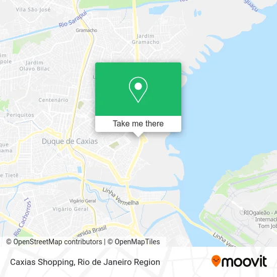
See Caxias Shopping, Duque De Caxias, on the map
Public Transit to Caxias Shopping in Duque De Caxias
Wondering how to get to Caxias Shopping in Duque De Caxias? Moovit helps you find the best way to get to Caxias Shopping with step-by-step directions from the nearest public transit station.
Moovit provides free maps and live directions to help you navigate through your city. View schedules, routes, timetables, and find out how long does it take to get to Caxias Shopping in real time.
Looking for the nearest stop or station to Caxias Shopping? Check out this list of stops closest to your destination: Rod. Washington Luíz 2895 - Vila São Luís Duque De Caxias; Rodovia Washington Luíz (Sentido Rio) | Caxias Shopping - Entrada Principal; Rodovia Washington Luiz (Sentido Rio) | Rei Do Bacalhau Rp; Rodovia Washington Luiz (Sentido Rio) | Hospital Moacir Do Carmo; Estrada São Vicente; Rodovia Washington Luiz (Sentido Petrópolis) | Gráfica Jornal O Globo; Rua Cruz Das Almas; Duque De Caxias.
Bus: 3559B (EXECUTIVO), 415M, 417T, 444L, 470C, 603I, 2417T, PETRÓPOLIS - CAXIAS (PARADOR), 01, 02, 11, MB16, EXECUTIVO, 125C, TZ07, 09, 016, 017, 018, 06, TZ21.Train: RAMAL SARACURUNA.
Want to see if there’s another route that gets you there at an earlier time? Moovit helps you find alternative routes or times. Get directions from and directions to Caxias Shopping easily from the Moovit App or Website.
We make riding to Caxias Shopping easy, which is why over 1.5 million users, including users in Duque De Caxias, trust Moovit as the best app for public transit. You don’t need to download an individual bus app or train app, Moovit is your all-in-one transit app that helps you find the best bus time or train time available.
For information on prices of bus and train, costs and ride fares to Caxias Shopping, please check the Moovit app.
Use the app to navigate to popular places including to the airport, hospital, stadium, grocery store, mall, coffee shop, school, college, and university.
Caxias Shopping Address: Caxias Shopping street in Duque De Caxias
- Terminal Rodoviário do Shopping Center,
- Mundo Verde,
- Aquamar,
- Rodovia Washington Luiz,
- Mega Associação De Benefícios Stand Caxias Shopping,
- Casas Bahia,
- C&A,
- Circo Marcos Frota,
- Secretaria Municipal de Ordem Pública,
- Restaurante Rei do Bacalhau,
- Caxias Shopping (Caxias Shopping Cinema),
- Renner (Lojas Renner - Caxias Shopping),
- Vezzo Móveis,
- McDonald's,
- Via Varejo S/A.,
- Auto Posto Estrela de Caxias,
- Viaduto Irineu Marinho Próximo ao 1025,
- Viaduto Irineu Marinho,
- Rua Almirante Grenfall,
- O Globo - Extra Jornal
Places Near Caxias Shopping (Duque De Caxias)
- Rua Ulysses Guimarães 16, Cidade Nova,
- Praia do Arpoador, Ipanema,
- Avenida Rio Branco, Centro,
- Shopping RioSul, Botafogo,
- Feira Livre da Gloria, Glória,
- Shopping Nova América, Del Castilho,
- Rua Licínio Cardoso, São Francisco Xavier,
- Feirão De Malhas, Duque De Caxias,
- Hospital Municipal Ronaldo Gazolla, Acari,
- Rio De Janeiro,
- Niterói, Niterói,
- Hospital Federal Cardoso Fontes, Jacarepaguá,
- Shopping Downtown, Barra Da Tijuca,
- Rodoviária Novo Rio (Rodoviária do Rio de Janeiro), Santo Cristo,
- Hospital Pedro Ernesto, Vila Isabel,
- Avenida Venezuela 134, Saúde,
- Shopping Rio Sul, Botafogo,
- Museu Do Amanhã, Centro,
- Norte Shopping, Cachambi,
- Hospital Federal Do Andaraí, Andaraí
How to get to popular places in Rio de Janeiro Region with public transit
Get around Duque De Caxias by public transit!
Traveling around Duque De Caxias has never been so easy. See step by step directions as you travel to any attraction, street or major public transit station. View bus and train schedules, arrival times, service alerts and detailed routes on a map, so you know exactly how to get to anywhere in Duque De Caxias.
When traveling to any destination around Duque De Caxias use Moovit's Live Directions with Get Off Notifications to know exactly where and how far to walk, how long to wait for your line, and how many stops are left. Moovit will alert you when it's time to get off — no need to constantly re-check whether yours is the next stop.
Wondering how to use public transit in Duque De Caxias or how to pay for public transit in Duque De Caxias? Moovit public transit app can help you navigate your way with public transit easily, and at minimum cost. It includes public transit fees, ticket prices, and costs. Looking for a map of Duque De Caxias public transit lines? Moovit public transit app shows all public transit maps in Duque De Caxias with all Bus, Train, Metro, Light Rail, Ferry, Cable Car, Gondola and Funicular routes and stops on an interactive map.
Rio de Janeiro Region has 8 transit type(s), including: Bus, Train, Metro, Light Rail, Ferry, Cable Car, Gondola and Funicular, operated by several transit agencies, including TrensRJ, Metrô Rio, VLT Carioca, Barcas Rio, BRT MOBI-Rio, Auto Viação Alpha, Auto Viação Tijuca, Gire Transportes, Transurb, Viação Nossa Senhora das Graças, Consórcio INTERSUL, Braso Lisboa (Municipal), Caprichosa Auto Ônibus, Auto Viação Três Amigos and Rodoviária Âncora Matias