How to get to Cdf 2017 by bus?
Click on the bus route to see step by step directions with maps, line arrival times and updated time schedules.
From Rue Saint-Jacques, Paris
41 minFrom Passerelle de l'Avre, Saint-Cloud
43 minFrom Clinique de Bercy, Charenton-Le-Pont
72 minFrom 16 b Rue Floréal, Bagnolet
68 minFrom Foire du Trône, Paris
73 minFrom Clinique de l'estrée, Stains
75 minFrom Paris Plage, Paris
39 minFrom Hôpital de Garches, Arrondissement de Nanterre
57 minFrom Hôpital René Huguenin - Institut Curie, Arrondissement de Nanterre
52 minFrom Cirque Pinder, Paris
72 min
How to get to Cdf 2017 by metro?
Click on the metro route to see step by step directions with maps, line arrival times and updated time schedules.
From Rue Saint-Jacques, Paris
46 minFrom Passerelle de l'Avre, Saint-Cloud
65 minFrom Clinique de Bercy, Charenton-Le-Pont
57 minFrom 16 b Rue Floréal, Bagnolet
55 minFrom Foire du Trône, Paris
53 minFrom Clinique de l'estrée, Stains
61 minFrom Paris Plage, Paris
29 minFrom Hôpital René Huguenin - Institut Curie, Arrondissement de Nanterre
57 minFrom Cirque Pinder, Paris
52 min
Metro stations near Cdf 2017 in Paris
Bus stops near Cdf 2017 in Paris
Light Rail stations near Cdf 2017 in Paris
- Thérèse Pierre, 6 min walk,VIEW
Bus lines to Cdf 2017 in Paris
- 43, Bagatelle,VIEW
- 92, Porte de Champerret,VIEW
- 341, Charles de Gaulle - Étoile,VIEW
- 82, Hôpital Américain,VIEW
- 274, Gare de Saint-Denis RER,VIEW
- 73, Charlebourg,VIEW
- N11, Pont de Neuilly - Métro,VIEW
- N24, Porte Maillot - Grande Armée,VIEW
- N153, Saint-Germain-En-Laye RER,VIEW
- N151, Gare de Mantes-La-Jolie - Quai 13,VIEW
What are the closest stations to Cdf 2017?
The closest stations to Cdf 2017 are:
- Ternes is 134 meters away, 2 min walk.
- Eglise Saint-Ferdinand is 180 meters away, 3 min walk.
- Thérèse Pierre is 443 meters away, 6 min walk.
- Ternes - Mac Mahon is 447 meters away, 6 min walk.
- Porte Des Ternes - Anny Flore is 546 meters away, 8 min walk.
- Argentine is 686 meters away, 10 min walk.
- Porte Maillot - Grande Armée is 697 meters away, 10 min walk.
- Porte de Champerret is 758 meters away, 10 min walk.
Which RER lines stop near Cdf 2017?
These RER lines stop near Cdf 2017: A, E.
Which metro lines stop near Cdf 2017?
These metro lines stop near Cdf 2017: 1, 2.
Which bus lines stop near Cdf 2017?
These bus lines stop near Cdf 2017: 244, 274, 43, 52, 73, 82.
What’s the nearest light rail station to Cdf 2017 in Paris?
The nearest light rail station to Cdf 2017 in Paris is Thérèse Pierre. It’s a 6 min walk away.
What’s the nearest metro station to Cdf 2017 in Paris?
The nearest metro station to Cdf 2017 in Paris is Ternes. It’s a 2 min walk away.
What’s the nearest bus station to Cdf 2017 in Paris?
The nearest bus station to Cdf 2017 in Paris is Eglise Saint-Ferdinand. It’s a 3 min walk away.
What time is the first light rail to Cdf 2017 in Paris?
The T3B is the first light rail that goes to Cdf 2017 in Paris. It stops nearby at 6:13 AM.
What time is the last light rail to Cdf 2017 in Paris?
The T3B is the last light rail that goes to Cdf 2017 in Paris. It stops nearby at 1:05 AM.
What time is the first metro to Cdf 2017 in Paris?
The 3 is the first metro that goes to Cdf 2017 in Paris. It stops nearby at 5:30 AM.
What time is the last metro to Cdf 2017 in Paris?
The 3 is the last metro that goes to Cdf 2017 in Paris. It stops nearby at 1:11 AM.
What time is the first bus to Cdf 2017 in Paris?
The N24 is the first bus that goes to Cdf 2017 in Paris. It stops nearby at 3:05 AM.
What time is the last bus to Cdf 2017 in Paris?
The N11 is the last bus that goes to Cdf 2017 in Paris. It stops nearby at 3:38 AM.
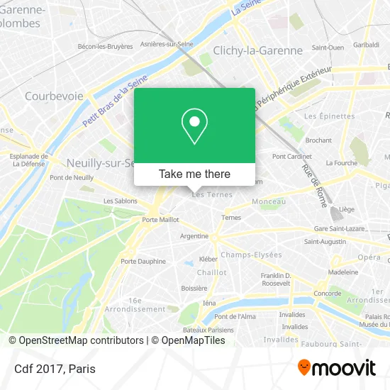
See Cdf 2017, Paris, on the map
Public Transit to Cdf 2017 in Paris
Wondering how to get to Cdf 2017 in Paris? Moovit helps you find the best way to get to Cdf 2017 with step-by-step directions from the nearest public transit station.
Moovit provides free maps and live directions to help you navigate through your city. View schedules, routes, timetables, and find out how long does it take to get to Cdf 2017 in real time.
Looking for the nearest stop or station to Cdf 2017? Check out this list of stops closest to your destination: Ternes; Eglise Saint-Ferdinand; Thérèse Pierre; Ternes - Mac Mahon; Porte Des Ternes - Anny Flore; Argentine; Porte Maillot - Grande Armée; Porte de Champerret.
RER: A, E.Metro: 1, 2, 3.Bus: 244, 274, 43, 52, 73, 82, 92, 341.
Want to see if there’s another route that gets you there at an earlier time? Moovit helps you find alternative routes or times. Get directions from and directions to Cdf 2017 easily from the Moovit App or Website.
We make riding to Cdf 2017 easy, which is why over 1.5 million users, including users in Paris, trust Moovit as the best app for public transit. You don’t need to download an individual bus app or train app, Moovit is your all-in-one transit app that helps you find the best bus time or train time available.
For information on prices of metro, bus, RER, train and light rail, costs and ride fares to Cdf 2017, please check the Moovit app.
Use the app to navigate to popular places including to the airport, hospital, stadium, grocery store, mall, coffee shop, school, college, and university.
Cdf 2017 Address: 20 Rue Guersant 75017 Paris street in Paris
- Cube,
- 20 Rue Guersant,
- Péreire,
- New al-Henceford Cuirs,
- 221 Boulevard Pereire,
- Comet,
- 8-10 Rue Torricelli,
- 188 Bis Boulevard Pereire,
- Jb Rodde,
- 19 Rue Lebon,
- 28 Passage Com E17,
- 28 Ter Rue Guersant,
- Blitz Motorcycles,
- Môm,
- 10 Rue des Ternes,
- 4-6 Rue Pierre Demours,
- Au Petit Marguery Rive Droite,
- 71-73 Avenue des Ternes,
- Marché des Ternes,
- Église Protestante Évangélique des Ternes
Places Near Cdf 2017 (Paris)
- Hôpital de la Pitié-Salpêtrière, Paris,
- Hôpital Henri Mondor, Creteil,
- Hopital Foch, Suresnes,
- Fondation Louis Vuitton, Paris,
- Créteil Soleil, Creteil,
- Gare Routière Flixbus, Paris,
- Hôpital Saint-Joseph, Paris,
- Institut Curie, Paris,
- Théâtre Mogador, Paris,
- 29 Rue Manin, Paris,
- Marché Saint-Pierre, Paris,
- Hôpital Necker, Paris,
- Hôpital Cochin, Paris,
- Hôpital Pitié Salpêtrière, Paris,
- Hôpital Beaujon, Clichy,
- Galeries Lafayette, Paris,
- Centre Hospitalier des 15/20, Paris,
- Galeries Lafayette Haussmann, Paris,
- Hopital Lariboisière, Paris,
- Atelier Des Lumieres, Paris
How to get to popular places in Paris with public transit
Get around Paris by public transit!
Traveling around Paris has never been so easy. See step by step directions as you travel to any attraction, street or major public transit station. View bus and train schedules, arrival times, service alerts and detailed routes on a map, so you know exactly how to get to anywhere in Paris.
When traveling to any destination around Paris use Moovit's Live Directions with Get Off Notifications to know exactly where and how far to walk, how long to wait for your line, and how many stops are left. Moovit will alert you when it's time to get off — no need to constantly re-check whether yours is the next stop.
Wondering how to use public transit in Paris or how to pay for public transit in Paris? Moovit public transit app can help you navigate your way with public transit easily, and at minimum cost. It includes public transit fees, ticket prices, and costs. Looking for a map of Paris public transit lines? Moovit public transit app shows all public transit maps in Paris with all Bus, Train, Metro, Light Rail, RER, Funicular and Gondola routes and stops on an interactive map.
Paris has 7 transit type(s), including: Bus, Train, Metro, Light Rail, RER, Funicular and Gondola, operated by several transit agencies, including RATP, RER, RER Bus de remplacement, Train, Train Bus de remplacement, Tramway Bus de remplacement, TER, ADP, Magical Shuttle, Argenteuil - Boucles de Seine, Autocars Dominique, Bièvre, Brie et 2 Morin, Le Bus - C.C. du Clermontois and Cœur d’Essonne