How to get to Cecinas Fanda by bus?
Click on the bus route to see step by step directions with maps, line arrival times and updated time schedules.
From Vistas de Curamavida, Los Ángeles
37 minFrom Peaje María Dolores, Los Ángeles
54 minFrom Peaje Lateral Rarinco, Los Ángeles
64 minFrom Cementerio Parque Santa María, Los Ángeles
43 minFrom Subestación El Avellano Transnet, Los Ángeles
31 minFrom Peaje Rarinco, Los Ángeles
59 minFrom Edificio Forestal Mininco, Los Ángeles
56 minFrom Cmpc, Los Ángeles
56 minFrom Club de Campo San Andres, Los Ángeles
42 minFrom Edificio Corporativo Cmpc, Los Ángeles
57 min
Bus stops near Cecinas Fanda in Los Ángeles
Bus lines to Cecinas Fanda in Los Ángeles
- C9V-R, Santiago Bueras,VIEW
- C9V2-R, Las Trancas,VIEW
- 1-R, El Esfuerzo,VIEW
- C8V-I, El Avellano,VIEW
- 6-I, Villa Génesis - Socavio,VIEW
- 10-I, Laguna del Laja - Villa Sur,VIEW
- 2-R, Av. Las Industrias - Pailluhue,VIEW
- 7-R, Villa Lomas de Sta María - Villa Sur,VIEW
- 8-R, Villa Lomas de Sta María - Socavio,VIEW
- C22-I, Las Trancas - Paillihue,VIEW
- C15-R, El Avellano - Paillihue,VIEW
- C25-R, El Avellano - Paillihue,VIEW
- C26-R, El avellano ´Paillihue,VIEW
- C27-R, Villa Lomas de Santa María - Paillihue,VIEW
- C28-R, Villa Lomas de Sta María - Paillihue,VIEW
- C22V-I, Las Trancas - Lauquen,VIEW
- C22V2-I, Las Trancas - Lauquen,VIEW
- C15V-R, El Avellano - Paillihue,VIEW
- C25V-R, El Avellano - Paillihue,VIEW
- C26V-R, El Avellano - Paillihue,VIEW
What are the closest stations to Cecinas Fanda?
The closest stations to Cecinas Fanda are:
- Bernardo O Higgins / Ferrocarril is 220 meters away, 4 min walk.
- Vicuna Mackenna / Lord Cochrane is 240 meters away, 4 min walk.
- Los Carrera / Edmundo Arellano is 479 meters away, 7 min walk.
- Los Carrera / Maria Auxiliadora is 511 meters away, 7 min walk.
- Manuel Rodriguez / Las Quintas is 592 meters away, 8 min walk.
- Freire / Eleuterio Ramirez is 886 meters away, 12 min walk.
Which bus lines stop near Cecinas Fanda?
These bus lines stop near Cecinas Fanda: 2-R, 6-I, 8V-R, C15V2-R.
What’s the nearest bus station to Cecinas Fanda in Los Ángeles?
The nearest bus stations to Cecinas Fanda in Los Ángeles are Bernardo O Higgins / Ferrocarril and Vicuna Mackenna / Lord Cochrane. The closest one is a 4 min walk away.
What time is the first bus to Cecinas Fanda in Los Ángeles?
The 4-R is the first bus that goes to Cecinas Fanda in Los Ángeles. It stops nearby at 7:18 AM.
What time is the last bus to Cecinas Fanda in Los Ángeles?
The 4-I is the last bus that goes to Cecinas Fanda in Los Ángeles. It stops nearby at 8:42 PM.
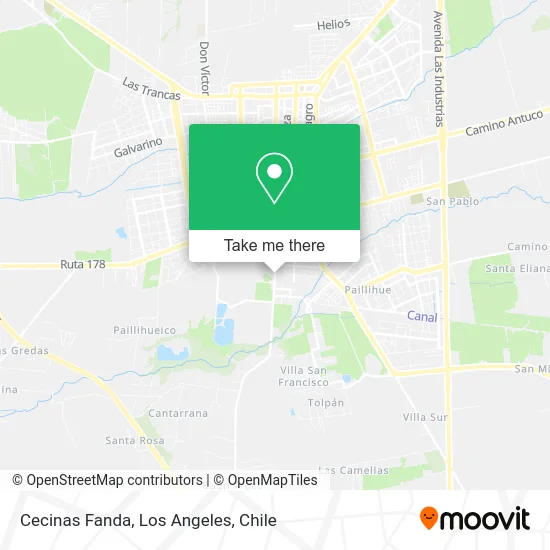
See Cecinas Fanda, Los Ángeles, on the map
Public Transit to Cecinas Fanda in Los Ángeles
Wondering how to get to Cecinas Fanda in Los Ángeles? Moovit helps you find the best way to get to Cecinas Fanda with step-by-step directions from the nearest public transit station.
Moovit provides free maps and live directions to help you navigate through your city. View schedules, routes, timetables, and find out how long does it take to get to Cecinas Fanda in real time.
Looking for the nearest stop or station to Cecinas Fanda? Check out this list of stops closest to your destination: Bernardo O Higgins / Ferrocarril; Vicuna Mackenna / Lord Cochrane; Los Carrera / Edmundo Arellano; Los Carrera / Maria Auxiliadora; Manuel Rodriguez / Las Quintas; Freire / Eleuterio Ramirez.
Bus: 2-R, 6-I, 8V-R, C15V2-R, C9V-R, C9V2-R, 1-R, C8V-I, 10-I, 7-R, 8-R, 2-I, 7-I, 8-I, 6-R, 10-R, 4-R, C13-I, C9-R, 4-I, C9-I, C13-R, C9V2-I.
Want to see if there’s another route that gets you there at an earlier time? Moovit helps you find alternative routes or times. Get directions from and directions to Cecinas Fanda easily from the Moovit App or Website.
We make riding to Cecinas Fanda easy, which is why over 1.7 million users, including users in Los Ángeles, trust Moovit as the best app for public transit. You don’t need to download an individual bus app or train app, Moovit is your all-in-one transit app that helps you find the best bus time or train time available.
For information on prices of bus, costs and ride fares to Cecinas Fanda, please check the Moovit app.
Use the app to navigate to popular places including to the airport, hospital, stadium, grocery store, mall, coffee shop, school, college, and university.
Cecinas Fanda Address: Cecinas Fanda, Calle Ferrocarril 1001, 4440000 Los Ángeles, Bíobío street in Los Ángeles
- Ferreteria y Aridos las Quintas,
- Escuela F-900 República De Alemania,
- Villa Todos Los Santos,
- Aserraderos-Agroforestal Nahuelbuta,
- Supermercado UNICO Los Ángeles,
- Apicultura Eduardo Antonio Pacheco Fuentes,
- Colegio Beato Damián de Molokai,
- Tribunal De Juicio Oral En Lo Penal De Los Angeles,
- Villa Las Quintas,
- Avenida Vicuña Mackenna,
- Colegio Santo Tomas,
- Maderas Sur - Ferreteria Sur,
- Nestlé Ex Chiprodal,
- Juzgado De Familia,
- Aserraderos-Aserraderos Cerro Colorado S.A.,
- Parque Central Avenida Vicuña Mackenna,
- Easy,
- Kenos Alimentos para Mascotas,
- La Carcel Full Drink,
- Fábrica Nestlé
Places Near Cecinas Fanda (Los Ángeles)
- 2° Juzgado de Policia Local, Los Angeles., Los Ángeles,
- Jardines de Rucalhue, Los Ángeles,
- Avenida Las industrias - Los Ángeles, Los Ángeles,
- Villa Mininco, Los Ángeles,
- Parque Lauquen Pje 7 Oriente Los Angeles Chile, Los Ángeles,
- Villa Las Tranqueras, Los Ángeles,
- Villa Parque Lauquen, Los Ángeles,
- Terminal Rural Vega Techada, Los Ángeles,
- Villa Lomas De Santa María, Los Ángeles,
- Villa Galilea, Los Ángeles,
- Clínica Los Andes, Los Ángeles,
- camino cerro colorado, Los Ángeles,
- Terminal Rodoviario Sta. María de Los Ángeles, Los Ángeles,
- Villa Parque Historiadores, Los Ángeles,
- Antuco, Los Ángeles,
- Ruta Q-61-R (Los Ángeles - Santa Bárbara / Ralco), Los Ángeles,
- Los Ángeles Chile, Los Ángeles,
- Villa España, Los Ángeles,
- Villa Jardines De La Republica (Av. Gabriela Mistral), Los Ángeles,
- Villa los Alcaldes, Los Ángeles
How to get to popular places in Los Angeles, Chile with public transit
Get around Los Ángeles by public transit!
Traveling around Los Ángeles has never been so easy. See step by step directions as you travel to any attraction, street or major public transit station. View bus and train schedules, arrival times, service alerts and detailed routes on a map, so you know exactly how to get to anywhere in Los Ángeles.
When traveling to any destination around Los Ángeles use Moovit's Live Directions with Get Off Notifications to know exactly where and how far to walk, how long to wait for your line, and how many stops are left. Moovit will alert you when it's time to get off — no need to constantly re-check whether yours is the next stop.
Wondering how to use public transit in Los Ángeles or how to pay for public transit in Los Ángeles? Moovit public transit app can help you navigate your way with public transit easily, and at minimum cost. It includes public transit fees, ticket prices, and costs. Looking for a map of Los Ángeles public transit lines? Moovit public transit app shows all public transit maps in Los Ángeles with all bus routes and stops on an interactive map.
Los Angeles, Chile has 1 transit type(s), including: bus, operated by several transit agencies, including Paillihue, Chiprodal Bolson, Iansa Avellano, Orompello Montecea, Transportes de pasajeros S.A., El esfuerzo, Paillihue Bolson, Ciudades de Chile, Las Americas, Linea Azul, Paillihue Avellano, Expreso Araucano, Sotracoli, San Sebastian and Duqueco