Directions to Cecsamex (San Gregorio Atzompa) with public transportation
The following transit lines have routes that pass near Cecsamex
How to get to Cecsamex by bus?
Click on the bus route to see step by step directions with maps, line arrival times and updated time schedules.
From Instituto Tecnológico De Puebla, Puebla
49 minFrom Barrio de Analco, San Andrés Cholula
35 minFrom Infonavit La Rosa, Puebla
45 minFrom Mexico 68, Puebla
49 minFrom Ciudad Universitaria, Puebla
43 minFrom Lomas Del Valle, Puebla
57 minFrom San Francisco Totimehuacán, Puebla
76 minFrom Tianguis La Cienega, Puebla
42 minFrom San Gregorio Zacapechpan, Nealtican
71 minFrom La Gran Bodega, Puebla
51 min
Bus stops near Cecsamex in San Gregorio Atzompa
Bus lines to Cecsamex in San Gregorio Atzompa
- RUTA PUEBLA, Ramal Puebla - Izucar De Matamoros,VIEW
- LÍNEA 1, Chachapa - Tlaxcalancingo,VIEW
- TLAXCALANCINGO - CENTRO (8 PONIENTE), Tlaxcalcingo - Centro,VIEW
- RUTA MALACATEPEC, Ramal Malacatepec - Puebla (Circuito),VIEW
- A2 - A, Centro - T. Tlaxcalancingo - Santa Clara Ocoyucan,VIEW
- A3 - A, Tonanzintla,VIEW
- RUTA AZTECA C, Ramal 1, San Esteban - Villa De Los Ángeles,VIEW
- RUTA 29, Ramal 2 El Molinito - Coronel Miguel Auza,VIEW
- RUTA SAN ANDRÉS CHOLULA, Ramal 4, Santiago Xicotenco,VIEW
- RUTA SUBURBANA PIRÁMIDES, Ramal 2, Barrio De San Miguel - Ciudad Judicial,VIEW
- RUTA PORTES GIL, Ruta Portes Gil - Ocoyucan - Puebla (Circuito),VIEW
What are the closest stations to Cecsamex?
The closest stations to Cecsamex are:
- Casa De Ángeles is 120 meters away, 2 min walk.
- General E. Zapata, 26 is 237 meters away, 4 min walk.
- General E. Zapata, 12 is 301 meters away, 4 min walk.
- Avenida Las Torres, 231 is 323 meters away, 5 min walk.
- José María Pino Suárez, 601 is 500 meters away, 7 min walk.
- Carretera Federal A Atlixco, 21 is 837 meters away, 11 min walk.
Which bus lines stop near Cecsamex?
These bus lines stop near Cecsamex: A2 - A, LÍNEA 1, RUTA 29, RUTA PUEBLA, TLAXCALANCINGO - CENTRO (8 PONIENTE).
What’s the nearest bus station to Cecsamex in San Gregorio Atzompa?
The nearest bus station to Cecsamex in San Gregorio Atzompa is Casa De Ángeles. It’s a 2 min walk away.
What time is the first bus to Cecsamex in San Gregorio Atzompa?
The LÍNEA 1 is the first bus that goes to Cecsamex in San Gregorio Atzompa. It stops nearby at 5:02 AM.
What time is the last bus to Cecsamex in San Gregorio Atzompa?
The RUTA PUEBLA is the last bus that goes to Cecsamex in San Gregorio Atzompa. It stops nearby at 1:37 AM.
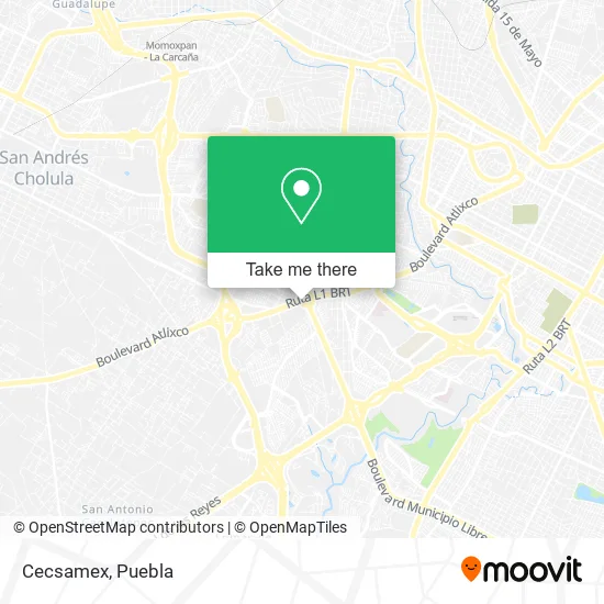
See Cecsamex, San Gregorio Atzompa, on the map
Public Transit to Cecsamex in San Gregorio Atzompa
Wondering how to get to Cecsamex in San Gregorio Atzompa? Moovit helps you find the best way to get to Cecsamex with step-by-step directions from the nearest public transit station.
Moovit provides free maps and live directions to help you navigate through your city. View schedules, routes, timetables, and find out how long does it take to get to Cecsamex in real time.
Looking for the nearest stop or station to Cecsamex? Check out this list of stops closest to your destination: Casa De Ángeles; General E. Zapata; General E. Zapata; Avenida Las Torres; José María Pino Suárez; Carretera Federal A Atlixco.
Bus: A2 - A, LÍNEA 1, RUTA 29, RUTA PUEBLA, TLAXCALANCINGO - CENTRO (8 PONIENTE), RUTA MALACATEPEC, A3 - A, RUTA AZTECA C, RUTA SAN ANDRÉS CHOLULA, RUTA SUBURBANA PIRÁMIDES, RUTA PORTES GIL.
Want to see if there’s another route that gets you there at an earlier time? Moovit helps you find alternative routes or times. Get directions from and directions to Cecsamex easily from the Moovit App or Website.
We make riding to Cecsamex easy, which is why over 1.5 million users, including users in San Gregorio Atzompa, trust Moovit as the best app for public transit. You don’t need to download an individual bus app or train app, Moovit is your all-in-one transit app that helps you find the best bus time or train time available.
For information on prices of bus, costs and ride fares to Cecsamex, please check the Moovit app.
Use the app to navigate to popular places including to the airport, hospital, stadium, grocery store, mall, coffee shop, school, college, and university.
Cecsamex Address: Cecsamex, Carretera Federal Puebla-Atlixco, Emiliano Zapata, 72824 San Andrés Cholula, Puebla street in San Gregorio Atzompa
- Casa de Justicia para Adolescentes,
- Centro Recreativo y Deportivo "Zapata",
- La Casa del Adolescente DIF Estatal Puebla,
- Casa de la niñez poblana,
- Carretera Federal Puebla - Atlixco,
- RUTA: Casa de Ángeles,
- Centro de Rehabilitación Integral Infantil,
- Ferretería Andrea,
- Santa Teresa,
- CIEPA,
- Albergue Psiquiatrico Infantil,
- Farmasana Super,
- Gas Uribe de Puebla SA de CV, carburación 2,
- Pescaderia Costa Esmeralda,
- Invernadero Via Atlixcayotlotl,
- Ciudad judicial cholula Puebla,
- Maxima Distribucion Sm,
- Wasabi Sushi,
- PEMEX,
- WESTERN UNION
Places Near Cecsamex (San Gregorio Atzompa)
- 25 Zona Militar, Puebla,
- Complejo Cultural Universitario, Ocoyucan,
- Parque Puebla, Puebla,
- Zona de los Fuertes, Puebla,
- Centro de Desarrollo Comunitario Tres Cruces, Puebla,
- Hospital Traumatología y Ortopedia de Puebla, San Pedro Cholula,
- Secretaria de Finanzas, Puebla,
- Hospital General Regional 36 IMSS San Alejandro, San Andrés Cholula,
- Plaza Las Animas, Puebla,
- SAT, San Andrés Cholula,
- Parque Ecologico, Pue., San Andrés Cholula,
- Tres Cruces, Puebla,
- Hospital Imss La Margarita, Puebla,
- Galerías Serdán, San Pedro Cholula,
- Estadio Cuauhtémoc, Puebla,
- Plaza Dorada Centro Comercial, Puebla,
- Ciudad Universitaria, Puebla,
- Centro Comercial Angelópolis, San Andrés Cholula,
- Centro Integral de Servicios CIS, San Andrés Cholula,
- Ciudad Judicial del Estado de Puebla, San Andrés Cholula
How to get to popular places in Puebla with public transit
Get around San Gregorio Atzompa by public transit!
Traveling around San Gregorio Atzompa has never been so easy. See step by step directions as you travel to any attraction, street or major public transit station. View bus and train schedules, arrival times, service alerts and detailed routes on a map, so you know exactly how to get to anywhere in San Gregorio Atzompa.
When traveling to any destination around San Gregorio Atzompa use Moovit's Live Directions with Get Off Notifications to know exactly where and how far to walk, how long to wait for your line, and how many stops are left. Moovit will alert you when it's time to get off — no need to constantly re-check whether yours is the next stop.
Wondering how to use public transit in San Gregorio Atzompa or how to pay for public transit in San Gregorio Atzompa? Moovit public transit app can help you navigate your way with public transit easily, and at minimum cost. It includes public transit fees, ticket prices, and costs. Looking for a map of San Gregorio Atzompa public transit lines? Moovit public transit app shows all public transit maps in San Gregorio Atzompa with all bus routes and stops on an interactive map.
Puebla has 1 transit type(s), including: bus, operated by several transit agencies, including RUTA, RUTA Alimentadoras, Rutas Convencionales and Líneas temporales