How to get to Cedva by bus?
Click on the bus route to see step by step directions with maps, line arrival times and updated time schedules.
From Fracc. Soberana Convencion, Aguascalientes
36 minFrom Cortijo San Marcos, Aguascalientes
51 minFrom Agropecuario Viñedos San Marcos, Aguascalientes
41 minFrom Sam's Club, Aguascalientes
26 minFrom Plaza Del Mueble, Aguascalientes
44 minFrom Universidad Metropolitana De Aguascalientes, Aguascalientes
48 minFrom Fracc Rinconada Jesús María, Aguascalientes
69 minFrom Hacienda San Martín, Aguascalientes
45 minFrom Universidad Santa Fe Aguascalientes, Aguascalientes
40 minFrom Terminal 50, Aguascalientes
43 min
Bus stops near Cedva in Aguascalientes
- Calle Cristobal Colon, 402, 2 min walk,VIEW
- Dr. Jesus Diaz De Leon, 337, 2 min walk,VIEW
- Juan De Montoro, 207a, 3 min walk,VIEW
- Licenciado Adolfo López Mateos Oriente, 412a, 4 min walk,VIEW
- Licenciado Adolfo López Mateos Oriente, 701b, 4 min walk,VIEW
- Dr. Jesus Diaz De Leon, 111, 4 min walk,VIEW
- Zaragoza Pagina 24, 8 min walk,VIEW
Bus lines to Cedva in Aguascalientes
- RUTA 39, Centro (Jardínde Zaragoza),VIEW
- RUTA 01, Vicente Guerrero - Margaritas,VIEW
- RUTA 03, La Ribera - UAA Sur,VIEW
- RUTA 04, Jesús María - Mahatma Gandhi,VIEW
- RUTA 05, Vicente Guerrero - La Ribera,VIEW
- RUTA 06, Jesús María - Mahatma Gandhi,VIEW
- RUTA 07, Villas Las Palmas - Centro (Jardínde Zaragoza),VIEW
- RUTA 09, Cumbres III - Mahatma Gandhi,VIEW
- RUTA 09, Mahatma Gandhi - Los Laureles,VIEW
- RUTA 11, Mahatma Gandhi - Chichimeco,VIEW
- RUTA 34, Villa Montaña - UPA,VIEW
- RUTA 37, UTMA - Hacienda San Marcos,VIEW
- RUTA 38, Vicente Guerrero - Paso Blanco,VIEW
- RUTA 43, UTMA - Lomas de New York - San Antonio,VIEW
- RUTA 43, San Antonio - UTMA,VIEW
- RUTA 46, Vicente Guerrero - Calvillito,VIEW
- RUTA 29, Centro (Jardínde Zaragoza),VIEW
- RUTA 48, Centro (Panteón De La Cruz),VIEW
- RUTA 23, Villa Montaña,VIEW
- RUTA 24, Vistas De Oriente - Los Negritos,VIEW
What are the closest stations to Cedva?
The closest stations to Cedva are:
- Calle Cristobal Colon, 402 is 87 meters away, 2 min walk.
- Dr. Jesus Diaz De Leon, 337 is 137 meters away, 2 min walk.
- Juan De Montoro, 207a is 213 meters away, 3 min walk.
- Licenciado Adolfo López Mateos Oriente, 412a is 226 meters away, 4 min walk.
- Licenciado Adolfo López Mateos Oriente, 701b is 233 meters away, 4 min walk.
- Dr. Jesus Diaz De Leon, 111 is 261 meters away, 4 min walk.
- Zaragoza Pagina 24 is 553 meters away, 8 min walk.
Which bus lines stop near Cedva?
These bus lines stop near Cedva: RUTA 01, RUTA 04, RUTA 11, RUTA 23, RUTA 24, RUTA 38, RUTA 41.
What’s the nearest bus station to Cedva in Aguascalientes?
The nearest bus stations to Cedva in Aguascalientes are Calle Cristobal Colon, 402 and Dr. Jesus Diaz De Leon, 337. The closest one is a 2 min walk away.
What time is the first bus to Cedva in Aguascalientes?
The RUTA 41 is the first bus that goes to Cedva in Aguascalientes. It stops nearby at 5:52 AM.
What time is the last bus to Cedva in Aguascalientes?
The RUTA 07 is the last bus that goes to Cedva in Aguascalientes. It stops nearby at 10:48 PM.
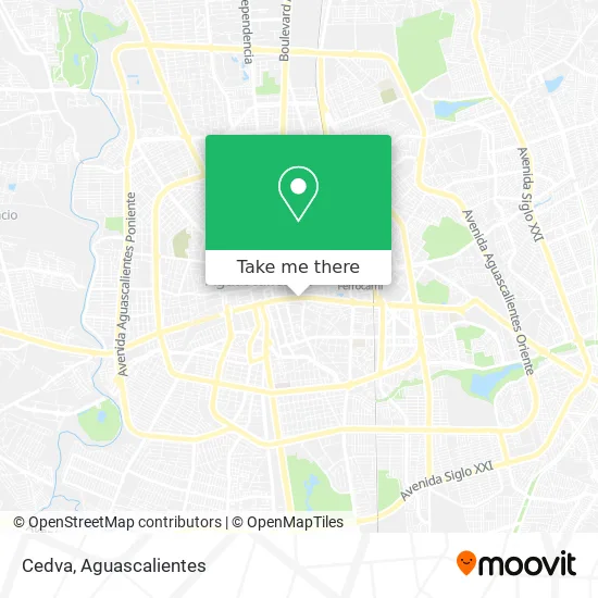
See Cedva, Aguascalientes, on the map
Public Transit to Cedva in Aguascalientes
Wondering how to get to Cedva in Aguascalientes? Moovit helps you find the best way to get to Cedva with step-by-step directions from the nearest public transit station.
Moovit provides free maps and live directions to help you navigate through your city. View schedules, routes, timetables, and find out how long does it take to get to Cedva in real time.
Looking for the nearest stop or station to Cedva? Check out this list of stops closest to your destination: Calle Cristobal Colon; Dr. Jesus Diaz De Leon; Juan De Montoro; Licenciado Adolfo López Mateos Oriente; Licenciado Adolfo López Mateos Oriente; Dr. Jesus Diaz De Leon; Zaragoza Pagina 24.
Bus: RUTA 01, RUTA 04, RUTA 11, RUTA 23, RUTA 24, RUTA 38, RUTA 41, RUTA 39, RUTA 03, RUTA 05, RUTA 06, RUTA 29, RUTA 48, RUTA 25, RUTA 12, RUTA 10.
Want to see if there’s another route that gets you there at an earlier time? Moovit helps you find alternative routes or times. Get directions from and directions to Cedva easily from the Moovit App or Website.
We make riding to Cedva easy, which is why over 1.5 million users, including users in Aguascalientes, trust Moovit as the best app for public transit. You don’t need to download an individual bus app or train app, Moovit is your all-in-one transit app that helps you find the best bus time or train time available.
For information on prices of bus, costs and ride fares to Cedva, please check the Moovit app.
Use the app to navigate to popular places including to the airport, hospital, stadium, grocery store, mall, coffee shop, school, college, and university.
Location: Aguascalientes
- Refacciones y Acc. Remo Motos,
- conalep oficinas,
- universidad las americas,
- CEDIS Rednatura,
- PRODUCTOS METALICOS MYGSA,
- Calle Josefa Ortiz De Dominguez,
- Banco Santander (México), S.A., institución de Banca Múltiple, grupo Financiero Santander México,
- Campos,
- Notaria Pública 36,
- 16 de Septiembre 222-A,
- Servicio Tecnico De Refrigeracion,
- Hornedo,
- El llanito,
- Col. El Llanito,
- Star Electronica,
- Hotel Real Plaza,
- Paola Guel Peinado y Maquillaje,
- Fonacot,
- Tapiceria Tapicar,
- Calle General Ignacio Zaragoza
Places Near Cedva (Aguascalientes)
- Hospital Imss No. 3, Aguascalientes,
- Terminal De Combis, Aguascalientes,
- La Isla San Marcos, Aguascalientes,
- Universidad Autónoma de Aguascalientes, Aguascalientes,
- Villasuncion, Aguascalientes,
- Centro Comercial Altaria, Aguascalientes,
- Nuevo Hospital Hidalgo, Aguascalientes,
- Centro, Aguascalientes,
- Ciudad industrial, Aguascalientes,
- Aeropuerto de Aguascalientes S.A. de C.V., Aguascalientes,
- clinica 3 uaa, Aguascalientes,
- Villas de Nuestra Señora de la Asunción, Aguascalientes,
- Agropecuario, Aguascalientes,
- Imss Clinica 1, Aguascalientes,
- Blvd. Luis Donaldo Colosio, Aguascalientes,
- Isla San Marcos, Aguascalientes,
- Parque Las Tres Centurias, Aguascalientes,
- Jesús María, Aguascalientes,
- Central De Autobuses, Aguascalientes,
- ESPACIOS, Aguascalientes
How to get to popular places in Aguascalientes with public transit
Get around Aguascalientes by public transit!
Traveling around Aguascalientes has never been so easy. See step by step directions as you travel to any attraction, street or major public transit station. View bus and train schedules, arrival times, service alerts and detailed routes on a map, so you know exactly how to get to anywhere in Aguascalientes.
When traveling to any destination around Aguascalientes use Moovit's Live Directions with Get Off Notifications to know exactly where and how far to walk, how long to wait for your line, and how many stops are left. Moovit will alert you when it's time to get off — no need to constantly re-check whether yours is the next stop.
Wondering how to use public transit in Aguascalientes or how to pay for public transit in Aguascalientes? Moovit public transit app can help you navigate your way with public transit easily, and at minimum cost. It includes public transit fees, ticket prices, and costs. Looking for a map of Aguascalientes public transit lines? Moovit public transit app shows all public transit maps in Aguascalientes with all bus routes and stops on an interactive map.
Aguascalientes has 1 transit type(s), including: bus, operated by several transit agencies, including Coordinación General de Movilidad