How to get to Celebration Point by bus?
Click on the bus route to see step by step directions with maps, line arrival times and updated time schedules.
From Pembroke Pines, FL, Miramar-Pembroke Pines
131 minFrom 18326 NW 7th Ave, Miami Gardens
63 minFrom Pembroke Lakes Mall Shopping Center, Miramar-Pembroke Pines
136 minFrom Miramar, FL, Miramar-Pembroke Pines
106 minFrom MIAMI hurricanes Game, Miami
78 minFrom Conchitas Transit Express, Hialeah
53 minFrom Broward/Miami-Dade County Border, Miami Gardens
79 minFrom Hialeah, FL, Hialeah
41 minFrom Hard Rock Stadium (Dolphin Stadium), Miami Gardens
82 minFrom 16900 NW 12th Ave, Miami Gardens
63 min
Bus stops near Celebration Point in Hialeah
Bus lines to Celebration Point in Hialeah
What are the closest stations to Celebration Point?
The closest stations to Celebration Point are:
- Nw 67 Av & Miami Lakeway N is 1079 yards away, 13 min walk.
- Nw 60 Av & Miami Lakes Dr is 1301 yards away, 16 min walk.
- Nw 158 St & Nw 57 Av is 2721 yards away, 32 min walk.
Which bus lines stop near Celebration Point?
These bus lines stop near Celebration Point: 183, 37.
What’s the nearest bus station to Celebration Point in Hialeah?
The nearest bus station to Celebration Point in Hialeah is Nw 67 Av & Miami Lakeway N. It’s a 13 min walk away.
What time is the first bus to Celebration Point in Hialeah?
The 37 is the first bus that goes to Celebration Point in Hialeah. It stops nearby at 3:57 AM.
What time is the last bus to Celebration Point in Hialeah?
The 37 is the last bus that goes to Celebration Point in Hialeah. It stops nearby at 1:50 AM.
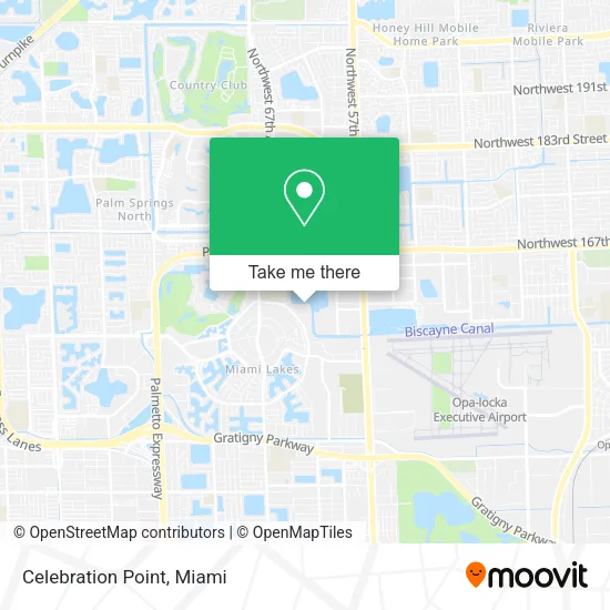
See Celebration Point, Hialeah, on the map
Public Transit to Celebration Point in Hialeah
Wondering how to get to Celebration Point in Hialeah? Moovit helps you find the best way to get to Celebration Point with step-by-step directions from the nearest public transit station.
Moovit provides free maps and live directions to help you navigate through your city. View schedules, routes, timetables, and find out how long does it take to get to Celebration Point in real time.
Looking for the nearest stop or station to Celebration Point? Check out this list of stops closest to your destination: Nw 67 Av & Miami Lakeway N; Nw 60 Av & Miami Lakes Dr; Nw 158 St & Nw 57 Av.
Bus: 183, 37, 75.
Want to see if there’s another route that gets you there at an earlier time? Moovit helps you find alternative routes or times. Get directions from and directions to Celebration Point easily from the Moovit App or Website.
We make riding to Celebration Point easy, which is why over 1.5 million users, including users in Hialeah, trust Moovit as the best app for public transit. You don’t need to download an individual bus app or train app, Moovit is your all-in-one transit app that helps you find the best bus time or train time available.
For information on prices of bus, costs and ride fares to Celebration Point, please check the Moovit app.
Use the app to navigate to popular places including to the airport, hospital, stadium, grocery store, mall, coffee shop, school, college, and university.
Celebration Point Address: 15535 Miami Lakeway N Hialeah, FL 33014 street in Hialeah
- Medicare Insurance Advisors Miami Lakes,
- USPS Collection Box - Blue Box,
- Vanilla Espresso Bakery Cafe,
- Miami Lakes Middle school,
- On Time Staffing,
- Maddy's Plushies,
- Federal and State Criminal Attorney Nayib Hassan, P.A.,
- Jovanny Valdez - Lifestyle International Realty,
- Allstate Insurance,
- FedEx,
- Ashley Prophete - 5 Percent Realty Group,
- Homevine,
- Serrano Group,
- D'Zamora Corp,
- Sachs Joseph D CPA Pa,
- Florida Pain Treatment Center,
- Florida Retirement Resources,
- Envy Wigs,
- American Contractors Indemnity,
- Hurtado Gomez Team
Places Near Celebration Point (Hialeah)
- Dolphin Mall Bus, Miami,
- Aventura Mall, Miami,
- Miami Freedom Park, Miami,
- Port of Miami Cruise Terminal, Miami,
- Marlins Park, Miami,
- Miami-Dade County Courthouse, Miami,
- Keiser University Flagship Campus, West Palm Beach,
- Bayside Marketplace, Miami,
- Brickell City Centre, Miami,
- Sawgrass Mall, Miami,
- Sawgrass mall ( FL ), Miami Beach,
- Zoo Miami, Miami,
- Dolphin Mall, Miami,
- Wynwood, Miami,
- Hard Rock Stadium, Miami Gardens,
- Aventura Mall, Miami Beach,
- Miami Design District, Miami,
- Richard E. Gerstein Justice Building, Miami,
- Miami VA Hospital, Miami,
- Little Havana, Miami
How to get to popular places in Miami with public transit
Get around Hialeah by public transit!
Traveling around Hialeah has never been so easy. See step by step directions as you travel to any attraction, street or major public transit station. View bus and train schedules, arrival times, service alerts and detailed routes on a map, so you know exactly how to get to anywhere in Hialeah.
When traveling to any destination around Hialeah use Moovit's Live Directions with Get Off Notifications to know exactly where and how far to walk, how long to wait for your line, and how many stops are left. Moovit will alert you when it's time to get off — no need to constantly re-check whether yours is the next stop.
Wondering how to use public transit in Hialeah or how to pay for public transit in Hialeah? Moovit public transit app can help you navigate your way with public transit easily, and at minimum cost. It includes public transit fees, ticket prices, and costs. Looking for a map of Hialeah public transit lines? Moovit public transit app shows all public transit maps in Hialeah with all Bus, Train, Light Rail and Ferry routes and stops on an interactive map.
Miami has 4 transit type(s), including: Bus, Train, Light Rail and Ferry, operated by several transit agencies, including Broward County Transit, Miami-Dade Transit, Metrorail, Palm Tran, Tri-Rail, Brightline, MARTY, City of Homestead Trolley, Key West Transit, Treasure Coast Connector, GoLine IRT, Amtrak, Greyhound-us, FlixBus-us and Aventura Express Shuttle Bus