How to get to Center For Advanced Studies by bus?
Click on the bus route to see step by step directions with maps, line arrival times and updated time schedules.
How to get to Center For Advanced Studies by train?
Click on the train route to see step by step directions with maps, line arrival times and updated time schedules.
Bus stops near Center For Advanced Studies in Verwaltungsverband Mittleres Schussental
Train stations near Center For Advanced Studies in Verwaltungsverband Mittleres Schussental
Bus lines to Center For Advanced Studies in Verwaltungsverband Mittleres Schussental
- R45, Tettnang Bärenplatz,VIEW
- 3, Rv Untereschach,VIEW
- N3, Friedrichshafen Stadtbahnhof,VIEW
- 1, Baindt Zeppelinstraße,VIEW
- 7537, Meersburg, Fähre,VIEW
- 21, Rv Bildungszentrum St.Konrad,VIEW
- R40, Ravensburg Polizeipräsidium,VIEW
- 4, Ravensburg Bahnhof,VIEW
- 700, Konstanz Bahnhof,VIEW
- R70, Pfullendorf Zob,VIEW
- 7539, Ravensburg Polizeipräsidium,VIEW
What are the closest stations to Center For Advanced Studies?
The closest stations to Center For Advanced Studies are:
- Rv Wilhelm-Hauff-Straße is 210 meters away, 3 min walk.
- Ravensburg Hirschgraben is 293 meters away, 4 min walk.
- Ravensburg Hallenbad is 496 meters away, 7 min walk.
- Ravensburg Gänsbühl is 843 meters away, 11 min walk.
- Ravensburg Meersburger Brücke Bstg 1 is 949 meters away, 13 min walk.
- Ravensburg Meersburger Brücke is 986 meters away, 13 min walk.
- Ravensburg is 1126 meters away, 15 min walk.
- Oberzell Bahnhof is 3999 meters away, 51 min walk.
Which train lines stop near Center For Advanced Studies?
These train lines stop near Center For Advanced Studies: RB 91, RE 3, RE 5, RE5.
Which bus lines stop near Center For Advanced Studies?
These bus lines stop near Center For Advanced Studies: 700, R45, R70, S30, S40.
What’s the nearest train station to Center For Advanced Studies in Verwaltungsverband Mittleres Schussental?
The nearest train station to Center For Advanced Studies in Verwaltungsverband Mittleres Schussental is Ravensburg. It’s a 15 min walk away.
What’s the nearest bus station to Center For Advanced Studies in Verwaltungsverband Mittleres Schussental?
The nearest bus station to Center For Advanced Studies in Verwaltungsverband Mittleres Schussental is Rv Wilhelm-Hauff-Straße. It’s a 3 min walk away.
What time is the first train to Center For Advanced Studies in Verwaltungsverband Mittleres Schussental?
The RE5 is the first train that goes to Center For Advanced Studies in Verwaltungsverband Mittleres Schussental. It stops nearby at 5:02 AM.
What time is the last train to Center For Advanced Studies in Verwaltungsverband Mittleres Schussental?
The RE5 is the last train that goes to Center For Advanced Studies in Verwaltungsverband Mittleres Schussental. It stops nearby at 1:12 AM.
What time is the first bus to Center For Advanced Studies in Verwaltungsverband Mittleres Schussental?
The 700 is the first bus that goes to Center For Advanced Studies in Verwaltungsverband Mittleres Schussental. It stops nearby at 4:35 AM.
What time is the last bus to Center For Advanced Studies in Verwaltungsverband Mittleres Schussental?
The 700 is the last bus that goes to Center For Advanced Studies in Verwaltungsverband Mittleres Schussental. It stops nearby at 1:19 AM.
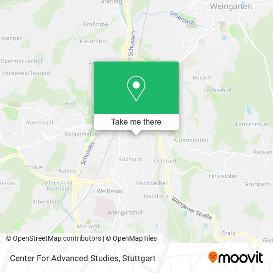
See Center For Advanced Studies, Verwaltungsverband Mittleres Schussental, on the map
Public Transit to Center For Advanced Studies in Verwaltungsverband Mittleres Schussental
Wondering how to get to Center For Advanced Studies in Verwaltungsverband Mittleres Schussental? Moovit helps you find the best way to get to Center For Advanced Studies with step-by-step directions from the nearest public transit station.
Moovit provides free maps and live directions to help you navigate through your city. View schedules, routes, timetables, and find out how long does it take to get to Center For Advanced Studies in real time.
Looking for the nearest stop or station to Center For Advanced Studies? Check out this list of stops closest to your destination: Rv Wilhelm-Hauff-Straße; Ravensburg Hirschgraben; Ravensburg Hallenbad; Ravensburg Gänsbühl; Ravensburg Meersburger Brücke Bstg 1; Ravensburg Meersburger Brücke; Ravensburg; Oberzell Bahnhof.
Train: RB 91, RE 3, RE 5, RE5, RE3, RE3, RB91, RB91.Bus: 700, R45, R70, S30, S40, 3, N3, 1, 7537, 21, R40.
Want to see if there’s another route that gets you there at an earlier time? Moovit helps you find alternative routes or times. Get directions from and directions to Center For Advanced Studies easily from the Moovit App or Website.
We make riding to Center For Advanced Studies easy, which is why over 1.5 million users, including users in Verwaltungsverband Mittleres Schussental, trust Moovit as the best app for public transit. You don’t need to download an individual bus app or train app, Moovit is your all-in-one transit app that helps you find the best bus time or train time available.
For information on prices of train and bus, costs and ride fares to Center For Advanced Studies, please check the Moovit app.
Use the app to navigate to popular places including to the airport, hospital, stadium, grocery store, mall, coffee shop, school, college, and university.
Center For Advanced Studies Address: Weinbergstraße 17 88214 Ravensburg street in Verwaltungsverband Mittleres Schussental
- Bayer Umweltservice Inh. Markus Hallmann Rohrreinigung,
- Schwestern vom Kloster,
- Kongregation der Franziskanerinnen von Sießen,
- Großmann Consulting,
- Dipl.-Ing. FH K. Rau Garten- und Landschaftsarchitektur,
- Grundschule Und Kindergarten Klösterle,
- Abendrealschule,
- Kindergarten Klösterle,
- Cpv Unternehmensberatung,
- Dhbw Bibliothek,
- Wtb407/Andreas Neininger,
- Duale Hochschule Ravensburg Bibliothek,
- Notariat Ravensburg,
- Paul Walter Notar Referat 1,
- Plätzlerzunft Altdorf- Weingarten 1348,
- Haus Der Betreuung Und Pflege am Mehlsack,
- Harald Enderle Wohnanlage Lebensräume für Jung & Alt,
- Dr. Günter J. Schäfer,
- Mundwohl,
- Stefanie Schweller
Places Near Center For Advanced Studies (Verwaltungsverband Mittleres Schussental)
- FlixBus Haltestelle, Stuttgart,
- Hanns-Martin-Schleyer-Halle (Stuttgart Hans-Martin-Schleyerhalle), Bad Cannstatt,
- Mercedes-Benz Museum, Bad Cannstatt,
- Im Wizemann (Halle), Bad Cannstatt,
- Schleyerhalle, Bad Cannstatt,
- Marmorsaal Im Weissenburgpark, Stuttgart-Süd,
- Mercedes-Benz Museum (Mercedes Museum Stuttgart), Bad Cannstatt,
- SI-Centrum, Möhringen,
- Hanns-Martin-Schleyer-Halle, Bad Cannstatt,
- Porsche-Arena, Bad Cannstatt,
- Waldfriedhof, Degerloch,
- Wilhelma (U-Bahn Wilhelma), Bad Cannstatt,
- Gleis 101/102 (tief), Stuttgart-Mitte,
- Klinikum Stuttgart - Katharinenhospital, Stuttgart-Mitte,
- Geilhaus Haus 33a, Reutlingen-Betzingen,
- Pariser Platz Stuttgart, Stuttgart-Mitte,
- Hauptbahnhof Stuttgart, Stuttgart-Mitte,
- Mettingen Eros-Center Puff Laufhaus, Esslingen Am Neckar,
- Porsche Museum, Zuffenhausen,
- Gasometer Pforzheim, Pforzheim
How to get to popular places in Stuttgart with public transit
Get around Verwaltungsverband Mittleres Schussental by public transit!
Traveling around Verwaltungsverband Mittleres Schussental has never been so easy. See step by step directions as you travel to any attraction, street or major public transit station. View bus and train schedules, arrival times, service alerts and detailed routes on a map, so you know exactly how to get to anywhere in Verwaltungsverband Mittleres Schussental.
When traveling to any destination around Verwaltungsverband Mittleres Schussental use Moovit's Live Directions with Get Off Notifications to know exactly where and how far to walk, how long to wait for your line, and how many stops are left. Moovit will alert you when it's time to get off — no need to constantly re-check whether yours is the next stop.
Wondering how to use public transit in Verwaltungsverband Mittleres Schussental or how to pay for public transit in Verwaltungsverband Mittleres Schussental? Moovit public transit app can help you navigate your way with public transit easily, and at minimum cost. It includes public transit fees, ticket prices, and costs. Looking for a map of Verwaltungsverband Mittleres Schussental public transit lines? Moovit public transit app shows all public transit maps in Verwaltungsverband Mittleres Schussental with all Bus, Train, Subway, Light Rail, Ferry, S-Bahn and Funicular routes and stops on an interactive map.
Stuttgart has 7 transit type(s), including: Bus, Train, Subway, Light Rail, Ferry, S-Bahn and Funicular, operated by several transit agencies, including SSB - Stadtbahn, SSB, SSB - Seilbahn / Zacke, S-Bahn Stuttgart, Rhein-Neckar-Verkehr GmbH (rnv), Karlsruher Verkehrsverbund, DB AG, DB Regiobus BW, Arverio Baden-Württemberg GmbH, DB RegioNetz Verkehrs GmbH Westfrankenbahn, DB Regio AG Baden-Württemberg, Südwestdeutsche Verkehrs-AG, DB Regio AG Mitte Region Hessen, DB and Bodensee-Oberschwaben-Bahn