How to get to Center For Comprehensive Health Practice by bus?
Click on the bus route to see step by step directions with maps, line arrival times and updated time schedules.
From Wo Hop Restaurant, Manhattan
82 minFrom 185 West Broadway, Manhattan
71 minFrom Pier 36 NYC, Manhattan
77 minFrom Zhong Hua Flushing-Chinatown Shuttle Van Service, Manhattan
65 minFrom The Westin New York at Times Square, Manhattan
43 minFrom Bowery Ballroom, Manhattan
72 minFrom New York Law School, Manhattan
71 minFrom East 28th Street, Manhattan
43 minFrom Flixbus Nyc 300 W 31st St., Manhattan
46 minFrom Washington Square Park, Manhattan
60 min
How to get to Center For Comprehensive Health Practice by train?
Click on the train route to see step by step directions with maps, line arrival times and updated time schedules.
From Wo Hop Restaurant, Manhattan
176 minFrom 185 West Broadway, Manhattan
169 minFrom Zhong Hua Flushing-Chinatown Shuttle Van Service, Manhattan
177 minFrom The Westin New York at Times Square, Manhattan
43 minFrom New York Law School, Manhattan
169 minFrom East 28th Street, Manhattan
47 minFrom Flixbus Nyc 300 W 31st St., Manhattan
78 minFrom Washington Square Park, Manhattan
124 min
How to get to Center For Comprehensive Health Practice by subway?
Click on the subway route to see step by step directions with maps, line arrival times and updated time schedules.
From Wo Hop Restaurant, Manhattan
43 minFrom 185 West Broadway, Manhattan
37 minFrom Pier 36 NYC, Manhattan
54 minFrom Zhong Hua Flushing-Chinatown Shuttle Van Service, Manhattan
45 minFrom The Westin New York at Times Square, Manhattan
26 minFrom Bowery Ballroom, Manhattan
36 minFrom New York Law School, Manhattan
37 minFrom East 28th Street, Manhattan
26 minFrom Flixbus Nyc 300 W 31st St., Manhattan
26 minFrom Washington Square Park, Manhattan
38 min
Bus stops near Center For Comprehensive Health Practice in Manhattan
Subway stations near Center For Comprehensive Health Practice in Manhattan
Bus lines to Center For Comprehensive Health Practice in Manhattan
What are the closest stations to Center For Comprehensive Health Practice?
The closest stations to Center For Comprehensive Health Practice are:
- Madison Av/E 109 St is 110 yards away, 2 min walk.
- 5 Av/E 109 St is 170 yards away, 3 min walk.
- Central Park North/5 Av is 221 yards away, 3 min walk.
- 103 St is 337 yards away, 5 min walk.
- E 106 St/Madison Av is 412 yards away, 5 min walk.
- Lexington Av/E 110 St is 424 yards away, 6 min walk.
- 110 St-Malcolm X Plaza is 526 yards away, 7 min walk.
Which bus lines stop near Center For Comprehensive Health Practice?
These bus lines stop near Center For Comprehensive Health Practice: M1, M103, M106, M2.
Which train lines stop near Center For Comprehensive Health Practice?
These train lines stop near Center For Comprehensive Health Practice: 1, 2, 3.
Which subway lines stop near Center For Comprehensive Health Practice?
These subway lines stop near Center For Comprehensive Health Practice: 2, 6.
What’s the nearest subway station to Center For Comprehensive Health Practice in Manhattan?
The nearest subway station to Center For Comprehensive Health Practice in Manhattan is 103 St. It’s a 5 min walk away.
What’s the nearest bus station to Center For Comprehensive Health Practice in Manhattan?
The nearest bus station to Center For Comprehensive Health Practice in Manhattan is Madison Av/E 109 St. It’s a 2 min walk away.
What time is the first subway to Center For Comprehensive Health Practice in Manhattan?
The 6 is the first subway that goes to Center For Comprehensive Health Practice in Manhattan. It stops nearby at 3:00 AM.
What time is the last subway to Center For Comprehensive Health Practice in Manhattan?
The 2 is the last subway that goes to Center For Comprehensive Health Practice in Manhattan. It stops nearby at 3:59 AM.
What time is the first bus to Center For Comprehensive Health Practice in Manhattan?
The M102 is the first bus that goes to Center For Comprehensive Health Practice in Manhattan. It stops nearby at 3:21 AM.
What time is the last bus to Center For Comprehensive Health Practice in Manhattan?
The M103 is the last bus that goes to Center For Comprehensive Health Practice in Manhattan. It stops nearby at 2:58 AM.
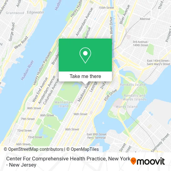
See Center For Comprehensive Health Practice, Manhattan, on the map
Public Transit to Center For Comprehensive Health Practice in Manhattan
Wondering how to get to Center For Comprehensive Health Practice in Manhattan? Moovit helps you find the best way to get to Center For Comprehensive Health Practice with step-by-step directions from the nearest public transit station.
Moovit provides free maps and live directions to help you navigate through your city. View schedules, routes, timetables, and find out how long does it take to get to Center For Comprehensive Health Practice in real time.
Looking for the nearest stop or station to Center For Comprehensive Health Practice? Check out this list of stops closest to your destination: Madison Av/E 109 St; 5 Av/E 109 St; Central Park North/5 Av; 103 St; E 106 St/Madison Av; Lexington Av/E 110 St; 110 St-Malcolm X Plaza.
Bus: M1, M103, M106, M2, M3, M4.Train: 1, 2, 3.Subway: 2, 6, 4, 6X, 3.
Want to see if there’s another route that gets you there at an earlier time? Moovit helps you find alternative routes or times. Get directions from and directions to Center For Comprehensive Health Practice easily from the Moovit App or Website.
We make riding to Center For Comprehensive Health Practice easy, which is why over 1.5 million users, including users in Manhattan, trust Moovit as the best app for public transit. You don’t need to download an individual bus app or train app, Moovit is your all-in-one transit app that helps you find the best bus time or train time available.
For information on prices of subway, train and bus, costs and ride fares to Center For Comprehensive Health Practice, please check the Moovit app.
Use the app to navigate to popular places including to the airport, hospital, stadium, grocery store, mall, coffee shop, school, college, and university.
Center For Comprehensive Health Practice Address: 35 E 110th St street in Manhattan
- American Access Care Manhattan,
- Thomas Perron,
- Jody's Shining Stars Inc.,
- The Margaret Morgan Lawrence Center For Family and Child Development,
- Kinesioworks Physical Therapy,
- Air Duct Cleaning Repair Services,
- 110th St and Madison Ave,
- Vc Cleaners Madison Ave,
- PM Architecture Pc,
- Ahmad Abouzanat Interior Design,
- Ahmad Abouzanat Studio,
- Wimpy's,
- Lehman Senior Center,
- Libertyx Bitcoin Atm,
- 110th and Madison Avenue,
- L’Elite Medispa,
- New York Latin Culture Magazine,
- Dopehouse Dispensary,
- Amazon Locker - Footstool,
- R&C Wine & Liquor
Places Near Center For Comprehensive Health Practice (Manhattan)
- Mountainside Hospital, Glen Ridge,
- Rockefeller Center, Manhattan,
- San Gennaro Feast, Manhattan,
- 911 Memorial, Manhattan,
- 26 Federal Plaza, Manhattan,
- 376 Hudson Street, Manhattan,
- Katz's Deli, Manhattan,
- Times Square, Manhattan,
- Chinatown, Manhattan,
- 1 Police Plaza, Manhattan,
- 111 Centre New York City Supreme Court, Manhattan,
- 66 John Street, Manhattan,
- Hudson Yards, Manhattan,
- Queens Center Mall, Queens,
- Pier 83, Manhattan,
- SoHo, Manhattan,
- Wall Street, Manhattan,
- qqqq, Manhattan,
- 3 Stone St, Manhattan,
- Bellevue Hospital, Manhattan
How to get to popular places in New York - New Jersey with public transit
Get around Manhattan by public transit!
Traveling around Manhattan has never been so easy. See step by step directions as you travel to any attraction, street or major public transit station. View bus and train schedules, arrival times, service alerts and detailed routes on a map, so you know exactly how to get to anywhere in Manhattan.
When traveling to any destination around Manhattan use Moovit's Live Directions with Get Off Notifications to know exactly where and how far to walk, how long to wait for your line, and how many stops are left. Moovit will alert you when it's time to get off — no need to constantly re-check whether yours is the next stop.
Wondering how to use public transit in Manhattan or how to pay for public transit in Manhattan? Moovit public transit app can help you navigate your way with public transit easily, and at minimum cost. It includes public transit fees, ticket prices, and costs. Looking for a map of Manhattan public transit lines? Moovit public transit app shows all public transit maps in Manhattan with all Bus, Train, Subway, Light Rail, Ferry and Cable Car routes and stops on an interactive map.
New York - New Jersey has 6 transit type(s), including: Bus, Train, Subway, Light Rail, Ferry and Cable Car, operated by several transit agencies, including MTA Subway, Metro-North Railroad, LIRR, PATH, MTA New York City Transit - Express routes, MTA Bus, NJ Transit, NYC Ferry, NICE bus, Bee-Line Bus, NJ Transit Rail, Norwalk Transit District, Hartford Line, River Valley Transit and HART