How to get to Center for Environmental Filmmaking by bus?
Click on the bus route to see step by step directions with maps, line arrival times and updated time schedules.
From Embassy Suites by Hilton Crystal City National Airport, Arlington County
89 minFrom Marine Barracks Washington, Washington
63 minFrom Ronald Reagan Washington National Airport (Dca), Arlington County
89 minFrom 17th & K Street NW, Washington
46 minFrom Palantir Technologies D.C., Washington
51 minFrom Hechinger Mall, Washington
65 minFrom Holiday Inn National Airport/Crystal City, Arlington County
83 minFrom 9th St NW and H, Washington
50 minFrom 8th St NE (8th st and h st ne), Washington
57 minFrom Ross Dress for Less, Washington
65 min
How to get to Center for Environmental Filmmaking by metro?
Click on the metro route to see step by step directions with maps, line arrival times and updated time schedules.
From Embassy Suites by Hilton Crystal City National Airport, Arlington County
62 minFrom Marine Barracks Washington, Washington
55 minFrom Ronald Reagan Washington National Airport (Dca), Arlington County
53 minFrom 17th & K Street NW, Washington
35 minFrom Palantir Technologies D.C., Washington
47 minFrom Hechinger Mall, Washington
72 minFrom Holiday Inn National Airport/Crystal City, Arlington County
66 minFrom 9th St NW and H, Washington
42 minFrom 8th St NE (8th st and h st ne), Washington
54 minFrom Ross Dress for Less, Washington
72 min
Bus stops near Center for Environmental Filmmaking in Washington
Metro station near Center for Environmental Filmmaking in Washington
- Tenleytown Metro Station, 53 min walk,VIEW
Bus lines to Center for Environmental Filmmaking in Washington
What are the closest stations to Center for Environmental Filmmaking?
The closest stations to Center for Environmental Filmmaking are:
- Nebraska Av Nw+American Univ is 116 yards away, 2 min walk.
- Massachusetts Av Nw+Ward Cir NW is 259 yards away, 4 min walk.
- Tenleytown Metro Station is 4511 yards away, 53 min walk.
Which bus lines stop near Center for Environmental Filmmaking?
These bus lines stop near Center for Environmental Filmmaking: D90, D96.
Which metro line stops near Center for Environmental Filmmaking?
RED (Shady Grove)
What’s the nearest bus station to Center for Environmental Filmmaking in Washington?
The nearest bus station to Center for Environmental Filmmaking in Washington is Nebraska Av Nw+American Univ. It’s a 2 min walk away.
What time is the first metro to Center for Environmental Filmmaking in Washington?
The RED is the first metro that goes to Center for Environmental Filmmaking in Washington. It stops nearby at 5:21 AM.
What time is the last metro to Center for Environmental Filmmaking in Washington?
The RED is the last metro that goes to Center for Environmental Filmmaking in Washington. It stops nearby at 12:19 AM.
What time is the first bus to Center for Environmental Filmmaking in Washington?
The C81 is the first bus that goes to Center for Environmental Filmmaking in Washington. It stops nearby at 5:32 AM.
What time is the last bus to Center for Environmental Filmmaking in Washington?
The D96 is the last bus that goes to Center for Environmental Filmmaking in Washington. It stops nearby at 12:53 AM.
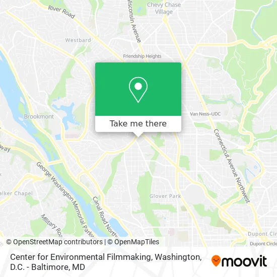
See Center for Environmental Filmmaking, Washington, on the map
Public Transit to Center for Environmental Filmmaking in Washington
Wondering how to get to Center for Environmental Filmmaking in Washington? Moovit helps you find the best way to get to Center for Environmental Filmmaking with step-by-step directions from the nearest public transit station.
Moovit provides free maps and live directions to help you navigate through your city. View schedules, routes, timetables, and find out how long does it take to get to Center for Environmental Filmmaking in real time.
Looking for the nearest stop or station to Center for Environmental Filmmaking? Check out this list of stops closest to your destination: Nebraska Av Nw+American Univ; Massachusetts Av Nw+Ward Cir NW; Tenleytown Metro Station.
Bus: D90, D96, C81.Metro: RED.
Want to see if there’s another route that gets you there at an earlier time? Moovit helps you find alternative routes or times. Get directions from and directions to Center for Environmental Filmmaking easily from the Moovit App or Website.
We make riding to Center for Environmental Filmmaking easy, which is why over 1.5 million users, including users in Washington, trust Moovit as the best app for public transit. You don’t need to download an individual bus app or train app, Moovit is your all-in-one transit app that helps you find the best bus time or train time available.
For information on prices of bus and metro, costs and ride fares to Center for Environmental Filmmaking, please check the Moovit app.
Use the app to navigate to popular places including to the airport, hospital, stadium, grocery store, mall, coffee shop, school, college, and university.
Center for Environmental Filmmaking Address: 4400 Massachusetts Ave NW Washington, DC 20016 street in Washington
- Abramson Family Founders Room, Sis Building,
- 4400 Massachusetts Ave NW,
- American University,
- AU – Kerwin Hall,
- AU - East Quad Building (EQB),
- National United Methodist Church,
- Nebraska Ave & New Mexico Ave,
- Battelle-Tompkins Atrium - AU,
- Eagle's Nest,
- Katzen Arts Center - American University,
- Massachusetts Ave NW,
- American University Bookstore,
- AU – Butler Board Room,
- The Tunnel at American University,
- Foxhall Pediatrics,
- Foxhall Internists, PC (Dr Charles Michael Citrin, MD),
- Georgetown Dermatology (Braun Dermatology and Skin Cancer Center),
- Columbia University,
- AU – McDowell Formal Lounge,
- U.S. Department of Homeland Security (DHS) - Nebraska Avenue Complex
Places Near Center for Environmental Filmmaking (Washington)
- M&T Bank Stadium, Baltimore,
- PG Mall, Prince George's County,
- Pennsylvania Ave NW (3rd st and pennsylvania), Washington,
- Georgetown, Washington,
- National Theatre, Washington,
- National Museum of African American History and Culture, Washington,
- Camden Yards, Baltimore,
- Rock Creek Tennis Center, Washington,
- Washington National Cathedral, Washington,
- Washington DC VA Medical Center, Washington,
- Sibley Memorial Hospital, Washington,
- Museum Of The Bible, Washington,
- The Anthem, Washington,
- National Zoo, Washington,
- Westfield Montgomery Mall, Montgomery County,
- Capital One Arena, Washington,
- Amazon Hq2, Arlington County,
- Warner Theatre, Washington,
- Basilica of the National Shrine, Washington,
- Marriott Marquis Washington, DC, Washington
How to get to popular places in Washington, D.C. - Baltimore, MD with public transit
Get around Washington by public transit!
Traveling around Washington has never been so easy. See step by step directions as you travel to any attraction, street or major public transit station. View bus and train schedules, arrival times, service alerts and detailed routes on a map, so you know exactly how to get to anywhere in Washington.
When traveling to any destination around Washington use Moovit's Live Directions with Get Off Notifications to know exactly where and how far to walk, how long to wait for your line, and how many stops are left. Moovit will alert you when it's time to get off — no need to constantly re-check whether yours is the next stop.
Wondering how to use public transit in Washington or how to pay for public transit in Washington? Moovit public transit app can help you navigate your way with public transit easily, and at minimum cost. It includes public transit fees, ticket prices, and costs. Looking for a map of Washington public transit lines? Moovit public transit app shows all public transit maps in Washington with all Bus, Train, Metro, Light Rail and Ferry routes and stops on an interactive map.
Washington, D.C. - Baltimore, MD has 5 transit type(s), including: Bus, Train, Metro, Light Rail and Ferry, operated by several transit agencies, including WMATA, Montgomery County Ride On, Fairfax Connector, TheBus, PRTC, DASH - Alexandria, Arlington Transit (ART), RTA of Central Maryland, MDOT MTA, MDOT MTA Light RailLink, MDOT MTA Commuter Bus, MDOT MTA Local Bus, FXBGO!, Virginia Railway Express (VRE) and MARC