How to get to Centre de Formation Ina by bus?
Click on the bus route to see step by step directions with maps, line arrival times and updated time schedules.
From Le Café de la Gare, Paris
66 minFrom Avenue Jean Jaurès, Paris
103 minFrom Pavillon d'Armenonville, Paris
39 minFrom Vitry-sur Seine, Vitry-Sur-Seine
120 minFrom Westfield Les 4 Temps, Puteaux
68 minFrom Stade Bauer, Saint-Ouen
114 minFrom Le République, Paris
77 minFrom Père-Lachaise, Paris
89 minFrom Avenue de Saint-Mandé, Paris
104 minFrom Jeu de Paume, Paris
56 min
How to get to Centre de Formation Ina by metro?
Click on the metro route to see step by step directions with maps, line arrival times and updated time schedules.
From Le Café de la Gare, Paris
49 minFrom Avenue Jean Jaurès, Paris
61 minFrom Pavillon d'Armenonville, Paris
56 minFrom Westfield Les 4 Temps, Puteaux
57 minFrom Stade Bauer, Saint-Ouen
62 minFrom Le République, Paris
48 minFrom Père-Lachaise, Paris
56 minFrom Avenue de Saint-Mandé, Paris
53 minFrom Jeu de Paume, Paris
38 min
Bus stops near Centre de Formation Ina in Issy-Les-Moulineaux
Metro station near Centre de Formation Ina in Issy-Les-Moulineaux
- Mairie D'Issy, 4 min walk,VIEW
Light Rail stations near Centre de Formation Ina in Issy-Les-Moulineaux
- Jacques-Henri Lartigue, 10 min walk,VIEW
RER station near Centre de Formation Ina in Issy-Les-Moulineaux
- Issy - Val de Seine, 14 min walk,VIEW
Bus lines to Centre de Formation Ina in Issy-Les-Moulineaux
What are the closest stations to Centre de Formation Ina?
The closest stations to Centre de Formation Ina are:
- Issy - Val de Seine is 58 meters away, 1 min walk.
- Issy - Val de Seine RER is 187 meters away, 3 min walk.
- Mairie D'Issy is 256 meters away, 4 min walk.
- Capitaine Ferber is 572 meters away, 8 min walk.
- Jacques-Henri Lartigue is 741 meters away, 10 min walk.
Which RER line stops near Centre de Formation Ina?
C (Pontoise/ Saint-Quentin-en-Yvelines/ Versailles-Chantiers/ Versailles-Château-Rive-Gauche)
Which metro lines stop near Centre de Formation Ina?
These metro lines stop near Centre de Formation Ina: 12, 8.
Which bus lines stop near Centre de Formation Ina?
These bus lines stop near Centre de Formation Ina: 126, 189, 39, 394.
Which light rail line stops near Centre de Formation Ina?
T2 (Porte de Versailles)
What’s the nearest light rail station to Centre de Formation Ina in Issy-Les-Moulineaux?
The nearest light rail station to Centre de Formation Ina in Issy-Les-Moulineaux is Jacques-Henri Lartigue. It’s a 10 min walk away.
What’s the nearest metro station to Centre de Formation Ina in Issy-Les-Moulineaux?
The nearest metro station to Centre de Formation Ina in Issy-Les-Moulineaux is Mairie D'Issy. It’s a 4 min walk away.
What’s the nearest bus station to Centre de Formation Ina in Issy-Les-Moulineaux?
The nearest bus station to Centre de Formation Ina in Issy-Les-Moulineaux is Issy - Val de Seine. It’s a 1 min walk away.
What’s the nearest RER station to Centre de Formation Ina in Issy-Les-Moulineaux?
The nearest RER station to Centre de Formation Ina in Issy-Les-Moulineaux is Issy - Val de Seine. It’s a 14 min walk away.
What time is the first light rail to Centre de Formation Ina in Issy-Les-Moulineaux?
The T2 is the first light rail that goes to Centre de Formation Ina in Issy-Les-Moulineaux. It stops nearby at 5:06 AM.
What time is the last light rail to Centre de Formation Ina in Issy-Les-Moulineaux?
The T2 is the last light rail that goes to Centre de Formation Ina in Issy-Les-Moulineaux. It stops nearby at 1:31 AM.
What time is the first metro to Centre de Formation Ina in Issy-Les-Moulineaux?
The 12 is the first metro that goes to Centre de Formation Ina in Issy-Les-Moulineaux. It stops nearby at 5:30 AM.
What time is the last metro to Centre de Formation Ina in Issy-Les-Moulineaux?
The 12 is the last metro that goes to Centre de Formation Ina in Issy-Les-Moulineaux. It stops nearby at 1:15 AM.
What time is the first bus to Centre de Formation Ina in Issy-Les-Moulineaux?
The N160 is the first bus that goes to Centre de Formation Ina in Issy-Les-Moulineaux. It stops nearby at 3:45 AM.
What time is the last bus to Centre de Formation Ina in Issy-Les-Moulineaux?
The N160 is the last bus that goes to Centre de Formation Ina in Issy-Les-Moulineaux. It stops nearby at 3:45 AM.
What time is the first RER to Centre de Formation Ina in Issy-Les-Moulineaux?
The C is the first RER that goes to Centre de Formation Ina in Issy-Les-Moulineaux. It stops nearby at 5:15 AM.
What time is the last RER to Centre de Formation Ina in Issy-Les-Moulineaux?
The C is the last RER that goes to Centre de Formation Ina in Issy-Les-Moulineaux. It stops nearby at 11:17 PM.
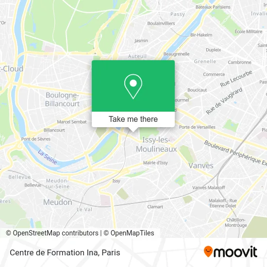
See Centre de Formation Ina, Issy-Les-Moulineaux, on the map
Public Transit to Centre de Formation Ina in Issy-Les-Moulineaux
Wondering how to get to Centre de Formation Ina in Issy-Les-Moulineaux? Moovit helps you find the best way to get to Centre de Formation Ina with step-by-step directions from the nearest public transit station.
Moovit provides free maps and live directions to help you navigate through your city. View schedules, routes, timetables, and find out how long does it take to get to Centre de Formation Ina in real time.
Looking for the nearest stop or station to Centre de Formation Ina? Check out this list of stops closest to your destination: Issy - Val de Seine; Issy - Val de Seine RER; Mairie D'Issy; Capitaine Ferber; Jacques-Henri Lartigue.
RER: C.Metro: 12, 8.Bus: 126, 189, 39, 394, 260, 323, 290, N160.Light Rail: T2.
Want to see if there’s another route that gets you there at an earlier time? Moovit helps you find alternative routes or times. Get directions from and directions to Centre de Formation Ina easily from the Moovit App or Website.
We make riding to Centre de Formation Ina easy, which is why over 1.5 million users, including users in Issy-Les-Moulineaux, trust Moovit as the best app for public transit. You don’t need to download an individual bus app or train app, Moovit is your all-in-one transit app that helps you find the best bus time or train time available.
For information on prices of metro, bus, RER and light rail, costs and ride fares to Centre de Formation Ina, please check the Moovit app.
Use the app to navigate to popular places including to the airport, hospital, stadium, grocery store, mall, coffee shop, school, college, and university.
Centre de Formation Ina Address: Rue Camille Desmoulins street in Issy-Les-Moulineaux
- INA Expert,
- Eurosport,
- Jurassic Park,
- Huawei Technologies France,
- Square Louis Blériot,
- Cantine Eurosport,
- La Poste,
- Aphelion,
- France Médias Monde,
- Icade,
- Cisco Systems France,
- Auchan Issy-les-Moulineaux (les 3 Moulins),
- Salle de Sport Coca-cola,
- 15 Rue Rouget de Lisle,
- Camille Desmoulins,
- Radio Foot Internationale - Rfi,
- France Médias Monde : Rfi Mcd F24 Cfi,
- France 24,
- Bouygues Immobilier O'Mallet,
- RFI
Places Near Centre de Formation Ina (Issy-Les-Moulineaux)
- Hôpital Saint-Joseph, Paris,
- 29 Rue Manin, Paris,
- Hôpital Henri Mondor, Creteil,
- Hôpital Beaujon, Clichy,
- Hopital Lariboisière, Paris,
- Gare Routière Flixbus, Paris,
- Fondation Louis Vuitton, Paris,
- Institut Curie, Paris,
- Marché Saint-Pierre, Paris,
- Hôpital de la Pitié-Salpêtrière, Paris,
- Galeries Lafayette Haussmann, Paris,
- Théâtre Mogador, Paris,
- Hôpital Necker, Paris,
- Hôpital Cochin, Paris,
- Hôpital Pitié Salpêtrière, Paris,
- Galeries Lafayette, Paris,
- Créteil Soleil, Creteil,
- Hopital Foch, Suresnes,
- Centre Hospitalier des 15/20, Paris,
- Atelier Des Lumieres, Paris
How to get to popular places in Paris with public transit
Get around Issy-Les-Moulineaux by public transit!
Traveling around Issy-Les-Moulineaux has never been so easy. See step by step directions as you travel to any attraction, street or major public transit station. View bus and train schedules, arrival times, service alerts and detailed routes on a map, so you know exactly how to get to anywhere in Issy-Les-Moulineaux.
When traveling to any destination around Issy-Les-Moulineaux use Moovit's Live Directions with Get Off Notifications to know exactly where and how far to walk, how long to wait for your line, and how many stops are left. Moovit will alert you when it's time to get off — no need to constantly re-check whether yours is the next stop.
Wondering how to use public transit in Issy-Les-Moulineaux or how to pay for public transit in Issy-Les-Moulineaux? Moovit public transit app can help you navigate your way with public transit easily, and at minimum cost. It includes public transit fees, ticket prices, and costs. Looking for a map of Issy-Les-Moulineaux public transit lines? Moovit public transit app shows all public transit maps in Issy-Les-Moulineaux with all Bus, Train, Metro, Light Rail, RER, Funicular and Gondola routes and stops on an interactive map.
Paris has 7 transit type(s), including: Bus, Train, Metro, Light Rail, RER, Funicular and Gondola, operated by several transit agencies, including RATP, RER, RER Bus de remplacement, Train, Train Bus de remplacement, Tramway Bus de remplacement, TER, ADP, Magical Shuttle, Argenteuil - Boucles de Seine, Autocars Dominique, Bièvre, Brie et 2 Morin, Le Bus - C.C. du Clermontois and Cœur d’Essonne