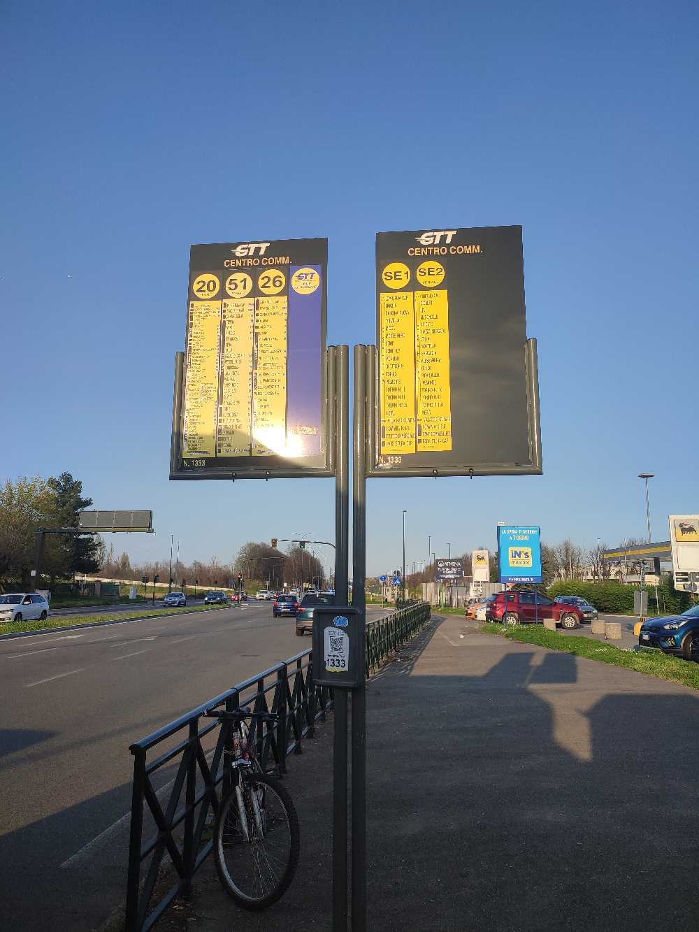
Shopping Center stop - Wednesday schedule
| Line | Direction | Time |
|---|---|---|
| SE2 | Settimo Torinese Via Lombardia | 5:00 AM |
| 20 | Stura via Industrial Zone Pescarito | 5:12 AM |
| SE1 | Settimo Torinese Via Lombardia | 5:16 AM |
| 51 | Stura Corso Vercelli | 5:25 AM |
| 26 | Park Stura | 5:32 AM |
| 20 | Stura via Borgata Paradiso | 5:44 AM |
| SE2 | Settimo Torinese Via Lombardia | 5:50 AM |
| 51 | Stura Corso Vercelli | 5:55 AM |
| SE1 | Settimo Torinese Via Lombardia | 5:59 AM |
| 26 | Park Stura | 6:02 AM |
| SE2 | Settimo Torinese Via Lombardia | 6:10 AM |
| 135 | Rivarolo Station | 6:15 AM |
| SE1 | Settimo Torinese Via Lombardia | 6:17 AM |
| 51 | Stura Corso Vercelli | 6:19 AM |
| 20 | Stura via Industrial Zone Pescarito | 6:21 AM |
| SE2 | Settimo Torinese Via Lombardia | 6:30 AM |
| 166 | Volpiano | 6:30 AM |
| 26 | Park Stura | 6:32 AM |
| SE1 | Settimo Torinese Via Lombardia | 6:36 AM |
| 51 | Stura Corso Vercelli | 6:41 AM |
| SE2 | Settimo Torinese Via Lombardia | 6:43 AM |
| 6 | Brusasco | 6:51 AM |
| 20 | Stura via Industrial Zone Pescarito | 6:53 AM |
| SE1 | Settimo Torinese Via Lombardia | 6:54 AM |
| SE2 | Settimo Torinese Via Lombardia | 7:00 AM |
Directions to Shopping Center stop (Turin) with public transit
The following transit lines have routes that pass near Shopping Center
 Bus: 26, 4N, 6, 107, 135.
- Train: SFM1, SFM2, SFM4, SFM7, R.
How to get to Shopping Center stop by bus?
Click on the bus route to see step by step directions with maps, line arrival times and updated time schedules.
How to get to Shopping Center stop by train?
Click on the train route to see step by step directions with maps, line arrival times and updated time schedules.
Bus stops near Shopping Center stop in Turin
- Turin (Shopping Center), 2 min walk,
- Vercelli 483, 4 min walk,
- North Shopping Center, 4 min walk,
- Elevated Road, 4 min walk,
- Cascinette, 8 min walk,
Train stations near Shopping Center station in Turin
- Turin Stura, 5 min walk,
- Turin Rebaudengo Fossata, 44 min walk,
Light Rail stations near Shopping Center station in Turin
- Gottardo, 36 min walk,
Bus lines to Shopping Center stop in Turin
- 6, Turin - Settimo - Casale,
- 107, Turin - Chivasso - Piova Massaia,
- 135, Rivarolo - San Benigno - Turin,
- 166, Turin - Volpiano - San Benigno,
- 4N, Via Degli Ulivi - Piazza Del Donatore Di Sangue,
- 26, Corso Vercelli (Park Stura) - Borgata Villaretto - Via Italia (Borgaro),
- 51, Park Stura - Corso Bolzano,
- 131, Turin - Rivarolo,
- 20, Stura via Borgata Paradiso,
- 85, Piossasco,
- SE1, Circular Park Stura - Via Lombardia (Settimo),
- SE2, Weekday Corso Vercelli (Park Stura) - Via Lombardia (Settimo T.se),
- 22, Special Corso Sebastopoli - Strada Delle Cascinette,
- 24, Special Via Vigliani - Strada Delle Cascinette,
What are the closest stations to Shopping Center?
The closest stations to Shopping Center are:
- Turin (Shopping Center) is 123 meters away, 2 min walk.
- Vercelli 483 is 244 meters away, 4 min walk.
- North Shopping Center is 260 meters away, 4 min walk.
- Elevated Road is 271 meters away, 4 min walk.
- Turin Stura is 356 meters away, 5 min walk.
- Cascinette is 617 meters away, 8 min walk.
- Gottardo is 2776 meters away, 36 min walk.
- Turin Rebaudengo Fossata is 3429 meters away, 44 min walk.
Which bus lines stop near Shopping Center?
These bus lines stop near Shopping Center: 26, 4N.
Which train line stops near Shopping Center?
SFM1 (Rivarolo)
What’s the nearest train station to Shopping Center in Turin?
The nearest train station to Shopping Center in Turin is Turin Stura. It’s a 5 min walk away.
What’s the nearest bus station to Shopping Center in Turin?
The nearest bus station to Shopping Center in Turin is Turin (Shopping Center). It’s a 2 min walk away.
What time is the first light rail to Shopping Center in Turin?
The 4 is the first light rail that goes to Shopping Center in Turin. It stops nearby at 5:06 AM.
What time is the last light rail to Shopping Center in Turin?
The 4 is the last light rail that goes to Shopping Center in Turin. It stops nearby at 1:32 AM.
What time is the first train to Shopping Center in Turin?
The R is the first train that goes to Shopping Center in Turin. It stops nearby at 5:29 AM.
What time is the last train to Shopping Center in Turin?
The R is the last train that goes to Shopping Center in Turin. It stops nearby at 10:54 PM.
What time is the first bus to Shopping Center in Turin?
The 4N is the first bus that goes to Shopping Center in Turin. It stops nearby at 4:30 AM.
What time is the last bus to Shopping Center in Turin?
The 4N is the last bus that goes to Shopping Center in Turin. It stops nearby at 1:59 AM.
Shopping Center station
 Taken by Anonymous
See Shopping Center stop, Turin, on the map
Public transit to Shopping Center stop (ID: 1333) in Turin
Looking for directions to Shopping Center in Turin, Italy?
Download the Moovit App to find the current schedule and step-by-step directions for Bus or Train routes that pass through Shopping Center.
Looking for the nearest stops closest to Shopping Center ? Check out this list of closest stops to your destination: Turin (Shopping Center); Vercelli 483; North Shopping Center; Elevated Road; Turin Stura; Cascinette; Gottardo; Turin Rebaudengo Fossata.
Bus: 26, 4N, 6, 107, 135, 166, 51, 131, 20, 85, SE1, SE2.Train: SFM1, SFM2, SFM4, SFM7, R, R, SFM6.
We make riding on public transit to Shopping Center easy, which is why over 1.5 million users, including users in Turin trust Moovit as the best app for public transit.
Use the app to navigate to popular places including to the airport, hospital, stadium, grocery store, mall, coffee shop, school, college, and university.
Shopping Center stop’s code is 1333
The first line to this stop is SE2, at 5:00 AM, and the last line is 20 at 12:57 AM.
This stop serves GTT Urban Service and GTT Suburban Service’s lines
Popular routes from Shopping Center stop, Turin
- Turin (Shopping Center),
- Vercelli 483,
- North Shopping Center,
- Elevated Road,
- Cascinette
Bus stops near Shopping Center stop
- Turin Stura,
- Turin Rebaudengo Fossata
Train stations near Shopping Center station
- Gottardo
Light Rail station near Shopping Center station
- Trofarello,
- San Vito Hospital,
- San Marzanotto - Boccanera Road,
- Foglizzo East,
- Turin - Fiat Mirafiori Plant - Corso Agnelli - Corso Traiano,
- Frossasco (Junction),
- Ciriè,
- Druento - Misterletta Road,
- Roddi Winery Junction,
- Bisalta,
- Caramagna (Carmagnola Road),
- De Gasperi,
- Monteu Da Po,
- Pino Center,
- Baldissera North,
- Moriondo,
- Scalenghe - Railway Station,
- Orbassano - Via Giolitti,
- Santhià - Hospital,
- Chivasso - Boschetto - San Francesco Street Corner Via Cene
Popular public transit stations in Turin
Get around Turin by public transit!
Traveling around Turin has never been so easy. See step by step directions as you travel to any attraction, street or major public transit station. View bus and train schedules, arrival times, service alerts and detailed routes on a map, so you know exactly how to get to anywhere in Turin.
When traveling to any destination around Turin use Moovit's Live Directions with Get Off Notifications to know exactly where and how far to walk, how long to wait for your line, and how many stops are left. Moovit will alert you when it's time to get off — no need to constantly re-check whether yours is the next stop.
Wondering how to use public transit in Turin or how to pay for public transit in Turin? Moovit public transit app can help you navigate your way with public transit easily, and at minimum cost. It includes public transit fees, ticket prices, and costs. Looking for a map of Turin public transit lines? Moovit public transit app shows all public transit maps in Turin with all Bus, Train, Metro, Light Rail, Funicular and Gondola routes and stops on an interactive map.
Turin has 6 transit type(s), including: Bus, Train, Metro, Light Rail, Funicular and Gondola, operated by several transit agencies, including GTT Urban Service, GTT Suburban Service, GTT Tourist Services, Trenitalia, Arenaways, Sadem, Cavourese, Grandabus Consortium, Bus Company - GrandaBus, Bus Company, Gelosobus, Nuova S.a.a.r., SAC, Giors Bus Lines and Allasia Bus Lines