How to get to Centro de Servicio Dxn Aguascalientes by bus?
Click on the bus route to see step by step directions with maps, line arrival times and updated time schedules.
Bus stops near Centro de Servicio Dxn Aguascalientes
- Centro (Jardín Carpio), 2 min walk,VIEW
- Valladolid, 308, 2 min walk,VIEW
- 5 De Mayo, 93, 3 min walk,VIEW
- 5 De Mayo, 655(Int), 3 min walk,VIEW
- Sin Nombre Número 662, 102a, 4 min walk,VIEW
- General José María Arteaga, 412, 4 min walk,VIEW
- Centro (Jardínde Zaragoza), 4 min walk,VIEW
- Larreategui, 126, 6 min walk,VIEW
Bus lines to Centro de Servicio Dxn Aguascalientes
- RUTA 02, Centro (Jardín Carpio),VIEW
- RUTA 04, Mahatma Gandhi - Jesús María,VIEW
- RUTA 08, Utma,VIEW
- RUTA 01, Vicente Guerrero - Margaritas,VIEW
- RUTA 03, La Ribera - UAA Sur,VIEW
- RUTA 05, Vicente Guerrero - La Ribera,VIEW
- RUTA 09, Mahatma Gandhi - Los Laureles,VIEW
- RUTA 34, Villa Montaña - UPA,VIEW
- RUTA 37, UTMA - Hacienda San Marcos,VIEW
- RUTA 47, Hacienda San Marcos - Clínica 10,VIEW
- RUTA 06, Mahatma Gandhi,VIEW
- RUTA 10, Uaa Sur,VIEW
- RUTA 38, Vicente Guerrero,VIEW
- RUTA 11, Mahatma Gandhi,VIEW
- RUTA 09, Mahatma Gandhi,VIEW
- RUTA 07, Villas Las Palmas - Centro (Jardínde Zaragoza),VIEW
- RUTA 29, Lomas del Ajedrez -Centro (Jardínde Zaragoza),VIEW
- RUTA 39, El Conejal - Centro (Jardínde Zaragoza),VIEW
- RUTA 43, San Antonio - UTMA,VIEW
- RUTA 16, Hacienda Nueva,VIEW
What are the closest stations to Centro de Servicio Dxn Aguascalientes?
The closest stations to Centro de Servicio Dxn Aguascalientes are:
- Centro (Jardín Carpio) is 73 meters away, 2 min walk.
- Valladolid, 308 is 112 meters away, 2 min walk.
- 5 De Mayo, 93 is 153 meters away, 3 min walk.
- 5 De Mayo, 655(Int) is 222 meters away, 3 min walk.
- Sin Nombre Número 662, 102a is 240 meters away, 4 min walk.
- General José María Arteaga, 412 is 248 meters away, 4 min walk.
- Centro (Jardínde Zaragoza) is 262 meters away, 4 min walk.
- Larreategui, 126 is 406 meters away, 6 min walk.
Which bus lines stop near Centro de Servicio Dxn Aguascalientes?
These bus lines stop near Centro de Servicio Dxn Aguascalientes: RUTA 03, RUTA 34, RUTA 39, RUTA 43, RUTA 48.
What’s the nearest bus station to Centro de Servicio Dxn Aguascalientes?
The nearest bus stations to Centro de Servicio Dxn Aguascalientes are Centro (Jardín Carpio) and Valladolid, 308. The closest one is a 2 min walk away.
What time is the first bus to Centro de Servicio Dxn Aguascalientes?
The RUTA 29 is the first bus that goes to Centro de Servicio Dxn Aguascalientes. It stops nearby at 6:00 AM.
What time is the last bus to Centro de Servicio Dxn Aguascalientes?
The RUTA 07 is the last bus that goes to Centro de Servicio Dxn Aguascalientes. It stops nearby at 10:45 PM.
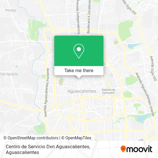
See Centro de Servicio Dxn Aguascalientes on the map
Public Transportation to Centro de Servicio Dxn Aguascalientes
Wondering how to get to Centro de Servicio Dxn Aguascalientes? Moovit helps you find the best way to get to Centro de Servicio Dxn Aguascalientes with step-by-step directions from the nearest public transit station.
Moovit provides free maps and live directions to help you navigate through your city. View schedules, routes, timetables, and find out how long does it take to get to Centro de Servicio Dxn Aguascalientes in real time.
Looking for the nearest stop or station to Centro de Servicio Dxn Aguascalientes? Check out this list of stops closest to your destination: Centro (Jardín Carpio); Valladolid; 5 De Mayo; 5 De Mayo; Sin Nombre Número 662; General José María Arteaga; Centro (Jardínde Zaragoza); Larreategui.
Bus: RUTA 03, RUTA 34, RUTA 39, RUTA 43, RUTA 48, RUTA 02, RUTA 04, RUTA 08, RUTA 01, RUTA 05, RUTA 09, RUTA 06, RUTA 10, RUTA 38, RUTA 11, RUTA 09.
Want to see if there’s another route that gets you there at an earlier time? Moovit helps you find alternative routes or times. Get directions from and directions to Centro de Servicio Dxn Aguascalientes easily from the Moovit App or Website.
We make riding to Centro de Servicio Dxn Aguascalientes easy, which is why over 1.5 million users, including users in Aguascalientes, trust Moovit as the best app for public transit. You don’t need to download an individual bus app or train app, Moovit is your all-in-one transit app that helps you find the best bus time or train time available.
For information on prices of bus, costs and ride fares to Centro de Servicio Dxn Aguascalientes, please check the Moovit app.
Use the app to navigate to popular places including to the airport, hospital, stadium, grocery store, mall, coffee shop, school, college, and university.
Centro de Servicio Dxn Aguascalientes Address: Centro de Servicio Dxn Aguascalientes, Calle Valladolid 108, Del Carmen, 20050 Aguascalientes, Agua street in Aguascalientes
- Bocimex,
- Taqueria Tacos del Rey,
- Cerrajeria El Sagrado Corazon,
- Quinta Esmeralda,
- Stephani Nail's,
- Hotel Rosita,
- Colegio Alexander Hamilton,
- Vidriera Vidrios Economicos de Aguascalientes,
- Motoservicio del Centro,
- Optica Franco,
- MARCOS REYNOSO,
- Boutique Nice Clothing,
- Luna Mágica,
- Ollinyoliztli,
- Los Fresnos Ags,
- Rueda Todo,
- Braut Innovaeventos,
- Avanza Soluciones,
- Bazar del Rio,
- Joyeria Joyas Guadalupe
Places Near Centro de Servicio Dxn Aguascalientes
- Jesús María, Aguascalientes,
- Terminal De Combis, Aguascalientes,
- Agropecuario, Aguascalientes,
- Isla San Marcos, Aguascalientes,
- Universidad Autónoma de Aguascalientes, Aguascalientes,
- Blvd. Luis Donaldo Colosio, Aguascalientes,
- Parque Las Tres Centurias, Aguascalientes,
- Centro Comercial Altaria, Aguascalientes,
- Ciudad industrial, Aguascalientes,
- Villas de Nuestra Señora de la Asunción, Aguascalientes,
- Hospital Imss No. 3, Aguascalientes,
- Centro, Aguascalientes,
- Nuevo Hospital Hidalgo, Aguascalientes,
- La Isla San Marcos, Aguascalientes,
- Aeropuerto de Aguascalientes S.A. de C.V., Aguascalientes,
- Villasuncion, Aguascalientes,
- Central De Autobuses, Aguascalientes,
- Imss Clinica 1, Aguascalientes,
- clinica 3 uaa, Aguascalientes,
- ESPACIOS, Aguascalientes
How to get to popular places in Aguascalientes with public transit
Get around Aguascalientes by public transit!
Traveling around Aguascalientes has never been so easy. See step by step directions as you travel to any attraction, street or major public transit station. View bus and train schedules, arrival times, service alerts and detailed routes on a map, so you know exactly how to get to anywhere in Aguascalientes.
When traveling to any destination around Aguascalientes use Moovit's Live Directions with Get Off Notifications to know exactly where and how far to walk, how long to wait for your line, and how many stops are left. Moovit will alert you when it's time to get off — no need to constantly re-check whether yours is the next stop.
Wondering how to use public transit in Aguascalientes or how to pay for public transit in Aguascalientes? Moovit public transit app can help you navigate your way with public transit easily, and at minimum cost. It includes public transit fees, ticket prices, and costs. Looking for a map of Aguascalientes public transit lines? Moovit public transit app shows all public transit maps in Aguascalientes with all bus routes and stops on an interactive map.
Aguascalientes has 1 transit type(s), including: bus, operated by several transit agencies, including Coordinación General de Movilidad