How to get to Ceramic Andychav by bus?
Click on the bus route to see step by step directions with maps, line arrival times and updated time schedules.
From Boulevard Juan Pablo II, Aguascalientes
28 minFrom Lomas del Chapulín, Aguascalientes
40 minFrom Paso Blanco, Aguascalientes
51 minFrom Fraccionamiento La Casita, Aguascalientes
32 minFrom Universidad Autónoma de Aguascalientes Campus Sur, Aguascalientes
46 minFrom IMSS Hospital General De Zona No.3, Aguascalientes
40 minFrom Unidad Deportiva Jesús María, Aguascalientes
43 minFrom Hacienda San Martín, Aguascalientes
45 minFrom Agropecuario Viñedos San Marcos, Aguascalientes
41 minFrom San Telmo Town Center, Aguascalientes
41 min
Bus stops near Ceramic Andychav in Aguascalientes
Bus lines to Ceramic Andychav in Aguascalientes
- RUTA 04, Jesús María - Mahatma Gandhi,VIEW
- RUTA 08, UTMA - Centro (Rivero y Gutiérrez),VIEW
- RUTA 16, Bellavista - Hacienda Nueva,VIEW
- RUTA 19, Vistas de Oriente - Pocitos,VIEW
- RUTA 27, Vicente Guerrero - Valle de los Cactus,VIEW
- RUTA 28, Chichimeco - Mahatma Gandhi,VIEW
- RUTA 36, Lunaria - Centro (Mercado Terán),VIEW
- RUTA 37, UTMA - Hacienda San Marcos,VIEW
- RUTA 43, San Antonio - UTMA,VIEW
- RUTA 43, UTMA - Lomas de New York - San Antonio,VIEW
- RUTA 48, Bellavista - Centro (Panteón de la Cruz),VIEW
- RUTA 10, Paseos De Aguascalientes,VIEW
- RUTA 01, Vicente Guerrero - Margaritas,VIEW
- RUTA 05, Vicente Guerrero - La Ribera,VIEW
- RUTA 29, Lomas del Ajedrez -Centro (Jardínde Zaragoza),VIEW
- RUTA 34, Villa Montaña - UPA,VIEW
- RUTA 38, Vicente Guerrero - Paso Blanco,VIEW
- RUTA 39, El Conejal - Centro (Jardínde Zaragoza),VIEW
What are the closest stations to Ceramic Andychav?
The closest stations to Ceramic Andychav are:
- Centro (Mercado Terán) is 140 meters away, 2 min walk.
- General Emiliano Zapata, 106 is 219 meters away, 3 min walk.
- 5 De Mayo, 401 is 296 meters away, 4 min walk.
Which bus lines stop near Ceramic Andychav?
These bus lines stop near Ceramic Andychav: RUTA 01, RUTA 03, RUTA 04, RUTA 06, RUTA 10, RUTA 25, RUTA 27, RUTA 34, RUTA 38, RUTA 43.
What’s the nearest bus station to Ceramic Andychav in Aguascalientes?
The nearest bus station to Ceramic Andychav in Aguascalientes is Centro (Mercado Terán). It’s a 2 min walk away.
What time is the first bus to Ceramic Andychav in Aguascalientes?
The RUTA 08 is the first bus that goes to Ceramic Andychav in Aguascalientes. It stops nearby at 6:10 AM.
What time is the last bus to Ceramic Andychav in Aguascalientes?
The RUTA 43 is the last bus that goes to Ceramic Andychav in Aguascalientes. It stops nearby at 10:21 PM.
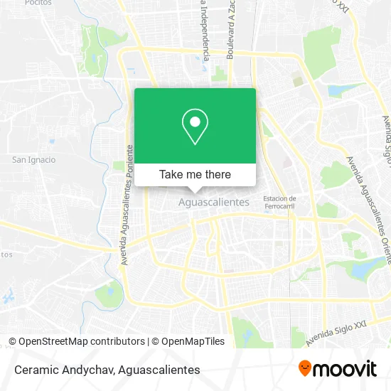
See Ceramic Andychav, Aguascalientes, on the map
Public Transit to Ceramic Andychav in Aguascalientes
Wondering how to get to Ceramic Andychav in Aguascalientes? Moovit helps you find the best way to get to Ceramic Andychav with step-by-step directions from the nearest public transit station.
Moovit provides free maps and live directions to help you navigate through your city. View schedules, routes, timetables, and find out how long does it take to get to Ceramic Andychav in real time.
Looking for the nearest stop or station to Ceramic Andychav? Check out this list of stops closest to your destination: Centro (Mercado Terán); General Emiliano Zapata; 5 De Mayo.
Bus: RUTA 01, RUTA 03, RUTA 04, RUTA 06, RUTA 10, RUTA 25, RUTA 27, RUTA 34, RUTA 38, RUTA 43, RUTA 08, RUTA 16, RUTA 19, RUTA 05, RUTA 29.
Want to see if there’s another route that gets you there at an earlier time? Moovit helps you find alternative routes or times. Get directions from and directions to Ceramic Andychav easily from the Moovit App or Website.
We make riding to Ceramic Andychav easy, which is why over 1.5 million users, including users in Aguascalientes, trust Moovit as the best app for public transit. You don’t need to download an individual bus app or train app, Moovit is your all-in-one transit app that helps you find the best bus time or train time available.
For information on prices of bus, costs and ride fares to Ceramic Andychav, please check the Moovit app.
Use the app to navigate to popular places including to the airport, hospital, stadium, grocery store, mall, coffee shop, school, college, and university.
Ceramic Andychav Address: Calle Libertad 242, Guadalupe, 20059 Aguascalientes, Aguascalientes street in Aguascalientes
- Centeo De Encuentro Y Convivencia Familiar DIF,
- Casa libertad,
- Nova Cell,
- Tienda de bisutería y Varios,
- Procuraduría de la Defensa del Menor,
- Marchand Victoria,
- El Señor Mueble,
- Central de Discos de Torreón,
- Natuzem,
- Multicopias Guadalupe,
- Santacruz,
- Parque Heroes,
- Saldos Departamentales,
- Casa de Música Santa Cecilia,
- Dragon Ball Z Unlimited,
- Farmacia Pasteur,
- Carpintería,
- Medio Maratón NISSAN One Team Spirit,
- Salto Quantico,
- Algo Inmuebles
Places Near Ceramic Andychav (Aguascalientes)
- Centro Comercial Altaria, Aguascalientes,
- clinica 3 uaa, Aguascalientes,
- Hospital Imss No. 3, Aguascalientes,
- Imss Clinica 1, Aguascalientes,
- Centro, Aguascalientes,
- Villas de Nuestra Señora de la Asunción, Aguascalientes,
- Nuevo Hospital Hidalgo, Aguascalientes,
- Aeropuerto de Aguascalientes S.A. de C.V., Aguascalientes,
- Central De Autobuses, Aguascalientes,
- Blvd. Luis Donaldo Colosio, Aguascalientes,
- Agropecuario, Aguascalientes,
- Isla San Marcos, Aguascalientes,
- Villasuncion, Aguascalientes,
- Universidad Autónoma de Aguascalientes, Aguascalientes,
- ESPACIOS, Aguascalientes,
- Ciudad industrial, Aguascalientes,
- Terminal De Combis, Aguascalientes,
- Parque Las Tres Centurias, Aguascalientes,
- Jesús María, Aguascalientes,
- La Isla San Marcos, Aguascalientes
How to get to popular places in Aguascalientes with public transit
Get around Aguascalientes by public transit!
Traveling around Aguascalientes has never been so easy. See step by step directions as you travel to any attraction, street or major public transit station. View bus and train schedules, arrival times, service alerts and detailed routes on a map, so you know exactly how to get to anywhere in Aguascalientes.
When traveling to any destination around Aguascalientes use Moovit's Live Directions with Get Off Notifications to know exactly where and how far to walk, how long to wait for your line, and how many stops are left. Moovit will alert you when it's time to get off — no need to constantly re-check whether yours is the next stop.
Wondering how to use public transit in Aguascalientes or how to pay for public transit in Aguascalientes? Moovit public transit app can help you navigate your way with public transit easily, and at minimum cost. It includes public transit fees, ticket prices, and costs. Looking for a map of Aguascalientes public transit lines? Moovit public transit app shows all public transit maps in Aguascalientes with all bus routes and stops on an interactive map.
Aguascalientes has 1 transit type(s), including: bus, operated by several transit agencies, including Coordinación General de Movilidad