How to get to Cernovsky by bus?
Click on the bus route to see step by step directions with maps, line arrival times and updated time schedules.
How to get to Cernovsky by train?
Click on the train route to see step by step directions with maps, line arrival times and updated time schedules.
Bus stops near Cernovsky in Verwaltungsverband Mittleres Schussental
Train stations near Cernovsky in Verwaltungsverband Mittleres Schussental
Bus lines to Cernovsky in Verwaltungsverband Mittleres Schussental
- S30, Bad Waldsee Bahnhof,VIEW
- 1, Baindt Marsweiler - Ravensburg Hofgut,VIEW
- 3, Ravensburg Bahnhof Bstg 6 - RV Untereschach,VIEW
- 31, Wolfegg Hofgarten - Ravensburg Bahnhof Bstg 3,VIEW
- 5, Baienfurt Achtalschule - Niederbiegen Bahnhof,VIEW
- 61, Ravensburg Bahnhof Bstg 8 - Berg, Wilhelm-Gindele-Straße Steig 1,VIEW
- R30, BW, Döchtbühlstadion Bstg 1 - Ravensburg Bahnhof Bstg 3,VIEW
- R60, Fleischwangen Kirche - Ravensburg Bahnhof Bstg 8,VIEW
- R65, Ravensburg Bahnhof Bstg 8 - Bad Saulgau Bahnhof,VIEW
- 20, Wolpertswende Rathaus - Ravensburg Bahnhof Bstg 10,VIEW
- 21, Bodnegg Schule - Ravensburg Bahnhof Bstg 10,VIEW
- 7534, Ravensburg Bahnhof Bstg 11 - Schlier Hintermoos,VIEW
- 7535, Ravensburg Bahnhof Bstg 13 - Vogt Schützenweg,VIEW
- 7537, Ravensburg Bahnhof Bstg 11 - Ravensburg Taldorf,VIEW
- R40, Ravensburg Bahnhof Bstg 7 - Wangen Busbahnhof Bstg 3,VIEW
- R70, Ravensburg Bahnhof Bstg 12 - Illmensee Adler,VIEW
- 7539, Ravensburg Polizeipräsidium,VIEW
- 4, Ravensburg Frauentor,VIEW
- S40, Ravensburg Bahnhof,VIEW
What are the closest stations to Cernovsky?
The closest stations to Cernovsky are:
- Rv St. Elisab.-Klinikum Pforte is 83 meters away, 2 min walk.
- Rv St. Elisabethen-Klinikum is 435 meters away, 6 min walk.
- Rv Gymnasien is 454 meters away, 7 min walk.
- Ravensburg Frauentor is 712 meters away, 10 min walk.
- Ravensburg Konzerthaus is 855 meters away, 12 min walk.
- Weingarten/Berg Bahnhof is 2762 meters away, 36 min walk.
- Weingarten Bob-Bahnhof is 2774 meters away, 36 min walk.
- Ravensburg is 3914 meters away, 51 min walk.
Which train lines stop near Cernovsky?
These train lines stop near Cernovsky: RB 91, RE 5, RE3, RE5.
Which bus lines stop near Cernovsky?
These bus lines stop near Cernovsky: 1, 3, 61, 700, R70, S30, S40.
What’s the nearest bus station to Cernovsky in Verwaltungsverband Mittleres Schussental?
The nearest bus station to Cernovsky in Verwaltungsverband Mittleres Schussental is Rv St. Elisab.-Klinikum Pforte. It’s a 2 min walk away.
What time is the first train to Cernovsky in Verwaltungsverband Mittleres Schussental?
The RE5 is the first train that goes to Cernovsky in Verwaltungsverband Mittleres Schussental. It stops nearby at 5:02 AM.
What time is the last train to Cernovsky in Verwaltungsverband Mittleres Schussental?
The RE5 is the last train that goes to Cernovsky in Verwaltungsverband Mittleres Schussental. It stops nearby at 1:12 AM.
What time is the first bus to Cernovsky in Verwaltungsverband Mittleres Schussental?
The 1 is the first bus that goes to Cernovsky in Verwaltungsverband Mittleres Schussental. It stops nearby at 4:24 AM.
What time is the last bus to Cernovsky in Verwaltungsverband Mittleres Schussental?
The 1 is the last bus that goes to Cernovsky in Verwaltungsverband Mittleres Schussental. It stops nearby at 1:29 AM.
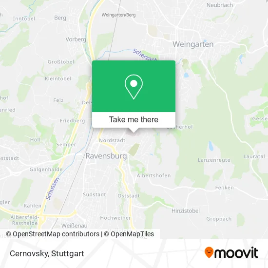
See Cernovsky, Verwaltungsverband Mittleres Schussental, on the map
Public Transit to Cernovsky in Verwaltungsverband Mittleres Schussental
Wondering how to get to Cernovsky in Verwaltungsverband Mittleres Schussental? Moovit helps you find the best way to get to Cernovsky with step-by-step directions from the nearest public transit station.
Moovit provides free maps and live directions to help you navigate through your city. View schedules, routes, timetables, and find out how long does it take to get to Cernovsky in real time.
Looking for the nearest stop or station to Cernovsky? Check out this list of stops closest to your destination: Rv St. Elisab.-Klinikum Pforte; Rv St. Elisabethen-Klinikum; Rv Gymnasien; Ravensburg Frauentor; Ravensburg Konzerthaus; Weingarten/Berg Bahnhof; Weingarten Bob-Bahnhof; Ravensburg.
Train: RB 91, RE 5, RE3, RE5, RB91, RB91.Bus: 1, 3, 61, 700, R70, S30, S40, 31, 5, 7539.
Want to see if there’s another route that gets you there at an earlier time? Moovit helps you find alternative routes or times. Get directions from and directions to Cernovsky easily from the Moovit App or Website.
We make riding to Cernovsky easy, which is why over 1.5 million users, including users in Verwaltungsverband Mittleres Schussental, trust Moovit as the best app for public transit. You don’t need to download an individual bus app or train app, Moovit is your all-in-one transit app that helps you find the best bus time or train time available.
For information on prices of bus and train, costs and ride fares to Cernovsky, please check the Moovit app.
Use the app to navigate to popular places including to the airport, hospital, stadium, grocery store, mall, coffee shop, school, college, and university.
Cernovsky Address: Elisabethenstraße 19 88212 Ravensburg street in Verwaltungsverband Mittleres Schussental
- Helianthus Klinik,
- Bäckerei & Konditorei Hamma Café Medicus,
- Therapiepunkt Ravensburg,
- Ergotherapie M Ergotherapie,
- Apotheke am Elisabethen-Krankenhaus,
- Dr. med. René Schandl,
- Dr. med. Michael Unger,
- Handchirurgie Ravensburg,
- Hörgeräte in Ravensburg,
- Ärztehaus Ravensburg,
- Hamma Café Medicus,
- Clinic Home Interface,
- Mvz Oberschwabenklinik,
- Krhs St.Elisabeth Pforte,
- Ravensburg Elisabethen-Klinikum Pforte,
- Sinova Klinik Ravensburg,
- Zfp Südwürttemberg,
- Ravensburg Nikolausstr. Hauptfriedhof,
- Tagesklinik,
- Kinderkrankenhaus St. Nikolaus
Places Near Cernovsky (Verwaltungsverband Mittleres Schussental)
- Hanns-Martin-Schleyer-Halle (Stuttgart Hans-Martin-Schleyerhalle), Bad Cannstatt,
- Schleyerhalle, Bad Cannstatt,
- Hanns-Martin-Schleyer-Halle, Bad Cannstatt,
- FlixBus Haltestelle, Stuttgart,
- Mercedes-Benz Museum (Mercedes Museum Stuttgart), Bad Cannstatt,
- SI-Centrum, Möhringen,
- Waldfriedhof, Degerloch,
- Marmorsaal Im Weissenburgpark, Stuttgart-Süd,
- Gasometer Pforzheim, Pforzheim,
- Porsche Museum, Zuffenhausen,
- Wilhelma (U-Bahn Wilhelma), Bad Cannstatt,
- Geilhaus Haus 33a, Reutlingen-Betzingen,
- Klinikum Stuttgart - Katharinenhospital, Stuttgart-Mitte,
- Mettingen Eros-Center Puff Laufhaus, Esslingen Am Neckar,
- Pariser Platz Stuttgart, Stuttgart-Mitte,
- Gleis 101/102 (tief), Stuttgart-Mitte,
- Hauptbahnhof Stuttgart, Stuttgart-Mitte,
- Mercedes-Benz Museum, Bad Cannstatt,
- Im Wizemann (Halle), Bad Cannstatt,
- Porsche-Arena, Bad Cannstatt
How to get to popular places in Stuttgart with public transit
Get around Verwaltungsverband Mittleres Schussental by public transit!
Traveling around Verwaltungsverband Mittleres Schussental has never been so easy. See step by step directions as you travel to any attraction, street or major public transit station. View bus and train schedules, arrival times, service alerts and detailed routes on a map, so you know exactly how to get to anywhere in Verwaltungsverband Mittleres Schussental.
When traveling to any destination around Verwaltungsverband Mittleres Schussental use Moovit's Live Directions with Get Off Notifications to know exactly where and how far to walk, how long to wait for your line, and how many stops are left. Moovit will alert you when it's time to get off — no need to constantly re-check whether yours is the next stop.
Wondering how to use public transit in Verwaltungsverband Mittleres Schussental or how to pay for public transit in Verwaltungsverband Mittleres Schussental? Moovit public transit app can help you navigate your way with public transit easily, and at minimum cost. It includes public transit fees, ticket prices, and costs. Looking for a map of Verwaltungsverband Mittleres Schussental public transit lines? Moovit public transit app shows all public transit maps in Verwaltungsverband Mittleres Schussental with all Bus, Train, Subway, Light Rail, Ferry, S-Bahn and Funicular routes and stops on an interactive map.
Stuttgart has 7 transit type(s), including: Bus, Train, Subway, Light Rail, Ferry, S-Bahn and Funicular, operated by several transit agencies, including SSB - Stadtbahn, SSB, SSB - Seilbahn / Zacke, S-Bahn Stuttgart, Rhein-Neckar-Verkehr GmbH (rnv), Karlsruher Verkehrsverbund, DB AG, DB Regiobus BW, Arverio Baden-Württemberg GmbH, DB RegioNetz Verkehrs GmbH Westfrankenbahn, DB Regio AG Baden-Württemberg, Südwestdeutsche Verkehrs-AG, DB Regio AG Mitte Region Hessen, DB and Bodensee-Oberschwaben-Bahn