How to get to Cerravalue by bus?
Click on the bus route to see step by step directions with maps, line arrival times and updated time schedules.
From Poligono Industrial Aimayr, San Martín De La Vega
50 minFrom Hospital Universitario Infanta Elena, Valdemoro
46 minFrom Centro Logístico El Corte Inglés, Valdemoro
98 minFrom Nassica, Área Metropolitana De Madrid Y Corredor Del Henares
69 minFrom Desguaces La Torre, Comarca Sur
134 minFrom Costco, Área Metropolitana De Madrid Y Corredor Del Henares
104 minFrom The Style Outlets Getafe, Getafe
97 minFrom Centro Comercial Nassica, Getafe
96 minFrom Hospital Infanta Cristina., Área Metropolitana De Madrid Y Corredor Del Henares
137 minFrom Parla, Madrid, Parla
106 min
How to get to Cerravalue by train?
Click on the train route to see step by step directions with maps, line arrival times and updated time schedules.
Bus stops near Cerravalue in Ciempozuelos
Train station near Cerravalue in Ciempozuelos
- Ciempozuelos, 12 min walk,VIEW
Bus lines to Cerravalue in Ciempozuelos
What are the closest stations to Cerravalue?
The closest stations to Cerravalue are:
- Av. Madre M.ª Antonia - Jerónimo Del Moral is 186 meters away, 3 min walk.
- Av. Consuelo - Doctor Rivas is 271 meters away, 4 min walk.
- Ciempozuelos is 928 meters away, 12 min walk.
Which bus lines stop near Cerravalue?
These bus lines stop near Cerravalue: 1, 415, 416, 425, 426.
Which train line stops near Cerravalue?
C3 (Aranjuez)
What’s the nearest train station to Cerravalue in Ciempozuelos?
The nearest train station to Cerravalue in Ciempozuelos is Ciempozuelos. It’s a 12 min walk away.
What’s the nearest bus station to Cerravalue in Ciempozuelos?
The nearest bus station to Cerravalue in Ciempozuelos is Av. Madre M.ª Antonia - Jerónimo Del Moral. It’s a 3 min walk away.
What time is the first train to Cerravalue in Ciempozuelos?
The C3 is the first train that goes to Cerravalue in Ciempozuelos. It stops nearby at 5:24 AM.
What time is the last train to Cerravalue in Ciempozuelos?
The C3 is the last train that goes to Cerravalue in Ciempozuelos. It stops nearby at 12:28 AM.
What time is the first bus to Cerravalue in Ciempozuelos?
The N402 is the first bus that goes to Cerravalue in Ciempozuelos. It stops nearby at 3:05 AM.
What time is the last bus to Cerravalue in Ciempozuelos?
The N402 is the last bus that goes to Cerravalue in Ciempozuelos. It stops nearby at 2:38 AM.
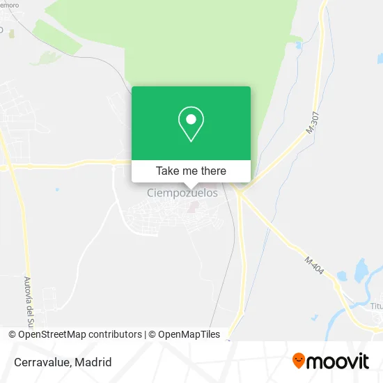
See Cerravalue, Ciempozuelos, on the map
Public Transit to Cerravalue in Ciempozuelos
Wondering how to get to Cerravalue in Ciempozuelos? Moovit helps you find the best way to get to Cerravalue with step-by-step directions from the nearest public transit station.
Moovit provides free maps and live directions to help you navigate through your city. View schedules, routes, timetables, and find out how long does it take to get to Cerravalue in real time.
Looking for the nearest stop or station to Cerravalue? Check out this list of stops closest to your destination: Av. Madre M.ª Antonia - Jerónimo Del Moral; Av. Consuelo - Doctor Rivas; Ciempozuelos.
Bus: 1, 415, 416, 425, 426, 410, N402.Train: C3.
Want to see if there’s another route that gets you there at an earlier time? Moovit helps you find alternative routes or times. Get directions from and directions to Cerravalue easily from the Moovit App or Website.
We make riding to Cerravalue easy, which is why over 1.5 million users, including users in Ciempozuelos, trust Moovit as the best app for public transit. You don’t need to download an individual bus app or train app, Moovit is your all-in-one transit app that helps you find the best bus time or train time available.
For information on prices of bus and train, costs and ride fares to Cerravalue, please check the Moovit app.
Use the app to navigate to popular places including to the airport, hospital, stadium, grocery store, mall, coffee shop, school, college, and university.
Cerravalue Address: Calle Capitán Antonio de Oro Pulido, 28350 Ciempozuelos street in Ciempozuelos
- R & G Asesoramiento Financiero Inmobiliario Consulting,
- Grupo Dental Vega del Jarama,
- Burger Acuario,
- Sociedad Anonima Española Tubo Fabrega,
- Localfuner,
- Office World,
- Promociones y Construcciones Gómez Ors,
- Pablo Naranjo Gutiérrez,
- Instalaciones y Desarrollos Integrales Corporativos,
- La Feria,
- Adelcapa,
- Energes Grupos Electrogenos,
- Servicios Funerarios Castellanomanchegos,
- Xvent Reunidos,
- Nacex,
- Mister Tarimas,
- Jiménez y Fernández Hostelería,
- La Tienda de los Niños,
- Vicaclima 2002,
- Manuel Miguel Gómez Ruiz
Places Near Cerravalue (Ciempozuelos)
- Estadio Wanda Metropolitano, Área Metropolitana De Madrid Y Corredor Del Henares,
- Sala La Riviera, Madrid,
- Centro Comercial Oasiz Madrid, Área Metropolitana De Madrid Y Corredor Del Henares,
- Hospital Universitario La Paz, Madrid,
- Centro Comercial Islazul, Área Metropolitana De Madrid Y Corredor Del Henares,
- Estacion de Chamartin, Madrid,
- Mendez Alvaro, Madrid,
- Calle de López de Hoyos 169, Madrid,
- Tres Aguas, Alcorcón,
- Mercadillo de Majadahonda, Majadahonda,
- Palacio De Vistalegre, Área Metropolitana De Madrid Y Corredor Del Henares,
- Rastro De Madrid, Área Metropolitana De Madrid Y Corredor Del Henares,
- Hospital Clínico Universitario San Carlos, Madrid,
- Wizink Center, Madrid,
- Centro Comercial La Gavia, Área Metropolitana De Madrid Y Corredor Del Henares,
- Plenilunio, Área Metropolitana De Madrid Y Corredor Del Henares,
- Nassica, Área Metropolitana De Madrid Y Corredor Del Henares,
- Plaza Mayor, Madrid,
- Centro Comercial La Vaguada, Área Metropolitana De Madrid Y Corredor Del Henares,
- Hospital Universitario Ramón y Cajal, Madrid
How to get to popular places in Madrid with public transit
Get around Ciempozuelos by public transit!
Traveling around Ciempozuelos has never been so easy. See step by step directions as you travel to any attraction, street or major public transit station. View bus and train schedules, arrival times, service alerts and detailed routes on a map, so you know exactly how to get to anywhere in Ciempozuelos.
When traveling to any destination around Ciempozuelos use Moovit's Live Directions with Get Off Notifications to know exactly where and how far to walk, how long to wait for your line, and how many stops are left. Moovit will alert you when it's time to get off — no need to constantly re-check whether yours is the next stop.
Wondering how to use public transit in Ciempozuelos or how to pay for public transit in Ciempozuelos? Moovit public transit app can help you navigate your way with public transit easily, and at minimum cost. It includes public transit fees, ticket prices, and costs. Looking for a map of Ciempozuelos public transit lines? Moovit public transit app shows all public transit maps in Ciempozuelos with all Bus, Train, Metro and Light Rail routes and stops on an interactive map.
Madrid has 4 transit type(s), including: Bus, Train, Metro and Light Rail, operated by several transit agencies, including Metro de Madrid, Metro Ligero, Tranvía de Parla, Renfe Cercanías - Servicios de Autobús especiales, Renfe Cercanias, Renfe Cercanías, EMT, Interurbanos, Urbanos de Alcalá de Henares, Urbanos de Alcobendas, Urbanos de Alcorcón, Urbanos de Algete, Urbanos de Aranjuez, Urbanos de Arganda del Rey and Urbanos de Arroyomolinos