How to get to Cerro David Fuentes (T) by bus?
Click on the bus route to see step by step directions with maps, line arrival times and updated time schedules.
From Av Colon, Talcahuano
51 minFrom Cafetería 1er Piso Clínica Biobío, Talcahuano
53 minFrom Sur Activo, Talcahuano
50 minFrom Universidad Andrés Bello, Talcahuano
42 minFrom Megacentro Hualpen, Concepcion
64 minFrom Caleta Lenga, Talcahuano
58 minFrom Jumbo, Concepcion
67 minFrom Torreones De Bellavista, Talcahuano
79 minFrom Lomas de San Andrés, Talcahuano
61 minFrom Lomas de Bellavista, Talcahuano
89 min
Bus stops near Cerro David Fuentes (T) in Talcahuano
Bus lines to Cerro David Fuentes (T) in Talcahuano
- 02AP, 02a - Centinela,VIEW
- 02KD, 02d - Diego Portales,VIEW
- 10AN, 10n - Los Bloques,VIEW
- 10CP, 10p - Leonera,VIEW
- 10DM, 10m - Los Bloques,VIEW
- 10JL, 10l - Los Bloques,VIEW
- 10TK, 10t - Tumbes,VIEW
- 11CM, 11c - Talcahuano,VIEW
- 11EQ, 11q - Los Bloques,VIEW
- 11FR, 11f - Talcahuano,VIEW
- 12QA, 12q - Puerto,VIEW
- 12RB, 12r - Puerto,VIEW
- 14HT, 14h - San Vicente,VIEW
- 16HK, 16k - Leonera,VIEW
- 16IV, 16v - Leonera,VIEW
- 20JL, 20l - Boca Sur,VIEW
- 20TM, 20m - San Pedro De La Costa,VIEW
- 20VA, 20v - Pta. Los Leones,VIEW
- 20ZW, 20w - San Pedro De La Costa,VIEW
- 31DF, 31d - Lobos Viejos,VIEW
What are the closest stations to Cerro David Fuentes (T)?
The closest stations to Cerro David Fuentes (T) are:
- Colon Esq Veintiuno De Mayo is 279 meters away, 5 min walk.
- Valdivia Esq La Union is 455 meters away, 7 min walk.
- Valdivia Esq Tumbes Poniente is 597 meters away, 9 min walk.
- Banco Encalada Esq Angamos is 601 meters away, 9 min walk.
Which bus lines stop near Cerro David Fuentes (T)?
These bus lines stop near Cerro David Fuentes (T): 02KD, 10AN, 12QA, 14HT, 31DF.
What’s the nearest bus station to Cerro David Fuentes (T) in Talcahuano?
The nearest bus station to Cerro David Fuentes (T) in Talcahuano is Colon Esq Veintiuno De Mayo. It’s a 5 min walk away.
What time is the first bus to Cerro David Fuentes (T) in Talcahuano?
The 11CM is the first bus that goes to Cerro David Fuentes (T) in Talcahuano. It stops nearby at 5:02 AM.
What time is the last bus to Cerro David Fuentes (T) in Talcahuano?
The 81SC is the last bus that goes to Cerro David Fuentes (T) in Talcahuano. It stops nearby at 2:48 AM.
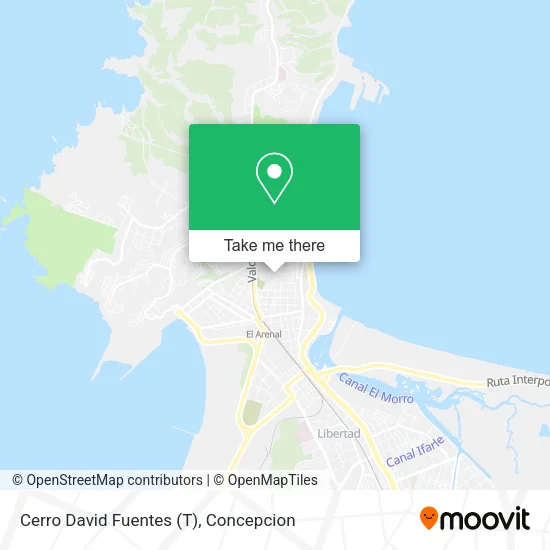
See Cerro David Fuentes (T), Talcahuano, on the map
Public Transit to Cerro David Fuentes (T) in Talcahuano
Wondering how to get to Cerro David Fuentes (T) in Talcahuano? Moovit helps you find the best way to get to Cerro David Fuentes (T) with step-by-step directions from the nearest public transit station.
Moovit provides free maps and live directions to help you navigate through your city. View schedules, routes, timetables, and find out how long does it take to get to Cerro David Fuentes (T) in real time.
Looking for the nearest stop or station to Cerro David Fuentes (T)? Check out this list of stops closest to your destination: Colon Esq Veintiuno De Mayo; Valdivia Esq La Union; Valdivia Esq Tumbes Poniente; Banco Encalada Esq Angamos.
Bus: 02KD, 10AN, 12QA, 14HT, 31DF, 02AP, 10CP, 10DM, 10BO, 13GS, 70I, 70J, 02AC, 80J, 80K, 80L.
Want to see if there’s another route that gets you there at an earlier time? Moovit helps you find alternative routes or times. Get directions from and directions to Cerro David Fuentes (T) easily from the Moovit App or Website.
We make riding to Cerro David Fuentes (T) easy, which is why over 1.5 million users, including users in Talcahuano, trust Moovit as the best app for public transit. You don’t need to download an individual bus app or train app, Moovit is your all-in-one transit app that helps you find the best bus time or train time available.
For information on prices of bus, costs and ride fares to Cerro David Fuentes (T), please check the Moovit app.
Use the app to navigate to popular places including to the airport, hospital, stadium, grocery store, mall, coffee shop, school, college, and university.
Location: Talcahuano, Concepcion
- Cirujano General-María de Los Angeles Burgos Esparza,
- David Fuentes,
- San Martín 646,
- Cerro David Fuentes,
- Riquelme 375,
- Casa de Cumpleaños y Eventos Infantiles Entreteparty,
- Escuela Anita Serrano,
- Jardin Infantil “Arcoiris de Amor”,
- Dentista-María Milly Loreto Yánez Morales,
- Domo Lamngen Boutique,
- Terapias Biomagnetismo Paulina Palma,
- Amigos del Teatro Dante.,
- Vintage Home Chile,
- Bar El Minerito,
- Cementerio Municipal N 1,
- Cerro David Fuentes (mirador),
- Serrano 83,
- Caja de compensacion Los Heroes,
- Farmacias Cruz Verde,
- Venta Barata Concepción
Places Near Cerro David Fuentes (T) (Talcahuano)
- Zoológico de Concepción, Concepcion,
- Hospital Las Higueras, Talcahuano,
- En La Micro Camino A Tome, Concepcion,
- San Pedro De La Paz, Concepcion,
- Vega Monumental, Concepcion,
- Playa Lenga,
- Clinica bio bio, Concepcion,
- Hualpén, Concepcion,
- En la micro camino a chiguayante, Concepcion,
- Hospital Clínico Del Sur, Concepcion,
- Universidad De Concepción, Concepcion,
- Club Hípico De Concepción, Talcahuano,
- Jumbo - Easy Hualpén, Concepcion,
- Lomas San Sebastian, Talcahuano,
- Caleta Tumbes, Talcahuano,
- Terminal Aeropuerto Carriel Sur, Talcahuano,
- Universidad Del Bío-Bío, Concepcion,
- Penco, Penco,
- Mall Plaza del Trebol, Talcahuano,
- Mall Plaza Mirador Bío Bío, Concepcion
How to get to popular places in Concepcion with public transit
Get around Talcahuano by public transit!
Traveling around Talcahuano has never been so easy. See step by step directions as you travel to any attraction, street or major public transit station. View bus and train schedules, arrival times, service alerts and detailed routes on a map, so you know exactly how to get to anywhere in Talcahuano.
When traveling to any destination around Talcahuano use Moovit's Live Directions with Get Off Notifications to know exactly where and how far to walk, how long to wait for your line, and how many stops are left. Moovit will alert you when it's time to get off — no need to constantly re-check whether yours is the next stop.
Wondering how to use public transit in Talcahuano or how to pay for public transit in Talcahuano? Moovit public transit app can help you navigate your way with public transit easily, and at minimum cost. It includes public transit fees, ticket prices, and costs. Looking for a map of Talcahuano public transit lines? Moovit public transit app shows all public transit maps in Talcahuano with all bus routes and stops on an interactive map.
Concepcion has 1 transit type(s), including: bus, operated by several transit agencies, including División de Transporte Público Regional