How to get to Certified Contractors Network by bus?
Click on the bus route to see step by step directions with maps, line arrival times and updated time schedules.
From Pearl Street Warehouse, Washington
75 minFrom US Holocaust Memorial Museum, Washington
70 minFrom The Anthem, Washington
74 minFrom Tabard Inn, Washington
64 minFrom Dirksen Senate Building, Washington
70 minFrom The Wharf, Washington
73 minFrom Embassy Suites at the Chevy Chase Pavilion, Washington
56 minFrom Thomas Jefferson Memorial, Washington
91 minFrom 9th & F St NW, Washington
63 minFrom C&O Canal Towpath, Washington
76 min
How to get to Certified Contractors Network by metro?
Click on the metro route to see step by step directions with maps, line arrival times and updated time schedules.
From Pearl Street Warehouse, Washington
61 minFrom US Holocaust Memorial Museum, Washington
59 minFrom The Anthem, Washington
62 minFrom Tabard Inn, Washington
56 minFrom Dirksen Senate Building, Washington
49 minFrom The Wharf, Washington
62 minFrom Embassy Suites at the Chevy Chase Pavilion, Washington
57 minFrom Thomas Jefferson Memorial, Washington
69 minFrom 9th & F St NW, Washington
45 min
Bus stops near Certified Contractors Network in Montgomery County
Metro stations near Certified Contractors Network in Montgomery County
Train station near Certified Contractors Network in Montgomery County
- Silver Spring Marc Wb, 30 min walk,VIEW
Bus lines to Certified Contractors Network in Montgomery County
What are the closest stations to Certified Contractors Network?
The closest stations to Certified Contractors Network are:
- New Hampshire Av+Sheridan St is 62 yards away, 1 min walk.
- New Hampshire Av+Poplar Av is 315 yards away, 4 min walk.
- Eastern Av Ne+New Hampshire Av NE is 517 yards away, 7 min walk.
- Kansas Av Ne+Eastern Av NE is 622 yards away, 8 min walk.
- Takoma is 1258 yards away, 15 min walk.
- Fort Totten is 2402 yards away, 29 min walk.
- Silver Spring Marc Wb is 2526 yards away, 30 min walk.
Which bus lines stop near Certified Contractors Network?
These bus lines stop near Certified Contractors Network: M60, P42.
Which metro line stops near Certified Contractors Network?
RED (Glenmont)
What’s the nearest metro station to Certified Contractors Network in Montgomery County?
The nearest metro station to Certified Contractors Network in Montgomery County is Takoma. It’s a 15 min walk away.
What’s the nearest train station to Certified Contractors Network in Montgomery County?
The nearest train station to Certified Contractors Network in Montgomery County is Silver Spring Marc Wb. It’s a 30 min walk away.
What’s the nearest bus station to Certified Contractors Network in Montgomery County?
The nearest bus station to Certified Contractors Network in Montgomery County is New Hampshire Av+Sheridan St. It’s a 1 min walk away.
What time is the first metro to Certified Contractors Network in Montgomery County?
The GREEN is the first metro that goes to Certified Contractors Network in Montgomery County. It stops nearby at 5:08 AM.
What time is the last metro to Certified Contractors Network in Montgomery County?
The GREEN is the last metro that goes to Certified Contractors Network in Montgomery County. It stops nearby at 12:33 AM.
What time is the first train to Certified Contractors Network in Montgomery County?
The MARC is the first train that goes to Certified Contractors Network in Montgomery County. It stops nearby at 5:51 AM.
What time is the last train to Certified Contractors Network in Montgomery County?
The MARC is the last train that goes to Certified Contractors Network in Montgomery County. It stops nearby at 7:37 PM.
What time is the first bus to Certified Contractors Network in Montgomery County?
The M60 is the first bus that goes to Certified Contractors Network in Montgomery County. It stops nearby at 5:03 AM.
What time is the last bus to Certified Contractors Network in Montgomery County?
The M60 is the last bus that goes to Certified Contractors Network in Montgomery County. It stops nearby at 2:33 AM.
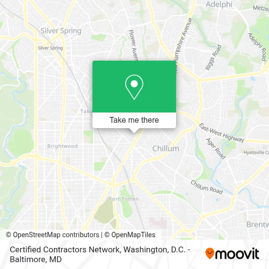
See Certified Contractors Network, Montgomery County, on the map
Public Transit to Certified Contractors Network in Montgomery County
Wondering how to get to Certified Contractors Network in Montgomery County? Moovit helps you find the best way to get to Certified Contractors Network with step-by-step directions from the nearest public transit station.
Moovit provides free maps and live directions to help you navigate through your city. View schedules, routes, timetables, and find out how long does it take to get to Certified Contractors Network in real time.
Looking for the nearest stop or station to Certified Contractors Network? Check out this list of stops closest to your destination: New Hampshire Av+Sheridan St; New Hampshire Av+Poplar Av; Eastern Av Ne+New Hampshire Av NE; Kansas Av Ne+Eastern Av NE; Takoma; Fort Totten; Silver Spring Marc Wb.
Bus: M60, P42, M6X.Train: MARC.Metro: RED, GREEN, YELLOW.
Want to see if there’s another route that gets you there at an earlier time? Moovit helps you find alternative routes or times. Get directions from and directions to Certified Contractors Network easily from the Moovit App or Website.
We make riding to Certified Contractors Network easy, which is why over 1.7 million users, including users in Montgomery County, trust Moovit as the best app for public transit. You don’t need to download an individual bus app or train app, Moovit is your all-in-one transit app that helps you find the best bus time or train time available.
For information on prices of bus and metro, costs and ride fares to Certified Contractors Network, please check the Moovit app.
Use the app to navigate to popular places including to the airport, hospital, stadium, grocery store, mall, coffee shop, school, college, and university.
Certified Contractors Network Address: 6476 Sligo Mill Rd street in Montgomery County
- Alexis Crystal Stevenson Modeling Agency - Acsma,
- Super Clean Laundromat,
- Lamond Riggs,
- Lamond Recreation Center,
- Chillum, Maryland,
- Dunbar High School,
- Sela Public Charter School & Shining Stars Montessori,
- De Jesucristo Iglesia Palabra Miel Washington DC,
- Washington Dc Table Tennis,
- 212 East,
- Riggs-LaSalle Recreation Center,
- Imperial Auto Body,
- Giant,
- Humane Rescue Alliance & Medical Center,
- Columbia MD-195,
- Columbia Columbia MD-195,
- Ruff N Ready Crab House,
- Washington Animal Rescue League (WARL),
- Capital MMA & Elite Fitness- Takoma Park,
- MD Lot Sunshine Ethio
Places Near Certified Contractors Network (Montgomery County)
- National Museum of African American History and Culture, Washington,
- Sibley Memorial Hospital, Washington,
- Camden Yards, Baltimore,
- Warner Theatre, Washington,
- Amazon Hq2, Arlington County,
- National Theatre, Washington,
- Washington National Cathedral, Washington,
- PG Mall, Prince George's County,
- The Anthem, Washington,
- Basilica of the National Shrine, Washington,
- Washington DC VA Medical Center, Washington,
- Georgetown, Washington,
- Marriott Marquis Washington, DC, Washington,
- Museum Of The Bible, Washington,
- National Zoo, Washington,
- Rock Creek Tennis Center, Washington,
- M&T Bank Stadium, Baltimore,
- Pennsylvania Ave NW (3rd st and pennsylvania), Washington,
- Capital One Arena, Washington,
- Westfield Montgomery Mall, Montgomery County
How to get to popular places in Washington, D.C. - Baltimore, MD with public transit
Get around Montgomery County by public transit!
Traveling around Montgomery County has never been so easy. See step by step directions as you travel to any attraction, street or major public transit station. View bus and train schedules, arrival times, service alerts and detailed routes on a map, so you know exactly how to get to anywhere in Montgomery County.
When traveling to any destination around Montgomery County use Moovit's Live Directions with Get Off Notifications to know exactly where and how far to walk, how long to wait for your line, and how many stops are left. Moovit will alert you when it's time to get off — no need to constantly re-check whether yours is the next stop.
Wondering how to use public transit in Montgomery County or how to pay for public transit in Montgomery County? Moovit public transit app can help you navigate your way with public transit easily, and at minimum cost. It includes public transit fees, ticket prices, and costs. Looking for a map of Montgomery County public transit lines? Moovit public transit app shows all public transit maps in Montgomery County with all Bus, Train, Metro, Light Rail and Ferry routes and stops on an interactive map.
Washington, D.C. - Baltimore, MD has 5 transit type(s), including: Bus, Train, Metro, Light Rail and Ferry, operated by several transit agencies, including WMATA, Montgomery County Ride On, Fairfax Connector, TheBus, PRTC, DASH - Alexandria, Arlington Transit (ART), RTA of Central Maryland, MDOT MTA, MDOT MTA Light RailLink, MDOT MTA Commuter Bus, MDOT MTA Local Bus, FXBGO!, Virginia Railway Express (VRE) and MARC