How to get to Cex by bus?
Click on the bus route to see step by step directions with maps, line arrival times and updated time schedules.
From Comfort Keepers, Scarborough
37 minFrom Intermed Urgent Care, South Portland
32 minFrom Merry Maids, Scarborough
37 minFrom TJC Properties, Scarborough
38 minFrom Sandler Training, South Portland
31 minFrom Scarborough Public Schools, Scarborough
37 minFrom Build-It Bros, Scarborough
35 minFrom Solo Portland Me Pool Table Movers, South Portland
41 min
Bus stops near Cex in Portland, ME
Train station near Cex in Portland, ME
- Portland Station, 19 min walk,VIEW
Ferry station near Cex in Portland, ME
- Casco Bay Lines Terminal, 47 min walk,VIEW
Bus lines to Cex in Portland, ME
- 60, St John St,VIEW
- 1, St John St + 117 St John St,VIEW
- 7, Portland Jetport,VIEW
- 8, Franklin Towers,VIEW
- 9A, Cbhs Outbound,VIEW
- 21, Fort Rd + Smcc,VIEW
- 24A, Thomas St + Millcreek Hub,VIEW
- 24B, 295 Gannett Dr,VIEW
- 24B, Gallery Blvd + Gallery Walmart,VIEW
- 9B, Washington Ave + Lambert St,VIEW
- HSK, Hancock St + Thames St,VIEW
What are the closest stations to Cex?
The closest stations to Cex are:
- Portland City Hall is 195 yards away, 3 min walk.
- Temple St + Fore St is 217 yards away, 3 min walk.
- Congress St + Exchange St is 365 yards away, 5 min walk.
- Franklin St + Fore St Sb is 448 yards away, 6 min walk.
- Portland Station is 1619 yards away, 19 min walk.
- Casco Bay Lines Terminal is 3970 yards away, 47 min walk.
Which bus lines stop near Cex?
These bus lines stop near Cex: 60, 7, 9B.
What’s the nearest train station to Cex in Portland, ME?
The nearest train station to Cex in Portland, ME is Portland Station. It’s a 19 min walk away.
What’s the nearest bus station to Cex in Portland, ME?
The nearest bus stations to Cex in Portland, ME are Portland City Hall and Temple St + Fore St. The closest one is a 3 min walk away.
What time is the first train to Cex in Portland, ME?
The DOWNEASTER is the first train that goes to Cex in Portland, ME. It stops nearby at 5:18 AM.
What time is the last train to Cex in Portland, ME?
The DOWNEASTER is the last train that goes to Cex in Portland, ME. It stops nearby at 1:00 AM.
What time is the first bus to Cex in Portland, ME?
The 7 is the first bus that goes to Cex in Portland, ME. It stops nearby at 5:15 AM.
What time is the last bus to Cex in Portland, ME?
The 21 is the last bus that goes to Cex in Portland, ME. It stops nearby at 11:08 PM.
What time is the first ferry to Cex in Portland, ME?
The DB is the first ferry that goes to Cex in Portland, ME. It stops nearby at 5:00 AM.
What time is the last ferry to Cex in Portland, ME?
The PK is the last ferry that goes to Cex in Portland, ME. It stops nearby at 11:10 PM.
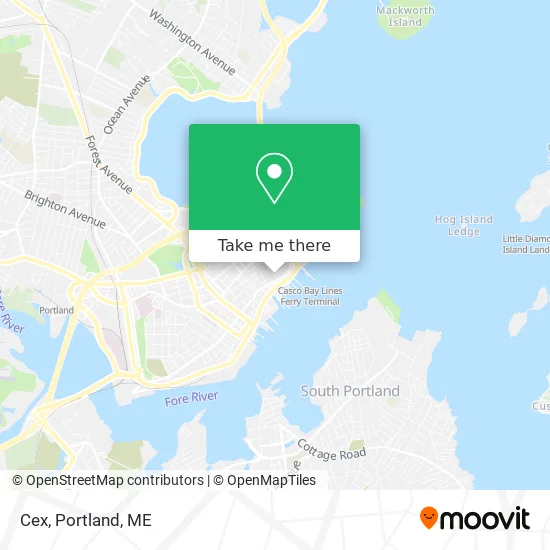
See Cex, Portland, ME, on the map
Public Transit to Cex in Portland, ME
Wondering how to get to Cex in Portland, ME? Moovit helps you find the best way to get to Cex with step-by-step directions from the nearest public transit station.
Moovit provides free maps and live directions to help you navigate through your city. View schedules, routes, timetables, and find out how long does it take to get to Cex in real time.
Looking for the nearest stop or station to Cex? Check out this list of stops closest to your destination: Portland City Hall; Temple St + Fore St; Congress St + Exchange St; Franklin St + Fore St Sb; Portland Station; Casco Bay Lines Terminal.
Bus: 60, 7, 9B, 1, 8, 9A, 21, 24A, 24B, 21, 24A, 24B.Train: DOWNEASTER.Ferry: DB, IB, PK.
Want to see if there’s another route that gets you there at an earlier time? Moovit helps you find alternative routes or times. Get directions from and directions to Cex easily from the Moovit App or Website.
We make riding to Cex easy, which is why over 1.5 million users, including users in Portland, ME, trust Moovit as the best app for public transit. You don’t need to download an individual bus app or train app, Moovit is your all-in-one transit app that helps you find the best bus time or train time available.
For information on prices of bus, costs and ride fares to Cex, please check the Moovit app.
Use the app to navigate to popular places including to the airport, hospital, stadium, grocery store, mall, coffee shop, school, college, and university.
Cex Address: 18 Exchange St, Portland, ME 04101 street in Portland, ME
- Old Port, Maine,
- Traps Eyewear,
- The Old Port,
- Studio Heleni,
- Starbucks,
- Fore Street Parking Garage ,
- A Podcast by Keepitlocalmaine (The Keep It Local Maine Podcast),
- Christensen David J - Asa Gold and Precious Metals Limited,
- Harpswell Capital,
- Let There Be Love Events,
- Bonfire Country Bar (Bonfire Country Tap House),
- Thames St. Parking Lot,
- 24A/24B Bus Stop,
- Eagle Island Tours,
- Dimillo's,
- Machias Savings Bank,
- Portland Harbor Hotel parking garage,
- Hanover Insurance Company (The Hanover Ins Grp Regal Office),
- Fisherman's Wharf Parking Lot,
- Cumberland County
Places Near Cex (Portland, ME)
- Mercy Hospital - Fore River Campus,
- Cape Elizabeth, ME, Cape Elizabeth,
- Fort Williams Park, Cape Elizabeth,
- On a bus to Kennebunkport,
- Walmart Scarborough Supercenter,
- Casco Bay Ferry Terminal,
- Walmart,
- Southern Maine Community College, South Portland,
- Clarion Hotel Portland,
- Jewell Island,
- Cross Insurance Arena,
- ZzZzZzZzZzZ, Westbrook,
- The Old Port,
- Portland International Jetport (PWM) (Portland International Jetport),
- Maine Medical Center,
- Fort Gorges,
- House Island,
- Maine Mall, South Portland,
- L. L. Bean Outlet,
- Exit 45 Park And Ride, South Portland
How to get to popular places in Portland, ME with public transit
Get around Portland, ME by public transit!
Traveling around Portland, ME has never been so easy. See step by step directions as you travel to any attraction, street or major public transit station. View bus and train schedules, arrival times, service alerts and detailed routes on a map, so you know exactly how to get to anywhere in Portland, ME.
When traveling to any destination around Portland, ME use Moovit's Live Directions with Get Off Notifications to know exactly where and how far to walk, how long to wait for your line, and how many stops are left. Moovit will alert you when it's time to get off — no need to constantly re-check whether yours is the next stop.
Wondering how to use public transit in Portland, ME or how to pay for public transit in Portland, ME? Moovit public transit app can help you navigate your way with public transit easily, and at minimum cost. It includes public transit fees, ticket prices, and costs. Looking for a map of Portland, ME public transit lines? Moovit public transit app shows all public transit maps in Portland, ME with all Bus, Train and Ferry routes and stops on an interactive map.
Portland, ME has 3 transit type(s), including: Bus, Train and Ferry, operated by several transit agencies, including Greater Portland Metro, City of South Portland, Biddeford Saco Old Orchard Beach Transit, Casco Bay Lines, Amtrak, Greyhound-us and FlixBus-us